Mt. Ibuki 伊吹山
|
Title   • File Name • File Name   • Date • Date   • Position • Position   |
|
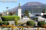
Mt. Ibuki or Ibukiyama is Shiga Prefecture's tallest mountain at 1,377 meters as well as one of Japan's 100 most famous mountains. It is well-known for the legend of Yamato Takeru and 1,200 species of wild flowers and plant life.
|
|
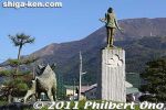
Yamato Takeru was a legendary prince and warrior who traveled a lot and defeated his enemies. However, he met his demise at Mt. Ibuki when he battled an evil god disguised as a white boar.
|
|
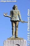
This statue of Yamato Takeru and evil boar are near the foot of Mt. Ibuki in Ueno.
|
|
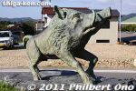
Yamato Takeru defeated the boar, but not before the boar showered him with poisonous mist. He went to Isame no Shimizu in Samegai whose waters healed him. Then he went on to Ise, but died soon afterward.
|
|

You can visit Mt. Ibuki by hiking up from the foot at Ueno or driving up the Ibukiyama Driveway (from Sekigahara) to the summit. MAP
|
|

Mt. Ibuki and camellias in winter.
|
|
|

Camellias and Mt. Ibuki, Maibara, Shiga Prefecture.
|
|
|
|

Mt. Ibuki and shinkansen, Maibara, Shiga Prefecture.
|
|

Most tourists traveling between Tokyo and Kyoto barely notice Mt. Ibuki and Lake Biwa along the way.
|
|
|
|
|
|
|

Mt. Ibuki and the entire shinkansen whizzing by.
|
|
|
|
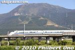
Mt. Ibuki and shinkansen.
|
|
|
|

Snowcapped Mt. Ibuki and half-frozen Mishima Pond in winter.
|
|

Snowcapped Mt. Ibuki and Mishima Pond in winter in Maibara.
|
|

Mt. Ibuki
|
|
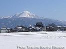
Mt. Ibuki as seen from Torahime in winter.
|
|
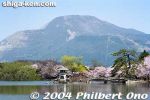
Mishima Pond with Mt. Ibuki and cherry blossoms.
|
|
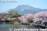
Mishima Pond with Mt. Ibuki and cherry blossoms.
|
|
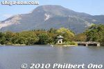
Mishima Pond
|
|
|
|
|
|
|
|

Promenade of cherry blossoms in the middle of rice fields.
|
|
|
|
|
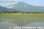
Mt. Ibuki and rice paddies
|
|
|
|
|

Ibukiyama Driveway toll road going to Mt. Ibuki summit. 伊吹山ドライブウェイ
|
|

Mt. Ibuki's summit is easily accessible via this Ibukiyama Driveway toll road (3,000 yen for passenger cars) from Sekigahara, Gifu Pref. This road opened in 1965 and is open to traffic during April to Nov.
|
|

Mt. Ibuki summit parking lot. The local bus also come up here. And loads of tour buses during flower seasons. Many tourists make the easy climb to the summit from the parking lot.
|
|

Entrance/exit to the Central Hiking Trail. 中央遊歩道
|
|

West Hiking Trail is most popular for hiking to the summit. 西遊歩道
|
|

Entrance to West Hiking Trail.
|
|

Rocky trail.
|
|

High heels not recommended.
|
|

The most common flower during summer it seems. シモツケソウ
|
|

Looking back on West Hiking Trail and parking lot
|
|

The most scenic part of Ibukiyama is the summit. It's a popular time to visit with many alpine flowers in bloom.
|
|

Tiger Lily コオニユリ
|
|

Easy 40-min. hike, but if's summer, it can get hot and sweaty.
|
|

Filipendula multijuga. We saw this everywhere back in 2006. However, in 2023, these flowers are mostly gone due to wild deer eating the plants. シモツケソウ
|
|

メタカラコウ
|
|

View of the 3rd station (san-gome) below. The 3rd station is accessible by gondola from the foot of Ibukiyama at Ueno.
|
|

ミヤマコアザミ
|
|

Path to summit
|
|

Path to summit
|
|

メタカラコウ
|
|

シシウド
|
|
|

Steep hiking trail going to the 3rd station (san-gome).
|
|
|

Summit buildings
|
|

シモツケソウ
|
|

Ligularia stenocephala メタカラコウ
|
|

High-altitude butterfly on rock
|
|

Dianthus superbus var. longicalycinus カワラナデシコ
|
|

Surrounding view with typical summer haze.
|
|

Summit is right there.
|
|
|

クガイソウ
|
|

The summit
|
|

Ibukiyama Temple and souvenir shops on right.
|
|

Statue of Prince Yamato-takeru. Mythical prince associated with Mt. Ibuki. 日本武尊像
|
|

Statue of Yamato Takeru-no-Mikoto 日本武尊像
|
|
|

The summit area. The gray tower building is the old Ibukiyama Weather Station which was in use until 2001. It is to be demolished.
|
|

Summit area
|
|

Mt. Ibuki summit area with pretty patches of summer flowers.
|
|
|

View from summit (Ibuki Driveway)
|
|
|
|
|

Ibukiyama Driveway carved on the side of the Ibuki mountain range.
|
|

3rd station (halfway up the mountain) as seen from the summit. 三合目
|
|

Ibuki town (Ueno) below
|
|

3rd station (gondola station and hotel can be seen) 三合目
|
|

Steep slope
|
|

Summit
|
|

Altar
|
|
|
|
|

East Hiking Trail. Takes 60 min. to the parking lot.
|
|

But the scenery is great atop Mt. Ibuki in summer. 東遊歩道
|
|
|
|
|
|
|
|
|

Torii and gravesite along the East Hiking Trail
|
|
|
|

Tarui and Ogaki in Gifu.
|
|

The trail is rocky.
|
|
|

Looking back at the summit.
|
|
|
|
|

Parking lot in sight.
|
|
|
|
|

Late afternoon and the parking lot is almost empty.
|
|

Ibukiyama Driveway
|
|

Ibukiyama Driveway
|
|
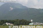
The 3rd station is halfway up Mt. Ibuki. A small plateau.
|
|

The 3rd station is halfway up Mt. Ibuki.
|
|
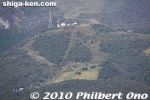
The 3rd station is halfway up Mt. Ibuki.
|
|
|
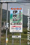
Near the foot of Ibuki is Ueno. Sign showing the way to the hiking trail.
|
|
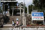
Sannomiya Shrine at the foot of Mt. Ibuki. The hiking trail and ski lift are near here. It's also how to get to the 3rd station.
|
|
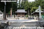
Sannomiya Shrine
|
|

About Sannomiya Shrine, established in 781.
|
|
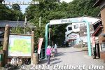
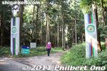
Welcome to Mt. Ibuki.
|
|

Map of Mt. Ibuki.
|
|
Another way to go up Ibukiyama was by gondola at the foot of the mountain. However, this gondola is no longer operating.
|
|
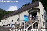
Gondola lift station. The gondola was somewhat pricey to go up to the 3rd station or Sangome. It stopped operating in 2011.
|
|
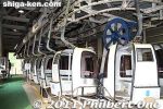
Boarding the gondola lift. This was in summer.
|
|
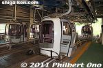
This gondola was built in 1989 to take people from the foot of the mountain directly to the 3rd station.
|
|
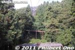
Before the gondola, we had to ride at least two ski lifts to reach the 3rd station.
|
|
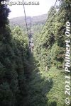
Going up Mt. Ibuki on the gondola.
|
|
|
|
|
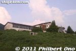
Approaching the 3rd station. The old Ibukiyama Kogen Hotel.
|
|
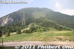
View of 3rd station. Higher up the mountain are the 4th and 5th stations.
|
|
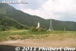
Statue of Nakayama Saijiro at Mt. Ibuki's 3rd station.
|
|
|
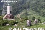
At the 3rd station is a statue of Nakayama Saijiro, a pioneer who spread skiing in the Kansai region via Mt. Ibuki.
|
|
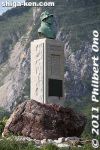
Statue of Nakayama Saijiro, principal of a high school in Kyoto who brought his students to learn how to ski on Mt. Ibuki. Erected in Sept. 1964 by the alumni of his school to mark the 50th anniversary of him starting skiing on Ibuki.
|
|
|
|
|
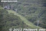
Old ski lift and run.
|
|
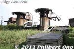
Old ski lifts from the 2nd station rusting.
|
|

Picture of all the ski lifts and gondola. Indicates that only the gondola is operating this day.
|
|
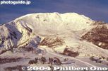
Snow on Mt. Ibuki at the 3rd station, the main area for skiing (when there is snow).
|
|

Skiing on Mt. Ibuki at the 3rd station. How it looked in the good old days.
|
|
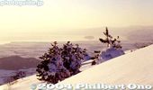
Snow on Mt. Ibuki and Lake Biwa as seen from the ski lift to the 3rd station.
|
|

Sunset on snowy Mt. Ibuki in winter at the 2nd station.
|
|
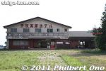
The old Ibuki Kogen Hotel.
|
|
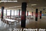
The old Ibuki Kogen Hotel used as a rest house.
|
|

Paragliders. There is a paragliding school on the 3rd station where anyone can take a daylong or half-day paragliding lesson.
|
|
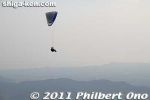
Paraglider
|
|
|
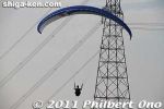
Paraglider
|
|

In summer, lilies bloom at sunset on Mt. Ibuki's 3rd station.
|
|

Lemon yellow lilies ユウスゲ
|
|

These lilies start to bloom from twilight.
|
|

Lemon yellow lilies on Mt. Ibuki. ユウスゲ
|
|
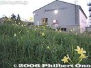
Ibukiyama gondola station and lilies
|
|
|
|

View of 3rd station
|
|
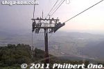
Going back down on the gondola.
|
|
|
|
|
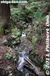
Chikara mizu or Power water.
|
|
|
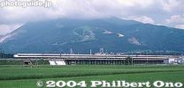
Mt. Ibuki and shinkansen
|
|
|
|

Omi-Nagaoka Station on JR Tokaido Line
|
|
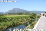
Near Omi-Nagaoka
|
|

Mt. Ibuki as seen from Lake Biwa.
|
|
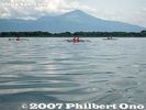
Mt. Ibuki as seen from Lake Biwa.
|
|
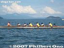
Mt. Ibuki as seen from Lake Biwa.
|
|

Mt. Ibuki as seen from Lake Biwa off Imazu.
|
|
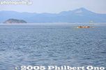
Mt. Ibuki as seen from Imazu.
|
|
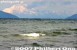
Mt. Ibuki as seen from Hikone.
|
|
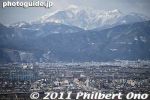
Mt. Ibuki as seen from Gifu Station.
|
|
|
|
|
|