 Image search results - "japannationalpark" Image search results - "japannationalpark" |

Shinkyo Sacred Bridge, Nikko 神橋
|
|
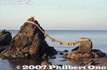
Meoto-Iwa Wedded Rocks off the coast of Futami-cho, Ise city, Mie Prefecture. 夫婦岩
|
|
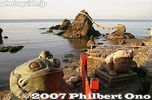
The shrine is dedicated to Sarutahiko and Ukano-mitama. Sarutahiko is a god which serves as a pathfinder guide. Deities for land/sea transportation safety. 二見�
|
|
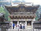
Yomeimon Gate, National Treasure, Nikko 陽明門
|
|
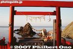
Futami Okitama Shrine does not have a main hall (Honden) like most other shrines. It worships the Okitama Sacred Stone in the ocean beyond the Wedded Rocks. 二見興玉神社
|
|

Seto Inland Sea as seen from Megishima, Kagawa Pref.
|
|
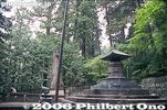
Tokugawa Ieyasu's mausoleum
|
|
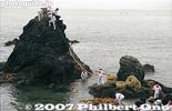
The new ropes are strung across the two rocks. A small rope tied to the end of the large rope is used to pull the large rope up the rock.
|
|
|
|

All the while, the cheering section chants and wave streamers.
|
|

Sakurajima 桜島Part of Kirishima-Yaku National Park.
|
|
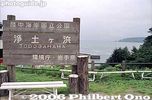
Jodogahama sign. Part of the Rikuchu-Kaigan National Park.Rikuchu-Kaigan National Park, Iwate Pref.
|
|
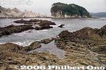
Jodogahama literally means Paradise Beach.Rikuchu-Kaigan National Park, Iwate Pref.
|
|

Dramatic rock formations.Rikuchu-Kaigan National Park, Iwate Pref.
|
|

Colorful koi carp fish in Bishamon-numa Pond, Fukushima Pref. 毘沙門沼Bandai-Asahi National Park
|
|

Bishamon-numa Pond, Fukushima Pref. Bandai-Asahi National Park 毘沙門沼
|
|
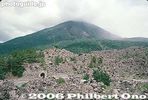
Sakurajima, Kagoshima. Part of Kirishima-Yaku National Park. 桜島
|
|

Benten-numa Pond, maximum depth 6 meters. 弁天沼Bandai-Asahi National Park
|
|
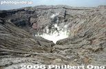
Mt. Naka-dake is Mt. Aso's most famous crater, Kumamoto 阿蘇山 中岳火口Measures 1 km wide north to south and 4 km east to west.
|
|

Always smoking, Mt. Naka-dake in Aso-san, Kumamoto 阿蘇山 中岳火口
|
|
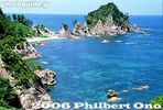
Uradome Coast, Tottori, part of the San-in Coast National Park. 山陰海岸国立公園
|
|
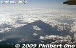
Mt. Fuji from the air.
|
|
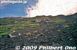
Rocky trail looking up on Mt. Fuji.
|
|
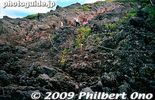
Rock and more rock on Mt. Fuji.
|
|

Mt. Fuji torii
|
|
|

Lake Akan at sunset.
|
|

Bihoro Pass Scenic Point has two lookout points a short walk from each other. This is from the second lookout point. Both have similar views of Lake Kussharo. Bihoro Pass is within Akan-Mashu National Park in Hokkaido.
|
|

Mt. Daisen in winter as seen from the train. Tottori Prefecture.
|
|

Mt. Daisen in winter as seen from the train. Tottori Prefecture.
|
|

This is Owakudani, now a danger zone and off limits. These photos were taken from an earlier trip. Hakone is part of the Fuji-Hakone-Izu National Park.
|
|
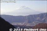
Mt. Fuji from Hakone.
|
|
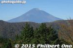
Mt. Fuji as seen from Ubako Station in Hakone. It was a clear autumn day in early Nov.
|
|
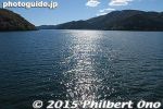
Heading for Hakone-machi on Lake Ashi in Hakone.
|
|

Lake Ashi's famous torii of Hakone Shrine with Mt. Fuji in the background.
|
|
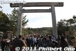
Ise Jingu Shrine's Naiku (Inner Shrine) is the main and most popular shrine at Ise. The shrine is rebuilt every 20 years and 2013 will mark the completion of the new shrine to replace the old one built in 1993.
|
|
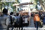
The bottleneck at Naiku was this little torii which most people wanted to walk through at the top of the steps. People like me who didn't have time opted to go up the steps on the right side in no time.
|
|
|
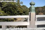
Uji Bridge is made of hinoki cypress wood. The bridge columns are made of keyaki.
|
|
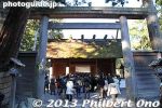
Entering Geku shrine at Ise.
|
|
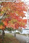
Lake Kawaguchi, Yamanashi.
|
|

If you visit Lake Kawaguchi, you might as well visit Lake Saiko or Lake Sai, a short bus ride away. There are a number of tourist attractions like ice caves and bat caves.
|
|
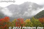
On 2010, Lake Saiko garnered national attention when the native species kunimasu, a type of salmon or black kokanee, thought extinct for 70 years, was discovered in the lake.
|
|
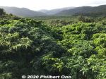
Great views of the greenery from the Otomi Lookout Deck.
|
|
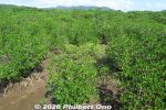
Sakishima suounoki mangroves, Iriomote. サキシマスオウノキ (古見)
|
|

Rishiri is one of Japan's northernmost islands off Wakkanai, Hokkaido. Round island with a distinctive cone-shaped mountain Mt. Rishiri (photo) in the middle. Part of Rishiri-Rebun-Sarobetsu National Park.
|
|

Rishiri as seen from Rebun. If you visit Rebun, also visit Rishiri and vice versa. They are almost like wedded islands. Rishiri is male (tall and distinct stature), Rebun is female (curvaceous).
|
|

Rebun is part of Rishiri-Rebun-Sarobetsu National Park.
|
|

Lake Toya and cherry blossoms. Shikotsu-Toya National Park
|
|

The Sands of Tottori. Every prefecture has something nationally (and sometimes internationally) famous. In the case of Tottori, it's definitely the sand dunes (sakyu in Japanese).It's on the beach facing the Sea of Japan. The dunes were formed by the ocean currents that deposited the sand on the coast for 100,000 years or so. I find that amazing since most of the beaches I know have the ocean currents eat away the sand.
|
|
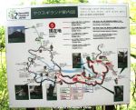
Yakusugi Land is a lush, thick, mountain forest area featuring ancient Yakusugi cedars (Cryptomeria japonica) native to Yakushima and the island's major attraction. You can see a variety of Yakusugi cedars by walking on a forest trail of varying lengThe forest trail starts and ends at the same place, but there are several trail options. The shortest trail route is 0.8 km long (yellow line on this map named Fureai-no-Michi, numbered from 1 to 6), taking about 30 min. This is the trail we went on. Even this short trail for tourists was very impressive. Another easy tourist trail is 1.2 km taking 50 min. (red line).
The longer trails going for 2.0 km, 3.0 km, and 4.4 km (green line) involve mountain climbing taking about 80 min., 150 min., and 3.5 hours respectively. These longer trails require proper climbing equipment and physical endurance.
|
|

Kuguri-tsuga or "Conifer Underpass." They have names for all these different trees in unusual shapes or growths.くぐり栂Japanese pamphlet (pdf) and map of the trail here: https://y-rekumori.com/pdf/yakusugi_land_pamphlet.pdf
|
|
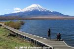
Lake Yamanaka and Mt. Fuji in Nov. There's a boardwalk. Thisis near Yamanakako Koryu Plaza. 山中湖交流プラザ きらら
|
|
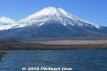
Lake Yamanaka and Mt. Fuji in Nov.
|
|
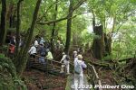
Yakusugi Land tourist hike to see old cedar trees (and stumps) on Yakushima island, Kagoshima.
|
|
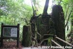
Kind of sad to see so many great Yakusugi cedar trees which were cut down. But at least they still survive in some form or hosting other trees and plants.
|
|
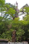
Kigensugi as it looks from the road. "Kigen" refers to the beginning of recorded history which in Japan is the year 660 when the first emperor came to being. The tree seems to be older though, at age 3,000 years.
|
|
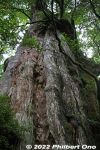
Back of Kigensugi cedar tree.
|
|
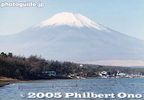
Mt. Fuji and Lake Yamanaka
|
|
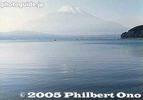
Mt. Fuji and Lake Yamanaka
|
|
|
|