 Image search results - "japanmt" Image search results - "japanmt" |

Lake Suwa and mountains
|
|
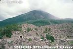
Sakurajima, Kagoshima. Part of Kirishima-Yaku National Park. 桜島
|
|
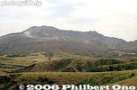
View of Mt. Aso
|
|

Lake Suwa and mountains
|
|

Aso Crater rim
|
|
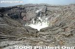
Mt. Naka-dake is Mt. Aso's most famous crater, Kumamoto 阿蘇山 中岳火口Measures 1 km wide north to south and 4 km east to west.
|
|

Mt. Naka-dake in Aso-san, Kumamoto. Measures 1 km wide north to south and 4 km east to west. 阿蘇山 中岳火口
|
|
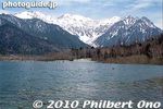
It's worth visiting Kamikochi, very scenic for Japan.
|
|
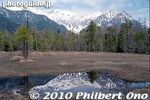
Kamikochi is accessible by bus from the Matsumoto Bus Terminal near JR Matsumoto Station.
|
|
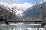
Kappabashi Bridge and the Hotaka mountains at Kamikochi, Nagano. 河童橋と穂高連峰
|
|

Kamikochi, Nagano
|
|
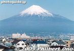
Mt. Fuji as seen from the shinkansen bullet train.
|
|
|
|
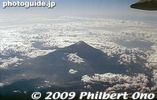
Mt. Fuji from the air.
|
|
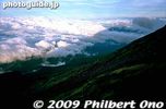
Shadow of Mt. Fuji
|
|
|
|
|
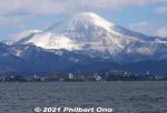
Snowy Mt. Ibuki as seen from Lake Biwa. Shiga Prefecture's highest mountain.
|
|

Mt. Daisen in winter as seen from the train. Tottori Prefecture.
|
|

Mt. Daisen in winter as seen from the train. Tottori Prefecture.
|
|

Fujisan Hongu Sengen Taisha Shrine's second torii has a fine view of Mt. Fuji.
|
|

Mt. Fuji and torii pillar.
|
|

The shrine has a varied and scenic landscape with a river, lawn, and natural spring pond.
|
|
|

At Sengen Taisha Shrine in Fujinomiya.
|
|
|
|

Mt. Fuji from the bus on the way to Shiraito Falls.
|
|

Red Mt. Fuji at sunset in Fujinomiya, Shizuoka.
|
|
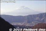
Mt. Fuji from Hakone.
|
|
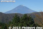
Mt. Fuji as seen from Ubako Station in Hakone. It was a clear autumn day in early Nov.
|
|
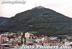
Hakodate's main attraction and landmark is Mt. Hakodate-yama, accessible by ropeway.
|
|
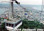
Going up Hakodate-yama, Hakodate, Hokkaido.
|
|

A bird's eye view of Hakodate from Hakodate-yama. The city is pretty compact. Easy to tour on bicycle.
|
|

At night from Hakodate-yama is the Million-Dollar View.
|
|

Camellias and Mt. Ibuki, Maibara, Shiga Prefecture.
|
|

Mt. Ibuki and shinkansen, Maibara, Shiga Prefecture.
|
|
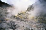
Mt. Io is Kawayu Onsen's hot spring source. It was also a sulphur mine from 1877 to 1896. At the time, sulphur was widely used in cigarette matches and gunpowder.
|
|
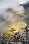
Mt. Io, Hokkaido. You can get quite close to the sulphur vents.
|
|

But the scenery is great atop Mt. Ibuki in summer. 東遊歩道
|
|

Mt. Ibuki and Mishima Pond, Maibara, Shiga Pref.
|
|

Mt. Fuji as seen from Nihondaira's Ginbodai. Even sunny days can be hazy, but at least Mt. Fuji was visible when I went in mid-March. It was too hazy to see the Izu Peninsula.
|
|

Mt. Fuji as seen from Nihondaira.
|
|

Mt. Yotei as seen from Niseko Hirafu, Niseko's largest ski grounds. Yotei-zan is dubbed as Hokkaido's Mt. Fuji. ニセコ ヒラフ・羊蹄山
|
|

Mt. Yotei-zan can be clearly seen from Niseko Hirafu. Hokkaido's Mt. Fuji. ニセコ ヒラフ・羊蹄山
|
|

Views while skiing on Niseko Annupuri, Hokkaido. ニセコアンヌプリ
|
|

Skiing on Niseko Annupuri, Hokkaido.
|
|

Mt. Nosokodake (野底岳), Ishigaki’s second highest mountain at 282 m. Can be climbed up a steep, narrow trail in about 15 min. We didn't climb it though.
|
|
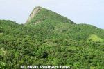
Side view of Mt. Nosokodake. This mountain is associated with a famous local folk tale about a girl named Maape. The mountain is nicknamed after her, "Nosoko Maape" (野底マーペー).On the nearby island of Kuroshima (黒島) in the 18th century, Maape and her childhood sweetheart, Kanimui, were happily living as farmers. They were to be married someday.
However, one day, a Ryukyu government decree ordered half the island's residents to move here near Nosokodake on Ishigaki while the other half could remain on Kuroshima. The island's population was split along the island's main road. Maape and Kanimui lived on the opposite sides of the road, and Maape was on the side where people had to move to Ishigaki.
|
|
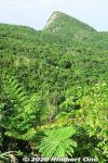
So she and her family were forced to move here to Nosokodake to start a new farming village and clear the thick jungle for farming. It was a hard life. Maape desperately missed her beloved Kanimui and couldn't forget him.
One day, she wanted to at least see Kuroshima where he lived, so she climbed up Mt. Nosokodake. At the top, she looked for Kuroshima, but her view of the island was blocked by Mt. Omotodake, Ishigaki's highest mountain. She collapsed on her knees and wailed in sorrow. Later, a worried villager looked for Maape who never returned home. On the top of the mountain, he found a crying rock gazing in the direction of Kuroshima. Maape had turned into stone.
|
|
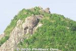
Even today, people who climb the mountain look for the Maape rock and assume this or that rock is her.This story is based on historical fact. The Ryukyu government sometimes forced people to migrate to undeveloped lands to start farming to increase agricultural production so they could pay more taxes. The kingdom was being heavily taxed by the Satsuma Domain in Kagoshima, and taxes had to paid in rice per head.
Read more about the folk tale here: https://photoguide.jp/log/2020/12/yaeyama-folk-songs-nosokodake-maape/
|
|

Nakajima islands, Lake Toya
|
|

Rishiri is one of Japan's northernmost islands off Wakkanai, Hokkaido. Round island with a distinctive cone-shaped mountain Mt. Rishiri (photo) in the middle. Part of Rishiri-Rebun-Sarobetsu National Park.
|
|

Approaching Rishiri by ferry. There are ferries from Wakkanai and Rebun going to Rishiri. Lighthouse near the port. Mt. Rishiri is 1,721 meters high.
|
|

Rishiri as seen from Rebun. If you visit Rebun, also visit Rishiri and vice versa. They are almost like wedded islands. Rishiri is male (tall and distinct stature), Rebun is female (curvaceous).
|
|

Mt. Showa-Shinzan is a lava dome which arose in the middle of farm land in 1943-45. Lake Toya, Hokkaido.
|
|

Lake Toya lookout deck on Mt. Usu, near the ropeway terminal. Showa-Shinzan clearly in sight. 洞爺湖展望台
|
|

Lake Toya's bald spot.
|
|

Showa-Shinzan closeup. Still steaming.
|
|

Mt. Usu's Ginnuma Crater, one of the largest. It was created during the 1977 eruption. 銀沼大火口
|
|

Mt. Usu or Usuzan as seen from the lake.
|
|

Eastern Lake Toya, with Mt. Usu in the distance.
|
|
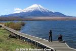
Lake Yamanaka and Mt. Fuji in Nov. There's a boardwalk. Thisis near Yamanakako Koryu Plaza. 山中湖交流プラザ きらら
|
|
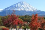
I visited Narusawa on a beauitful autumn day with snow-capped Mt. Fuji and autumn foliage. Narusawa, Yamanashi Prefecture.
|
|

Mt. Fuji in autumn with red momiji maple leaves. Narusawa, Yamanashi Prefecture.
|
|
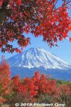
Mt. Fuji in autumn with red momiji maple leaves. Narusawa, Yamanashi Prefecture.
|
|

Mt. Fuji in autumn with red momiji maple leaves. Narusawa, Yamanashi Prefecture.
|
|
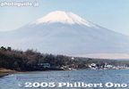
Mt. Fuji and Lake Yamanaka
|
|
|
|