Rivers and Waterfalls 川と滝
|
|
|

Kiso River with Inuyama Castle in the distance
|
|

Akikawa River below Kichijoji Falls, Hinohara, Tokyo
|
|

Kichijoji Falls consist of three small waterfalls. Hinohara, Tokyo 吉祥寺滝
|
|

View of Kiso River
|
|

Hossawa Falls, Hinohara, Tokyo
|
|
|

Hossawa Falls
|
|

Waterfalls
|
|

Ice crystals and running water. Normally, the Hossawa waterfall freezes over in winter.
|
|

Otaki Waterfall
|
|

Hossawa Falls, Hinohara, Tokyo
|
|

Hossawa Falls is one of Japan's 100 Famous Falls. 日本の滝百選
|
|

Tama River in Mitake Gorge, Tokyo
|
|

Tama River in Mitake Gorge, Tokyo
|
|

It's actually a series of small waterfalls. Mt. Hinodeyama, Tokyo.
|
|

Seta River, Shiga Pref. 瀬田川
|
|
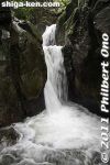
Fudo-no-taki Waterfall in Mikumo, Konan, Shiga Prefecture.
|
|

First you see Otodome Falls, big and impressive.
|
|

Otodome Falls in Fujinomiya, Shizuoka
|
|

Shiraito Falls in Fujinomiya, Shizuoka
|
|

Shiraito Falls in Fujinomiya, Shizuoka.
|
|

Shiraito Falls in Fujinomiya, Shizuoka.
|
|
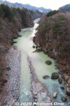
Kinugawa River as seen from Kinutateiwa Bridge in Kinugawa Onsen.
|
|
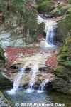
Furukama Falls in Kinugawa Onsen, Tochigi. 古釜の滝
|
|
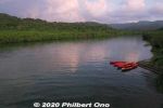
There was this dock where we could get on our kayaks. Maira River, Iriomote.
|
|

A few clouds, but the sunrise was getting to be nice.
|
|

Sunrise kayaking on Iriomote, Yaeyama, Okinawa.
|
|

Our guide was Harubaru, but he doesn't normally do sunrise kayaking unless you ask him to: http://harubaru-iriomote.okinawa/course/
|
|

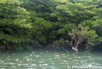
After the sunrise, we paddled along the mangroves on the river's edge.
|
|

After the sunrise, we paddled along the mangroves on the river's edge.
|
|

Lovely morning, too bad we didn't have time to kayak more upstream on Maira River, Iriomote.
|
|

Shinmei no Taki waterfalls are these small waterfalls along the road. Kora, Shiga Prefecture.
|
|

Sobetsu Falls, Lake Toya, Hokkaido.
|
|

In northern Iriomote, Urauchi River is Okinawa's longest (19 km), widest (200 m), and deepest (15 m) river. It's home to a whopping 400 species of fish or 10 percent of Japan's fish species.Over 20 fish species are endangered. Urauchi River is within Iriomote-Ishigaki National Park. Both sides of the river are lush with mangroves and forests. 西表国立公園
|
|
The boat operator narrates the sights along the river. There are even signs indicating the flora. This sign indicates a mangrove species called "me-hirugi" (メヒルギ) in Japanese or Kandelia obovata growing in brackish water.It has white, star-shaped flowers.
|
|

Urauchi River is fed by the runoff from Iriomote's central mountains. Urauchi River jungle cruise is about 30 min. or 8 km upstream to another boat dock called Gunkan-iwa. 西表島・浦内川
|
|

Ferns and tree ferns also grow at upstream. シダ類
|
|

After hiking about 30 min., a scenic point gives a view of Mariyudu Falls. Series of three waterfalls. It empties into a round stream pool. "Mariyudu" means stream pool. マリゥドゥの滝
|
|

Mariyudu Falls on Urauchi River. About 20 meters wide and 16-meter drop in total. One of Japan's 100 Famous Waterfalls. マリゥドゥの滝*People can no longer come this close to the falls. There were people who slipped and fell in, so the closeup path is blocked.
|
|

Kanbire (Kanpire) Falls on Urauchi River, near the center of Iriomote. This is about 2 km from the Gunkan-iwa boat dock. Or 30-40-min. hike. You can get quite close to the falls. カンビレーの滝Instead of having one big drop, Kanbire Falls flow down on a series of steps on the river for about 200 meters. The riverside also has small potholes. Kanbire (Kanpire) means "where gods sit." This spot was considered to be a sacred site where the gods gathered.
|
|

Yoro town's most famous attraction is Yoro Park and Yoro (Yoro-no-taki) Falls, especially during cherry blossom season in early April
|
|

People enjoy the river and flowers in Yoro.
|
|

The famous Yoro Falls in Gifu.
|
|

Yoro-no-taki Falls is 32 meters high and 4 meters wide. Swimming under the falls is not allowed. This is the closest you can get.
|
|
|
|