Urauchi River Cruise and Waterfall Hike 浦内川自然研究路
|
Title   • File Name • File Name   • Date • Date   • Position • Position   |
|

On Iriomote, one convenient way to tour the island is go on a sightseeing tour by bus. They pick you up when you arrive at the port and take you to the major sights like Urauchi River and Yubu.You can book a tour from Ishigaki.
|
|

On the tour bus on Iriomote going north. Lots of sugar cane.
|
|

Northern Iriomote has Okinawa and Iriomote's longest river, Urauchi River (18 km). It's a popular tourist route to go on the jungle cruise, then hike through the forest to see two waterfalls on the river.Near Urauchi-hashi Bridge at the mouth of the river, there's a boat dock for Urauchi jungle river cruises. Since the hiking trail is rocky or muddy, don't wear high heels or slippers. Wear sneakers or hiking shoes. Although there's a restroom along the hiking trail, it's not as clean as you would like. Better to use the toilet at the boat dock before the cruise. Also bring something to drink. The roundtrip cruise and hike will take about 3 hours. Map here
|
|

Boat dock at Urauchi River on Iriomote. If you come on your own, the jungle river cruise is ¥1,800 for adults. 西表島・浦内川The boat cruise takes about 30 min. to a dock upstream where you get off for the waterfall hike. Boats depart here once or twice an hour from morning to early afternoon.
|
|

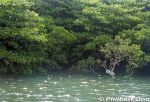
In northern Iriomote, Urauchi River is Okinawa's longest (19 km), widest (200 m), and deepest (15 m) river. It's home to a whopping 400 species of fish or 10 percent of Japan's fish species.Over 20 fish species are endangered. Urauchi River is within Iriomote-Ishigaki National Park. Both sides of the river are lush with mangroves and forests. 西表国立公園
|
|

The boat operator narrates the sights along the river. There are even signs indicating the flora. This sign indicates a mangrove species called "me-hirugi" (メヒルギ) in Japanese or Kandelia obovata growing in brackish water.It has white, star-shaped flowers.
|
|

Urauchi River is fed by the runoff from Iriomote's central mountains. Urauchi River jungle cruise is about 30 min. or 8 km upstream to another boat dock called Gunkan-iwa. 西表島・浦内川
|
|

Wish we could see the Iriomote wildcat swimming across the river, but they are nocturnal.
|
|

Ferns and tree ferns also grow at upstream. シダ類
|
|

Another Urauchi River cruise boat. 西表島・浦内川 遊覧ボート
|
|

We got off the boat upstream here at Gunkan-iwa, named after a rock slab looking like the side of a battleship. 軍艦岩
|
|

At Gunkan-iwa dock, there's a hiking trail called Urauchigawa Shizen Kenkyu-ro. A nature trail that goes to two waterfalls.Note that cell phones won't work on the hiking trail. 浦内川自然研究路
|
|

Urauchi River hiking trail to waterfalls. It can be quite muddy.
|
|

Sometimes there are views from the hiking trail.
|
|

Lush forest, but rocky and muddy trail. Hiking shoes or sneakers are good. Sometimes a tree or branch has fallen over the trail. Need to go over/under it.
|
|

Ferns and a nameless mini waterfall.
|
|

After hiking about 30 min., a scenic point gives a view of Mariyudu Falls. Series of three waterfalls. It empties into a round stream pool. "Mariyudu" means stream pool. マリゥドゥの滝
|
|

Mariyudu Falls on Urauchi River. About 20 meters wide and 16-meter drop in total. One of Japan's 100 Famous Waterfalls. マリゥドゥの滝*People can no longer come this close to the falls. There were people who slipped and fell in, so the closeup path is blocked.
|
|

Behind Mariyudu Falls looking from upstream.
|
|

Mariyudu Falls. From here, the hiking trail continues to another waterfall, Kanbire (Kanpire) Falls about 250 meters away.
|
|

Kanbire (Kanpire) Falls on Urauchi River, near the center of Iriomote. This is about 2 km from the Gunkan-iwa boat dock. Or 30-40-min. hike. You can get quite close to the falls. カンビレーの滝Instead of having one big drop, Kanbire Falls flow down on a series of steps on the river for about 200 meters. The riverside also has small potholes. Kanbire (Kanpire) means "where gods sit." This spot was considered to be a sacred site where the gods gathered.
|
|

Hiking back. The lady in front of me was wearing rubber slippers on this muddy trail. She kept slipping and almost falling. Her dainty feet got all muddy.
|
|

River cruise back to the dock.
|
|

Urauchi River boat dock as seen from Urauchi Bridge near the mouth of the river.
|
|
|
|

Mangroves near the mouth of Urauchi River, seen from Urauchi Bridge.
|
|

Bus stop (Urauchihashi) for the Urauchi River boat dock. In the background is our tour bus.
|
|

On the northern tip of Iriomote is scenic Hoshi-suna Beach. Famous for star-shaped sand grains, but hard to find. 西表 星砂の浜Map here
|
|

Iriomote Hoshisuna Beach.
|
|

Iriomote Hoshizuna Beach.
|
|

Northern Iriomote coast.
|
|
|
|
|