 Image search results - "river" Image search results - "river" |
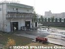
Seta Rowing Club's 2-story clubhouse located in Otsu, Shiga Prefecture. The club is a registered NPO. The club is named after Seta River at the southern tip of Lake Biwa. Regattas are also held on the river, Lake Biwa's sole outflowing river.
|
|

PR poster designed by Tetsuo OshiroPoster for the race.
京都大学ボート部OBの尾城徹雄様に作成したポスター。大学内や大津市石山商店街などで張り出された。
|
|

Kiso River with Inuyama Castle in the distance
|
|
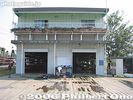
Seta Rowing Club's clubhouse. Boats are stored on the bottom floor, while the 2nd floor has office space, ergo machines, meeting room, locker room, etc. Web site here
|
|
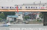
Karahashi Bridge as the starting point for alumni races
|
|
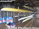
Oars and boats stored on the bottom floor. The club offers 2-hour rowing lessons on Sundays during May to Nov. Address: 6-1 Ogaya, Otsu, Shiga 520-2144 Japan. Phone/Fax: 077-545-9961, Email: info@setarc.jp
|
|
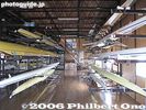
Many boats are made in Italy.
|
|

Kyoto Univ. in dark blue T-shirts
|
|
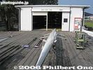
Right across the clubhouse is the Annex boat house.
|
|
|
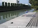
Club's boat dock. This narrow canal leads to Lake Biwa.
|
|

Finish line 300 meters later
|
|

Rowing exercise machines called "ergometers" or "ergo" or "indoor rower." In Japan, they call it "ergo." エルゴThe machine measures the energy you expend rowing. Also measures how fast and far you rowed if you were on water. They even have ergo rowing contests which is a sport itself.
|
|

Tokyo Univ. (Todai) crew return to land after a race
|
|
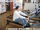
The rowing lesson starts with an ergo workout.
|
|
|
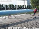
Carrying the boat.
|
|
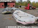
Rafts ready to roll from Käylä
|
|

The gateway to the Seta area is Karahashi-mae Station.
|
|

On July 29, 2007, this regatta was held for the second time. It targets mainly beginner rowers. Organized by the Seta Rowing Club which seeks to have more people enjoy water sports on Lake Biwa. Seta-Karahashi Bridge was the regatta's starting line. The Lake Biwa Rowing Song CD was awarded to all the 1st, 2nd, and 3rd place winners in all five categories.
|
|

Anegawa River was the site of a major battle with Oda Nobunaga and Tokugawa Ieyasu defeating Azai Nagamasa and the Asakura clan on Aug. 9 1570. The area was left with so many dead that the river ran red.Local place names such as Chibara (Blood Field) stuck. Looking toward Nomura-bashi Bridge where the Anegawa battle monument stands.
|
|
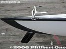
Sleek rudder and steering cables
|
|

Keihan train at Karahashi-mae Station.
|
|

Univ. of Tokyo alumni crew in light blue T-shirts
|
|

Sixty rowing teams (300 people) rowed in five categories, including beginner and expert rowers, ranging in age from junior high to senior citizens.
|
|

Nomura-bashi Bridge crosses Anegawa River. This is where Oda Nobunaga battled the Azai clan.
|
|
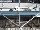
Rowing seat with moving seat on rails, fixed shoes, and outrigger for the oar.
|
|

Seta-no-Karahashi Bridge with the new paint job in 2012. 瀬田之唐橋
|
|

Kyoto Univ. alumni crew in dark blue T-shirts
|
|

When I walked around, my planned 20-min. stay turned into a 2-hour walking tour of this pacifying place, full of mountains and a clear river. A delightful discovery. Suigen Park
|
|

This is the boat dock where people got on and off the boats. The boats were provided by local rowing organizations. The regatta was organized by the Seta Rowing Club in Otsu.
|
|
|
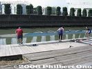
Carrying the boat to water.
|
|

The observation deck is about 125 meters above the ground. The tallest building along the Sea of Japan coast. Fine view of Shinano River.
|
|

The original Seta-no-Karahashi Bride was the site of historic battles. It has two bridges, one long and one short going over an island in the river.
|
|

Kyoto Univ. alumni crew at start line
|
|

On the side of the road near the bus stop, there is a trail going down to Tama River.
|
|

Completely surrounded by mountains with a clear river running in the middle.
|
|

A rowing team leaves the dock for Seta-Karahashi Bridge seen in the background.
|
|

Battle monument
|
|
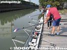
Inserting the oars into the outriggers.
|
|

In the foreground is Bandaibashi Bridge, spanning Shinano River.
|
|

The current bridge was rebuilt in 1979 and painted a beige color.
|
|

On Karahashi Bridge
|
|

A suspension bridge over the river.
|
|

A few bridges span the river.
|
|

Seta-Karahashi Bridge, the start line.
|
|

Anegawa River Battle Memorial
|
|
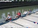
Ready to row on a "quad" sculling race boat. Each person rows with two oars.Sorry for the small image.
|
|
|
|

Race starts for Kyoto Univ. alumni
|
|

Tama River as seen from the bridge.
|
|
|

Up to four rowing teams raced down a 250-meter straight course.
|
|

Anegawa River Battle Memorial, rear view with the battle date engraved.
|
|
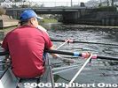
We now enter Lake Biwa.
|
|
|
|
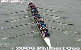
Kyoto Univ. alumni
|
|

Tama River
|
|

Tama River, looks very inviting in summer.
|
|

Akikawa River below Kichijoji Falls, Hinohara, Tokyo
|
|
|

Front view of Anegawa River Battle Memorial where Oda Nobunaga and Tokugawa Ieyasu defeated Azai Nagamasa and the Asakura clan on Aug. 9 1570.
|
|
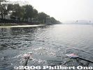
Lake Biwa Rowing Course operated by Shiga Prefecture for major rowing regattas. It is near the head of Seta River, and very near Seta Rowing Club.
|
|

Too hazy to see Sado island.
|
|
|

Kyoto Univ. starts to veer off course
|
|

Tama River, very quiet and peaceful.
|
|

Upriver as seen from the bridge.
|
|
|

Anegawa River Battle Memorial, dedicated to the war dead
|
|
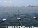
Oars keep the unstable boat stable.
|
|

Toward the mouth of Shinano River.
|
|

Seta-no-Karahashi Bridge in autumn. 瀬田之唐橋
|
|

Kyoto Univ. is unable to correct their misdirection
|
|

Crystal clear water of Tama River
|
|
|

All the boats are held stationary with a rope provided from the bridge.
|
|

The battle site is next to Nomura village. Nobunaga and the Azai called it the Battle at Nomura.
|
|
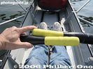
The oar handles overlap when you pull them. Often my hands bumped into each other.
|
|
|
|
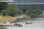
A faulty rudder runs them aground
|
|

Crystal clear water of Tama River with fall leaves.
|
|
|
|

Next to the battle memorial is another monument.
|
|
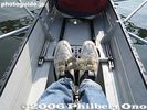
Shoes are fixed to a small, angled platform.
|
|

Ferry to Sado island.
|
|

Life jackets, helmets, waterproof jacket/pants, boots, and glovesFirst we had to suit up. It was like we were ready for combat. But it wasn't that dangerous.
|
|
|
|

Tamagawa River has a good number of cherry trees in Hamura.
|
|

Cherry blossoms along the Shakujii River, near Shin-Itabashi Station on the Mita subway line.
|
|
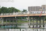
4-man crew alumni boat race
|
|
|
|

Trout fishing ponds for customers in warmer months.
|
|
|
|
|
|
|

Weeping cherry
|
|

There are cherries on both sides of the river and a walking path on both sides.
|
|
|
|

These photos were taken in Feb. Probably scenic in fall.
|
|

Riverside fishing ponds
|
|
|
|
|
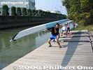
After a neat rowing trip, the boat is lifted out of the water.
|
|
|

Miyagawa River 宮川
|
|

Seta-no-Karahashi Bridge with the new paint job in 2012.
|
|

Weeping cherry next to the water park.
|
|

Entrance to one walking path with a poem monument.
|
|
|

Mountain with a patch of green.
|
|

Path to Otaki Waterfalls 雄滝
|
|

Kichijoji Falls consist of three small waterfalls. Hinohara, Tokyo 吉祥寺滝
|
|
|

Battle map showing the position of the opposing armies.
|
|

Rinsing the shell with fresh water.
|
|

Fishing boats
|
|

Nakahashi Bridge over Miyagawa River 宮川に掛かる中橋
|
|

Seta-no-Karahashi Bridge
|
|

Weeping cherries
|
|
|

8-man crew alumni in their 20s and 30s at starting line
|
|

Bus stop. Notice the monkey crossing the road.
|
|

Waterwheel 水車
|
|

Most races were not close.
|
|

Sign indicating the site of the Battle at Anegawa River.
|
|

The boat is pencil-thin.
|
|
|

Seta-no-Karahashi Bridge over Seta River
|
|
|
|
|
|

There were many hikers on the bus, and I wondered where they were going, so I followed them.
|
|
|
|
|

This is where the Azai and Oda Nobunaga armies clashed.
|
|

Rinsing the oars.
|
|
|
|
|

Tamagawa Josui floodgate. Hamura is noted as the starting point of the Tamagawa Josui Aqueduct built by the Tamagawa farmer brothers in 1653 to supply water to the growing and thirsty city of Edo.
|
|

Cherry tree shadow
|
|

Kyodai alumni in their 20s and 30s
|
|

Numerous monkey poop along the road.
|
|

Waterwwheel (not working)
|
|

The 250-meter course is very short, and each race ends within a minute or two.
|
|
|
|
|

Central Niigata
|
|
|

Entry point of Tamagawa Josui Aqueduct straight ahead. This water has been diverted from the Tamagawa River (on the right).
|
|

River wall
|
|
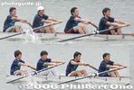
Kyodai alumni in their 20s and 30s
|
|

View of Kiso River
|
|
|

Trail to waterfalls
|
|

Hossawa Falls, Hinohara, Tokyo
|
|

Finish line. In the background is the Kyoto University Rowing Club's boat house.
|
|

Signs indicating the Battle of Anegawa River. This is next to the battle memorial.
|
|
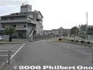
Entrance and road to the rowing clubhouse
|
|

Nakahashi Bridge
|
|
|

Start of Tamagawa Josui Aqueduct. The Aqueduct was built in 1653, 50 years after Shogun Tokugawa Ieyasu moved to Edo. 玉川上水
|
|

Shakujii River sprinkled with fallen petals.
|
|
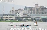
One of the main events, the 4-man boat race between Todai and Kyodai on a 3200-meter course.
|
|

Pretty scenic area.
|
|

When I was walking here, I did not know there was a waterfall.
|
|
|
|

Mt. Ibuki was witness to the battle.
|
|
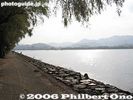
Near the rowing club is the Lake Biwa Rowing Course where regattas are held. 滋賀県立琵琶湖漕艇場
|
|

Nakahashi Bridge
|
|

Tamagawa Josui Aqueduct entrance.
|
|

Pleasant walking path.
|
|

Todai's 4-man crew in the lead
|
|

The area is part of the Chichibu-Tama National Park.
|
|

Path from above.
|
|

The race had to be stopped for a few minutes each time this cruise boat passed by.
|
|

Anegawa River, where thousands lay dead after the battle.
|
|

Floodgate. The position and length is almost the same as the original one built in the 17th century. Only the materials have been replaced with concrete. Water from the Tamagawa River going to Tamagawa Josui canal/Aqueduct.
|
|
|
|

Kyodai's 4-man crew try to keep up
|
|

Trail to Mt. Kumotori, Tokyo's tallest mountain. That's where the hikers were headed.
|
|
|

Hossawa Falls
|
|

The Lake Biwa rowing Song CD was also sold.
|
|

Anegawa River is a shallow river.
|
|
|
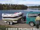
Great day for raftingBut later we had hail.
|
|

Tamagawa River is dammed here by Hamura Intake Weir. Some of the diverted water is released back into Tamagawa River on the right.
|
|

Kanizaka Park near Tamagawa River かに坂公園
|
|

Tamagawa River is on Komae's southern border.
|
|
|
|

Todai's 4-man crew rowing
|
|

Trail to Mt. Kumotori
|
|

Waterfalls
|
|

Ice crystals and running water. Normally, the Hossawa waterfall freezes over in winter.
|
|
|

Anegawa River ran red with the blood of fallen warriors in Aug. 1570.
|
|

Tamagawa River
|
|

Map along the Tamagawa River
|
|

Tama River
|
|

A few bridges cross the river.
|
|

Kyodai's 4-man crew rowing
|
|

Tama River
|
|

Otaki Waterfall
|
|

The Lake Biwa rowing Song CD was also sold during the regatta which lasted from 9 am to 4 pm.
|
|

Anegawa River
|
|

Map of Tamagawa Josui Aqueduct
|
|

Tamagawa River
|
|

Bridge going to Machida.
|
|
|

Kyodai's 4-man crew rowing with dark-blue blades
|
|

By coincidence, I found this man-made waterfall.
|
|

An observation deck is also provided.
|
|

Hossawa Falls, Hinohara, Tokyo
|
|

CDs
|
|

Anegawa River
|
|

Park adjacent to Tamagawa Josui Aqueduct
|
|

Riverside path good for bicycles. Much of the river has a bicycle path.
|
|

On the way to Takebayashi Park, you can see Ochiai River.
|
|
|

Todai won this one.
|
|
|

View from the observation deck
|
|

Sketch of regatta course
|
|

Anegawa River
|
|

Statue of the Tamagawa brothers who were consigned to build the Tamagawa Josui Aqueduct.
|
|

Jogging route along Tamagawa River
|
|

Tamagawa River
|
|
|

Haiku poems solicited from the public are also displayed along the riverside.
|
|
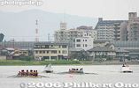
Main race: 8-man crew for Todai and Kyodai coming round the bend on the 3200-meter course
|
|

Waterfall
|
|
|

Hossawa Falls is one of Japan's 100 Famous Falls. 日本の滝百選
|
|

Dragon boat
|
|

Anegawa River
|
|

Statue of the Tamagawa brothers
|
|
|
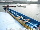
Dragon boat
|
|

Ochiair River with nanohana rape blossoms.
|
|
|
|
|
|
|

Materials and technique used for the Tamagawa Josui floodgate in the Edo Period.
|
|

Gohon Matsu, or Five Pine Trees, one of Tokyo's Best 100 Sights. Lots of movies have been shot here. 五本松
|
|
| 1324 files on 6 page(s) |
1 |
 |
 |
 |
|