 Image search results - "pine" Image search results - "pine" |

Kenrokuen is one of Japan's three most famous gardens (besides Korakuen in Okayama and Kairakuen in Mito, Ibaraki). The garden was originally the castle garden for Kanazawa Castle. Katsurazaka Entrance to Kenrokuen Garden 桂坂口
|
|

Kenrokuen is classified as a "kaiyu-shiki teien" (回遊式庭園) or "circular-strolling Japanese garden." It's a common and classic Japanese garden design where you simply walk around the garden, usually around a central pond.
|
|
|

Karasaki Pine Tree in Kenrokuen Garden, Kanazawa, Ishikawa Pref.
|
|
|
|

Ropes are strung over the tree to protect it against the weight of snow.
|
|

Karasaki Pine Tree in Kenrokuen Garden 唐崎松
|
|

The Karasaki Pine Tree is the garden's largest pine tree.
|
|

Karasaki Pine Tree in Kenrokuen Garden, Kanazawa, Ishikawa Pref.
|
|
|
|

Horai island 蓬莱島
|
|

Pine trees and pond
|
|

Neagari-no-matsu Pine tree with rising roots. 根上松
|
|

Neagari-no-matsu Pine tree with rising roots. 根上松
|
|
|

This garden is very green. Even the pond is deep green. Kiyosumi Garden is classified as a "kaiyu-shiki teien" (回遊式庭園) or "circular-strolling Japanese garden." It's a common and classic Japanese garden design where you simply walk around the garden, usually around a central pond.
|
|

Tiny pink flowers
|
|

Kasumigaike Pond
|
|
|

Many matsu pine trees and many stones.
|
|

Nakahashi Bridge. During the Takayama Festival, ornate floats cross this bridge. 宮川に掛かる中橋
|
|

Karasaki Pine Tree
|
|
|

Stepping stones, called Isowatari, are another major feature of the garden.
|
|

Nakahashi Bridge and pine tree
|
|
|

Stepping stones, called Isowatari. 磯渡り
|
|

Isowatari. 磯渡り
|
|
|

次郎弁天の池
|
|

Benten Pond
|
|
|
|
|
|
|

Ryotei teahouse 涼亭
|
|
|

Verse 2 Lyrics (Omatsu/Omi-Maiko) 二番の英訳(雄松"Pine trees are very green, on sands very white.
Omatsugasato is, a young maiden's home.
Bush of red camellia, hides her teary face.
She's weeping o'er a lost love, much too short to last.
松は緑に 砂白き
雄松が里の 乙女子は
赤い椿の 森蔭に
はかない恋に 泣くとかや
Matsu wa midori ni, suna shiroki
Omatsugasato no, otomego wa
Akai tsubaki no, morikage ni
Hakanai koi ni, naku toka ya
Omi-Maiko is still famous for white sand beaches and pine trees. In summer these beaches are cluttered with people trying to get a tan.
See more photos of Omi-Maiko here.
|
|

"Pine trees are very green, on sands very white." Omi-Maiko
|
|
|
|

Pine tree and Ryotei
|
|

White sands of Omi-Maiko (Omatsu), Otsu, Shiga
|
|

Pine tree and Ryotei
|
|
|
|

Ripples lap white sands of Omi-Maiko.
|
|

Stone pagoda on island named Matsushima
|
|

Pine trees at Omi-Maiko
|
|

Kyoto University Rowing Club arrive at Omi-Maiko in Aug. 2006 during their annual Lake Biwa rowing trip.
|
|

Omatsu "Famous Place" marker
|
|

View of Mt. Mikami from Karasaki, across Lake Biwa.
|
|

Boat landing is near the entrance to Genkyu-en Garden.
|
|
|
|

End of the 50-min. ride. It was pleasant, and highly recommended. Boat landing for the Hikone-jo Ohori Meguri boat ride is near the entrance to Genkyu-en Garden.
|
|
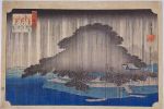
Hiroshige's woodblock print of Night Rain in Karasaki from his "Omi Hakkei" (Eight Views of Omi) series.
|
|
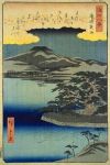
Hiroshige's woodblock print of Night Rain in Karasaki from his "Omi Hakkei" (Eight Views of Omi) series.
|
|

Huge 300-year-old pine tree
|
|

300-year-old pine tree
|
|

300-year-old pine tree
|
|

Side view of 300-year-old pine tree
|
|
|
|

Site of the Enryokan State Guesthouse. Built in May 1869, it was Japan's first Western-style building made of stone. It served as an office of the Japanese navy before it was refitted as guest house. 延遼館
|
|

Site of the Enryokan State Guesthouse. Former U.S. President Ulysses Grant and his wife stayed there for two months in 1879 during their world tour. Hawaii's King Kalakaua also stayed here in 1881. He traveled by horse carriage to meet Emperor Meiji.
|
|

The U-shaped Enryokan was used as a guest house until 1883 when the new Rokumeikan 鹿鳴館 guest house was completed. Due to old age, the Enryokan was torn down in 1889. Many new Shiodome skyscrapers loom over the site.
|
|

Site of the Enryokan State Guesthouse. Under former Tokyo Governor Masuzoe, Tokyo had plans to faithfully reconstruct the Enryokan in time for the 2020 Tokyo Olympics. Plan has been shelved.
|
|

Walking through the Enryokan site, now dotted with pine trees.
|
|
|

Many pine trees in the garden
|
|

Gingko tree and pine tree in autumn
|
|

Gingko tree in autumn
|
|

Gingko tree and pine tree in autumn
|
|

English explanation for yuki-zuri which are those strings propping up the pine tree branches as a countermeasure against snow.
|
|
|
|

A small garden and little stream which was behind the Enryokan State Guesthouse.
|
|
|
|
|
|
|

Shiori-no-Ike Pond
|
|
|

Shiori-no-Ike Pond with ducks. This is a tidal pond.
|
|

Otsutaibashi Bridge over the pond.
|
|

Pine trees along the shore
|
|
|

Otsutaibashi Bridge
|
|
|
|
|
|
|
|
|
|
|
|

Straw band wrapped around the pine tree trunk to catch bugs crawling on the trunk.
|
|

Ninomaru Garden 二の丸庭園
|
|

Ninomaru Garden
|
|
|
|

The famous Karasaki pine tree as seen from Lake Biwa.
|
|

The famous Karasaki pine tree as seen from Lake Biwa.
|
|

Karasaki Shrine torii. It is a branch shrine of Hiyoshi Taisha. 唐崎神社 MAP
|
|

Karasaki Shrine has numerous pine trees, including the famous century-old pine tree.
|
|

Omi Hakkei (Eight Views of Omi) marker at Karasaki. Omi was the old name for Shiga. A woodblock print artist depicted the Eight Views of Omi. One of them was titled, "Night Rain at Karasaki" showing the big pine in the rain at night.
|
|

Pine tree and Lake Biwa.
|
|

Karasaki Pine Tree was still healthy and deep green in 2004.
|
|

Karasaki Pine Tree is the third generation tree since the original one was planted 1,400 years ago. Current pine tree was planted in 1887.
|
|

Sadly, as of 2023, this Karasaki Pine Tree has largely wilted due to wind and rain over the years. The branches have suffered cumulative damage including hollowing out of the trunk.
|
|

Mt. Mikami across Lake Biwa from Karasaki.
|
|
|
|
|

Omi Hakkei (Eight Views of Omi) marker
|
|

Mt. Mikami + Pine Tree at Karasaki.
|
|

Karasaki Shrine
|
|

The most common flower during summer it seems. シモツケソウ
|
|

Tiger Lily コオニユリ
|
|

Filipendula multijuga. We saw this everywhere back in 2006. However, in 2023, these flowers are mostly gone due to wild deer eating the plants. シモツケソウ
|
|

メタカラコウ
|
|

ミヤマコアザミ
|
|

Path to summit
|
|

メタカラコウ
|
|

シシウド
|
|

シモツケソウ
|
|

Ligularia stenocephala メタカラコウ
|
|

Dianthus superbus var. longicalycinus カワラナデシコ
|
|
|

クガイソウ
|
|

Summit area
|
|

Mt. Ibuki summit area with pretty patches of summer flowers.
|
|
|
|
|

But the scenery is great atop Mt. Ibuki in summer. 東遊歩道
|
|
|
|
|
|
|
|
|
|
|
|
|

In summer, lilies bloom at sunset on Mt. Ibuki's 3rd station.
|
|

Lemon yellow lilies ユウスゲ
|
|

These lilies start to bloom from twilight.
|
|

Lemon yellow lilies on Mt. Ibuki. ユウスゲ
|
|
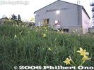
Ibukiyama gondola station and lilies
|
|
|
|
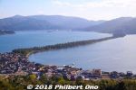
Amanohashidate is northern Kyoto's main attraction and very famous for centuries as one of Japan's Scenic Trio (Nihon Sankei 日本三景). The other two in the scenic trio are Miyajima (vermillion torii and shrine on the ocean) in Hiroshima and Matsushima (pine tree islands) near Sendai, Miyagi Prefecture. It's about 3.6 km long, totally flat, and you can cross it on foot or by bicycle (rentals available) on a dirt road in the middle. The road is lined with thousands of Japanese pine trees and closed to vehicular traffic. This view is from the northern end atop Kasamatsu Park. Near Amanohashidate Station.
|
|
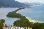
The thing about Amanohashidate is that it looks very different from different lookout points. The most popular spots to view Amanohashidate are on the hilltop on the southern end and northern end.If you have time, I highly recommend that you see it from both the southern end and northern ends. Which means you should rent a bicycle and ride across Amanohashidate.
This is from the hilltop on the southern end, from a small amusement park called Amanohashidate Viewland easily accessible via chair lift or cable car, and a short walk from Amanohashidate Station. Map: https://goo.gl/maps/yNhxjwK2ocz
This southern end connects to mainland Japan, so what you see in the distance is Tango Peninsula up north.
The left side is the west side with an enclosed, but connected ocean named Asoumi Sea. The right side is the east side with white-sand beaches facing the open ocean. Ships can still go through both sides of the sandbar through a narrow strait on the southern end.
The greenery area on the lower left facing the sandbar is Chionji Temple.
|
|
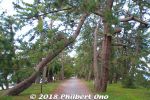
A few pine trees died or were knocked down.
|
|
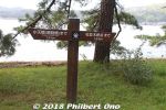
Good to know how far away you are.
|
|
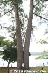
Wedded pine trees on Amanohashidate. (夫婦松)
|
|
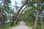
Wind-blown pine trees.
|
|
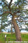
Pine tree for the sawn maiden's clothes. 羽衣の松
|
|
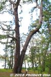
Looks like another wedded pair of pine trees, but it is named "Good Friends pine trees." なかよしの松
|
|
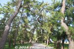
Don't ever get tired of the scenery.
|
|
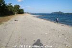
Sunny beach on Amanohashidate.
|
|
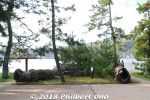
The Twin Dragon Pine Trees were broken. 双龍の松
|
|
|
|

East edge of Amanohashidate looking toward Kasamatsu Park on the hill.
|
|
|
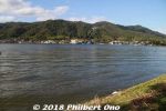
East edge of Amanohashidate looking toward Kasamatsu Park on the hill.
|
|
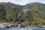
Kasamatsu Park on the hill as seen from Amanohashidate.
|
|
|
|
|
|
|
|
Fork in the road. Go left.
|
|
Entrance to Amanohashidate's northern end.
|
|
|
|
|
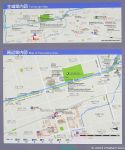
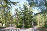
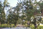
Soka Matsubara is a nice, long pedestrian path stretching for 1.5 km lined on both sides with over 600 evergreen pine trees. Part of Soka-juku post town on the old Nikko Kaido road to Nikko in Tochigi Prefecture. Designated as a National Place of Scenic Beauty. Near Dokkyodaigakumae Station (Tobu Railway from Asakusa).
|
|
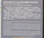
About Soka Matsubara. Some 60 of the pine trees have survived since the Edo Period.
|
|
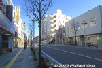
While walking on this main road to Soka-Matsubara, you will soon see the large arch bridge over the road.
|
|
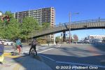
Where the Soka-Matsubara pine tree path intersects with a major road at two locations, there's a large arch bridge to enable pedestrians to keep walking non-stop along the pine trees.
|
|
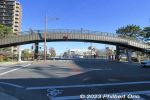
This is one of the two arch bridges. Named Hyakutai-bashi (百代橋), 62.5 meters long, 3.5 m wide. It has steps and a narrow slope to push bicycles. Not wheelchair accessible.
|
|
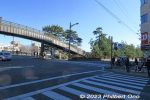
Soka-Matsubara pine tree path continues on the right going south. There's another similar arch bridge at the intersection further south.
|
|
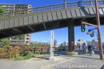
The arch bridge is near the middle of the pine tree path. If you want to walk through the entire pine tree path from here, go left first, then backtrack and walk south until the end. Monument near the arch bridge.
|
|
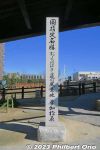
Monument indicating Soka-Matsubara as a Scenic Place on the Oku-no-Hosomichi path.
|
|
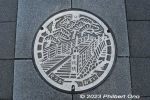
Soka's manhole depicts Hyakutai-bashi (百代橋) and Soka-Matsubara pine trees in Soka, Saitama. "Hyakutai" (Eternity) comes from Basho's Oku-no-Hosomichi poetry collection.
|
|
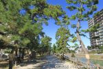
From Hyakutai-bashi Bridge, I first walked north along Soka-Matsubara.
|
|
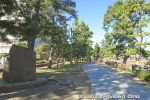
Matsuo Basho monument
|
|
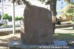
Matsuo Basho monument at Soka-Matsubara.
|
|
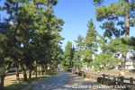
Soka-Matsubara pine trees north of Hyakutai-bashi Bridge.
|
|
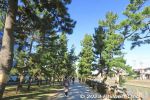
Soka Matsubara pine trees may have been originally planted as early as 1683 by government official Ina Tada'atsu (伊奈忠篤) in the Fudaba Park area where there was a river boat dock.
|
|
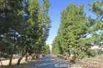
By 1877, Soka-Matsubara had 800+ pine trees. In the 1930s, Soka-Matsubara had over 700 pine trees. However, by the 1960s due to vehicle exhaust fumes, the number of pine trees shrank to 60.
|
|
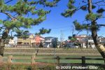
A local group was formed in 1976 to replant pine trees. Their efforts was successful with 500+ trees planted. Vehicular traffic through the pine trees stopped in 1982. Thankfully, it's now pedestrians only.
|
|
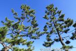
Green pines against the blue sky are therapeutic for the eyes.
|
|
|
|
|
|
|
|
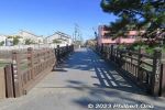
Nakazone Bridge over Ayase River.
|
|
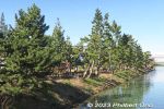
Ayase River
|
|
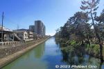
Ayase River looking south. 綾瀬川
|
|
|
|
|
|
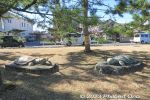
Turtle sculptures.
|
|
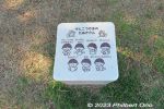
Stone bench.
|
|
|
|
|
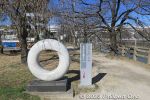
The northern end of Soka-Matsubara has this ring.
|
|
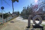
Northern end of Soka-Matsubara. From here, walk 1.5 km to reach the southern end of Soka-Matsubara pine trees.
|
|
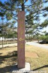
Monument says 今様草加松原 mean "Modern-style Soka-Matsubara" in reference to current efforts to preserve the pine tree path in modern ways.
|
|
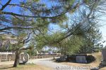
Northern end of Soka-Matsubara.
|
|
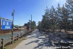
Starting to backtrack to Hyakutai Bridge and proceed to the southern end of the pine trees.
|
|
|
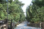
Soka-Matsubara pine tree path.
|
|
|
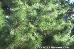
Pine needles and pine cones.
|
|
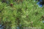
Pine needles and pine cones up close.
|
|
|
|
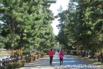
The pine tree path is popular among joggers and for walks.
|
|
|
|
|
|
|
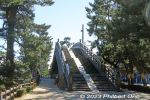
Back to Hyakutai Bridge. This is near the halfway point on the Soka-Matsubara path.
|
|
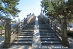
Hyakutai Bridge has steps and a narrow slope for pushing bicycles. Not wheelchair accessible. 百代橋
|
|
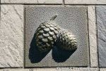
Hyakutai Bridge is decorated with small relief sculptures like these pine cones.
|
|
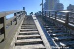
Going up Hyakutai Bridge.
|
|
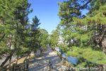
Northern view from Hyakutai Bridge.
|
|
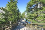
Northern view of pine trees from Hyakutai Bridge.
|
|
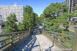
Hyakutai Bridge.
|
|
|
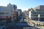
View from Hyakutai Bridge. This road goes to the train station straight ahead.
|
|

View from Hyakutai Bridge.
|
|
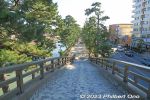
Southern view from Hyakutai Bridge.
|
|
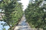
Southern view of Soka-Matsubara pine trees from Hyakutai Bridge, Saitama.
|
|
|
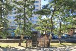
Along the pine tree path is this monument for the Japanese bush clover planted by the late Donald Keene who first visited Soka in 1988 to give a keynote speech at the Oku-no-Hosomichi International Symposium.
|
|
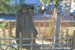
Monument for the Japanese bush clover planted by the late Donald Keene. Flowers not in season in Feb. Donald Keene was a renown professor of Japanese studies (especially literature) at Columbia University in New York. ドナルド・キーン記念植樹
|
|
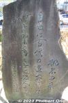
Monument for the Japanese bush clover planted by the late Donald Keene.
|
|
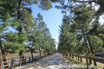
Walking south along Soka-Matsubara pine trees.
|
|
|
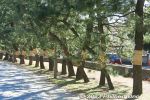
Straw bands are wrapped on the tree trunks to catch harmful insects.
|
|
|
|
|
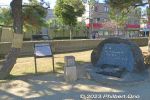
Monument inscribed with: "Place of Scenic Beauty: Soka Matsubara - Scenic Place Along Oku-no-Hosomichi" Calligraphy by Donald Keene.
|
|

About Soka Matsubara as a Scenic Place Along Oku-no-Hosomichi. It's one of the 25 designated Scenic Places along the Oku-no-Hosomichi extending over 12 prefectures.
|
|
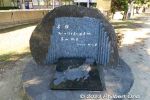
Donald Keene wrote the inscribed sentence: "Place of Scenic Beauty: Soka Matsubara - Scenic Place Along Oku-no-Hosomichi"Donald Keene was a renown professor of Japanese studies (especially literature) at Columbia University in New York. Keene is revered in Soka for helping with local activities related to Oku-no-Hosomichi.
He also famously became a Japanese citizen and spent the last years of his life living in Japan.
|
|
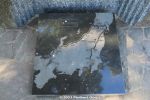
Soka's claim to fame is this pine tree path's inclusion as a Scenic Place along the Oku-no-Hosomichi travel route taken by famous Haiku poet Basho.Monument includes a map of Basho's Oku-no-Hosomichi travel route. He started from Fukagawa, Tokyo, visited Soka, went up north to Sendai, Sakata (Yamagata), and proceeded back along the Sea of Japan, Niigata, Kanazawa, Tsuruga, and ended at Ogaki, Gifu. All the places he visited on this epic journey has monuments or statues celebrating Basho.
|
|
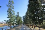
Non-stop pine trees on Soka-Matsubara. Probably the longest pine tree path I've been on.
|
|
|
|
|
|
|
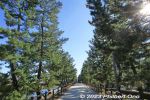
Soka-Matsubara pine trees in Soka, Saitama. Part of the Nikko Kaido road and Oku-no-Hosomichi stop by Haiku poet Matsuo Basho.
|
|
|
|
|
|