 Most viewed - OKINAWA 沖縄県 Most viewed - OKINAWA 沖縄県 |

Okinawan kimono called the bingata, perhaps Okinawa's most famous kimono. The design is made by applying dyes through a stencil.753 viewsIt was originally worn by Okinawa's royal family members. It is now the costume of a slow-moving Okinawan dance called "Yotsudake."
Model: Maki Uyeunten
|
|

Yotsudake, Okinawa's most famous dance. 四つ竹469 views
|
|

Back view of yotsudake dancers on stage.371 views
|
|
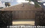
Okinawan house, Taketomi. Taketomi is a National Important Traditional Townscape Preservation District (重要伝統的建造物群保存地区).325 views
|
|
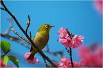
January: A Japanese White Eye visits the Cherry Blossoms. Okinawa is the first place in all of Japan to see these blossoms and they bloom through the month into early February. All photos copyright 2009 Michael Lynch.315 viewsPhoto copyright 2009 Michael Lynch.
|
|
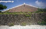
Okinawan house and rock wall, Taketomi314 views
|
|
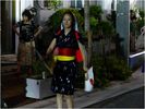
Eisa dancing is performed on the streets at night in every village on Okinawa during the three days of Obon, late in August. Here a young lady dressed in traditional Okinawan yukata (an informal kimono) marches while waving Rising Sun paper fans.287 viewsPhoto copyright 2009 Michael Lynch.
|
|

This dance is called "Nuchibana" (flower lei) featuring a string of red and white flowers.252 viewsOkinawan dancer wearing a kimono with her right arm exposed outside the sleeve. The dance is called "Nuchibana" (flower lei) featuring a string of red and white flowers. The dance expresses the feelings of a young woman in love.
|
|

250 viewsDancer: Nariko Miyagi
|
|

Hoshi Sunahama or Star Sand Beach239 views
|
|
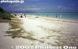
Kondoi beach229 views
|
|
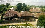
227 views
|
|

Taketomi Primary School226 views
|
|
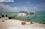
Taketomi Port boat for Ishigaki221 views
|
|

218 views
|
|
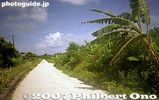
White coral road216 views
|
|
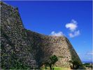
Nakagusuku Castle is part of a World Heritage Site of Okinawan gusuku castles. This is a view looking eastward from the base of the 3d enclosure (migusuku). Photos in this album all by Michael Lynch.213 views Constructed in mid-fourteenth century of limestone rocks, placed without the use of mortar, Commodore Perry praised the construction technique on his visit to Okinawa in 1853.
|
|
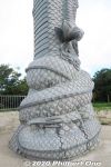
Foot of Ryuchu dragon pillar in Naha, Okinawa.210 views
|
|

Boat for Taketomi at Ishigaki Port.209 views
|
|
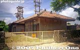
Power voltage station201 views
|
|

On Taketomi, residential homes are toward the middle of the island, not along the beaches. The middle part of the island is built on hard rock called chert. Freshwater wells can be dug along this rock to provide water. View from lookout tower.196 views
|
|
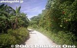
White coral road, one of Taketomi's trademarks.193 views
|
|

Kondoi beach193 views
|
|

Dancer: Nariko Miyagi191 views
|
|
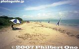
Be aware that these parasols are not free.191 views
|
|

186 views
|
|
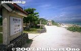
Kondoi Picnic Site186 views
|
|
186 views
|
|
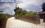
186 views
|
|
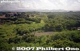
Outside the middle part of Taketomi, the ground is on limestone where water seeps through. Difficult to have rice paddies or wells on limestone.175 views
|
|

Lookout tower175 views
|
|
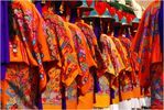
October: A parade of traditional Okinawan Kimonos and headwear takes place every year on Kokusai Street in Naha, where a reenactment of the coronation of the King and Queen of the Ryukyu Kingdom is performed.171 viewsPhoto copyright 2009 Michael Lynch.
|
|
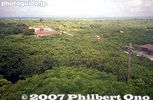
View from lookout tower169 views
|
|

167 views
|
|

167 views
|
|

On Taketomi, the best way to get around.167 views
|
|

164 views
|
|

Japan Transocean Air (JTA) Boeing 737-800 plane painted like a whale shark (blue). ジンベエ ジェット163 viewsNot my plane back to Haneda though. This video shows how they painted the plane: https://youtu.be/MbrK-8Bkjx0
|
|

For their parting shot, these Eisa dancers couldn’t resist flashing the Peace sign along with their smiles for the camera. 160 viewsPhoto copyright 2009 Michael Lynch.
|
|

156 views
|
|

My take-out dinner at Naha Airport before the flight back to Tokyo. Goya-champuru and rice. 156 views
|
|
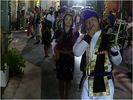
During each brief pause in the Eisa music, the men make a loud whistling noise that is distinctly Okinawan. All photos copyright 2009 Michael Lynch.156 viewsPhoto copyright 2009 Michael Lynch.
|
|

November: This dragon statue guards the corner in front of the Uruma City office. Dragons are part of many Asian sea-faring cultures folklore and Okinawa also holds year-round Dragon boat races.151 viewsPhoto copyright 2009 Michael Lynch.
|
|
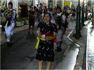
The Eisa dancers are all unmarried men and women between 20 and 30 years of age. The small handheld drums, known as Panraku, have the traditional symbol of Okinawa painted in gold on them.149 viewsPhoto copyright 2009 Michael Lynch.
|
|
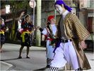
The brown and beige garment worn by this Buffoon is hand woven clothing called Bashofu. It is made from the fiber of banana plants. There may be two or three of these characters with each Eisa group skipping and weaving through the dancers as if they...149 viewsThe brown and beige garment worn by this Buffoon is hand woven clothing called Bashofu. It is made from the fiber of banana plants. There may be two or three of these characters with each Eisa group skipping and weaving through the dancers as if they weren’t there. Photo copyright 2009 Michael Lynch.
|
|

146 views
|
|

Here the Buffoon (called Gajangani) can be seen going in the opposite direction of all the other male dancers and waving a banana leaf. Some clowns carry bottles of sake and try to get bystanders to drink with them.145 viewsPhoto copyright 2009 Michael Lynch.
|
|
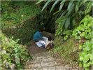
Sacred Well. There are three spring-fed wells within the castle. This one is located in the West enclosure and is also a sacred site where people make ritual offerings. Photo copyright 2009 Michael Lynch.144 viewsThe woman on the left gave consent to take a photo after helping her down the rough, stone stairs.
|
|

143 views
|
|

142 views
|
|
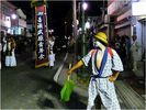
The Buffoon, Clown, or Town Drunk is a man who zig-zags through the line of dancers to the beat of his own drum, entertaining everyone and chasing evil spirits away.140 viewsPhoto copyright 2009 Michael Lynch.
|
|

137 views
|
|
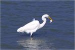
December: A white Pacific Reef Egret catches breakfast on the east coast of Okinawa. Photo copyright 2009 Michael Lynch.136 viewsPhoto copyright 2009 Michael Lynch.
|
|
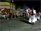
Different color yukata and uniforms of the dancers are worn, depending on which district or village they represent.136 viewsPhoto copyright 2009 Michael Lynch.
|
|
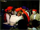
Here a group of men reach into a cooler for some refreshments while on a quick break from dancing. They will pile on trucks and move to the next location, performing Eisa dances well past midnight at every street, in every village for miles around.132 viewsPhoto copyright 2009 Michael Lynch.
|
|
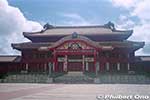
The ornate Seiden Hall, Shuri Castle's most important and central building and National Treasure. Saw it on a previous trip. 131 viewsVery ornate building with wood carvings, lacquered surfaces, paintings, and sculptures. It was meticulously rebuilt in 1992. (首里城 正殿)
Notice the stone dragon pillars flanking the center entrance and sculptures of dragon heads and lion head on the red roof tile roof.
|
|
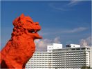
July: A Shisa (Lion-Dog) seems to dwarf the Royal Hotel in Yomitan, which is on the West coast of the island. Another influence from trade with China, the Shisa may be seen everywhere in the Prefecture, warding off evil spirits. This one stands...129 viewsJuly: A Shisa (Lion-Dog) seems to dwarf the Royal Hotel in Yomitan, which is on the West coast of the island. Another influence from trade with China, the Shisa may be seen everywhere in the Prefecture, warding off evil spirits. This one stands around 30 feet tall, most tile-roofed homes have Shisa closer to a foot tall guarding them, either mounted on the roof or walls surrounding the house. Photo copyright 2009 Michael Lynch.
|
|
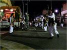
Each team of Eisa dancers has its own band riding in the back of a straw roof-covered truck. Sanshin (3 stringed instrument) players sing and play Okinawan folk music accompanied by CD’s blasted over a loudspeaker system. 127 viewsPhoto copyright 2009 Michael Lynch.
|
|
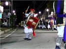
The large drum used for marching is slightly smaller than a Taiko and is called an Odaiko drum. The drummer in this photo is the only female player of this team to play such a large drum and she smiles and beats it enthusiastically.127 viewsPhoto copyright 2009 Michael Lynch.
|
|

The large banner or flag carried on a bamboo pole is known as Hatagashisa and also represents a village or district. Each has their own unique design and the team takes pride in displaying it as a symbol of strength and prosperity for their hometown.124 viewsPhoto copyright 2009 Michael Lynch.
|
|
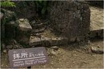
Utaki. A closeup view of a place of worship. Incense is sometimes burned and coins placed in the stone container centered within the utaki stone walls. Photo copyright 2009 Michael Lynch.119 views
|
|
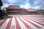
Before the fire, Nanden South Hall (南殿) was connected to the Seiden main hall seen on the left. To enter the Seiden, we had to enter this hall first (entrance on the right). 116 viewsThe fire also gutted this building beyond repair and had to be torn down along with the Hokuden North Hall (北殿) on the other side of the Seiden.
Photography inside the main buildings wasn't allowed, so sadly I don't have any photos of the interior.
|
|

Rear Gate. Most visitors will enter through this gate to the castle, as it is closest to the parking and ticket sales. Photo copyright 2009 Michael Lynch.116 views
|
|

Three Sacred Sites. The South enclosure contains three Utaki (sacred sites), all within a small area, as seen by the signs in this picture. Many Okinawans come to worship at these Utaki and make offerings. Photo copyright 2009 Michael Lynch.116 viewsFrom the high ground to the left of this scene, you may be able to see Kudaka-Jima, where locals believe the first Okinawans originated.
|
|

World Heritage Marker. Photo copyright 2009 Michael Lynch.115 views
|
|
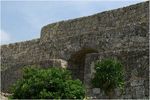
Second Enclosure. A view of the archway and stone construction from inside the 2nd enclosure, looking East. Photo copyright 2009 Michael Lynch.115 views
|
|
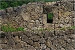
Gun Port. At several locations along the North walls of the castle, gun ports may be seen, where sentries could repel invaders. Photo copyright 2009 Michael Lynch.114 viewsMany visitors are surprised to learn that firearms were in existence in the 14th century.
|
|
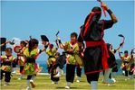
May: Eisa, a dance originally associated with ancestor worship during the Obon holidays, is now practiced at any festival or cultural event. Here, at Henza Island, a small festival celebrating Golden Week, the spirit of Okinawa was demonstrated in music114 viewsMay: Eisa, a dance originally associated with ancestor worship during the Obon holidays, is now practiced at any festival or cultural event. Here, at Henza Island, a small festival celebrating Golden Week, the spirit of Okinawa was demonstrated in music and dance to the enjoyment of all in attendance. Photo copyright 2009 Michael Lynch.
|
|

Hoshinmon Gate and the Una as seen from the Seiden.113 viewsThis red-and-white plaza is the castle's trademark, the Una courtyard where official ceremonies were held. The red path in the middle was where the King would walk to the main hall.
|
|
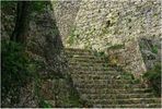
Stone Stairs. They lead to the 2nd enclosure. Visitors should wear sturdy walking shoes, as the stone-lined pathways and stairs can be very difficult to walk on without twisting an ankle. Photo copyright 2009 Michael Lynch.112 views
|
|
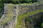
Terraced Walls. A view looking from north to south standing at an elevated point along the inner castle walls. Photo copyright 2009 Michael Lynch.110 views
|
|
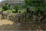
Sacred Site. There are eight special places of worship (Utaki) located within the castle walls. This view looks toward the East from the inside of the 1st enclosure. Photo copyright 2009 Michael Lynch.109 views
|
|
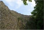
A view from the base of the West enclosure. Constructed in mid-fourteenth century of limestone rocks, placed without the use of mortar, Commodore Perry praised the construction technique on his visit to Okinawa in 1853. Photo copyright 2009 Michael Lynch.106 views
|
|

My video of Okinawan dances like yotsudake and a karate dance.106 views
|
|
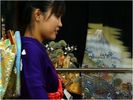
September: This young lady is trying on Kimonos at a shop in Naha in preparation for “Coming of Age Day” which is celebrated in January. During the 3d week of January, all who turned twenty years of age during the past year are initiated as adults..101 viewsSeptember: This young lady is trying on Kimonos at a shop in Naha in preparation for “Coming of Age Day” which is celebrated in January. During the 3d week of January, all who turned twenty years of age during the past year are initiated as adults. Her mother is preparing her early. Photo copyright 2009 Michael Lynch.
|
|
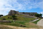
March: The weather starts to warm up, schools have their Spring break and tourists begin to flock to the many attractions available throughout the island. This is Katsuren Castle, which overlooks a peninsula on the East coast of Okinawa.99 viewsPhoto copyright 2009 Michael Lynch.
|
|
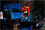
August: The lively lead-singer of a popular band named Zukan jumps and shouts while performing at the Kin Festival. During the summer months there are festivals every weekend, somewhere on the island.98 viewsPhoto copyright 2009 Michael Lynch.
|
|
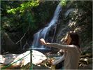
June: Hiji Waterfall in Kunigami is the largest in Okinawa and attracts many visitors from mainland Japan. It provides a refreshing, cool break after the 45 minute hike, along a nature trail, to reach this beautiful scene.97 viewsPhoto copyright 2009 Michael Lynch.
|
|
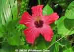
Red hibiscus95 views
|
|
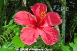
Red hibiscus94 views
|
|
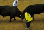
February: A bullfight at the Ishikawa-Dome in Uruma City took place as part of the Lunar New Year festivities. While all of Japan utilizes the Gregorian calendar, many traditions in Okinawa revolve around its historical ties with China. By Michael Lynch93 viewsPhoto copyright 2009 Michael Lynch.
|
|
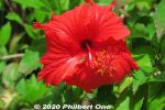
Red hibiscus93 views
|
|
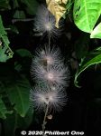
White powder-puff flowers or sagari-bana in Japanese (サガリバナ) and a small moth. There are pink ones too. 93 viewsDuring summer, they bloom for only one night, then the flowers fall off the next morning. It was early Nov. (still warm), so maybe we got lucky to see it.
|
|
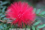
92 views
|
|
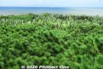
Ryukyu matsu pine trees are native to Okinawa. 琉球松91 views
|
|
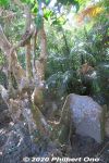
In the old days, part of the root was used as a rudder on Okinawan sabani fishing boats. (サキシマスオウノキ 先島蘇芳木 Heritiera littoralis)91 views
|
|
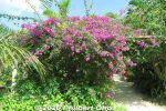
Bougainvillea on Yubu, in bloom year round.90 views
|
|
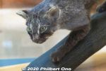
Only 100 or so left on the island. They are nocturnal and have stubby legs and a thick tail. Discovered relatively recently in 1965.90 views
|
|
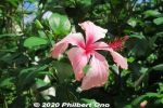
Lots of tropical flowers on Yubu Island, especially hibiscus.89 views
|
|
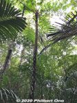
Tree fern, common in Okinawa. The fronds break off. 木生シダ89 views
|
|
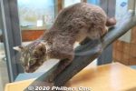
Iriomote is famous for the Iriomote wildcat (イリオモテ ヤマネコ). Endemic to Iriomote and critically endangered. 88 views
|
|
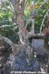
An exotic plant on Iriomote called "looking-glass mangrove" (Sakishima suounoki) with huge roots that look like a byobu folding screen. (サキシマスオウノキ 先島蘇芳木 Heritiera littoralis)88 views
|
|
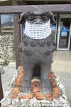
Seesa lion dog with mask, Ishigaki.87 views
|
|
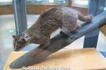
There's no zoo, etc., where we can see a live Iriomote cat. They only have stuffed Iriomote cats here at the Iriomote Wildlife Conservation Center.87 views
|
|
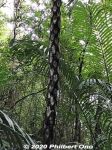
The trunk of a tree fern shows the remains of branches that broke off. 木生シダ87 views
|
|

Bats on Iriomote.86 views
|
|
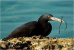
April: A black Pacific Reef Egret gathers building materials for a nest at Red Beach. Photo copyright 2009 Michael Lynch.85 viewsPhoto copyright 2009 Michael Lynch.
|
|
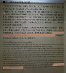
Characteristics of the Iriomote wildcat.85 views
|
|

Ryukyu matsu pine tree is endemic to Okinawa. It stands straight up and takes an umbrella shape like this. Okinawa's official tree. リュウキュウマツ (琉球松)84 viewsWe don't really see pine trees like this on mainland Japan.
|
|

My lunch.83 views
|
|

She's selling goya (bitter melon) juice. I tried it.80 views
|
|

Mt. Nosokodake (野底岳), Ishigaki’s second highest mountain at 282 m. Can be climbed up a steep, narrow trail in about 15 min. We didn't climb it though.79 views
|
|
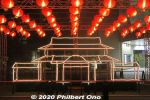
Shuri Castle illumination monument at Pallet Kumoji in Nov. 2020. (首里城うむいの燈(あかり)モニュメント)79 viewsLit up in the evening until midnight from Oct. 28 to Nov 15, 2020. Many local businesses sponsored the artwork.
|
|

The flowers in the jet bridge is a very nice touch at Naha Airport.78 views
|
|

The good old days when Boeing 747s still flew into Naha Airport.78 views
|
|

Okinawa World's Habu show was interesting, but not particularly thrilling. The viper is not like a trained monkey doing tricks for a treat each time. The snake doesn't understand such a concept. 76 views
|
|

Colorful fish in the old Makishi Public Market where you could pick the fish to be cooked for your meal.75 views
|
|
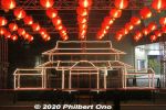
Shuri Castle illumination monument was lit up in the evening until midnight from Oct. 28 to Nov 15, 2020. Many local businesses sponsored the artwork. (首里城うむいの燈(あかり)モニュメント)75 views
|
|

Pickled vegetables.74 views
|
|
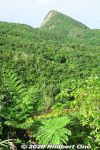
So she and her family were forced to move here to Nosokodake to start a new farming village and clear the thick jungle for farming. It was a hard life. 74 viewsMaape desperately missed her beloved Kanimui and couldn't forget him.
One day, she wanted to at least see Kuroshima where he lived, so she climbed up Mt. Nosokodake. At the top, she looked for Kuroshima, but her view of the island was blocked by Mt. Omotodake, Ishigaki's highest mountain. She collapsed on her knees and wailed in sorrow. Later, a worried villager looked for Maape who never returned home. On the top of the mountain, he found a crying rock gazing in the direction of Kuroshima. Maape had turned into stone.
|
|

Near Kokusai-dori (Naha's main drag) at Pallet Kumoji mall, there was this Shuri Castle illumination monument complemented by paper lanterns. (首里城うむいの燈(あかり)モニュメント)73 views
|
|
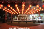
Shuri Castle illumination monument was lit up in the evening until midnight from Oct. 28 to Nov 15, 2020. Many local businesses sponsored the artwork. (首里城うむいの燈(あかり)モニュメント)73 views
|
|
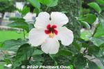
White and red hibiscus73 views
|
|
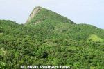
Side view of Mt. Nosokodake. This mountain is associated with a famous local folk tale about a girl named Maape. The mountain is nicknamed after her, "Nosoko Maape" (野底マーペー).72 viewsOn the nearby island of Kuroshima (黒島) in the 18th century, Maape and her childhood sweetheart, Kanimui, were happily living as farmers. They were to be married someday.
However, one day, a Ryukyu government decree ordered half the island's residents to move here near Nosokodake on Ishigaki while the other half could remain on Kuroshima. The island's population was split along the island's main road. Maape and Kanimui lived on the opposite sides of the road, and Maape was on the side where people had to move to Ishigaki.
|
|

Shuri Castle illumination monument at Pallet Kumoji in Nov. 2020. (首里城うむいの燈(あかり)モニュメント)72 views
|
|
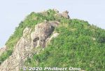
Even today, people who climb the mountain look for the Maape rock and assume this or that rock is her.71 viewsThis story is based on historical fact. The Ryukyu government sometimes forced people to migrate to undeveloped lands to start farming to increase agricultural production so they could pay more taxes. The kingdom was being heavily taxed by the Satsuma Domain in Kagoshima, and taxes had to paid in rice per head.
Read more about the folk tale here: https://photoguide.jp/log/2020/12/yaeyama-folk-songs-nosokodake-maape/
|
|

At Pallet Kumoji mall, there was this Shuri Castle illumination monument complemented by paper lanterns. (首里城うむいの燈(あかり)モニュメント)71 views
|
|
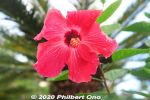
Red hibiscus70 views
|
|
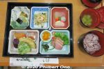
Lunch was named, "Okinawa Makunouchi Bento Akabana" (沖縄幕の内弁当「アカバナ」. ("Akabana" means "hibiscus" in Okinawan.) Price was ¥1,320.69 viewsIriomote black rice, champuru, brown sugar yokan: 西表産黒紫米入りごはん、アーサのお吸い物、うみぶどう、ミミガー、漬物、沖縄黒糖煮、 アンダー味噌、野菜天ぷら、ウムクジ(紅イモを米粉であえて揚げたもの)、かまぼこ、チャンプ ルー、黒糖羊羹
|
|
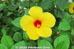
Yellow hibiscus69 views
|
|
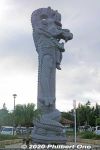
Side view of Ryuchu dragon pillar in Naha, Okinawa.67 views
|
|
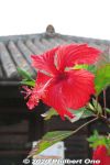
Red hibiscus in Okinawa World.66 views
|
|

Shurijo Castle was the seat of the Ryukyu Kingdom's government from 1429 to 1879 when it became Okinawa Prefecture. 64 viewsThe Ryukyuan kings were from the Sho Clan (尚) starting with Shō Hashi who unified the three kingdoms on the main island in 1429. The other islands also eventually came under the control of the Shuri government after successful military campaigns.
|
|
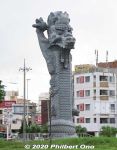
Ryuchu dragon pillar in Naha, Okinawa.64 views
|
|
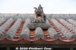
Shisa (シーサー) guardian lion dog statue on the roof to ward off evil spirits at Okinawa World.64 views
|
|
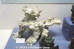
In Okinawa Culture Museum, Shisa made of coral.63 views
|
|
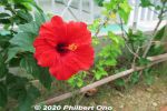
Red hibiscus. Lots of flowers in this area.62 views
|
|
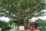
Chinese banyan or gajumaru tree (ガジュマル) at Okinawa World.62 views
|
|
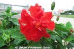
Red hibiscus, Naha.61 views
|
|
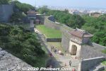
Kankaimon Gate and Kyukeimon Gate.60 views
|
|
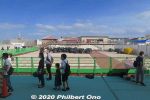
Oct. 31, 2019, the day all of Okinawa cried. Shurijo Castle's Seiden Hall was totally destroyed by fire along with connecting halls. Apparently caused by short-circuited wiring on the left side of the building.57 viewsAfter the charred remains were cleaned up, the castle fully reopened to the public in June 2020 with this elevated walkway for visitors to see the ruins and the progress of the castle's reconstruction.
|
|
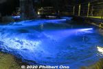
Blue Spring is also a limestone dam.57 views
|
|
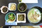
Ishigaki cuisine for lunch. Main dish was soba noodles. Side dishes of pig's ear, goya & tuna, juushi flavored rice (じゅーしー), local seaweed, and brown sugar jelly (dessert). 56 viewsPig's ear is chewy/crunchy, not really tasty, but has a lot of collagen, so it's a health food.
|
|

Old Ishigaki Airport terminal, Arrivals. No jet bridges. Jets (Boeing 737) started flying here only from 1979. 56 views
|
|
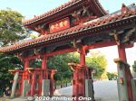
Shuri Castle's Shureimon Gate 守礼門 also appeared on the defunct ¥2000 bill.56 views
|
|

Habu viper from Kumejima.56 views
|
|
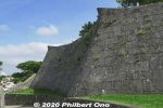
Shuri Castle wall with pointy tips.54 views
|
|
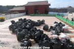
Ideal roof tiles have minimal water absorption and shrinkage. Researchers in Okinawa are testing various clay samples and firing temperatures. 54 viewsThey found that the best clay is from the city of Nago, and that's where the clay came from for the Seiden's 1992 reconstruction. However today, there's not enough clay in Nago to make the necessary 55,000 red roof tiles for the new Seiden and other buildings.
So they scoured other locations on the island and found a good source. Now they are trying to figure out how much recycled red roof tile powder should be mixed into the new clay to make the new roof tiles. They want to somehow reuse the old roof tiles.
|
|
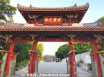
The reconstruction of Shureimon was the start of a decades-long process to reconstruct the major buildings of the castle, especially the ornate Seiden main hall in 1992. 53 viewsOther castle buildings were also reconstructed and the castle's reconstruction was finally completed in spring 2019. It was a great celebration.
|
|

This is the old Ishigaki Airport before it closed in March 2013 and was replaced by the new and current airport slightly north of this old airport.52 views
|
|

Old Ishigaki Airport terminal for JTA. Small building. The old airport first opened in 1943 for military use. It became a civilian airport in 1956.51 viewsThis passenger terminal building was built in 1961 and used mainly by JTA (Japan Transocean Air) and RAC (Ryukyu Air Commuter). ANA had its own adjacent terminal.
|
|
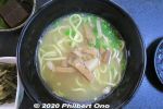
Yaeyama soba noodles50 views
|
|

Old Ishigaki Airport terminal for JTA, Arrivals. No jet bridges.50 views
|
|

At the old Ishigaki Airport, inside the JTA passenger waiting area at the boarding gate.50 views
|
|

Delicious Okinawan breakfast at Takemori Inn/Ryokan (竹盛旅館).50 views
|
|

At the old Ishigaki Airport, JTA boarding gate. One of the check-in staff wears a yukata. Also notice the old digital signage.49 views
|
|
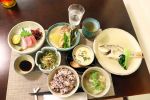
Dinner at Takemori Inn. Chawan-mushi, local fish, Yaeyama soba. The ryokan owner was very friendly. Not English-speaking though.49 views茶碗蒸し、海藻と野菜和え、近海魚の刺身、近海魚の塩煮、煮物(冬瓜)、ソーキ、昆布、こんにゃく、黒紫米入り西表産ひとめぼれごはん、八重山そば
|
|

Sunrise hike up Mt. Yarabudake (屋良部岳) on Sakieda Peninsula in western Ishigaki. It starts near the summit from this small, easy-to-miss trail.48 views
|
|
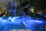
Inside Okinawa World's Gyokusendo Cavern, this is called the Blue Spring. Perhaps the prettiest spot of all. 青の泉48 views
|
|

Walking on the tarmac to the JTA plane at Ishigaki Airport.47 views
|
|

Inside JTA plane, flight attendants figuring out what to tell us.47 views
|
|

Taking off at the old Ishigaki Airport.47 views
|
|

Runway at the old Ishigaki Airport. The slanty white building visible is the ANA hotel on the beach. That's how close the old airport was to town.46 views
|
|
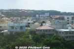
Shuri Castle is Naha's top tourist attraction. The home of kings who ruled the Ryukyu Kingdom from 1429 to 1879 before it was annexed by Japan and renamed Okinawa Prefecture. Shuri Castle was the kingdom's capital.45 viewsPhoto shows Shurijo on a hill as seen from Shuri Station on the Yui Rail. The castle grounds extend about 400 meters long and 200 meters wide. This hill is about 130 meters high.
|
|
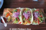
Tacos at Airando FIJI Restaurant & Cafe.45 views
|
|

Ferns and tree ferns also grow at upstream. シダ類44 views
|
|

Mariyudu Falls on Urauchi River. About 20 meters wide and 16-meter drop in total. One of Japan's 100 Famous Waterfalls. マリゥドゥの滝44 views*People can no longer come this close to the falls. There were people who slipped and fell in, so the closeup path is blocked.
|
|
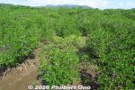
Sakishima suounoki mangroves, Iriomote. サキシマスオウノキ (古見)44 views
|
|

After hiking about 30 min., a scenic point gives a view of Mariyudu Falls. Series of three waterfalls. It empties into a round stream pool. "Mariyudu" means stream pool. マリゥドゥの滝43 views
|
|

Hiking back. The lady in front of me was wearing rubber slippers on this muddy trail. She kept slipping and almost falling. Her dainty feet got all muddy.43 views
|
|

Approaching the old Ishigaki Airport terminal.43 views
|
|

JTA plane's see-sa at Ishigaki Airport.43 views
|
|

Ground crew at the old Ishigaki Airport waving goodbye to us. I waved back.43 views
|
|
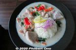
Lunch at Airando FIJI Restaurant & Cafe.43 views
|
|
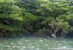
The boat operator narrates the sights along the river. There are even signs indicating the flora. This sign indicates a mangrove species called "me-hirugi" (メヒルギ) in Japanese or Kandelia obovata growing in brackish water.42 viewsIt has white, star-shaped flowers.
|
|

Urauchi River is fed by the runoff from Iriomote's central mountains. Urauchi River jungle cruise is about 30 min. or 8 km upstream to another boat dock called Gunkan-iwa. 西表島・浦内川42 views
|
|

On Runway 04 at the old Ishigaki Airport. At 1,500 meters, it was too short for jets larger than a Boeing 737. So the new airport was built on a different location.42 views
|
|
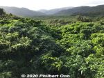
Great views of the greenery from the Otomi Lookout Deck.42 views
|
|

Kanbire (Kanpire) Falls on Urauchi River, near the center of Iriomote. This is about 2 km from the Gunkan-iwa boat dock. Or 30-40-min. hike. You can get quite close to the falls. カンビレーの滝41 viewsInstead of having one big drop, Kanbire Falls flow down on a series of steps on the river for about 200 meters. The riverside also has small potholes. Kanbire (Kanpire) means "where gods sit." This spot was considered to be a sacred site where the gods gathered.
|
|
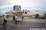
No jet bridge, but it wasn't a problem when it didn't rain.41 views
|
|

I liked walking on the tarmac to the plane at Ishigaki Airport.41 views
|
|
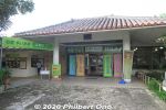
Yaima Mura is a small architectural park of traditional Yaeyama homes overlooking Nagura Bay. Open 9:00 am–5:30 pm. Adult admission ¥1,000, kids ¥500. https://www.yaimamura.com/40 views
|
|

Kabira Bay on Ishigaki, perhaps the island's most famous tourist spot. Glass bottom boats to see coral and tropical fish in shallow water.39 views
|
|
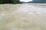
While walking here, I looked down since my intuition told me I might find something...39 views
|
|

Northern Iriomote has Okinawa and Iriomote's longest river, Urauchi River (18 km). It's a popular tourist route to go on the jungle cruise, then hike through the forest to see two waterfalls on the river.39 viewsNear Urauchi-hashi Bridge at the mouth of the river, there's a boat dock for Urauchi jungle river cruises. Since the hiking trail is rocky or muddy, don't wear high heels or slippers. Wear sneakers or hiking shoes. Although there's a restroom along the hiking trail, it's not as clean as you would like. Better to use the toilet at the boat dock before the cruise. Also bring something to drink. The roundtrip cruise and hike will take about 3 hours. Map here
|
|

In northern Iriomote, Urauchi River is Okinawa's longest (19 km), widest (200 m), and deepest (15 m) river. It's home to a whopping 400 species of fish or 10 percent of Japan's fish species.39 viewsOver 20 fish species are endangered. Urauchi River is within Iriomote-Ishigaki National Park. Both sides of the river are lush with mangroves and forests. 西表国立公園
|
|
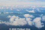
Aerial view of Ibaruma and Hirakubo, Ishigaki.39 views
|
|

Taking off at the old Ishigaki Airport.39 views
|
|
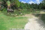
Water Buffalo Pond (水牛の池) on Yubu.38 views
|
|

Descending toward Ishigaki Airport adjacent to farmland.38 views
|
|
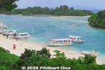
Kabira Bay, Ishigaki. It's actually a large bay and this is only a small part of it. Scenic with white beach, blue ocean, small islands and coral on the bottom.37 views
|
|
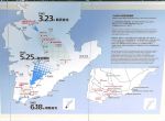
The war's progression.37 views
|
|
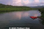
There was this dock where we could get on our kayaks. Maira River, Iriomote.37 views
|
|

After the sunrise, we paddled along the mangroves on the river's edge.37 views
|
|

Lovely morning, too bad we didn't have time to kayak more upstream on Maira River, Iriomote.37 views
|
|
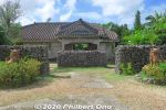
Makishi Residence is a traditional Yaeyama home. 旧牧志邸37 views
|
|

Behind Mariyudu Falls looking from upstream.37 views
|
|

On the northern tip of Iriomote is scenic Hoshi-suna Beach. Famous for star-shaped sand grains, but hard to find. 西表 星砂の浜37 viewsMap here
|
|

Iriomote Hoshizuna Beach.37 views
|
|

Taking off at the old Ishigaki Airport.37 views
|
|

Shiraho37 views
|
|

Glass bottom boat in Kabira Bay, Ishigaki.36 views
|
|
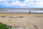
Manta Beach on Yubu. マンタの浜36 views
|
|

Monument for Harry Shinichi Gima (儀間真一), an Okinawan-American nisei from Hawaii who donated money to buy the land here to build the Himeyuri memorials and museum. 36 viewsHis parents immigrated to Hawaii from Yomitan.
|
|

Harry Shinichi Gima worked as an engineer on a US military base in Okinawa and visited Himeyuri Monument in 1951. 36 viewsHe wanted the story and place to be presented more properly, so he quietly donated the money to the Himeyuri Alumini Association to buy the land.
This area was originally just a grassy area. None of the asphalt or cement we see here today. The land was privately owned.
|
|
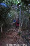
Thick, wild forest and lots of exposed tree roots. The frequent typhoons wash/blow away the soil from the tree roots.36 views
|
|

Mariyudu Falls. From here, the hiking trail continues to another waterfall, Kanbire (Kanpire) Falls about 250 meters away.36 views
|
|

Banna Park on Banna Hill (230m elevation) in the northern fringe of central Ishigaki is a large nature & recreational park. This is one of the main lookout points. Named "Emerald Ocean Lookout Point" overlooking the city center and nearby is36 viewsThis is in Zone B of the park along the Banna Skyline road. This photo was taken before the stargazing platform was built next to it. エメラルドの海を見る展望台
|
|

36 views
|
|
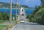
Kouri Island is a small, round island easily accessible by car on this scenic highway bridge over the ocean from Yagaji Island off the coast of Motobu Peninsula.36 views
|
|
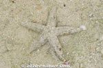
Sure enough, a well-disguised starfish moving in slow motion. Hope it's not the kind that eats coral or other native species. Kabira Bay, Ishigaki.35 views
|
|

35 views
|
|
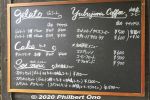
A nice cafe at Manta Beach on Yubu.35 views
|
|
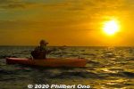
Our guide was Harubaru, but he doesn't normally do sunrise kayaking unless you ask him to: http://harubaru-iriomote.okinawa/course/35 views
|
|

Wish we could see the Iriomote wildcat swimming across the river, but they are nocturnal.35 views
|
|

The center of this photo shows the site where the new airport was going to be built.35 views
|
|

Shiraho coral reefs on Ishigaki.35 views
|
|

Ishigaki Port is on the southern coast of Ishigaki island. It's the marine gateway to other Yaeyama islands such as Taketomi, Iriomote, Kuroshima, and Aragusuku.35 viewsIshigaki Port consists of multiple port facilities. For tourists, the facility for tourist boats going to other Yaeyama islands might be called "Ishigaki Port Remote Island Terminal" or nicknamed "Euglena Ishigaki Port Remote Island Terminal" (ユーグレナ石垣港離島ターミナル) since a company named Euglena bought the naming rights for 5 years in 2018.
|
|

Having tea or ice cream on an old water buffalo cart. (Photo by tour guide motti.)35 views
|
|

Inside the butterfly garden (蝶々園) on Yubu. (Photo by tour guide motti.)35 views
|
|
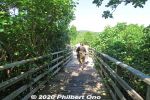
Boardwalk at Sakishima suounoki mangroves in the Komi area. サキシマスオウノキ (古見)35 views
|
|
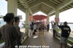
Local tour guides, car rentals, etc., try to attract the attention of arriving tourists at Ohara Port.35 views
|
|
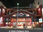
On Kokusai-dori in Naha, souvenir shop looking like Shuri Castle.35 views
|
|

At Naha Airport, my last treat on Okinawa, Beni-imo soft-serve from Blue Seal.35 views
|
|
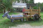
Lots of water buffalo monuments and sculptures on Yubu.34 views
|
|
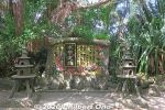
Water Buffalo Monument34 views
|
|
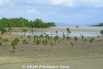
Iriomote mangroves.34 views
|
|
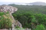
Top of Mt. Yarabudake. This rock is known as Troll's Tongue.34 views
|
|

Boat dock at Urauchi River on Iriomote. If you come on your own, the jungle river cruise is ¥1,800 for adults. 西表島・浦内川34 viewsThe boat cruise takes about 30 min. to a dock upstream where you get off for the waterfall hike. Boats depart here once or twice an hour from morning to early afternoon.
|
|

We got off the boat upstream here at Gunkan-iwa, named after a rock slab looking like the side of a battleship. 軍艦岩34 views
|
|

Urauchi River hiking trail to waterfalls. It can be quite muddy.34 views
|
|

Lush forest, but rocky and muddy trail. Hiking shoes or sneakers are good. Sometimes a tree or branch has fallen over the trail. Need to go over/under it.34 views
|
|

Iriomote Hoshisuna Beach.34 views
|
|

Ishigaki is the gateway to Okinawa Prefecture's Yaeyama Islands. Ishigaki Airport near central Ishigaki is how most visitors get to Yaeyama.34 viewsBird's eye view of central Ishigaki from a jet plane going to land at Ishigaki Airport.
|
|

34 views
|
|

Having tea or ice cream on an old water buffalo cart. (Photo by tour guide motti.)34 views
|
|
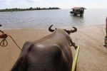
Gentle water buffalo knows the direction. Photo by Kinjo Toru.34 views
|
|
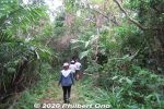
Iriomote has many hiking trails through the tropical forest or jungle. The popular trails usually lead to a waterfall, but we went on a short nature trail in Otomi that didn't lead to anything. 大富林道大正池34 views
|
|
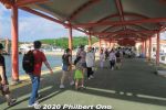
Tourists arriving Ohara Port.34 views
|
|

The old Ohara Port, Iriomote.34 views
|
|
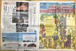
For the 1st anniversary of the Shurijo Castle fire on Oct. 31, 2020, all the local Okinawan newspapers were filled with special articles about the fire and reconstruction efforts.34 views
|
|
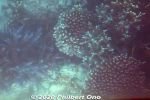
Glass bottom boat in Kabira Bay, Ishigaki.33 views
|
|
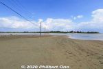
Yubu is a small, sandbar island near Mihara, Iriomote. They converted the island into a lush botanical garden. 33 views
|
|
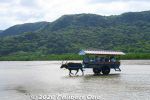
Water buffalo taking tourists to Yubu Island from Iriomote.33 views
|
|

Water buffalo taking toursts to Yubu Island from Iriomote.33 views
|
|
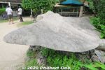
Manta Beach on Yubu. マンタの浜33 views
|
|
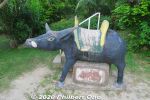
Lots of water buffalo sculptures on Yubu.33 views
|
|
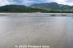
Iriomote across the shallow water.33 views
|
|
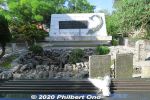
Himeyuri Cenotaph (white) built in 1957 and older monuments. The small stone monument on the right is the original Himeyuri Monument that was placed here in 1946. ひめゆりの塔33 viewsThis monument stands over the entrance of the cave where 80 people died on June 19, 1945 when US troops searching for Japanese soldiers threw in white phosphorus grenades. It's like a smoke bomb that suffocates people. Those who died included 38 Himeyuri high school student nurses and four of their teachers. US troops didn't know who were in the caves.
|
|

33 views
|
|

Mangroves near the mouth of Urauchi River, seen from Urauchi Bridge.33 views
|
|

Our JTA plane that landed at Ishigaki Airport.33 views
|
|

33 views
|
|

On the southern coast of Ishigaki, we stayed at Ishigakijima Beach Hotel Sunshine for one night. It's a nice hotel. About 30 min. by car from the airport. 本館 https://www.ishigakijima-sunshine.net/33 views
|
|
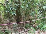
Beehive roped off. (Do not disturb.)33 views
|
|
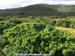
Great views of the greenery from the Otomi Lookout Deck.33 views
|
|
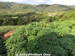
Great views of the greenery from the Otomi Lookout Deck.33 views
|
|
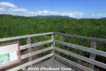
33 views
|
|

The old Ohara Port when it was still operating. Tour buses, taxis, etc., await arriving passengers.33 views
|
|
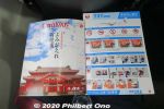
JTA in-flight magazine "Coralway" had a nice Japanese article about the reconstruction of Shuri Castle in Naha.33 views
|
|
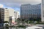
In central Naha, Kokusai-dori is the city's main drag of shops and restaurants. Mostly for tourists. The nearest rail stations are Kencho-mae and Makishi Stations on the Yui Rail. Large building on the right is the Okinawa Prefectural capitol.33 views
|
|
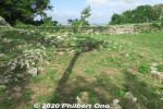
Urasoe Castle (浦添城) was originally built in the 12th century and served as the headquarters of the Chuzan Kingdom, one of the three kingdoms on the main island until they were unified to form the Ryukyu Kingdom in 1429. 33 viewsOnly a few stone walls and craggy rocks remain, no buildings. It is also famous as Hacksaw Ridge featured in the acclaimed 2016 movie, "Hacksaw Ridge" directed by Mel Gibson.
|
|
| 1547 files on 7 page(s) |
1 |
 |
 |
 |
 |
|