 Most viewed - HOKKAIDO 北海道 Most viewed - HOKKAIDO 北海道 |
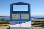
Photo op.9 views
|
|
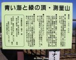
Mt. Sokuryo is also on the migratory path of birds like the falcon. Great for bird watchers. Signboard about Mt. Sokuryo.9 views
|
|
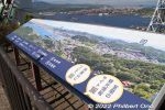
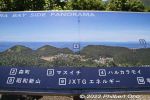
Points of interest from Mt. Sokuryo.9 views
|
|
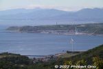
Part of Etomo-Rinkai Park can be seen.9 views
|
|
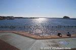
9 views
|
|
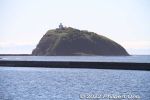
Daikoku Island 大黒島9 views
|
|
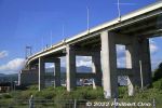
Hakucho Bridge ramp.9 views
|
|
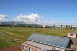
Balcony with views of Hakucho Bridge.9 views
|
|
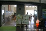
Roadside Station Mitara Muroran gift shop sells mainly edibles.9 views
|
|
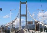
Driving on Hakucho Bridge to mainland Hokkaido.9 views
|
|

Steel factory in Muroran.9 views
|
|

Former JR Muroran Station.9 views
|
|

Etomo Peninsula is quite famous for its dramatic coast including Tokkarisho scenic point. トッカリショ展望台9 views
|
|

It was built in 1964 and sailed from 1965 to March 1988 when the Seikan railway tunnel opened. 9 views
|
|

Yotei-zan as seen from Niseko Hirafu. ニセコ ヒラフ・羊蹄山8 views
|
|

Niseko Annupuri ski grounds has a different view of Mt. Yotei compared to Hirafu. ニセコアンヌプリ8 views
|
|

Views while skiing on Niseko Annupuri. ニセコアンヌプリ8 views
|
|
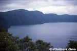
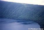
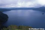
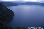
Too bad it was a cloudy day. Lake Mashu has no outflowing river.8 views
|
|
8 views
|
|
8 views
|
|
8 views
|
|
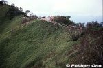
Trail to a scenic lookout point on Lake Mashu.8 views
|
|

8 views
|
|
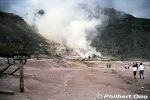
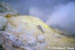
Literally nicknamed "Sulfur Mountain," Mt. Io is a convenient, steaming tourist attraction between Lake Kussharo and Lake Mashu. The mountain's Ainu name is "Atosa-nupuri," meaning "naked mountain" since it hardly has an8 views
|
|

Since there was no machinery in those days, mining operations were done manually with a pick and shovel. Prison labor was used for the mining. The sulphur was then loaded on horseback and boats to Kushiro.8 views
|
|
After the mining operation closed in 1896, the Hokkaido government bought the railway. Today, this railway is connected to JR Senmo Line which opened in 1931.8 views
|
|

By the 2000s, the water acidity decreased enough to introduce fish which could endure the acidity. Only small stocks of rainbow trout, Kokanee, and Masu salmon are now in the lake. The lake has no fishing industry.8 views
|
|

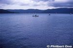
Boats for rent at Sunayu, Lake Kussharo, Hokkaido. In winter, the lake freezes over.8 views
|
|
8 views
|
|
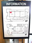
Museum floor plan. Two floors.8 views
|
|
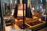
Chiyonoyama's trophy room.8 views
|
|

Poem about Cape Chikyu. Although the original name is Chikiu (チキウ岬) coming from the Ainu word "Chikepu" (チケプ) meaning cliff. It has been Japanized into "Chikyu" (地球) meaning Earth.8 views
|
|
8 views
|
|
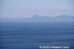
Mt. Usu in the Lake Toya area can be seen.8 views
|
|
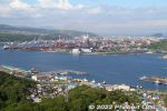
Across Muroran Port is the huge North Nippon Works (Muroran) steel plant.8 views
|
|
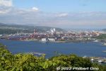
測量山展望台8 views
|
|
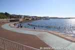
Etomo-Rinkai Park waterfront.8 views
|
|
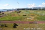
Miniature golf course.8 views
|
|
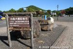
Hakucho Bridge memorial stone.8 views
|
|
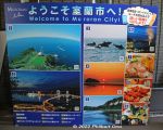
Welcome to Muroran! Local tourist sights.8 views
|
|

Hakucho Bridge Memorial Museum8 views
|
|
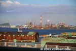
View of the Muroran steel plant from Hakucho Bridge.8 views
|
|

Steel factory in Muroran as seen from Hakucho Bridge.8 views
|
|

JR Muroran Station8 views
|
|

Niseko Hirafu has both easy and steep (moguls) slopes. ニセコ ヒラフ7 views
|
|

Views from Niseko Annupuri at close to sunset.7 views
|
|

7 views
|
|
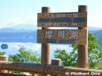
Newer Lake Mashu sign at a lookout point. 7 views
|
|

View of Lake Mashu from Scenic Point 1.7 views
|
|

Mt. Io, meaning "Sulphur Mountain," is a lava dome spewing steam and sulphur gases. Tourists can walk and easily see the sulphur and steam vents. 7 views
|
|

Lake Kussharo is another scenic lake in Akan-Mashu National Park in eastern Hokkaido. Japan's largest caldera lake. Unlike Lake Mashu, Kussharo is accessible to tourists like here at Sunayu.7 views
|
|

Boating on Lake Kussharo, Hokkaido.7 views
|
|

The lake circumerence is 57 km. Deepest point is 125 meters. In the middle of the lake is Nakajima island, a volcano. Japan's largest island in a lake. The island is uninhabited by humans.7 views
|
|

7 views
|
|
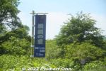
Road signs in Fukushima, Matsumae indicate you're in a Yokozuna town.7 views
|
|
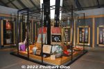
Chiyonofuji's trophy room, filled with trophies, awards, and mawashi ceremonial aprons.7 views
|
|
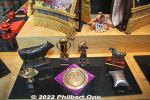
Various awards.7 views
|
|
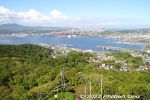
Mt. Sokuryo has a clear view of Muroran Port. The mountain is a 50-min. walk or 10-drive from JR Muroran Station. It's uphill, so going by car/taxi is recommended.7 views
|
|
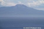
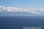
Mt. Komagatake as seen from Mt. Sokuryo in Muroran.7 views
|
|

Map of Shukuzu Shinsui Greenbelt Park.7 views
|
|
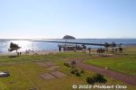
7 views
|
|
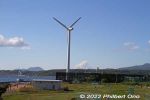
Etomo Peninsula has power-generating windmills.7 views
|
|
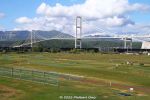
Hakucho Bridge, Muroran. Built in 1998. 白鳥大橋7 views
|
|
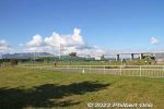
View of Hakucho Bridge that goes from the tip of Etomo Peninsula back to mainland Hokkaido.7 views
|
|
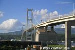
Hakucho Bridge, Muroran. 白鳥大橋7 views
|
|
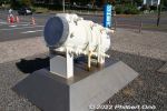
Cutaway of suspension cable used on Hakucho Bridge.7 views
|
|

Roadside Station Mitara Muroran has a gift shop and restaurant on the first floor. The second floor is the Hakucho Bridge Memorial Museum. カナスチールみたら室蘭(白鳥大橋記念館)7 views
|
|
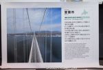
About Muroran, a steel town.7 views
|
|
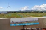
The museum also has a balcony with views of Hakucho Bridge.7 views
|
|
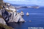
Near Cape Chikyu, Tokkarisho scenic point has dramatic sea cliffs. トッカリショ展望台7 views
|
|

Skiing on Niseko Annupuri. ニセコアンヌプリ6 views
|
|
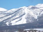
Niseko Moiwa was near our lodge. ニセコモイワ6 views
|
|

Bihoro Pass is within Akan-Mashu National Park. 6 views
|
|
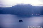
6 views
|
|

Note that there are other mountains named Mt. Io (Io-zan). This one is near Kawayu Onsen hot spring in Hokkaido.6 views
|
|

Boats can be rented at Sunayu. In May 1938, the Kussharo Earthquake had sulfates seep into the lake from the lake bottom, making the water too acidic (pH4) for fish which got wiped out. 6 views
|
|

Wakoto Peninsula6 views
|
|
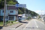
Road signs in Fukushima, Matsumae point the way to Yokozuna Chiyonoyama and Chiyonofuji Memorial Hall.6 views
|
|

About Chiyonofuji.6 views
|
|
6 views
|
|

Mt. Sokuryo (elevation 199.6 m) is another scenic point on Etomo Peninsula with panoramic views. "Sokuryo" means "measurement" because it was used as a base point in surveying the distance between Muroran and Sapporo in 1872. 6 views
|
|
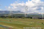
Hakucho Bridge, Muroran. Built in 1998. 白鳥大橋6 views
|
|

Bokoi Station (母恋駅). "Bokoi" means maternal love.6 views
|
|
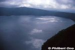
Sunlight peeking through the clouds is reflected on the lake surface.5 views
|
|

Wakoto Peninsula east side.5 views
|
|
5 views
|
|
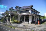
Old JR Muroran Station.5 views
|
|
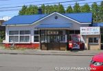
Bokoi Station (母恋駅). "Bokoi" means maternal love, so it's somewhat famous. Tour buses always point it out.5 views
|
|
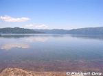
Lake Kussharo as seen from Sunayu. Lake Kussharo's caldera volcano started forming over one million years ago. The caldera lake formed over 40,000 years ago. 4 viewsPart of the caldera lake was filled in by Mashu volcano eruptions, making Kussharo lose its round shape and become bean-shaped.
|
|

When I visited, there were Ainu on the Sunayu beach posing for tourists for a fee. 4 views
|
|

Wakoto Peninsula4 views
|
|

Lake Kussharo's water surface looks artistic.4 views
|
|
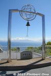
Bell of Happiness on the lookout deck.4 views
|
|

Muroran steel works as seen from the highway.4 views
|
|
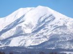
Niseko Annupuri is another famous ski resort in Niseko. This was another large area with long ski runs. ニセコアンヌプリ3 views
|
|

3 views
|
|

3 views
|
|

3 views
|
|
3 views
|
|
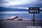
Wakoto Peninsula is another tourist part of Lake Kussharo. It's a small peninsula (2.5 km shoreline) with natural hot springs. 和琴半島2 views
|
|
| 1864 files on 8 page(s) |
 |
 |
 |
 |
8 |
|