 Image search results - "yamanashi" Image search results - "yamanashi" |

JR Kofu Station
|
|
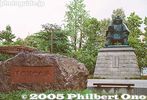
Park in front of Kofu Station.
|
|

Statue of Takeda Shingen.
|
|

Omatsuri is actually a place name. The small settlement has a lodge and restaurant.
|
|

Bus to Taba. The bus runs from Okutama Station in Tokyo. It is the only public transportation link with the village.
|
|

Omatsuri bus stop for Okutama.
|
|

I was in Okutama and noticed that the bus goes on to Tabayama village in neighboring Yamanashi. I got really curious and rode the bus to Tabayama. This is central Tabayama.
|
|

Omatsuri bus stop for Taba.
|
|

When I walked around, my planned 20-min. stay turned into a 2-hour walking tour of this pacifying place, full of mountains and a clear river. A delightful discovery. Suigen Park
|
|

On the side of the road near the bus stop, there is a trail going down to Tama River.
|
|

Completely surrounded by mountains with a clear river running in the middle.
|
|

A suspension bridge over the river.
|
|

A few bridges span the river.
|
|

Tama River as seen from the bridge.
|
|
|

Tama River
|
|

Tama River, looks very inviting in summer.
|
|

Tama River, very quiet and peaceful.
|
|

Upriver as seen from the bridge.
|
|

Crystal clear water of Tama River
|
|
|
|

Crystal clear water of Tama River with fall leaves.
|
|
|
|

Trout fishing ponds for customers in warmer months.
|
|

These photos were taken in Feb. Probably scenic in fall.
|
|

Riverside fishing ponds
|
|

Mountain with a patch of green.
|
|

Path to Otaki Waterfalls 雄滝
|
|

Bus stop. Notice the monkey crossing the road.
|
|

Waterwheel 水車
|
|

There were many hikers on the bus, and I wondered where they were going, so I followed them.
|
|
|
|

Numerous monkey poop along the road.
|
|

Waterwwheel (not working)
|
|
|

Trail to waterfalls
|
|

Pretty scenic area.
|
|

When I was walking here, I did not know there was a waterfall.
|
|

The area is part of the Chichibu-Tama National Park.
|
|

Path from above.
|
|

Trail to Mt. Kumotori, Tokyo's tallest mountain. That's where the hikers were headed.
|
|
|

Trail to Mt. Kumotori
|
|

Waterfalls
|
|

Tama River
|
|

Otaki Waterfall
|
|

By coincidence, I found this man-made waterfall.
|
|

An observation deck is also provided.
|
|
|

View from the observation deck
|
|

Waterfall
|
|
|
|
|
|
|
|
|

Fishing pond
|
|

Riverside picnic pavilions
|
|

Picnic pavilion with charcoal grill (for the fish caught).
|
|

Outdoor stage
|
|

Tennis courts with snow.
|
|

Fishing ponds
|
|

Camping bungalows
|
|

Camping bungalows along the river. For warmer months.
|
|

Glorious Tama River
|
|
|

Scarecrow
|
|

Scarecrow
|
|

Roadside waterwell
|
|

Taba bus stop
|
|

Taba bus garage
|
|

Taba bus stop and bus garage
|
|

Bus to Okutama, Tokyo
|
|
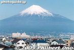
Mt. Fuji as seen from the shinkansen bullet train.
|
|
|
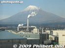
Smokestacks mar the view of Fuji.
|
|
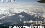
Mt. Fuji from the air.
|
|

Yoshida-guchi trail entrance sign.
|
|
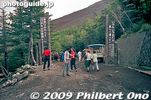
Yoshida-guchi trail entrance, we started from the 5th station.
|
|
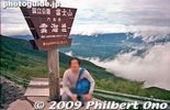
After climbing for about 40 min., we reached the 6th station here. We're already above the clouds.
|
|
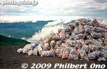
Bags of drink cans.
|
|
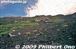
Rocky trail looking up on Mt. Fuji.
|
|
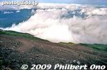
Looking down at the trail.
|
|
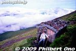
Hut roofs are weighed down with rocks so it doesn't blow away with the wind.
|
|
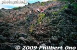
Rock and more rock on Mt. Fuji.
|
|

A good part of the trail had us going on all fours.
|
|
|

Mt. Fuji torii
|
|
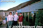
Our mountain hut on the 8th station, called Toyokan. 東洋館
|
|
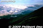
Shadow of Mt. Fuji
|
|
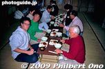
We spent the night in the mountain hut with a small dinner.
|
|
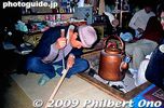
Branding my walking stick.
|
|
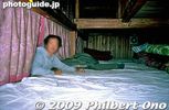
Our bunk bed.
|
|

Watching the sunrise from outside our hut.
|
|

Reaching the summit.
|
|

At the summit of Mt. Fuji. It was so windy and rainy that we couldn't walk around the rim. Could hardly see anything.
|
|
Going down was tiring too. But better than going up.
|
|
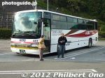
There are five lakes at the northern foot of Mt. Fuji known as Fuji Goko (富士五湖). They are easily accessible by bus from Shinjuku, Tokyo, taking 2-3 hours for around 4,000 yen round trip.
|
|
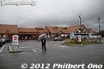
The second largest of the five lakes at the foot of Mt. Fuji, Lake Kawaguchi is well developed for tourists. This is Kawaguchiko Station on the Fujikyuko Line. From central Tokyo, going by bus is more convenient, although traffic delays a always possible
|
|
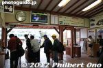
Inside Kawaguchiko Station on the Fujikyuko Line. Buses from Tokyo stop at Kawaguchiko Station as well as local toruist buses. Kawaguchiko Station is the area's transportation hub.
|
|
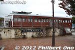
Train display in front of Kawaguchiko Station.
|
|
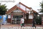
Next to Kawaguchiko Station is this tourist information office. Get free pamphlets, maps, etc. English spoken. Many foreign tourists also visit the Five Lakes of Mt. Fuji.
|
|
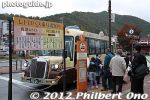
In front of Kawaguchiko Station are a number of bus stops. A convenient tourist retro bus goes around the lake and neighboring lakes. I visited in autumn.
|
|
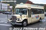
Two types of retro tourist buses. One goes to the other side of Lake Kawaguchi and one goes to Lake Saiko.
|
|
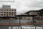
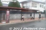
Bus stops in front of Kawaguchiko Station.
|
|
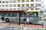
You can also catch a bus to Lake Yamanaka and to Mt. Fuji's 5th Station which is about halfway up the mountain.
|
|
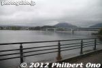
Lake Kawaguchi is quite well developed for tourists with lodging, shops, museums, onsen baths, and tourist buses. It's the second most popular Fuji Goko lake after Lake Yamanaka.
|
|
I caught a retro bus to go to the other side of the lake.
|
|
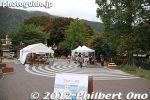
Lake Kawaguchi holds its autumn foliage festival (Koyo Matsuri) from late Oct. to mid-Nov. on the northern shore where there is a long corridor of maple trees.
|
|
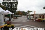
A few food stalls.
|
|
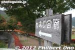
Corridor of maple trees (momiji), but I was too early in Oct.
|
|
|
|
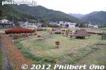
Adjacent to the maple trees was this park or garden featuring small thatched-roof houses.
|
|
|
|
|
|
|
|
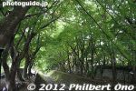
Most of the maple leaves at Lake Kawaguchi were still like this when I was there. They are late in turning color this year. Give them 10 more days.
|
|
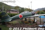
What in the world is this doing here, I asked myself at the end of the maple tree corridor. That's what I like about Japan, always something totally unexpected.A Japanese Zero fighter plane??
|
|
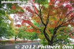
Autumn leaves at Lake Kawaguchi (northern shore). The trees are also lit up at night during the Koyo festival.
|
|
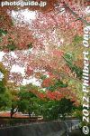
Maple trees at Lake Kawaguchi. One of the few that was red.
|
|
|
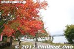
On the nearby shore, a few more maple trees.
|
|
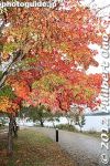
Lake Kawaguchi, Yamanashi.
|
|
|
|
|
|

There would be a view of Mt. Fuji from here. Most hotels are on the northern shore so they can see Mt. Fuji across the lake.
|
|
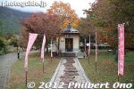
A small shrine dedicated to Fukurokuju, one of the Seven Gods of Good Fortune. He is the god of God of wisdom and longevity. 福禄寿
|
|
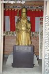
Fukurokuju, one of the Seven Gods of Good Fortune, is the god of God of wisdom and longevity.. 福禄寿
|
|

About Fukurokuju. This area of the lake has seven shrines for all of the Seven Gods of Good Fortune.
|
|
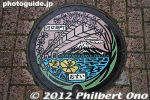
Manhole at Lake Kawaguchi, Yamanashi.
|
|
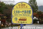
Bus stop for the retro tourist bus.
|
|
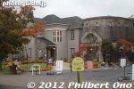
Museum at Lake Kawaguchi.
|
|
|
|
|

Herb Museum at Lake Kawaguchi.
|
|

Panorama of the southern shore of Lake Kawaguchi.
|
|
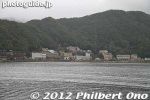
View of Lake Kawaguchi's northern shore.
|
|
|
|
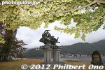
Southern shore of Lake Kawaguchi with a statue of two sister goddesses dancing over the lake. The sculptor was Gakuryo Nasu.
|
|
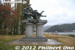
Southern shore of Lake Kawaguchi with a statue of two sister goddesses dancing over the lake. The sculptor was Gakuryo Nasu.
|
|

ABout the statue of two sister goddesses dancing over the lake. The sculptor was Gakuryo Nasu.
|
|
|
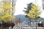
Southern shore of Lake Kawaguchi with gingko and poplar trees. I saw quite a few foreign tourists, including Chinese. It's a great weekend getaway for Tokyoites.
|
|
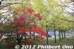
Maple and ginkgo trees on the southern shore of Lake Kawaguchi.
|
|
|
|
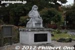
Statue of Kajiwara Kagetoki (1140-1200 梶原 景時) at Lake Kawaguchi. A warrior against the Taira.
|
|
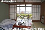
My room where I stayed at Lake Kawaguchi. It had a sun deck which provided a good view of Mt. Fuji. I paid only 4,800 yen for the night without meals.
|
|

Nice Japanese-style room, but no Internet connection. I needed a break anyway.
|
|
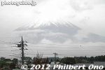
Morning view of Mt. Fuji from my room at Lake Kawaguchi. This is the only glimpse of Mt. Fuji I got during a cloudy and sometimes drizzly weekend.
|
|
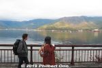
Strolling along the lake is pleasant for tourists.
|
|
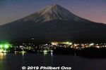
Evening view of Lake Kawaguchi and Mt. Fuji from a hillside hotel.
|
|

If you visit Lake Kawaguchi, you might as well visit Lake Saiko or Lake Sai, a short bus ride away. There are a number of tourist attractions like ice caves and bat caves.
|
|
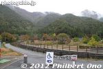
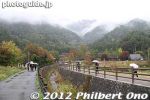
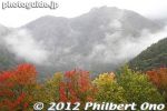
Decided to visit Saiko Iyashi-no-Sato Nenba, an outdoor museum of thatched-roof houses. It is one of the stops on the tourist bus circuit. 西湖いやしの里根場
|
|
There are five lakes at the northern foot of Mt. Fuji known as Fuji Goko (富士五湖). They are easily accessible by bus from Shinjuku, Tokyo, taking 2-3 hours for around 4,000 yen round trip.
|
|
On 2010, Lake Saiko garnered national attention when the native species kunimasu, a type of salmon or black kokanee, thought extinct for 70 years, was discovered in the lake.
|
|
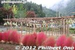
Gourd garden at Lake Saiko's Saiko Iyashi-no-Sato Nenba.
|
|
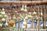
Gourds growing at Saiko Iyashi-no-Sato Nenba. I was soon to find out why they are growing these gourds. (Not for eating.) Whenever I see gourds, it reminds me of Hawaiian hula because they are used as hand drums.
|
|

About Saiko Iyashi-no-Sato Nenba. There used to be a real village here until it was destroyed by a typhoon. Residents moved away, and the village was reconstructed with thatched-roof homes. The museum opened in 2006.
|
|
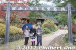
Entrance to Saiko Iyashi-no-Sato Nenba.
|
|

There are mostly tourist souvenir shops selling food and local crafts. One house sold ancient mochi (dark and red colored) and had an irori fireplace. Another house rented samurai armor and kimono to dress up in for only 500 yen.
|
|

In 1966, a big typhoon bringing heavy rains caused a mudflow that destroyed the homes here, killing 94 residents. The entire settlement was destroyed so the survivors moved to the opposite side of the lake.
|
|
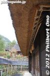
In 2006, they opened this outdoor museum as a testament to the old villagers here. Over the years, they expanded and added more houses. There are now 20 houses.
|
|
|
|
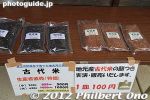
Ancient varieties of rice.
|
|
|
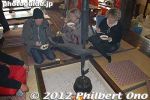
A house with an irori where we could have tea and sweets.
|
|
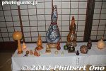
The gourds grown here are used for decorative purposes.
|
|
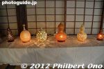
The gourds grown here are used for decorative purposes. Saiko Iyashi-no-Sato Nenba, Lake Saiko, Yamanashi.
|
|
|
|
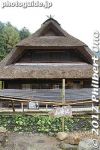
Wasabi garden.
|
|
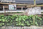
Growing wasabi with very clean water at Saiko Iyashi no Sato Nenba.
|
|
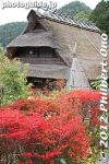
Saiko Iyashi-no-Sato Nenba, Lake Saiko, Yamanashi.
|
|
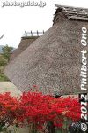
Saiko Iyashi-no-Sato Nenba, Lake Saiko.
|
|
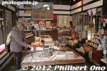
Souvenir shop.
|
|
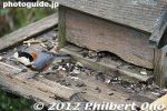
Bird house.
|
|
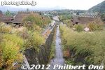
The outdoor museum is not huge, but big enough to spend a good amount of time. On clear days, it gives good views of Mt. Fuji.
|
|
|
|
|
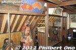
2nd floor of this house had woodblock prints.
|
|
|
|

Stuffed bear
|
|
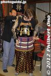
This house rented samurai armor and kimono to dress up in for only 500 yen.
|
|
|
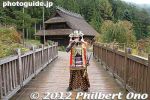
They allow you to walk around like this.
|
|
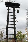
Fire watch tower.
|
|
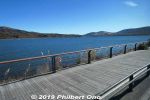
Lake Yamanaka is the largest of the Fuji Five Lakes near Mt. Fuji. It's not as touristy as Lake Kawaguchi, but there are many vacation lodging owned by universities and companies.
|
|
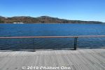
Views of Mt. Fuji are beautiful in fall and winter. There's a good bicycling path around the lake. The road around Lake Yamanaka will also be part of the Tokyo 2020 Olympic cycling road race course from Tokyo to Fuji Speedway.
|
|

Yamanakako Tourism Association has tourist information and also rents bicycles. We rented bicycles here. It's slightly away from the main part of the lake.
|
|

Map shows the Tokyo 2020 Olympic cycling road race course.
|
|

One of many boat docks.
|
|

Feeding koi fish.
|
|
|

Excellent cycling path around Lake Yamanaka.
|
|
|
|
|
|
|
|
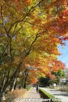
Some fall foliage along the cycling path around Lake Yamanaka.
|
|

Lookout tower.
|
|
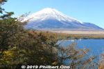
View from Lookout tower.
|
|
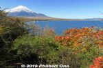
View from Lookout tower.
|
|
|
|
|
|
|
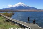
Lake Yamanaka and Mt. Fuji in Nov. There's a boardwalk. Thisis near Yamanakako Koryu Plaza. 山中湖交流プラザ きらら
|
|
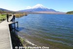
Lake Yamanaka and Mt. Fuji in Nov.
|
|
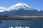
Lake Yamanaka and Mt. Fuji in Nov.
|
|

Lake Yamanaka and Mt. Fuji in Nov.
|
|
|

Lake Yamanaka and Mt. Fuji at Hirano no Hama beach. 平野の浜
|
|

Lake Yamanaka and Mt. Fuji at Hirano no Hama beach. 平野の浜
|
|

Lake Yamanaka manhole showing Mt. Fuji and swans.
|
|

Tourist information center at Hirano, Lake Yamanaka 平野
|
|

Tourist information center at Hirano, Lake Yamanaka 平野
|
|
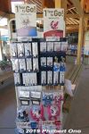
Olympic merchandise inside Tourist information center.
|
|

Tourist information center.
|
|
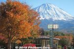
Narusawa is a village near Mt. Fuji and part of Fuji-Hakone-Izu National Park. At the Narusawa Michinoeki Road Station, there are nice views of Mt. Fuji.
|
|
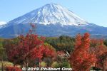
I visited Narusawa on a beauitful autumn day with snow-capped Mt. Fuji and autumn foliage. Narusawa, Yamanashi Prefecture.
|
|
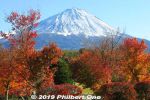
Mt. Fuji in autumn.
|
|
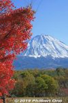
Mt. Fuji in autumn with red momiji maple leaves.
|
|

Mt. Fuji in autumn with red momiji maple leaves. Narusawa, Yamanashi Prefecture.
|
|
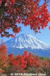
Mt. Fuji in autumn with red momiji maple leaves. Narusawa, Yamanashi Prefecture.
|
|
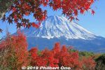
Mt. Fuji in autumn with red momiji maple leaves.
|
|

Mt. Fuji in autumn with momiji maple leaves.
|
|
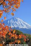
Mt. Fuji in autumn with momiji maple leaves. Narusawa, Yamanashi Prefecture.
|
|
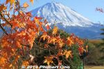
Mt. Fuji in autumn with momiji maple leaves. Narusawa, Yamanashi Prefecture.
|
|

Mt. Fuji in autumn with momiji maple leaves.
|
|
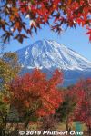
Mt. Fuji in autumn with red momiji maple leaves.
|
|

Mt. Fuji in autumn with red momiji maple leaves. Narusawa, Yamanashi Prefecture.
|
|
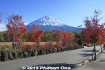
Narusawa, Yamanashi Prefecture.
|
|
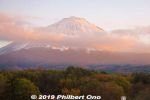
Mt. Fuji at sunset. Narusawa, Yamanashi Prefecture.
|
|
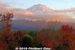
Mt. Fuji at sunset in autumn. Narusawa, Yamanashi Prefecture.
|
|
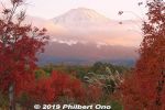
Mt. Fuji at sunset in autumn.
|
|
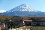
Mt. Fuji in Narusawa, Yamanashi Prefecture.
|
|
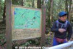
Aokigahara Forest is on the northwestern foot/slope of Mt. Fuji. This forest is also known as "Suicide Forest" since some people have committed suicide in Aokigahara.But apparently not in the part of the forest we hiked in. Our guides assured us that we wouldn't see any bodies...(and we didn't.) This is our English-speaking guide from this company:
https://www.the-highestpeak.com/english
|
|
|
|
|
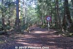
Despite its reputation, Aokigahara Forest didn't look or feel spooky or scary at all. It looked like any other forest in Japan. There are distinct trails and signs to follow. It's possible to get dangerously lost if you stray too far (more than 200 meters) from the trails. The forest has multiple trail entrances, and I was told a few of them have signs trying to discourage suicide.
|
|
|
|
|
|
|