 Image search results - "waterfall" Image search results - "waterfall" |

Area around entrance to Hossawa Falls
|
|

Entrance to Hossawa Falls (free admission)
|
|

To Kichijoji Falls
|
|

Signboard showing Hinohara's waterfalls
|
|

Explanation sign
|
|

Down to Kichijoji Falls, right next to the highway.
|
|

Trail to Hossawa Falls
|
|

Gorge
|
|

Trail to Hossawa Falls is very lush
|
|

Downstream of falls
|
|

Beware of falling rocks
|
|

Akikawa River below Kichijoji Falls, Hinohara, Tokyo
|
|

It's a short trail, but very nature-rich
|
|

Kichijoji Falls 吉祥寺滝
|
|
|

Kichijoji Falls 吉祥寺滝
|
|

Small river below, fed by the waterfall
|
|

Kichijoji Falls 吉祥寺滝
|
|

Monuments
|
|
|

This is not the waterfall.
|
|

Upstream Kichijoji Falls
|
|

Path to Otaki Waterfalls 雄滝
|
|

Kichijoji Falls consist of three small waterfalls. Hinohara, Tokyo 吉祥寺滝
|
|

Kichijoji Falls, Hinohara, Tokyo
|
|

Finally, a sign of the waterfall.
|
|
|

There it is. Notice the smaller falls at the top.
|
|
|
|

Hossawa Falls, Hinohara, Tokyo
|
|

Upstream Akikawa River from the waterfalls
|
|

Base of Hossawa Falls
|
|

Highway next to Kichijoji Falls
|
|

Hossawa Falls
|
|

Down to another scenic point near Kichijoji Falls
|
|

Hossawa Falls
|
|

Gorge near Kichijoji Falls
|
|

Waterfalls
|
|

Ice crystals and running water. Normally, the Hossawa waterfall freezes over in winter.
|
|

Crystal-clear water
|
|

Otaki Waterfall
|
|

Ice crystals on rocks
|
|

Akikawa River
|
|

An observation deck is also provided.
|
|

Hossawa Falls, Hinohara, Tokyo
|
|

To Nakayama Falls 中山の滝
|
|
|

View from the observation deck
|
|
|
|

Nakayama Falls as seen from the road. 中山の滝
|
|

Waterfall
|
|

Hossawa Falls is one of Japan's 100 Famous Falls. 日本の滝百選
|
|

Nakayama Falls as seen from the road. 中山の滝
|
|
|

The waterfall is actually a series of four falls, only two of which can be seen.
|
|

Nakayama Falls 中山の滝
|
|

Total height of the falls is 60 meters, from the top falls not visible.
|
|

Monument saying "Thanks you for the pure water."
|
|

Trail back to the entrance
|
|

Bridge with waterfall motif
|
|

Shiraito Waterfall. Nothing spectacular. 白糸の滝
|
|
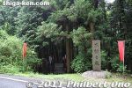
Near the south of JR Mikumo Station (Kusatsu Line) is Fudo-no-taki Waterfall. One of two noted waterfalls in Konan. The waterfall's trail entrance is right along the road, marked by a stone monument. MAP
|
|
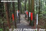
From the road, the path to the waterfall is very short, lined with banners written with the names of ascetic pilgrims who came to pray or practice at the waterfall.
|
|
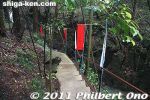
Path going to the waterfall.
|
|
|
|
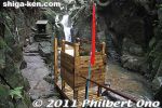
There's even a small lookout deck.
|
|
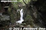
On the left of the waterfall is a small altar for Fudo-Myo-o, the patron god of mountain ascetic priests. The waterfall takes its name after this god.
|
|

Fudo-no-taki Waterfall in Mikumo, Konan, Shiga Prefecture.
|
|
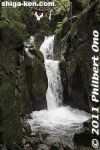
The waterfall is about 5 meters high.
|
|
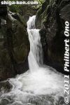
Fudo-no-taki Waterfall in Mikumo, Konan, Shiga Prefecture.
|
|
|

Altar for Fudo-Myo-o.
|
|
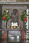
Altar for Fudo-Myo-o.
|
|
|

Etching on stone.
|
|
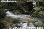
Upstream at the top of the waterfall.
|
|
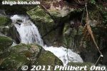
Top of the waterfall.
|
|
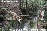
Top of the waterfall.
|
|
|
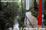
Looking downstream from the waterfall.
|
|

My video of Fudo-no-taki Waterfall in Mikumo, Konan, Shiga Prefecture.
|
|

Some tourist shops at Shiraito Falls.
|
|
|
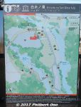
Map of Shiraito Falls area.
|
|
|
|

First you see Otodome Falls, big and impressive.
|
|

Otodome Falls in Fujinomiya, Shizuoka
|
|
|
|
|

Shiraito Falls
|
|
|

Shiraito Falls has some steps to go down, then a bridge over the river.
|
|
|
|
|
|
|

Shiraito Falls
|
|
|

Shiraito Falls in Fujinomiya, Shizuoka
|
|
|

Shiraito Falls in Fujinomiya, Shizuoka.
|
|

Shiraito Falls in Fujinomiya, Shizuoka.
|
|
|
|

Shiraito Falls in Fujinomiya, Shizuoka. "Shiraito" means "white threads" in Japanese. It refers to the numerous slivers of water falling. This is one of Japan's most famous waterfalls also part of the Fuji-Hakone-Izu National Park
|
|

The water flows from Mt. Fuji's runoff between layers of rock. So the water is flowing through the rock layers. Interesting phenomenon.
|
|
|
|
|
|
|
|

Inside the tourist info center at Shiraito Falls.
|
|

Bus schedule back to Fujinomiya Station from Shiraito Falls.
|
|
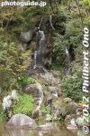
Aioi Waterfall is a small waterfall flowing into a pond. Built in 1934 using the natural terrain.
|
|

Sobetsu Falls, Lake Toya, Hokkaido.
|
|

At Gunkan-iwa dock, there's a hiking trail called Urauchigawa Shizen Kenkyu-ro. A nature trail that goes to two waterfalls.Note that cell phones won't work on the hiking trail. 浦内川自然研究路
|
|

Urauchi River hiking trail to waterfalls. It can be quite muddy.
|
|

Sometimes there are views from the hiking trail.
|
|

Lush forest, but rocky and muddy trail. Hiking shoes or sneakers are good. Sometimes a tree or branch has fallen over the trail. Need to go over/under it.
|
|

Ferns and a nameless mini waterfall.
|
|

After hiking about 30 min., a scenic point gives a view of Mariyudu Falls. Series of three waterfalls. It empties into a round stream pool. "Mariyudu" means stream pool. マリゥドゥの滝
|
|

Mariyudu Falls on Urauchi River. About 20 meters wide and 16-meter drop in total. One of Japan's 100 Famous Waterfalls. マリゥドゥの滝*People can no longer come this close to the falls. There were people who slipped and fell in, so the closeup path is blocked.
|
|

Behind Mariyudu Falls looking from upstream.
|
|

Mariyudu Falls. From here, the hiking trail continues to another waterfall, Kanbire (Kanpire) Falls about 250 meters away.
|
|

Kanbire (Kanpire) Falls on Urauchi River, near the center of Iriomote. This is about 2 km from the Gunkan-iwa boat dock. Or 30-40-min. hike. You can get quite close to the falls. カンビレーの滝Instead of having one big drop, Kanbire Falls flow down on a series of steps on the river for about 200 meters. The riverside also has small potholes. Kanbire (Kanpire) means "where gods sit." This spot was considered to be a sacred site where the gods gathered.
|
|

Hiking back. The lady in front of me was wearing rubber slippers on this muddy trail. She kept slipping and almost falling. Her dainty feet got all muddy.
|
|

River cruise back to the dock.
|
|

Urauchi River boat dock as seen from Urauchi Bridge near the mouth of the river.
|
|
|
|

Mangroves near the mouth of Urauchi River, seen from Urauchi Bridge.
|
|

Bus stop (Urauchihashi) for the Urauchi River boat dock. In the background is our tour bus.
|
|

Roadside stream
|
|

Getting nearer to Yoro-no-taki Falls. It's a good uphill hike which will tire you. But it's not too long.
|
|
|
|

Yoronotaki Falls is one of Japan's 100 Famous Waterfalls and 100 Famous Water Springs.
|
|

You'll be frustrated to see a few more stone steps that you need to clumb to get closer to the falls.
|
|

The famous Yoro Falls in Gifu.
|
|

養老の滝
|
|

Yoro-no-taki Falls is 32 meters high and 4 meters wide. Swimming under the falls is not allowed. This is the closest you can get.
|
|
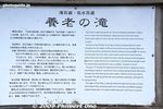
About Yoro Falls (in English).
|
|

Small shrine next to the falls.
|
|

In Yugawara, Fudo Falls is a serene and quiet waterfall 15 meters high. Flanked by small Shinto shrines. From JR Yugawara Station, take a bus for "Oku-Yugawara" or "Fudo-daki" and get off at "Fudo-daki." 20-min. ride.
|
|
|
|
|