 Image search results - "volcano" Image search results - "volcano" |

Sakurajima 桜島Part of Kirishima-Yaku National Park.
|
|
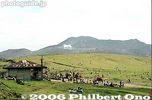
Kusasenri park 草千里Grassy park on the periphery of Mt. Aso.
|
|
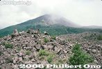
Sakurajima 桜島
|
|

Horseback riding at Kusasenri. 草千里
|
|

View from the slope
|
|
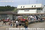
Aso Volcano Museum 阿蘇火山博物館
|
|

Walking paths near the mountain.
|
|
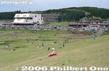
Kusasenri
|
|
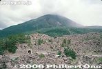
Sakurajima, Kagoshima. Part of Kirishima-Yaku National Park. 桜島
|
|
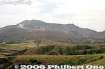
View of Mt. Aso
|
|

Leaving Sakurajima across the bay.
|
|
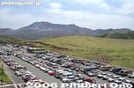
Kusasenri parking lot
|
|
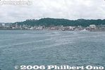
Kagoshima port
|
|
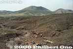
Spectacular ropeway ride
|
|
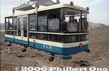
Aso-san Ropeway 阿蘇山ロープウェー
|
|
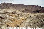
Ropeway
|
|

Aso Crater rim
|
|

Notice the emergency shelters.
|
|
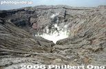
Mt. Naka-dake is Mt. Aso's most famous crater, Kumamoto 阿蘇山 中岳火口Measures 1 km wide north to south and 4 km east to west.
|
|

Mt. Naka-dake in Aso-san, Kumamoto. Measures 1 km wide north to south and 4 km east to west. 阿蘇山 中岳火口
|
|

Always smoking, Mt. Naka-dake in Aso-san, Kumamoto 阿蘇山 中岳火口
|
|
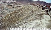
Crater rim
|
|

Sign for taking "I was here" photos.
|
|

World's largest caldera still active.
|
|
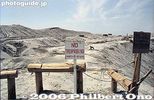
No entry
|
|
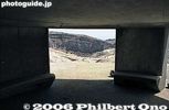
Inside emergency shelter.
|
|
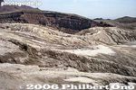
Spectacular rock and cliff formations.
|
|
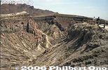
Fantastic artwork by nature
|
|

Art of nature
|
|

Natural sculptures
|
|
|
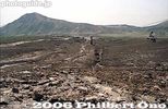
Walking back instead of taking the ropeway.
|
|
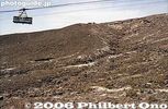
Ropeway
|
|
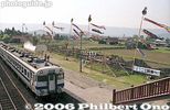
Aso Station
|
|

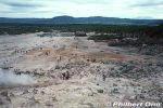
Mt. Io, meaning "Sulphur Mountain," is a lava dome spewing steam and sulphur gases. Tourists can walk and easily see the sulphur and steam vents.
|
|
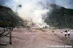
Literally nicknamed "Sulfur Mountain," Mt. Io is a convenient, steaming tourist attraction between Lake Kussharo and Lake Mashu. The mountain's Ainu name is "Atosa-nupuri," meaning "naked mountain" since it hardly has an
|
|
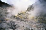
Mt. Io is Kawayu Onsen's hot spring source. It was also a sulphur mine from 1877 to 1896. At the time, sulphur was widely used in cigarette matches and gunpowder.
|
|

The mining operations here and in other nearby mountain quickly developed local industry in eastern Hokkaido which had been largely undeveloped.
|
|

Since there was no machinery in those days, mining operations were done manually with a pick and shovel. Prison labor was used for the mining. The sulphur was then loaded on horseback and boats to Kushiro.
|
|
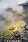
Mt. Io, Hokkaido. You can get quite close to the sulphur vents.
|
|

In 1887, a railway was built from Mt. Io to Shibecha, 41 km away. It was Hokkaido's second railway to be built after the railway between Sapporo and Otaru.
|
|
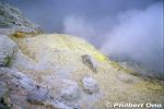
After the mining operation closed in 1896, the Hokkaido government bought the railway. Today, this railway is connected to JR Senmo Line which opened in 1931.
|
|

Sulphur mining ended altogether in Hokkaido in 1963.
|
|

Note that there are other mountains named Mt. Io (Io-zan). This one is near Kawayu Onsen hot spring in Hokkaido.
|
|
|
|
Back to the visitor's center.
|
|

The Nishiyama Crater Trail (Nishiyama Kako Sansakuro) is accessible by car or bus from Toyako Onsen Spa or Toya Station. Get off at the Nishiyama Kako Kitaguchi which is in front of this former fire dept. station. 旧西胆振消防組合本部
|
|

The fire dept. building was damaged by the eruption, so it is no longer used by the fire dept. However, you can enter it and see some display panels.
|
|

Inside former fire station.
|
|

Next to the former fire station is this small pond, called Nishiyama Kako-numa, created by the eruption and blocking the road. 西山火口沼(西新山沼)
|
|

Road blocked by the pond. The Nishiyama Craters are part of Mt. Usu. They are on the west side of Usuzan and were formed by the March 2000 eruption.
|
|

The former fire station in the distance. The building still looks quite new.
|
|

The north entrance to the Nishiyama Crater Trail (Nishiyama Kako Sansakuro Kitaguchi). Open from April 20 to Nov. 10 during 7 am - 6 pm. Free admission, but donations accepted.
|
|

The trail starts with a bumpy asphalt road.
|
|

The wrecked road.
|
|

The walking trail becomes a nice wooden boardwalk on rough terrain.
|
|

Apparently there weren't any cars on the road when this happened since everyone had been evacuated before the eruption occurred.
|
|

Flowers from the asphalt cracks.
|
|

The trail continues to more dramatic landscapes.
|
|

Sign explaining the deformed road.
|
|

Broken telephone pole.
|
|

No. 1 Nishiyama Crater Lookout deck for the most conspicuous crater, still emitting steam.
|
|

No. 1 Nishiyama Crater Lookout deck
|
|

One of the largest and most active Nishiyama crater. There are about 30 craters in the area, and this one emits the most steam.
|
|

An adjacent crater contains water and emits some steam.
|
|

Nishiyama Crater Trail
|
|

It takes about 40 min. to walk the crater trail one way. So allow at least 90 min. for a round-trip.
|
|

View of the No. 2 Nishiyama Crater Lookout deck
|
|
|
|

View from the No. 2 Nishiyama Crater Lookout deck
|
|

View from the No. 2 Nishiyama Crater Lookout deck
|
|

View from the No. 2 Nishiyama Crater Lookout deck
|
|

View from the No. 2 Nishiyama Crater Lookout deck. On the right is the crater of the initial eruption occurring in March 2000.
|
|

Close-up of Nishiyama's first crater formed during the March 2000 eruption.
|
|

Another crater which is dry.
|
|
|

Crater bottom.
|
|

The trail passes by a wrecked confection factory.
|
|

The trail goes to the Minami-guchi (South entrance) of the crater trail.
|
|

Wrecked confection factory. A dramatic reminder of what volcanoes can do.
|
|

Going further along the crater trail.
|
|

Another wrecked house.
|
|
|

Wrecked car
|
|

More dramatic terrain. There's no threat of further eruptions in this area, so don't worry about getting caught in a shower of hot lava and volcanic ash while walking around here.
|
|

Heading back. Remember that the trail is not open during the winter months. For more info call 0142-75-4400.
|
|

Toyako Visitor Center and Volcano Science Museum (smaller building on left). 洞爺湖ビジターセンター
|
|

Entrance to Toyako Visitor Center (free admission, but admission charged for the Volcano Science Museum).
|
|

G8 Hokkaido Toyako Summit countdown at Toyako Visitors Center and Volcano Science Museum in Toyako Onsen Spa.
|
|

Toyako Visitor Center and Volcano Science Museum in Toyako Onsen Spa with G8 Summit welcome sign.
|
|

The Toyako Visitor Center is spacious with a giant aerial photo of Lake Toya and various exhibits introducing the lake which is within the Shikotsu-Toya National Park.
|
|

Giant aerial photo of Lake Toya.
|
|

Toyako Visitor Center
|
|

Volcanic rock which you can touch. Toyako Visitor Center
|
|

How Lake Toya was formed.
|
|

Fishes in Lake Toya
|
|

Birds around Toyako
|
|
|

The Toyako Visitor Center also has the Volcano Science Museum (admission 600 yen). A room (seen on left) simulating the 1977 Mt. Usu eruption with a video and vibrating sound is a must-see.
|
|

Wrecked car on display. The main attraction is the Mt. Usu Volcanic Eruption Theater which shows an engrossing film about Usuzan's eruptions. 火山科学館
|
|

A short bus ride from Toyako Onsen is the Nishiyama crater trail. Highly recommended. A series of craters can be seen up close. More photos here.
|
|

Road to Showa-Shinzan. That's the Showa-Shinzan Youth Hostel on the right. Best way to get to Showa-Shinzan is by bus from Toyako Onsen bus terminal.
|
|

Buses from Toyako Onsen don't run very often, so check the bus timetable beforehand. I opted to rent a bicycle and rode to Showa-Shinzan. Unless you like to push a bicycle up a very long slope for about 30 min., take a bus.
|
|

Distance-wise, Showa-Shinzan is not very far. But the killer slope will get you... At least the return bike ride was a thrill and very quick.
|
|

After a long walk uphill with a bicycle, Showa-Shinzan is in sight. Showa-Shinzan is in the town of Sobetsu.
|
|

There's a large parking lot full of tourists.
|
|

Mt. Showa-Shinzan is a lava dome which arose in the middle of farm land in 1943-45. Lake Toya, Hokkaido.
|
|

We cannot climb Showa-Shinzan.
|
|

The closest we can go is this park at the foot.
|
|

Statue of Masao Mimatsu, a post office worker who observed and documented the development of Showa-Shinzan. His records are valuable.
|
|

Statue of Masao Mimatsu.
|
|

Park at the foot of Showa-Shinzan which means "New Mountain of the Showa Period." Showa-Shinzan is adjacent to Mt. Usu.
|
|

A tourist village called Kazan-mura (Volcano Village) has developed at the foot of Showa-Shinzan. 火山村
|
|

Mt. Usu is on the left, Showa-Shinzan on the right. In the background is the conical Mt. Yotei. Between Usu and Showa-Shinzan is the tourist village and the Usuzan Ropeway terminal.
|
|

Usuzan Ropeway terminal on the left.
|
|

Usuzan Ropeway car holds over 100 people.
|
|

Leaving the ropeway terminal.
|
|

The ropeway distance is 1370 meters. It takes only 6 min. to reach Mt. Usu. The roundtrip ropeway fare is 1,450 yen for adults, 730 yen for kids.
|
|

Showa-Shinzan gets smaller.
|
|

Usuzan Ropeway, Lake Toya.
|
|

View of Lake Toya from the ropeway car.
|
|

View of Lake Toya from the ropeway car.
|
|

Lookout deck on Mt. Usu, near the ropeway terminal.
|
|

Toyako lookout deck on Mt. Usu, near the ropeway terminal. 洞爺湖展望台
|
|

Lake Toya lookout deck on Mt. Usu, near the ropeway terminal. Showa-Shinzan clearly in sight. 洞爺湖展望台
|
|

Mt. Showa-Shinzan as seen from Mt. Usu.
|
|

Lake Toya's bald spot.
|
|

Showa-Shinzan closeup. Still steaming.
|
|

Lake Toya as seen from Mt. Usu.
|
|

Lake Toya as seen from Mt. Usu.
|
|

You can see the road (and youth hostel) where you turn right to reach Showa-Shinzan.
|
|

Lava dome on Mt. Usuzan
|
|

From the ropeway terminal is a path to another hill which has another lookout point.
|
|
|

Alpine flowers
|
|

Mt. Usu Crater lookout deck on the top of the hill. 有珠山火口原展望台
|
|

Mt. Usu Crater lookout deck on the top of the hill. 有珠山火口原展望台
|
|

This lookout point is for viewing the Ginnuma Crater.
|
|

Lava dome on Mt. Usu. This volcano has erupted four times in the 20th century: 1910, 1943-45, 1977-78, and 2000 (on the west side called Nishiyama).
|
|

Another hiking trail goes closer to Ginnuma Crater for a better view.
|
|

Path to Ginnuma Crater
|
|

Mt. Usu's Ginnuma Crater, one of the largest. It was created during the 1977 eruption. 銀沼大火口
|
|

The hiking trail goes along the rim of Ginnuma Crater. Most people don't go that far. 銀沼大火口
|
|

View of Date city and the ocean.
|
|

During the last eruption in 2000, Toyako Onsen was damaged by the debris. But no one died because everyone had been evacuated. A series of tell-tale earthquakes prompted the evacuation.
|
|

View of Showa-Shinzan and ropeway terminal.
|
|

Heading back to the ropeway terminal.
|
|

Ropeway terminal
|
|

Ropeway terminal
|
|

Going back down on the Usuzan Ropeway.
|
|

Toyako Visitors Center and Volcano Science Museum in Toyako Onsen Spa.
|
|

G8 Hokkaido Toyako Summit countdown at Toyako Visitors Center and Volcano Science Museum in Toyako Onsen Spa.
|
|

Mt. Showa-Shinzan as seen from Lake Toya.
|
|

Mt. Usu or Usuzan as seen from the lake.
|
|

Showa-Shinzan is on the left, with Mt. Usu at center.
|
|
|

Toyako Onsen Spa
|
|
|
|
|
|
|