 Image search results - "tumuli" Image search results - "tumuli" |
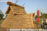
Festival's focal pointThis grass hut is at the center of the festival site which is within the Sakitama Tumuli Park. It will be burned later in the evening for the festival's climax.
|
|

Offerings
|
|

Festival siteIt is a circular site with people sitting along the perimeter.
|
|

SpectatorsThese people are sitting in the best area to view the festival.
|
|

EntertainmentAn outdoor stage provides a variety of entertainment during the day.
|
|

Festival participantsThey are dressed in the costume of the ancient Kofun (Tumuli) Period of Japan. They will be carrying torches from the nearby tumuli.
|
|

TumulusCherry trees are at the top.
|
|

Shinto ceremonyAt around 6:30 pm, the festival climax starts.
|
|

Torch bearers enter
|
|

Marvelous spectacle
|
|

Parade aroundThe torch bearers parade around the entire perimeter before they gather around the hut.
|
|
|

Male prince
|
|

Female princess reigning over the Sakitama Fire Festival in Gyoda, SaitamaShe's 15 years old.
|
|
|

Torch lightingThe prince and princess light the torch that will ignite the hut.
|
|

Climax
|
|
|
|

Torch bearers from the tumulus
|
|
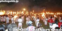
Stage ceremonyThe torch bearers gathered in front of the stage where there were speeches and cheers.
|
|

FireworksThe festival ended at 7:30 pm.
|
|

Ritto Archaeological Center right next to the Wada Tumuli. 栗東市出土文化財センター
|
|

Wada Tumuli is the group of nine small tumuli in Ritto. 和田古墳群 MAP
|
|

Tumulus No. 5 with a reconstructed chamber made of stone in Ritto.
|
|

Tumulus No. 5 with a reconstructed chamber made of stone.
|
|

Tumulus No. 5
|
|

Tumulus No. 5 with a reconstructed chamber made of stone.
|
|

Tumulus No. 5 with a reconstructed chamber made of stone.
|
|

Tumulus No. 5 with a reconstructed chamber made of stone (looking out).
|
|

The tumuli in Ritto are estimated to have been built during the 6th to 7th centuries.
|
|

Tumulus No. 1 at the top of the slope.
|
|
|
|

Most of the tumuli are just dirt mounds with no chamber opened for inspection.
|
|
|
|
|
|
|
|

The archeological museum and tumuli on right, at the foot of My. Anyoji.
|
|

Inside the Ritto Archaeological Center. 栗東市出土文化財センター
|
|
|
|

Many items found in and around the tumuli.
|
|

Inside the Ritto Archaeological Center. 栗東市出土文化財センター
|
|
|

Beads
|
|

Earrings
|
|

How jewelry was worn.
|
|

Workers restore unearthed artifacts.
|
|

地山古墳
|
|

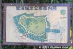
Park mapThe park has numerous tumuli as well as an archeological museum.
|
|

Inariyama TumulusPeople are allowed to climb up the tumulus.
|
|

Inariyama Tumulus
|
|

Maruhaka-yama TumulusThis is Japan's largest round tumulus (also used during the Fire Festival).
|
|

Maruhaka-yama TumulusCherry trees are at the top.
|
|
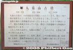
Maruhaka-yama Tumulus sign
|
|

Shogun-yama Tumulus
|
|

Kawarazuka Tumulus
|
|

Futagoyama Tumulus
|
|

Stone marker for the Kabuto-zuka Tumulus 兜塚古墳. Tokyo Prefectural Historic Place. About a 10-min. walk from Komae Station (Odakyu Line). 兜塚古墳Komae has numerous ancient tumuli, some say up to 100. However, most have been dismantled and only 13 are left. Kabuto-zuka is the city's largest tumulus, in the middle of a residential neighborhood. It is round, with a diameter of 38 meters, and height 6 meters. It is a Tokyo Prefectural Historic Place. Most other tumuli are on private property and permission is required to enter them.
|
|

It's just a small hill 6 meters high, 38 meters diameter.
|
|

Komae used to have about a hundred tumuli, but most have been destroyed. Only 13 are left. Only two are open to the public, while the others are on private property.
|
|
|
|
|
|
|
Saginuma Castle Park is the site of both the defunct Saginuma Castle (built during Heian Period, 8th to 12th century) and Saginuma Tumuli or burial mounds. Exact castle construction date is unknown, and not much is known. No castle structures remain, but there is a small stone coffin on display inside a hut.
|
|
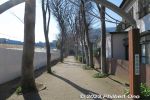
Saginuma Castle Park is a 10 to 15-min. walk from Keisei-Tsudanuma Station. Near Narashino City Hall. Map: https://goo.gl/maps/xkw1vc8j4ze96tyT7
|
|
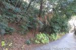
Walk along the right side of the castle park hill until you see steps going up.
|
|
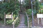
Steps to go up Saginuma Castle Park. The hill is 18 meters high.
|
|
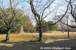
Saginuma Castle Park is a small, flat park ringed with cherry blossom trees. This was in winter.
|
|
|
|
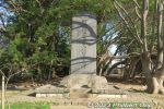
Saginuma Castle was built by a local lord named Saginuma Taro Genta Mitsuyoshi. This is a monument for him. 鷺沼太郎源太光義の碑
|
|

Saginuma Castle Park has two kofun burial mounds labeled as Mound A (A号墳) and Mound B (B号墳). They were discovered here in 1966. Mound A is keyhole-shaped. Mound B includes a stone coffin.Saginuma Tumuli date from the latter 6th century, based on haniwa sculpture pieces excavated from Mound A in 1966. The mounds are 20 to 25 meters long.
|
|
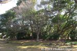
Mound A tumulus (A号墳) at Saginuma Castle Park.
|
|
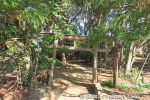
Mound A tumulus (A号墳) at Saginuma Castle Park has a small torii.
|
|
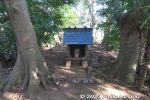
Mound A tumulus (A号墳) at Saginuma Castle Park. Local nobility was buried here during the 6th century. There's now a small shrine.
|
|
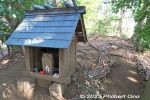
Mound A tumulus (A号墳) at Saginuma Castle Park.
|
|
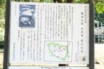
Mound B (B号墳) had two stone coffins. Although one coffin was destroyed, the other remains intact. Now protected by a hut. The stone coffin contained the remains of two adults,
|
|
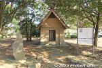
Mound B tumulus (B号墳) at Saginuma Castle Park. Hut preserving a stone coffin. B号墳の箱式石棺
|
|
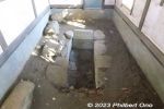
Stone coffin in Mound B is 2 meters long, 0.8 meter wide, and 0.7 meter deep. The stones came from southern Chiba Prefecture and shaped with metallic tools. The coffin was covered with large stones. B号墳の箱式石棺The remains of two adult males were found in the coffin in 1966. Chokutō sword fragments, ancient jewelry, arrowheads, and small knife were also found.
|
|
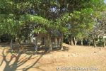
Mound B and stone coffin hut.
|
|
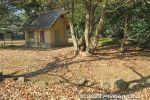
Mound B and stone coffin hut.
|
|
|
|
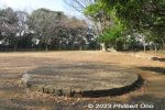
Remains of a natural gas well.
|
|
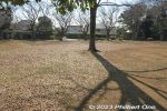
Park has a lot of space to run around.
|
|
|
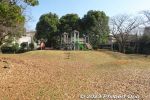
Park includes playground equipment for kids.
|
|
|
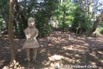
Pieces of haniwa sculptures were dug up and the park has two replicated Naniwa statues. One human and one horse. Unknown what the original haniwa actually looked like.
|
|
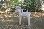
Horse haniwa statue (replica).
|
|
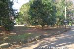
Walking around the burial mound.
|
|
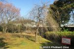
Weeping cherry trees.
|
|
|
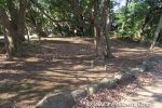
The burial mounds have stones along the perimeter.
|
|
Walking back to the train station along the side of the park.
|
|
|
|
|
|
|