 Image search results - "trees" Image search results - "trees" |

Entrance to Kyu-Shiba Rikyu Gardens, a real oasis in an urban jungle. Another waterfront garden with classic Japanese-style elements with a pond, pine trees, rocks, and stone lanterns.
|
|

Kyu-Shiba-rikyu was first built in the 17th century and used as the residence of a number of nobles. Purchased from the Arisugawa family in 1875 by the Imperial Household Agency which made it the Shiba Detached Palace.
|
|

Bird's eye view of Kyu-Shiba Rikyu Gardens as seen from Hamamatsu World Trade Center
|
|

The buildings were destroyed in the Kanto Earthquake in 1923 and the property was donated to Tokyo in 1924 to commemorate the start of Emperor Showa's reign.
|
|
|
|

Trail to Hossawa Falls
|
|

Pine trees and pond
|
|

Trail to Hossawa Falls is very lush
|
|
|
|

Beware of falling rocks
|
|
|

It's a short trail, but very nature-rich
|
|
|
|
|
|

Small river below, fed by the waterfall
|
|
|
|

Cherry blossoms along the Shakujii River, near Shin-Itabashi Station on the Mita subway line.
|
|

Boundary between Ome city and Hinode-machi town. I was hiking from Mt. Mitake in neighboring Ome.
|
|

Monuments
|
|

Koi carp fish
|
|

There are cherries on both sides of the river and a walking path on both sides.
|
|
|

Bracing a pine tree for winter snow.
|
|

Entrance to one walking path with a poem monument.
|
|

Very close to the summit of Hinode-yama. Only one lodge is here.
|
|
|
|

Last flight of steps to the summit.
|
|
|

Keyaki-dori road with bare zelkova trees.
|
|
|
|
|

Yukimi Stone Lantern
|
|

A short walk from the Information Center is Area C (C-chiku), a flat area of woods with katakuri flowers in bloom. C地区
|
|

Cherry tree shadow
|
|

Top of Mt. Hinode-yama
|
|
|

They even provide a small deck for you to stand on to see the flowers. C地区
|
|

River wall
|
|

Top of Mt. Hinode-yama
|
|
|

Shakujii River sprinkled with fallen petals.
|
|

Benches all over for us to gaze at the panorama.
|
|

Dry waterfall
|
|

It is getting rarer to see these flowers in Tokyo. Kiyose has an active movement to help preserve and nuture these flowers every year.
|
|

Pleasant walking path.
|
|

Alpine map pointing the way to various areas
|
|

Stone monuments
|
|
|
|
|

Mt. Hinode-yama summit has a little picnic pavilion
|
|

Bridge to Nakashima island
|
|

A few bridges cross the river.
|
|

Benches for hikers who had lunch.
|
|

Nakashima island
|
|

A short walk away is Area B which is a wooded slope with the flowers growing wild. B地区
|
|
|

Spectacular views from the top of Mt. Hinode-yama, Tokyo. But I couldn't recognize any landmarks.
|
|

The numerous people and trees made it impossible to see the slope itself.
|
|
|

Tiny purple flowers on the slope
|
|
|

Views from the top of Mt. Hinode-yama, Tokyo
|
|
|
|

Haiku poems solicited from the public are also displayed along the riverside.
|
|

Views from the top of Mt. Hinode-yama, Tokyo
|
|
|
|
|

Views from the top of Mt. Hinode-yama. The large white building is the Seibu baseball dome in Tokorozawa.
|
|
|
|

Surrounding mountains in pastel colors
|
|

World Trade Center in Hamamatsucho overlooked the garden. World Trade Center Building (世界貿易センタービル) in Hamamatsuchō was a 40-story commercial skyscraper. It was once Japan's tallest building in 1970.The building closed for good on June 30, 2021 and was torn down during Aug. 2021 to March 2023. The building will be replaced with a new World Trade Center building to be completed in March 2027.
|
|

Stone lantern
|
|
|
|

Trail to go down
|
|

Little park
|
|

Going down
|
|
|
|
|

Petals
|
|
|
|
|
|

Petals on the ground
|
|
|

Paper lantern written with "Itabashi-ku."
|
|
|
|

Petals and tree roots.
|
|

Lots of steps, glad I was going down instead of up.
|
|

The little park has a side of an old building on the ground, serving as a stage.
|
|
|
|
|

Lots of trees.
|
|

Hill
|
|

Fork in the road. Turned left for the waterfall trail.
|
|

Small hill
|
|

Log bridge
|
|
|

Pine cone
|
|

Okuno village was here.
|
|

Beware of bears...
|
|

Looking up a slope...
|
|
|
|

Finally a waterfall
|
|

More waterfalls...
|
|

And more...
|
|

The other side of the bridge is a trail to a nearby village.
|
|
|

Verse 2 Lyrics (Omatsu/Omi-Maiko) 二番の英訳(雄松"Pine trees are very green, on sands very white.
Omatsugasato is, a young maiden's home.
Bush of red camellia, hides her teary face.
She's weeping o'er a lost love, much too short to last.
松は緑に 砂白き
雄松が里の 乙女子は
赤い椿の 森蔭に
はかない恋に 泣くとかや
Matsu wa midori ni, suna shiroki
Omatsugasato no, otomego wa
Akai tsubaki no, morikage ni
Hakanai koi ni, naku toka ya
Omi-Maiko is still famous for white sand beaches and pine trees. In summer these beaches are cluttered with people trying to get a tan.
See more photos of Omi-Maiko here.
|
|

Railing broken by snow.
|
|

This is the famous Shiraiwa Waterfall. 白岩の滝
|
|
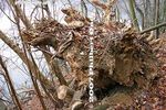
Tree keeled over.
|
|

Shiraiwa Waterfall. 白岩の滝
|
|

"Pine trees are very green, on sands very white." Omi-Maiko
|
|

Lake Okutama
|
|
|
|

It's actually a series of small waterfalls. Mt. Hinodeyama, Tokyo.
|
|

White sands of Omi-Maiko (Omatsu), Otsu, Shiga
|
|
|

Trail to Shiraiwa Waterfalls
|
|

Ripples lap white sands of Omi-Maiko.
|
|

Trail to Shiraiwa Waterfalls
|
|

Entrance to trail to Shiraiwa Waterfalls and Mt. Hinode-yama
|
|

Pine trees at Omi-Maiko
|
|

Kyoto University Rowing Club arrive at Omi-Maiko in Aug. 2006 during their annual Lake Biwa rowing trip.
|
|

Omatsu "Famous Place" marker
|
|

View of Mt. Mikami from Omi-Fuji Karyoku Koen Park in spring.
|
|

View of Mt. Mikami-yama amid rice paddies in Yasu. Elevation 432 meters.
|
|

View of Mt. Mikami from Karasaki, across Lake Biwa.
|
|

After passing through a bamboo grove, there is a clearing with the Tempo Gimin Monument.
|
|

At the foot of Mt. Mikami is Tempo Gimin Monument dedicated to the farmers who were tortured to death after the 1842 Tempo Ikki (天保一揆) uprising against the government's unfair land taxation surveys..
|
|

Gate to the Back Mountain Path. Be sure to close the gate after entering. I don't know how it would prevent monkeys from climbing over the low gate. Between Sept. 23 and Nov. 3 during mushroom season, 500 yen admission is charged for the Front/Back pa
|
|

Hiking up the Back Mountain Path. The trail actually goes mainly toward the side of the mountain rather than the back. The back of the mountain has a trail going down toward Kibogaoka Bunka Koen Park.
|
|

Two wooden signs pointed in opposite directions both say "To Mt. Mikami summit." Go right to continue on the easier Back Mountain Path. Or go left to get on the steeper Front Mountain Path. The large white sign says "Take home your trash.&q
|
|

Sacred tree. The bark from this tree is used for the roofing of the shrine. Do not scratch or damage it.
|
|

Steps
|
|

The trail is rocky and rooty, with lots of tree roots.
|
|

Sometimes log steps are provided.
|
|

Halfway point called Uchikoshi 打越. It's a small clearing and crossroads for multiple trails. Also a good place to harvest matsutake mushrooms during the fall (Sept. 23-Nov. 3).
|
|

Sign
|
|

This trail goes around the side of the mountain. Not recommended.
|
|

Trail to summit.
|
|

500 meters until the peak.
|
|

Roots
|
|

Chain railing is helpful.
|
|

Roots
|
|

Steel railing to grab.
|
|

Small torii and shrine.
|
|

No sign for this little shrine.
|
|

Kokegatani Valley. There's a small dip in the trail, going down and up again. This is a small valley near the peak. Visible as a small notch next to the peak. 苔が谷
|
|

Kokegatani
|
|

View from the dip. There should be a better view on the other side too, but too many trees block the view.
|
|

Yuba-no-Futokoro
|
|

The sign is almost totally unreadable.
|
|

Summit in sight.
|
|

Shrine and torii at the summit.
|
|

Shrine and torii at the summit.
|
|

A shrine with a view.
|
|

Gods here must be happy to see such grand views.
|
|

This is almost near the mountain's peak.
|
|

Sacred rock where the god lives.
|
|

Great view, but hazy when I was there. Ishibe is toward the left, and the shinkansen tracks toward the right.
|
|

Sign pointing to a lookout point, slightly below the shrine.
|
|

Going down to the lookout point.
|
|

Lookout point on Mt. Mikami in Yasu.
|
|

View from Mt. Mikami, Yasu. Ishibe is toward the left.
|
|
|

Looking toward Ritto
|
|

View from Mt. Mikami, Yasu.
|
|

On the right, Route 8 can be seen crossing Yasu River.
|
|

Route 8 crossing Yasu River
|
|

The path on the left leads to the mountain's peak.
|
|
|

To the peak.
|
|

Just beyond the tree is the peak.
|
|

Summit of Mt. Mikami. Only a small clearing with a bench. It was a great day for hiking. It is quite a popular mountain for climbers. Even for families with little kids. Didn't see any monkeys. No bears.
|
|

Sign at the summit.
|
|

"Take home your trash"
|
|

Going down from the summit.
|
|
|
|

Log steps
|
|

Large stone walls
|
|

Chain railing
|
|

Chain railing really helps.
|
|

Lots of ferns.
|
|

1.4 km to Karyoku Koen Park
|
|
|

Downward slope and trail. This trail is called the Karyoku Koen-gawa Tozando which starts from the Karyoku Koen flower park. 花緑公園側登山道
|
|

Tree trunk
|
|
|

850 meters to Karyoku Koen flower park.
|
|

Entrance/Exit to Karyoku Koen-gawa Tozando
|
|

Getting close to civilization.
|
|

Beware of snakes (mamushi). Never saw any. Never saw any monkeys either.
|
|
|
|

Prevent forest fires.
|
|

Boat landing is near the entrance to Genkyu-en Garden.
|
|
|

End of the 50-min. ride. It was pleasant, and highly recommended. Boat landing for the Hikone-jo Ohori Meguri boat ride is near the entrance to Genkyu-en Garden.
|
|

Nicknamed "Akarenga Chosha" (Red Brick Government Building), a fire in 1909 gutted the interior, but the exterior was little damaged. The building was restored in 1911. 赤れんが庁舎
|
|

Most of the building materials, stones and wood, were procured from Hokkaido. The building is flanked by yaezakura cherry trees which bloom in early May.
|
|

Former Hokkaido Government Office Building and yaezakura cherry blossoms, Sapporo
|
|

Adjacent pond and cherry blossoms
|
|
|
|
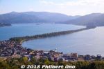
Amanohashidate is northern Kyoto's main attraction and very famous for centuries as one of Japan's Scenic Trio (Nihon Sankei 日本三景). The other two in the scenic trio are Miyajima (vermillion torii and shrine on the ocean) in Hiroshima and Matsushima (pine tree islands) near Sendai, Miyagi Prefecture. It's about 3.6 km long, totally flat, and you can cross it on foot or by bicycle (rentals available) on a dirt road in the middle. The road is lined with thousands of Japanese pine trees and closed to vehicular traffic. This view is from the northern end atop Kasamatsu Park. Near Amanohashidate Station.
|
|
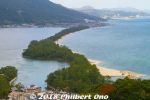
The thing about Amanohashidate is that it looks very different from different lookout points. The most popular spots to view Amanohashidate are on the hilltop on the southern end and northern end.If you have time, I highly recommend that you see it from both the southern end and northern ends. Which means you should rent a bicycle and ride across Amanohashidate.
This is from the hilltop on the southern end, from a small amusement park called Amanohashidate Viewland easily accessible via chair lift or cable car, and a short walk from Amanohashidate Station. Map: https://goo.gl/maps/yNhxjwK2ocz
This southern end connects to mainland Japan, so what you see in the distance is Tango Peninsula up north.
The left side is the west side with an enclosed, but connected ocean named Asoumi Sea. The right side is the east side with white-sand beaches facing the open ocean. Ships can still go through both sides of the sandbar through a narrow strait on the southern end.
The greenery area on the lower left facing the sandbar is Chionji Temple.
|
|
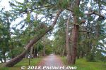
A few pine trees died or were knocked down.
|
|
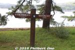
Good to know how far away you are.
|
|
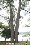
Wedded pine trees on Amanohashidate. (夫婦松)
|
|
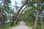
Wind-blown pine trees.
|
|
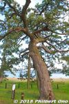
Pine tree for the sawn maiden's clothes. 羽衣の松
|
|
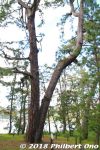
Looks like another wedded pair of pine trees, but it is named "Good Friends pine trees." なかよしの松
|
|
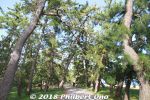
Don't ever get tired of the scenery.
|
|
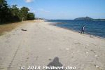
Sunny beach on Amanohashidate.
|
|
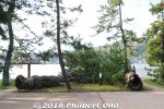
The Twin Dragon Pine Trees were broken. 双龍の松
|
|
|
|

East edge of Amanohashidate looking toward Kasamatsu Park on the hill.
|
|
|
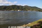
East edge of Amanohashidate looking toward Kasamatsu Park on the hill.
|
|
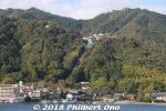
Kasamatsu Park on the hill as seen from Amanohashidate.
|
|
|
|
|
|
|
|
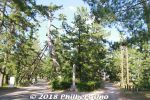
Fork in the road. Go left.
|
|
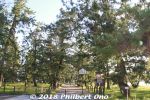
Entrance to Amanohashidate's northern end.
|
|
|
|

Map of the Kodaira Green Road between Kodaira Station and Hana-Koganei Station, a 2.6 km distance.
|
|

Entering Kodaira Green Road from Kodaira Station. Kodaira Green Road is a 21-km pedestrian and bike path lined with trees, flowers, and some old houses. Very pleasant. I walked 2.6 km of it from Kodaira Station to Hana-Koganei Station.
|
|
|
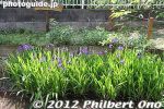
Some early-blooming irises.
|
|
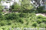
One major sight is this hydrangea park that blooms in mid-June to early July. あじさい公園
|
|
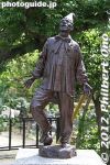
Kodaira Green Road is also noted for sculptures along the way. This is Pierrot by Kodaira-native Saito Sogan (1889-1974). ピエロ
|
|
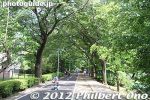
The Road is split for pedestrians and bicyclists.
|
|
|
|
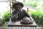
Kodaira Green Road is also noted for sculptures along the way by Kodaira-native Saito Sogan (1889-1974). This is Natural Scientist. 自然科学者
|
|
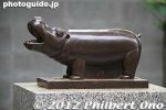
Kodaira Green Road is also noted for sculptures along the way by Kodaira-native Saito Sogan (1889-1974). This is a Hippo. カバ
|
|
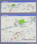
Soka Matsubara is a nice, long pedestrian path stretching for 1.5 km lined on both sides with over 600 evergreen pine trees. Part of Soka-juku post town on the old Nikko Kaido road to Nikko in Tochigi Prefecture. Designated as a National Place of Scenic Beauty. Near Dokkyodaigakumae Station (Tobu Railway from Asakusa).
|
|
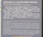
About Soka Matsubara. Some 60 of the pine trees have survived since the Edo Period.
|
|
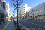
While walking on this main road to Soka-Matsubara, you will soon see the large arch bridge over the road.
|
|
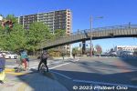
Where the Soka-Matsubara pine tree path intersects with a major road at two locations, there's a large arch bridge to enable pedestrians to keep walking non-stop along the pine trees.
|
|
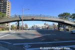
This is one of the two arch bridges. Named Hyakutai-bashi (百代橋), 62.5 meters long, 3.5 m wide. It has steps and a narrow slope to push bicycles. Not wheelchair accessible.
|
|
| 904 files on 4 page(s) |
1 |
 |
|