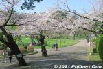
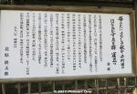
 Image search results - "trail" Image search results - "trail" |

Nature trail
|
|

Nature trail
|
|

Nature trail into bamboo forest.
|
|

View of Ritto from Mt. Anyoji. Marvelous view if it weren't for the trees...
|
|

View of Ritto from Mt. Anyoji.
|
|

View Hira mountains from Mt. Anyoji.
|
|
|

View from Mt. Anyoji in Ritto.
|
|

View from Mt. Anyoji.
|
|

Mt. Anyoji trail sign totally illegible. No map on the mountain to tell you where ypu are either.
|
|

Small shrine
|
|

Another broken sign.
|
|

View from Mt. Anyoji 安養寺山
|
|

Power line tower on Mt. Anyoji
|
|

Mt. Anyoji from afar looks like a tumulus.
|
|

850 meters to Karyoku Koen flower park.
|
|

Entrance/Exit to Karyoku Koen-gawa Tozando
|
|

Getting close to civilization.
|
|

Beware of snakes (mamushi). Never saw any. Never saw any monkeys either.
|
|
|
|
|

Prevent forest fires.
|
|
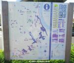
Water & Greenery Corridor (Mizu-to-Midori-no-Kairo) is a semi-urban, hiking trail in the northwestern part of Ichikawa fronting the border with Tokyo along Edogawa River.This part of Ichikawa is dotted with patches, hills, and slithers of small forests, parks, and ponds. This "Corridor" links all this greenery and bodies of water to help protect and preserve the flora and fauna in a coordinated effort by local environmental groups.
This is a map of the trail. Download the official map here: https://www.city.ichikawa.lg.jp/gre01/1111000022.html
|
|
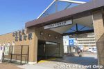
The corridor is 6 km and takes a few hours to walk it between Kita-Kokubun Station (photo) and Konodai Station both in Ichikawa.There are also side treks to other nearby sights. Enjoyable especially when the cherry blossoms are in bloom or during the autumn foliage.
|
|
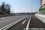
From Kita-Kokubun Station, we walked about 600 meters along this highway until we reached the first green belt.Local environmental groups have been active in trying to preserve and protect the city's nature, but it's an uphill struggle with the encroaching urban development, especially when the Hokuso train line was built through Ichikawa in 1979.
|
|
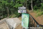
For the most part, the trail has signage in both Japanese and English. We soon got to some greenery called Horinouchi Ryokuchi green belt. There's this fork in the trail. Go left to see the shell mound in Horinouchi Kaizuka Park.
|
|
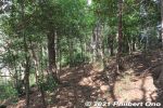
Horinouchi Ryokuchi green belt. 堀之内緑地
|
|
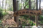
Horinouchi Ryokuchi green belt. 堀之内緑地
|
|
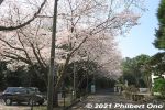
After the small green belt, walk on the street to the Shell Mound.
|
|
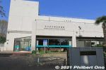
You will pass by the Ichikawa Municipal Museum of History. Free admission, but it was closed when we were there. Horinouchi Kaizuka Shell Mound Park has two museums. 市川歴史博物館
|
|
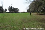
Horinouchi Kaizuka Park is a flat hill where shells, animal bones, and other food waste were discarded by Jomon people 4,000 years ago. "Kaizuka" means "shell mound." 堀之内貝塚公園This hill was also the site of a Jomon Period human settlement 2,500 to 4,000 years ago. A number of excavations were made since 1904 and ancient human remains, pottery, etc., have been found. National Historic Site.
|
|
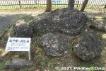
Hardened shell rocks from the ocean 150,000 years ago displayed in Horinouchi Kaizuka Park. These are not shells discarded by humans. 堀之内貝塚公園
|
|
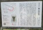
It's hard to discern, but Horinouchi Kaizuka Shell Mound is as long as 225 meters and 100 meters wide. Pink portion in the diagram on the upper left shows where the shells, animal bones (mostly boar and deer) and other food waste were tossed on the hillsides during 4,000 to 2,500 years ago (Jomon Period). They form a horseshoe shape on the hill.
The mound was a central feature of the Jomon Period cluster of homes in this area. Since the late 19th century (Meiji Period), many digs and research on this shell mound have been conducted by archaeologists. However, there are still unknown things about mound.
|
|
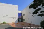
The other museum in the park is the Ichikawa Archaeology Museum displaying shell mound remains as old as 3,000 years (Jomon Period). Pottery & human remains found here are also exhibited. Good to have this museum next to the shell mound. 市川考古�
|
|
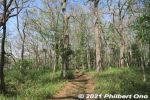
Walking through Horinouchi Kaizuka Shell Mound, larger than what meets the eye. The shell mound's immediate area was the ocean shallows where it was easy to harvest shellfish.
|
|
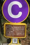
The mound has these alphabetized markers to indicate where the shells are. They form a horseshoe shape (or U shape) on the mound.
|
|

While walking through Horinouchi Kaizuka Shell Mound, we indeed saw many pieces of shell or pottery on the ground.
|
|
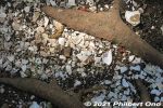
While walking through Horinouchi Kaizuka Shell Mound, many pieces of shell or pottery on the ground. Still here, after thousands of years!Read more about this shell mound here: https://ichikawashi.jp/horinouchi/index_en.html
|
|
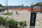
Next was Kozuka-yama Park. There are restrooms. 小塚山公園
|
|
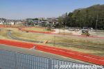
Kozuka-yama Park was still under construction. 小塚山公園
|
|
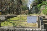
Sawara Park, we walked through here.
|
|
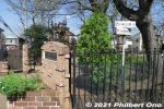
Small athletics field.
|
|
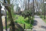
Follow the sign to Konodai Ryokuchi green belt.
|
|
|
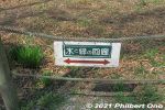
Signage for the hiking trail.
|
|
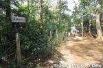
Follow the sign.
|
|

Water hose manhole for firemen.
|
|

Rules for using Junsai-ike Ryokuchi Park. No bicycle riding, dogs must be leashed, etc.
|
|
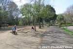
Junsai-ike Ryokuchi green belt park. じゅん菜池緑地
|
|
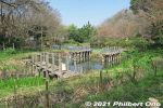
Junsai-ike Ryokuchi green belt park じゅん菜池緑地
|
|

Junsai-ike Ryokuchi Park is a nature area where the flora and fauna are not to be disturbed. じゅん菜池緑地
|
|

If you started the hike at Kita-Kokubun Station, Junsai-ike Pond Ryokuchi green belt park is the first substantial park where you can rest or have lunch. Large pond and cherry blossoms. じゅん菜池緑地
|
|
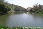
Junsai-ike Pond じゅん菜池
|
|
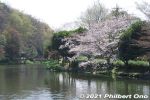
Junsai-ike Pond じゅん菜池
|
|
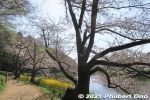
Some cherry blossoms along Junsai-ike Pond in late March. じゅん菜池
|
|
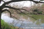
じゅん菜池
|
|
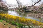
Cherry blossoms along Junsai-ike Pond.
|
|
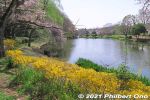
In autumn, Junsai-ike Pond is also noted for fall leaves.
|
|

Some cherry blossoms along Junsai-ike Pond. じゅん菜池
|
|

Small bridge in the middle of Junsai-ike Pond.
|
|
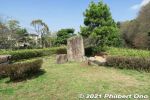
Small island in the middle of the pond.
|
|
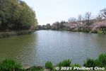
Junsai-ike Pond. No swan boats or rowboats. Only ducks. じゅん菜池
|
|
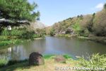
Some cherry blossoms along Junsai-ike Pond. じゅん菜池
|
|

Cherry blossoms along Junsai-ike Pond in late March. じゅん菜池
|
|
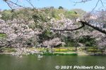
Cherry blossoms along Junsai-ike Pond. じゅん菜池
|
|
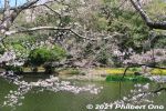
Cherry blossoms along Junsai-ike Pond. じゅん菜池
|
|
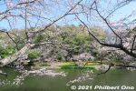
Cherry blossoms along Junsai-ike Pond. じゅん菜池
|
|
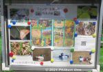
Photos of the park's flora and fauna by a local environmental group.
|
|
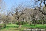
Plum blossom trees near Junsai-ike Pond.
|
|
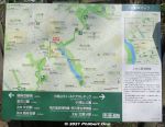
Map and where we are now.
|
|
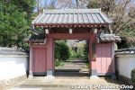
The trail passes by a few temples like Ekoin Betsuin Temple. This is the temple gate. 回向別院
|
|
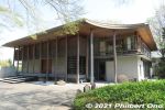
Ekoin Betsuin Temple's main hall rebuilt in 2009. There's actually a cafe (Cafe Terrace Ekoin) on the 2nd floor. It belongs to the Jodo-shu Buddhist sect and is a branch of Ekoin Temple in Ryogoku, Tokyo. 回向院市川別院源光寺
|
|
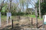
Follow the trail to Satomi Park next.
|
|
|
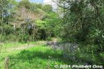
Lush trees and shrubs in Konodai Ryokuchi Park. 国府台緑地
|
|
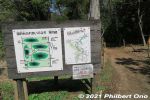
We came out of this trail which goes through into a small forest of different species of trees.
|
|
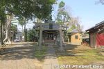
Konodai Tenmangu Shrine dedicated to Michizane, scholar deity. Stone lanterns behind the torii date from 1863. 国府台天満宮
|
|
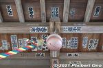
Ceiling and bell.
|
|
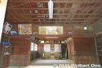
Inside Konodai Tenmangu Shrine. 国府台天満宮
|
|
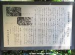
About Konodai Tenmangu Shrine and an event called Tsujikiri.
|
|
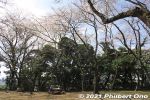
Next is Satomi Park, another large park with different areas. This part is undeveloped and quiet. 里見公園
|
|
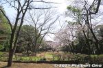
Satomi Park is the site of Konodai Castle occupied by the Satomi Clan who ruled the Boso domain in present-day Chiba during the 16th century. Almost nothing remains though. 国府台城
|
|
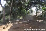
Places to sit in the park.
|
|
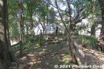
Satomi Park also has the Akedo Kofun burial mound complete with two stone coffins exposed on the mound. 明戸古墳石棺
|
|
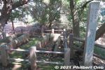
Two stone coffins on Akedo Kofun burial mound. Experts believe that they contained the remains of local nobility who ruled this area in the 6th to 7th century. Chiba Prefecture has many of these stone coffins. 明戸古墳石棺
|
|
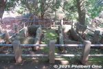
The Akedo Kofun burial mound stone coffins date from the 6th century. They were discovered in 1479. The dirt mound over the coffins fell away to expose the coffins which contained samurai armor, swords, etc. 明戸古墳石棺
|
|
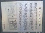
About the Akedo Kofun burial mound. The diagram shows a keyhole-shaped burial mound. The stone coffins are on the top of the round hill. This burial mound has been a noted site since the Edo Period. 明戸古墳石棺
|
|
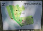
Map of Satomi Park. The burial mound is on the upper part next to the red, dotted oval on the map. The park is next to Edogawa River.
|
|
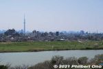
View of Edogawa River from Satomi Park. Across the river is Koiwa and Shibamata. Tokyo Skytree can also be seen. 江戸川
|
|
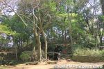
Satomi Park, near the burial mound.
|
|
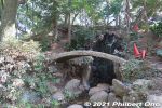
Satomi Park
|
|
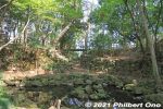
Konodai Castle remains in Satomi Park. Embankments and rocks. 国府台城
|
|
|
|
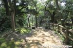
At the top of this small hill is Ichikawa city's highest point (elevation).
|
|
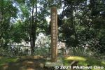
Marker indicating Ichikawa city's highest point (elevation). A whopping 30.1 meters above sea level.
|
|
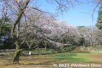
Cherry blossoms in Satomi Park.
|
|
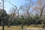
Cherry blossoms in Satomi Park.
|
|
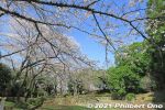
Cherry blossoms in Satomi Park.
|
|
|

Sign on a cherry tree saying that no hanami flower-viewing picnics are not allowed here due to Covid-19.
|
|
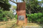
Poetry Monument for So Sakon's poem. 宗 左近
|
|

Poetry Monument for So Sakon's Ichikawa poem. He was a longtime resident and honorary citizen of Ichikawa . 宗 左近
|
|
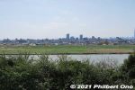
Edogawa River.
|
|
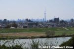
Edogawa River and Tokyo Skytree as seen from Satomi Park.
|
|
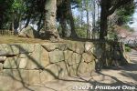
Castle-like stone foundation.
|
|
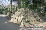
Castle-like stone foundation. Satomi Park is the site of Konodai Castle. However, this stone foundation is not original.
|
|
|
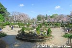
Satomi Park water fountain. This is another area of the park. Totally different landscape. This was the main site of Konodai Castle. 国府台城
|
|
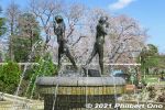
Satomi Park water fountain.
|
|
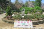
Satomi Park visit date.
|
|
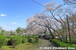
Satomi Park cherry blossoms.
|
|
|
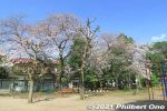
Satomi Park playground.
|
|
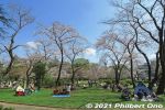
This is where most people enjoyed Satomi Park, under the cherry blossoms.
|
|
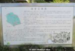
Being the site of Konodai Castle, Satomi Park was also the site of the Battles of Konodai fought twice between the local Satomi Clan (ruler of Awa Province in present-day Chiba) and the invading Hojo Clan (from Odawara) in the 16th century. The Hojo won the final battle and thereby took control of present-day Chiba. The Hojo is said to have expanded and reinforced Konodai Castle.
However, when Tokugawa Ieyasu took control of Japan, he had Konodai Castle dismantled because it had a intimidating view of his own Edo Castle.
|
|

During World War II, Satomi Park was an Imperial Army base camp. It finally became a public park in 1959. Flower beds now cover the site of Konodai Castle.
|
|
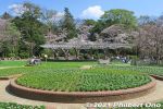
Satomi Park is also noted for roses in early summer and fall. The rose is Ichikawa's official flower.
|
|
|
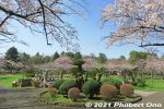
Flowery site of Konodai Castle in Ichikawa, Chiba. No castle buildings. 国府台城跡
|
|
|
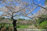
Nice cherry blossoms at Satomi Park, Ichikawa.
|
|
|
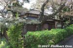
Satomi Park also has Shien-soja (紫烟草舎), the former home of famous tanka poet named Kitahara Hakushū (1885–1942) (北原白秋). He lived in this house for only a year in 1916.
|
|

About Shien-soja. It was originally located in Koiwa (Edogawa Ward, Tokyo) and moved here. (紫烟草舎).
|
|
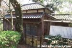
Shien-soja (紫烟草舎).
|
|
|
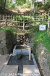
Old well on the fringe of Satomi Park named "Rakan-no-I". 羅漢の井
|
|
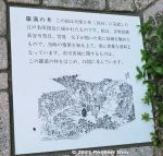
The Rakan-no-I well was actually depicted in this 1834 illustration, part of Illustrations of Edo's Noted Sights. 羅漢の井
|
|

The Nishiyama Crater Trail (Nishiyama Kako Sansakuro) is accessible by car or bus from Toyako Onsen Spa or Toya Station. Get off at the Nishiyama Kako Kitaguchi which is in front of this former fire dept. station. 旧西胆振消防組合本部
|
|

The fire dept. building was damaged by the eruption, so it is no longer used by the fire dept. However, you can enter it and see some display panels.
|
|

Inside former fire station.
|
|

Next to the former fire station is this small pond, called Nishiyama Kako-numa, created by the eruption and blocking the road. 西山火口沼(西新山沼)
|
|

Road blocked by the pond. The Nishiyama Craters are part of Mt. Usu. They are on the west side of Usuzan and were formed by the March 2000 eruption.
|
|

The former fire station in the distance. The building still looks quite new.
|
|

The north entrance to the Nishiyama Crater Trail (Nishiyama Kako Sansakuro Kitaguchi). Open from April 20 to Nov. 10 during 7 am - 6 pm. Free admission, but donations accepted.
|
|

The trail starts with a bumpy asphalt road.
|
|

The wrecked road.
|
|

The walking trail becomes a nice wooden boardwalk on rough terrain.
|
|

Apparently there weren't any cars on the road when this happened since everyone had been evacuated before the eruption occurred.
|
|

Flowers from the asphalt cracks.
|
|

The trail continues to more dramatic landscapes.
|
|

Sign explaining the deformed road.
|
|

Broken telephone pole.
|
|

No. 1 Nishiyama Crater Lookout deck for the most conspicuous crater, still emitting steam.
|
|

No. 1 Nishiyama Crater Lookout deck
|
|

One of the largest and most active Nishiyama crater. There are about 30 craters in the area, and this one emits the most steam.
|
|

An adjacent crater contains water and emits some steam.
|
|

Nishiyama Crater Trail
|
|

It takes about 40 min. to walk the crater trail one way. So allow at least 90 min. for a round-trip.
|
|

View of the No. 2 Nishiyama Crater Lookout deck
|
|
|

View from the No. 2 Nishiyama Crater Lookout deck
|
|

View from the No. 2 Nishiyama Crater Lookout deck
|
|

View from the No. 2 Nishiyama Crater Lookout deck
|
|

View from the No. 2 Nishiyama Crater Lookout deck. On the right is the crater of the initial eruption occurring in March 2000.
|
|

Close-up of Nishiyama's first crater formed during the March 2000 eruption.
|
|

Another crater which is dry.
|
|
|

Crater bottom.
|
|

The trail passes by a wrecked confection factory.
|
|

The trail goes to the Minami-guchi (South entrance) of the crater trail.
|
|

Wrecked confection factory. A dramatic reminder of what volcanoes can do.
|
|

Going further along the crater trail.
|
|

Another wrecked house.
|
|
|
|

Wrecked car
|
|

More dramatic terrain. There's no threat of further eruptions in this area, so don't worry about getting caught in a shower of hot lava and volcanic ash while walking around here.
|
|

Heading back. Remember that the trail is not open during the winter months. For more info call 0142-75-4400.
|
|

Northern Lake Toya includes the Takarada Nature Footpath along the lake shore. 財田自然観察道
|
|
|
|
|
|
|


