 Image search results - "tamagawa" Image search results - "tamagawa" |

When I walked around, my planned 20-min. stay turned into a 2-hour walking tour of this pacifying place, full of mountains and a clear river. A delightful discovery. Suigen Park
|
|

On the side of the road near the bus stop, there is a trail going down to Tama River.
|
|

Completely surrounded by mountains with a clear river running in the middle.
|
|

A suspension bridge over the river.
|
|

A few bridges span the river.
|
|

Tama River as seen from the bridge.
|
|
|

Tama River
|
|

Tama River, looks very inviting in summer.
|
|

Tama River, very quiet and peaceful.
|
|

Upriver as seen from the bridge.
|
|

Crystal clear water of Tama River
|
|
|
|

Crystal clear water of Tama River with fall leaves.
|
|
|

Tamagawa River has a good number of cherry trees in Hamura.
|
|
|
|

Trout fishing ponds for customers in warmer months.
|
|

Weeping cherry
|
|

These photos were taken in Feb. Probably scenic in fall.
|
|

Riverside fishing ponds
|
|

Weeping cherry next to the water park.
|
|

Mountain with a patch of green.
|
|

Path to Otaki Waterfalls 雄滝
|
|

Weeping cherries
|
|

Bus stop. Notice the monkey crossing the road.
|
|

Waterwheel 水車
|
|
|

There were many hikers on the bus, and I wondered where they were going, so I followed them.
|
|
|

Tamagawa Josui floodgate. Hamura is noted as the starting point of the Tamagawa Josui Aqueduct built by the Tamagawa farmer brothers in 1653 to supply water to the growing and thirsty city of Edo.
|
|

Numerous monkey poop along the road.
|
|

Waterwwheel (not working)
|
|

Entry point of Tamagawa Josui Aqueduct straight ahead. This water has been diverted from the Tamagawa River (on the right).
|
|
|

Trail to waterfalls
|
|

Start of Tamagawa Josui Aqueduct. The Aqueduct was built in 1653, 50 years after Shogun Tokugawa Ieyasu moved to Edo. 玉川上水
|
|

Pretty scenic area.
|
|

When I was walking here, I did not know there was a waterfall.
|
|

Tamagawa Josui Aqueduct entrance.
|
|

The area is part of the Chichibu-Tama National Park.
|
|

Path from above.
|
|

Floodgate. The position and length is almost the same as the original one built in the 17th century. Only the materials have been replaced with concrete. Water from the Tamagawa River going to Tamagawa Josui canal/Aqueduct.
|
|

Trail to Mt. Kumotori, Tokyo's tallest mountain. That's where the hikers were headed.
|
|
|
|

Tamagawa River is dammed here by Hamura Intake Weir. Some of the diverted water is released back into Tamagawa River on the right.
|
|

Kanizaka Park near Tamagawa River かに坂公園
|
|

Tamagawa River is on Komae's southern border.
|
|

Trail to Mt. Kumotori
|
|

Waterfalls
|
|

Tamagawa River
|
|

Map along the Tamagawa River
|
|

Tama River
|
|

Tama River
|
|

Otaki Waterfall
|
|

Map of Tamagawa Josui Aqueduct
|
|

Tamagawa River
|
|

Bridge going to Machida.
|
|

By coincidence, I found this man-made waterfall.
|
|

An observation deck is also provided.
|
|

Park adjacent to Tamagawa Josui Aqueduct
|
|

Riverside path good for bicycles. Much of the river has a bicycle path.
|
|
|

View from the observation deck
|
|

Statue of the Tamagawa brothers who were consigned to build the Tamagawa Josui Aqueduct.
|
|

Jogging route along Tamagawa River
|
|

Tamagawa River
|
|

Waterfall
|
|
|
|

Statue of the Tamagawa brothers
|
|

Tamagawa Josui canal in Fussa
|
|
|
|
|
|

Materials and technique used for the Tamagawa Josui floodgate in the Edo Period.
|
|

Gohon Matsu, or Five Pine Trees, one of Tokyo's Best 100 Sights. Lots of movies have been shot here. 五本松
|
|
|
|
|

Tamagawa Josui Aqueduct required constant repair and maintenance during the Edo Period. It created new jobs for Hamura residents (mostly farmers).
|
|

There are actually more than five pine trees. A nice, quite place to relax and scenic during all four seasons. 五本松
|
|

Fishing pond
|
|

Tamagawa Josui Aqueduct lined with cherry trees. I missed the full bloom period.
|
|

Tamagawa River bicycling path.
|
|

Riverside picnic pavilions
|
|

Walking path parallel to Tamagawa Josui Aqueduct. These are all cherry trees.
|
|

The Tamagawa Monument near Tama River is inscribed with a Tamagawa poem from the Manyoshu, the oldest existing collection of Japanese poetry dating from the 7th to 8th centuries. 玉川碑、万葉歌碑
|
|

Picnic pavilion with charcoal grill (for the fish caught).
|
|

Cherry trees
|
|

The Manyo Poetry Monument is 3 meters tall near azalea bushes and a nice cherry tree. (Photos taken in Dec.)
|
|

Outdoor stage
|
|

Tamagawa Josui Aqueduct
|
|

Inscribed as follows: 多麻河泊爾左良須/弖豆久利佐良左良 (たまがわにさらすてづくりさらさらになにぞこのこのここだかなしき). It somehow means, "This child is really cute!"
|
|

Tennis courts with snow.
|
|

Tamagawa Josui Aqueduct goes on for over 40 km to Yotsuya in Tokyo.
|
|

Fishing ponds
|
|

Camping bungalows
|
|

Camping bungalows along the river. For warmer months.
|
|

Glorious Tama River
|
|
|

Scarecrow
|
|

Scarecrow
|
|

Roadside waterwell
|
|

Taba bus stop
|
|

Taba bus garage
|
|

Taba bus stop and bus garage
|
|

Bus to Okutama, Tokyo
|
|
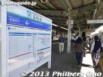
Higashi-Yamato Minami Park is a large park with greenery and sports facilities. One interesting edifice is the former Hitachi Aircraft Transformer Substation pockmarked with bullet holes from World War II. The park was formerly the US Air Force's Yamato Air Station. Before that from 1938 and during World War II, it was the site of a military aircraft engine factory. Near Tamagawa Josui Station on the Seibu Haijima Line.
|
|
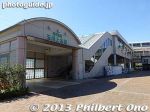
Tamagawa Josui Station
|
|
|
|
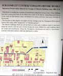
Kurayoshi's Shirakabe White-Wall Warehouses are in a National Important Traditional Townscape Preservation District (重要伝統的建造物群保存地区) named Utsubuki-Tamagawa (打吹玉川).This used to be a castle town until 1615. It was a commercial district up to the 1920s. About 100 traditional buildings with white walls (kura storehouses) and red roof tiles remain. The Tottori earthquake in Oct. 2016 damaged a few white walls. A short bus ride from JR Kurayoshi Station.
|
|

Map of Shirakabe Warehouse district in Kurayoshi. The district is compact, easy to walk around.
|
|

Road where I got off the bus.
|
|
|
|
|

The main kura storehouses here. 赤瓦二号館
|
|

The main Shirakabe kura storehouses in Kurayoshi, Tottori. 赤瓦二号館
|
|

The main Shirakabe kura storehouse in Kurayoshi, Tottori. 赤瓦二号館
|
|

The main Shirakabe kura warehouse in Kurayoshi, Tottori. 赤瓦二号館
|
|

The main Shirakabe kura warehouse in Kurayoshi, Tottori. 赤瓦二号館
|
|

The main Shirakabe kura warehouse in Kurayoshi, Tottori. 赤瓦二号館
|
|
|
|
|
|
|
|
|
|
|

Mt. Utsubuki where there was a castle until 1615. 打吹山
|
|
|
|
|
|
|
|
|
|

Tamagawa River
|
|

Tamagawa River 玉川と研屋町の町並み
|
|
|
|
|
|
|

This street corner had a large monument for Yokozuna Kotozakura, a sumo wrestler from Kurayoshi.
|
|

Kotozakura was active in the 1960s-70s and later became a successful sumo stable master training wrestlers like Kotokaze and Kotonowaka.
|
|

Statue of Yokozuna Kotozakura, a sumo wrestler from Kurayoshi, Tottori. 横綱琴櫻
|
|

Statue of Yokozuna Kotozakura, a sumo wrestler from Kurayoshi, Tottori. 横綱琴櫻
|
|

Statue of Yokozuna Kotozakura, a grand champion sumo wrestler from Kurayoshi, Tottori. 横綱琴櫻
|
|

Statue of Yokozuna Kotozakura, a grand champion sumo wrestler from Kurayoshi, Tottori. 横綱琴櫻
|
|

Back view of statue of Yokozuna Kotozakura, a grand champion sumo wrestler from Kurayoshi, Tottori.
|
|
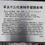
About Yokozuna Kotozakura. 横綱琴櫻
|
|

Monument for Yokozuna Kotozakura. 横綱琴櫻
|
|

Monument for Yokozuna Kotozakura. 横綱琴櫻
|
|

Small museum for Yokozuna Kotozakura. Too bad it was closed when I was there. 横綱琴櫻
|
|

Signs in English.
|
|
|
|
|
|
|
|
|
|
|
|
|
|
|

Benzaiten Hall next to Dairenji Temple. 弁財天堂
|
|

Benten Hall 弁財天堂
|
|

Benzaitendo Hall
|
|
|

To Benten Hall.
|
|

To Dairenji Temple.
|
|

Gate to Dairenji Temple.
|
|

Dairenji Temple.
|
|

Dairenji Temple.
|
|

Dairenji Temple bell.
|
|

Old telephone.
|
|

Ring out the old year with the temple bell.
|
|

Dairenji Temple main hall in Kurayoshi, Tottori. Belongs to the Jodo-shu Buddhist sect. 大蓮寺
|
|

Dairenji Temple main hall in Kurayoshi, Tottori. 大蓮寺
|
|

Dairenji Temple in Kurayoshi, Tottori also has graves of local merchants who made it rich and local samurai. 大蓮寺
|
|

Dairenji Temple in Kurayoshi, Tottori also has graves of local merchants who made it rich and local samurai. 大蓮寺
|
|

Dairenji Temple bell
|
|

Dairenji Temple bell
|
|

Small Buddha
|
|

Dairenji Temple
|
|

Kurayoshi, Tottori manhole.
|
|
|
|
|

Earthquake damage on the plaster.
|
|
|

Komyoji Temple with red roof tiles.
|
|
|
|
|

Condemned.
|
|
|
|
|


