 Image search results - "sakieda" Image search results - "sakieda" |

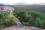
Sunrise hike up Mt. Yarabudake (屋良部岳) on Sakieda Peninsula in western Ishigaki. It starts near the summit from this small, easy-to-miss trail.
|
|
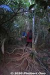
Thick, wild forest and lots of exposed tree roots. The frequent typhoons wash/blow away the soil from the tree roots.
|
|
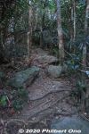
Typical mountain trail on Ishigaki.
|
|

A few steep parts, but ropes help you up.
|
|
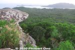
Top of Mt. Yarabudake. This rock is known as Troll's Tongue.
|
|
|
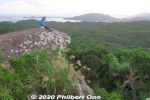
Our tour guide on Troll's Tongue playing his sanshin.
|
|

Our tour guide took a picture of us on Yarabudake.
|
|

Top of Yarabudake, Ishigaki. Waiting for the sunrise.
|
|
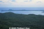
Looking toward Sakieda Bay and Kabira.
|
|

Beyond the mountain in the center is Kabira Bay.
|
|
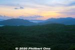
Too cloudy for a nice sunrise, but the views were marvelous on Mt. Yarabudake.
|
|
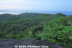
Looking toward Taketomi island in the distance.
|
|
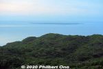
Taketomi island in the distance. Flat, coral outcrop. Quaint, charming island, a short boat ride from Ishigaki Port.
|
|
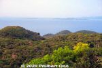
Straight ahead is Kohama island (小浜島) in the distance. The small island in front of it on the right is Kayama (嘉弥真島). The big island on the right is Iriomote.
|
|

Drive further around Sakieda Peninsula and see Ishigaki Cape Ogansaki Lighthouse. Built in March 1983. 石垣御神埼灯台
|
|

Cape Ogansaki 御神埼
|
|

Cape Ogansaki 御神埼
|
|

Cape Ogansaki 御神埼
|
|

Cape Ogansaki 御神埼
|
|

Cape Ogansaki 御神埼
|
|

On Cape Ogansaki, memorial for the 35 people who died in the Yaeyama Maru that was shipwrecked on Dec. 8, 1952 off this coast. 御神埼Monument was built in Dec. 1976.
|
|
|
|
|
|


