 Image search results - "mt." Image search results - "mt." |

Road to Mt. Yukinoyama, an ancient mountain and home to over 200 tumuli built during the 5th to 7th centuries. In 2013, it was designated as a National Historic Site.
|
|

Approaching Kawamori. 川守
|
|

Kawamori bus stop, nearest to Mt. Yukinoyama.
|
|

To Mt. Yukinoyama
|
|
|
|
|

Mt. Yukinoyama and Hino River 雪野山と日野川
|
|

Mt. Yukinoyama and Hino River 雪野山と日野川
|
|

Hino River 日野川
|
|

Hino River 日野川
|
|
|

Mt. Mitake is one of Tokyo's easily accessible peaks via cable car. But it still requires a good deal of climbing up slopes and steps. You can also hike to adjacent Mt. Hinode-yama. Great daytrip getaway from Tokyo's concrete jungle.Getting off the train at Mitake Station on the JR Ome Line. I wasn't the only one who decided it was a good day to hike up Mitake. 御岳駅
|
|

Boundary between Ome city and Hinode-machi town. I was hiking from Mt. Mitake in neighboring Ome.
|
|

Mt. Yukinoyama and Ryuoji Temple. MAP
|
|

Mitake Station on the JR Ome Line. 御岳駅
|
|
|

Ryuoji Temple 龍王寺
|
|

Very close to the summit of Hinode-yama. Only one lodge is here.
|
|

Ryuoji Temple 龍王寺
|
|

Mitake Station on the JR Ome Line. 御岳駅
|
|

Last flight of steps to the summit.
|
|

Ryuoji Temple belongs to the Tendai Sect. 龍王寺
|
|

Bus stop for cable car station.
|
|
|

Ryuoji Temple 龍王寺
|
|

Bus for cable car station.
|
|

Top of Mt. Hinode-yama
|
|

Tenjin Shrine 天神社
|
|

Hitsujiyama Park with weeping cherry blossoms and Mt. Bukosan. 羊山公園
|
|

Cable car station.
|
|

Top of Mt. Hinode-yama
|
|

Tenjin Shrine, reconstructing the shrine. Ryuo-cho, Shiga. 天神社
|
|

Hitsujiyama Park with weeping cherry blossoms
|
|

Welcome to Mt. Mitake
|
|

Benches all over for us to gaze at the panorama.
|
|

Hiking trail on Mt. Yukinoyama.
|
|

Hitsujiyama Park and Mt. Bukosan.
|
|

Cable car for Mt. Mitake.
|
|

Alpine map pointing the way to various areas
|
|

Mountain God Memorial 山の神
|
|

Hitsujiyama Park and Mt. Bukosan.
|
|

570 yen one way. There's also a lift for an extra 100 yen. No one rides the lift.
|
|
|

Trail flanked by ferns
|
|

Cable car to Mt. Mitake
|
|

Mt. Hinode-yama summit has a little picnic pavilion
|
|

Ferns
|
|

Mitake-san Station for cable car
|
|

Benches for hikers who had lunch.
|
|

Lookout deck near cable car station
|
|

Spectacular views from the top of Mt. Hinode-yama, Tokyo. But I couldn't recognize any landmarks.
|
|

1st lookout point, too many trees in the way.
|
|

View from lookout deck on Mt. Mitake, Tokyo
|
|

Views from the top of Mt. Hinode-yama, Tokyo
|
|

View from Yukinoyama
|
|
|

Views from the top of Mt. Hinode-yama, Tokyo
|
|

View of Ryuo-cho town from Mt. Yukinoyama.
|
|

Mt. Hinode-yama which is next to Mt. Mitake.
|
|

Views from the top of Mt. Hinode-yama. The large white building is the Seibu baseball dome in Tokorozawa.
|
|

Map of hiking trails on Yukinoyama. It takes about 90-120 min. to go up and down the mountain. There are some fine views from the trails.
|
|

Lift station in middle (very short distance) which no one rides.
|
|

Surrounding mountains in pastel colors
|
|

Top of Yukinoyama at 308 meters elevation. The views are obstructed by many trees. 雪野山 頂上
|
|

Welcome Gate. Everyone goes through here instead and walk toward the top.
|
|
|

Top of Yukinoyama. 雪野山 頂上
|
|

Back of welcome gate.
|
|

Trail to go down
|
|

View from top of Yukinoyama
|
|

Torii ahead. Mt. Mitake is topped with a Shinto shrine.
|
|

Going down
|
|

View from top of Yukinoyama
|
|

Torii
|
|
|

View from top of Yukinoyama
|
|

Back of torii
|
|
|

View from top of Yukinoyama
|
|
|
|
|
|

Hailstones in Feb.
|
|
|
|
|

Hinode-yama, my target after Mt. Mitake.
|
|
|

This trail was much more scenic.
|
|

Bird house
|
|

Lots of steps, glad I was going down instead of up.
|
|

Ryuo-cho town as seen from Yukinoyama
|
|
|
|
|
|

Mt. Mitake Visitors Center where you can get maps and hiking advice.
|
|

Lots of trees.
|
|

Looking toward Higashi-Omi.
|
|

Inside Visitors Center
|
|

Fork in the road. Turned left for the waterfall trail.
|
|

Water barrels in case of fire.
|
|

Old minka house on Mt. Mitake, Tokyo
|
|

Log bridge
|
|
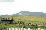
Kusasenri park 草千里Grassy park on the periphery of Mt. Aso.
|
|

Trail going down the middle of the mountain.
|
|

Mitake-san Youth Hostel. The mountain has many lodges and inns.
|
|
|

Horseback riding at Kusasenri. 草千里
|
|

View of central Ryuo-cho town from Mt. Yukinoyama.
|
|

Slope up
|
|

Pine cone
|
|
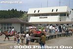
Aso Volcano Museum 阿蘇火山博物館
|
|
|

Thatched roof
|
|

Okuno village was here.
|
|
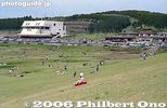
Kusasenri
|
|

Ferns
|
|

Mt. Mitake, Tokyo
|
|

Beware of bears...
|
|
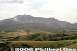
View of Mt. Aso
|
|

Ferns all over
|
|

Veranda
|
|

Looking up a slope...
|
|
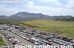
Kusasenri parking lot
|
|
|

Tree designated as a Natural Monument. Almost dead in Feb. though.
|
|
|

Grass skiing
|
|
|

Souvenir shops and restaurants
|
|

Finally a waterfall
|
|

Grass skiing
|
|

Lookout point
|
|

Steps toward Musashi-Mitake Shrine
|
|

More waterfalls...
|
|
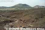
Spectacular ropeway ride
|
|
|

More steps
|
|

And more...
|
|
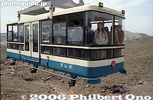
Aso-san Ropeway 阿蘇山ロープウェー
|
|
|

Lots of stone monuments (not gravestones)
|
|
|
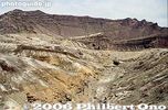
Sadly, the scenic Aso-san Ropeway (built in 1958) stopped operating in Aug. 2014 and was dismantled by 2019.
|
|
|

More monuments
|
|

This is the famous Shiraiwa Waterfall. 白岩の滝
|
|

Aso Crater rim
|
|

Sky over Ryuo-cho town
|
|

More steps (rest time)
|
|

Shiraiwa Waterfall. 白岩の滝
|
|

Notice the emergency shelters.
|
|

Entrance to an ancient tumulus (No entry)
|
|

More steps...
|
|
|
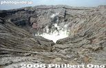
Mt. Naka-dake is Mt. Aso's most famous crater, Kumamoto 阿蘇山 中岳火口Measures 1 km wide north to south and 4 km east to west.
|
|

Oh my God, more steps...
|
|

It's actually a series of small waterfalls. Mt. Hinodeyama, Tokyo.
|
|

Mt. Naka-dake in Aso-san, Kumamoto. Measures 1 km wide north to south and 4 km east to west. 阿蘇山 中岳火口
|
|

Musashi-Mitake Shrine
|
|
|

Always smoking, Mt. Naka-dake in Aso-san, Kumamoto 阿蘇山 中岳火口
|
|

Musashi-Mitake Shrine, Tokyo 武蔵御嶽神社
|
|

Trail to Shiraiwa Waterfalls
|
|
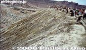
Crater rim
|
|

Musashi-Mitake Jinja 武蔵御嶽神社
|
|

Trail to Shiraiwa Waterfalls
|
|

Sign for taking "I was here" photos.
|
|

The shrine buildings at rear.
|
|

Entrance to trail to Shiraiwa Waterfalls and Mt. Hinode-yama
|
|

World's largest caldera still active.
|
|

View of Ritto from Mt. Anyoji. Marvelous view if it weren't for the trees...
|
|

View from the shrine, not much.
|
|
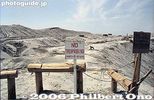
No entry
|
|

View of Ritto from Mt. Anyoji.
|
|

But there was one clear pocket of scenery.
|
|
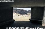
Inside emergency shelter.
|
|

View Hira mountains from Mt. Anyoji.
|
|
|
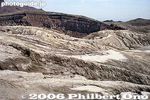
Spectacular rock and cliff formations.
|
|
|

Omikuji
|
|
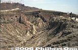
Fantastic artwork by nature
|
|

View from Mt. Anyoji in Ritto.
|
|

Omikuji
|
|

Art of nature
|
|

View from Mt. Anyoji.
|
|

Treasure House 宝物殿
|
|

Natural sculptures
|
|

Mt. Anyoji trail sign totally illegible. No map on the mountain to tell you where ypu are either.
|
|

Musashi-Mitake Shrine, Tokyo
|
|
|

Small shrine
|
|

Going down
|
|
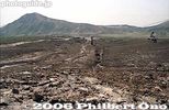
Walking back instead of taking the ropeway.
|
|

Another broken sign.
|
|

Turn left for Mt. Hinode-yama
|
|
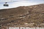
Ropeway
|
|

View from Mt. Anyoji 安養寺山
|
|

Cable car station peak.
|
|
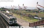
Aso Station
|
|

Power line tower on Mt. Anyoji
|
|

The torii which we passed through.
|
|

Mt. Anyoji from afar looks like a tumulus.
|
|

Wooden cart wheels are a common sight.
|
|

Trail to Mt. Hinode-yama. Takes about 40 min. from Mt. Mitake.
|
|
|

Deep forest
|
|
|

Roots
|
|

Torii
|
|
|

Take a left here.
|
|

Hiking guide
|
|

Roots in stone
|
|
|

Steps
|
|
|
|
|
|
|
|
|

View of Mt. Mikami from Omi-Fuji Karyoku Koen Park in spring.
|
|

View of Mt. Mikami-yama amid rice paddies in Yasu. Elevation 432 meters.
|
|
|

View of Mt. Mikami from Karasaki, across Lake Biwa.
|
|
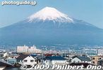
Mt. Fuji as seen from the shinkansen bullet train.
|
|
|
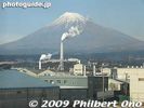
Smokestacks mar the view of Fuji.
|
|
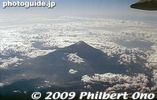
Mt. Fuji from the air.
|
|

Yoshida-guchi trail entrance sign.
|
|
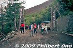
Yoshida-guchi trail entrance, we started from the 5th station.
|
|
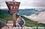
After climbing for about 40 min., we reached the 6th station here. We're already above the clouds.
|
|

Bags of drink cans.
|
|
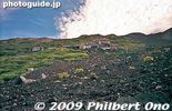
Rocky trail looking up on Mt. Fuji.
|
|
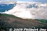
Looking down at the trail.
|
|

Hut roofs are weighed down with rocks so it doesn't blow away with the wind.
|
|
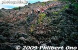
Rock and more rock on Mt. Fuji.
|
|

A good part of the trail had us going on all fours.
|
|
|

Mt. Fuji torii
|
|
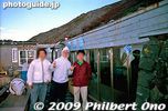
Our mountain hut on the 8th station, called Toyokan. 東洋館
|
|
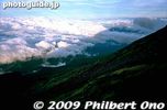
Shadow of Mt. Fuji
|
|
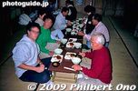
We spent the night in the mountain hut with a small dinner.
|
|

Branding my walking stick.
|
|
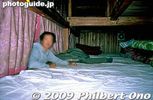
Our bunk bed.
|
|

Watching the sunrise from outside our hut.
|
|

Reaching the summit.
|
|

At the summit of Mt. Fuji. It was so windy and rainy that we couldn't walk around the rim. Could hardly see anything.
|
|
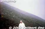
Going down was tiring too. But better than going up.
|
|
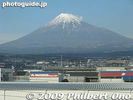
After climbing it, my image of this mountain will never be the same.
|
|
|
|
| 992 files on 4 page(s) |
1 |
 |
|