 Image search results - "mount" Image search results - "mount" |

From Tokyo, Gala Yuzawa is the most convenient place to ski. The Joetsu shinkansen can take you there in little over an hour and the train station has the ski gondola. An easy day trip.
|
|

Road to Mt. Yukinoyama, an ancient mountain and home to over 200 tumuli built during the 5th to 7th centuries. In 2013, it was designated as a National Historic Site.
|
|
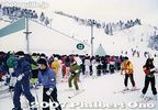
The line gets very long during the morning, so I usually go later in the day and ski until night when it is much less crowded. I catch the last shinkansen back to Tokyo.
|
|

Approaching Kawamori. 川守
|
|

It's not a large or long run, but better than nothing.
|
|

Kawamori bus stop, nearest to Mt. Yukinoyama.
|
|

The quality of the snow is not as good as in Hokkaido, but better than nothing.
|
|

To Mt. Yukinoyama
|
|
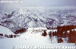
View from the top.
|
|
|
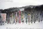
Skis left outside as their owners have lunch. It's nice that no one steals your skis.
|
|
|

Mt. Yukinoyama and Hino River 雪野山と日野川
|
|

Mt. Yukinoyama and Hino River 雪野山と日野川
|
|

Hino River 日野川
|
|

Hino River 日野川
|
|
|
|

Mt. Mitake is one of Tokyo's easily accessible peaks via cable car. But it still requires a good deal of climbing up slopes and steps. You can also hike to adjacent Mt. Hinode-yama. Great daytrip getaway from Tokyo's concrete jungle.Getting off the train at Mitake Station on the JR Ome Line. I wasn't the only one who decided it was a good day to hike up Mitake. 御岳駅
|
|

Boundary between Ome city and Hinode-machi town. I was hiking from Mt. Mitake in neighboring Ome.
|
|

Mt. Yukinoyama and Ryuoji Temple. MAP
|
|

Mitake Station on the JR Ome Line. 御岳駅
|
|
|

Ryuoji Temple 龍王寺
|
|

Very close to the summit of Hinode-yama. Only one lodge is here.
|
|

Ryuoji Temple 龍王寺
|
|

Mitake Station on the JR Ome Line. 御岳駅
|
|

Last flight of steps to the summit.
|
|

Ryuoji Temple belongs to the Tendai Sect. 龍王寺
|
|

Bus stop for cable car station.
|
|
|

A symbol of Chichibu, Mt. Bukosan is being slowly eaten away by cement companies. 武甲山
|
|

Ryuoji Temple 龍王寺
|
|

Bus for cable car station.
|
|

Top of Mt. Hinode-yama
|
|

Tenjin Shrine 天神社
|
|

Hitsujiyama Park with weeping cherry blossoms and Mt. Bukosan. 羊山公園
|
|

Cable car station.
|
|

Top of Mt. Hinode-yama
|
|

Tenjin Shrine, reconstructing the shrine. Ryuo-cho, Shiga. 天神社
|
|

Hitsujiyama Park with weeping cherry blossoms
|
|

Welcome to Mt. Mitake
|
|

Benches all over for us to gaze at the panorama.
|
|

Hiking trail on Mt. Yukinoyama.
|
|

Hitsujiyama Park and Mt. Bukosan.
|
|

Cable car for Mt. Mitake.
|
|

Alpine map pointing the way to various areas
|
|

Mountain God Memorial 山の神
|
|

Hitsujiyama Park and Mt. Bukosan.
|
|

570 yen one way. There's also a lift for an extra 100 yen. No one rides the lift.
|
|
|

Trail flanked by ferns
|
|

Cable car to Mt. Mitake
|
|

Mt. Hinode-yama summit has a little picnic pavilion
|
|

Ferns
|
|

Mitake-san Station for cable car
|
|

Benches for hikers who had lunch.
|
|

Lookout deck near cable car station
|
|

Spectacular views from the top of Mt. Hinode-yama, Tokyo. But I couldn't recognize any landmarks.
|
|

1st lookout point, too many trees in the way.
|
|

View from lookout deck on Mt. Mitake, Tokyo
|
|

Views from the top of Mt. Hinode-yama, Tokyo
|
|

View from Yukinoyama
|
|
|

Views from the top of Mt. Hinode-yama, Tokyo
|
|

View of Ryuo-cho town from Mt. Yukinoyama.
|
|

Mt. Hinode-yama which is next to Mt. Mitake.
|
|

Views from the top of Mt. Hinode-yama. The large white building is the Seibu baseball dome in Tokorozawa.
|
|

Map of hiking trails on Yukinoyama. It takes about 90-120 min. to go up and down the mountain. There are some fine views from the trails.
|
|

2nd lookout point 第二展望台
|
|

Lift station in middle (very short distance) which no one rides.
|
|

Surrounding mountains in pastel colors
|
|

Top of Yukinoyama at 308 meters elevation. The views are obstructed by many trees. 雪野山 頂上
|
|

Welcome Gate. Everyone goes through here instead and walk toward the top.
|
|
|

Top of Yukinoyama. 雪野山 頂上
|
|

Back of welcome gate.
|
|

Trail to go down
|
|

View from top of Yukinoyama
|
|

Torii ahead. Mt. Mitake is topped with a Shinto shrine.
|
|

Going down
|
|

View from top of Yukinoyama
|
|

Torii
|
|
|

View from top of Yukinoyama
|
|

Back of torii
|
|
|

View from top of Yukinoyama
|
|
|
|
|
|

Hailstones in Feb.
|
|
|
|
|

Hinode-yama, my target after Mt. Mitake.
|
|
|

This trail was much more scenic.
|
|

Bird house
|
|

Lots of steps, glad I was going down instead of up.
|
|

Ryuo-cho town as seen from Yukinoyama
|
|
|
|
|
|

Mt. Mitake Visitors Center where you can get maps and hiking advice.
|
|

Lots of trees.
|
|

Looking toward Higashi-Omi.
|
|

Inside Visitors Center
|
|

Fork in the road. Turned left for the waterfall trail.
|
|

Water barrels in case of fire.
|
|

Old minka house on Mt. Mitake, Tokyo
|
|

Log bridge
|
|

Sakurajima 桜島Part of Kirishima-Yaku National Park.
|
|
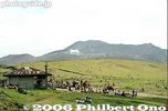
Kusasenri park 草千里Grassy park on the periphery of Mt. Aso.
|
|

Trail going down the middle of the mountain.
|
|

Lake Suwa
|
|

Mitake-san Youth Hostel. The mountain has many lodges and inns.
|
|
|
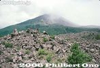
Sakurajima 桜島
|
|

Horseback riding at Kusasenri. 草千里
|
|

View of central Ryuo-cho town from Mt. Yukinoyama.
|
|

Lake Suwa
|
|

Slope up
|
|

Pine cone
|
|

View from the slope
|
|
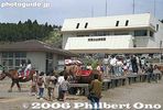
Aso Volcano Museum 阿蘇火山博物館
|
|
|
|

Lake Suwa and mountains
|
|

Thatched roof
|
|

Okuno village was here.
|
|

Walking paths near the mountain.
|
|
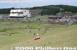
Kusasenri
|
|

Ferns
|
|

Lake Suwa and mountains
|
|

Mt. Mitake, Tokyo
|
|

Beware of bears...
|
|
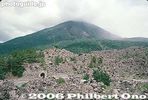
Sakurajima, Kagoshima. Part of Kirishima-Yaku National Park. 桜島
|
|
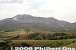
View of Mt. Aso
|
|

Ferns all over
|
|

Lake Suwa and mountains
|
|

Veranda
|
|

Looking up a slope...
|
|

Leaving Sakurajima across the bay.
|
|
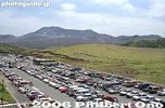
Kusasenri parking lot
|
|
|
|

Tree designated as a Natural Monument. Almost dead in Feb. though.
|
|
|
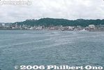
Kagoshima port
|
|
|
|
|

Souvenir shops and restaurants
|
|

Finally a waterfall
|
|

Lookout point
|
|
|
|

Steps toward Musashi-Mitake Shrine
|
|

More waterfalls...
|
|
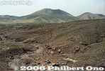
Spectacular ropeway ride
|
|
|
|

Lakeside park
|
|

More steps
|
|

And more...
|
|
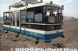
Aso-san Ropeway 阿蘇山ロープウェー
|
|
|

Lakeside park
|
|

Lots of stone monuments (not gravestones)
|
|
|
|
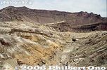
Sadly, the scenic Aso-san Ropeway (built in 1958) stopped operating in Aug. 2014 and was dismantled by 2019.
|
|
|

Lakeside park
|
|

More monuments
|
|

This is the famous Shiraiwa Waterfall. 白岩の滝
|
|

Aso Crater rim
|
|

Sky over Ryuo-cho town
|
|

Lake Suwa
|
|

More steps (rest time)
|
|

Shiraiwa Waterfall. 白岩の滝
|
|

Notice the emergency shelters.
|
|

Entrance to an ancient tumulus (No entry)
|
|

Lake Suwa
|
|

More steps...
|
|
|
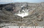
Mt. Naka-dake is Mt. Aso's most famous crater, Kumamoto 阿蘇山 中岳火口Measures 1 km wide north to south and 4 km east to west.
|
|

Lake Suwa and bridge
|
|

Oh my God, more steps...
|
|

It's actually a series of small waterfalls. Mt. Hinodeyama, Tokyo.
|
|

Mt. Naka-dake in Aso-san, Kumamoto. Measures 1 km wide north to south and 4 km east to west. 阿蘇山 中岳火口
|
|
|

Musashi-Mitake Shrine
|
|
|

Always smoking, Mt. Naka-dake in Aso-san, Kumamoto 阿蘇山 中岳火口
|
|

Bridge across Kamaguchi Floodgate
|
|

Musashi-Mitake Shrine, Tokyo 武蔵御嶽神社
|
|

Trail to Shiraiwa Waterfalls
|
|
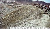
Crater rim
|
|

Bridge across Kamaguchi Floodgate
|
|

Musashi-Mitake Jinja 武蔵御嶽神社
|
|

Trail to Shiraiwa Waterfalls
|
|

Sign for taking "I was here" photos.
|
|
|

The shrine buildings at rear.
|
|

Entrance to trail to Shiraiwa Waterfalls and Mt. Hinode-yama
|
|

World's largest caldera still active.
|
|

Kamaguchi Floodgate
|
|

View from the shrine, not much.
|
|
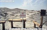
No entry
|
|

Carp caught from Lake Suwa
|
|

But there was one clear pocket of scenery.
|
|
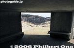
Inside emergency shelter.
|
|

View Hira mountains from Mt. Anyoji.
|
|

Lake Suwa during a warm winter.
|
|
|
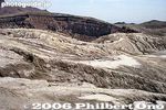
Spectacular rock and cliff formations.
|
|
|
|
|

Omikuji
|
|
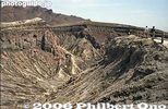
Fantastic artwork by nature
|
|

View from Mt. Anyoji in Ritto.
|
|
|
|

Omikuji
|
|

Art of nature
|
|

View from Mt. Anyoji.
|
|
|
|

Treasure House 宝物殿
|
|

Natural sculptures
|
|

Mt. Anyoji trail sign totally illegible. No map on the mountain to tell you where ypu are either.
|
|

Oguchi Taro monument
|
|

Musashi-Mitake Shrine, Tokyo
|
|
|

Small shrine
|
|
|
|

Going down
|
|
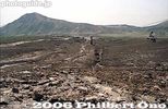
Walking back instead of taking the ropeway.
|
|

Another broken sign.
|
|

Locomotive from Ohio, USA used in the 1930s.
|
|

Turn left for Mt. Hinode-yama
|
|
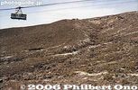
Ropeway
|
|

View from Mt. Anyoji 安養寺山
|
|

Sculpture in lakeside park
|
|

Cable car station peak.
|
|
|
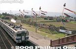
Aso Station
|
|

The torii which we passed through.
|
|

Water fountain
|
|

Mt. Anyoji from afar looks like a tumulus.
|
|

Wooden cart wheels are a common sight.
|
|
|
|

Trail to Mt. Hinode-yama. Takes about 40 min. from Mt. Mitake.
|
|

Lakeside park
|
|
|

Ducks
|
|

Deep forest
|
|

Ducks fly away on Lake Suwa.
|
|
|
| 968 files on 4 page(s) |
1 |
 |
|