 Image search results - "map" Image search results - "map" |

About the song and rowing route... この歌について(日本語解説)Shiga Prefecture's most famous and beloved song is called Biwako Shuko no Uta (琵琶湖周航の歌) or "Lake Biwa Rowing Song." I have rendered this song into both pictures and English, according to my own imagination and interpretation.
Please see this page for a full explanation: https://photoguide.jp/txt/Lake_Biwa_Rowing_Song
First composed in 1917 by a bunch of college students from Kyoto, the song has been recorded by many famous Japanese singers and groups. In 1971, it became a major nationwide hit with singer Tokiko Kato's rendition. Today, the song remains a favorite among choir groups in Japan, and a choir singing contest is held for the song every June (since 1997) in Imazu, the birthplace of the song in the northwestern corner of Lake Biwa.
Shiga Prefecture also has stone monuments dedicated to each of the six verses. There's even a museum (Biwako Shuko no Uta Shiryokan) in Imazu dedicated to the song. Okaya city on the shores of Lake Suwa in Nagano Prefecture, the birthplace of the song's composer, Taro Oguchi (小口太郎) (1897-1924), also has a song monument and bronze statue of him.
|
|

Map of Asukayama Park. Near Oji Station on the Keihin-Tohoku Line, a slender park noted for cherry blossoms.
|
|
|
|

Tahoto Pagoda and Gekkoden Hall at Gokokuji temple in Bunkyo-ku, Tokyo
|
|

Map of park. The park is a long, elongated shape.
|
|

Map of Mt. Mikami. It says the trail is 1.3 km long, taking 40 min. For normal people, allow 80 min. to reach the peak. I took about 90 min. to reach the top, while taking time to take pictures.
|
|
|
|
|
|
|
|
|
|
|
|
|

Eikando is a Jodo-shu Buddhist temple famous for autumn foliage, especially red maples. One of Kyoto's most photogenic spots for fall leaves.
|
|

Sutra Repository 経堂
|
|
|
|

When you first enter Eikando temple in Kyoto, this is what you see. A hint of more to come.
|
|
|
|
|
|
|
|

This path of maples would be redder a several days earlier. Path to Miei-do Hall.
|
|
|
|
|
|
|

Everywhere you look in Eikando is so utterly photogenic, or should I say paint-genic since they didn’t have cameras when the temple was built. Everywhere looks like a scene from a classic Japanese painting.
|
|
|
|

Even the shape and placement of the trees are so artistic.
|
|

Eigenji Temple
|
|

Eikando temple, Kyoto
|
|

Whoever landscaped or designed the temple grounds was an artistic genius.
|
|
|
|
|
|
|
|
|
|

Main entrance to the temple.
|
|

Courtyard garden
|
|

Courtyard garden seen from the Shaka-do Hall.
|
|
|

Courtyard garden seen from the Shaka-do Hall.
|
|
|
|
|
|
|
|

Roof of the Mieei-do Hall.We were not allowed to photograph inside the temple buildings.
|
|
|

Amida-do Hall
|
|

Amida-do Hall
|
|

Temple bell
|
|
|
|
|
|
|

Yasuragi Kannon at Eikando
|
|
|
|

Yasuragi Kannon statue at the bottom of the steps of Amida-do Hall.
|
|
|
|

Miei-do Hall (Daiden)
|
|

Miei-do Hall (Daiden)
|
|
|

Hojo-ike Pond. Notice the two-story pagoda (Tahoto) in the distance.
|
|

Hojo-ike Pond. The two-story pagoda (Tahoto) in the distance.
|
|

The two-story pagoda (Tahoto) is a short climb up the stairs. Worth the view.
|
|

View from the two-story pagoda on the hillside. This would be a sea of red during the peak period. I have to come back here.
|
|

View from the two-story Tahoto pagoda on the hillside at Eikando.
|
|
|
|

Bridge to Benten-shima on Hojo-ike Pond.
|
|

Bridge to Benten-shima on Hojo-ike Pond.
|
|

Miei-do Hall in the distance.
|
|
|
|

Gasen-do Hall
|
|
|

Gasen-do Hall
|
|

Eikando
|
|

Bridge to Benten-shima on Hojo-ike Pond.
|
|

Bridge to Benten-shima on Hojo-ike Pond.
|
|
|

Eikando
|
|
|

JPN Cafe
|
|
|

They also had a rest area where they served tea and sweets amid the foliage. Brisk business.
|
|
|
|
|

Eikando
|
|
|
|
|

Eikando
|
|
|

Eikando, Kyoto
|
|

I was a few days too late to see the peak. Will return again in autumn.
|
|
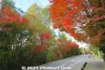
There were a few maple (momiji) trees along the way.
|
|
|
|
|
|
|
|
|
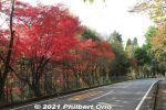
Although I was rewarded with these red maples, one-hour is kind of a long walk. Slight uphill too.
|
|
|
|
|
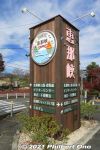
Finally, the Enakyo sign.
|
|

Enakyo marker sign.
|
|
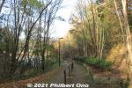
From the bus stop, there's a short path down to the riverside.
|
|
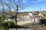
Cross the road and there's the starting point to explore Enakyo. Building on the left is the Visitors' Center.
|
|

Map of Enakyo. There's a sightseeing boat pier on the left, a few hotels, and a small spit of land that is Sazanami Park, one main attraction.
|
|
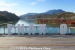
Most tourists visiting Enakyo will first arrive here, a short walk from the bus stop and parking lot. The "Y" is missing here. Maybe it was designed to have a human posing as the "Y" in a selfie.
|
|
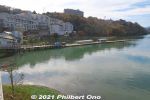
On the left is a pier for sightseeing boats taking tourists to see the unusual rock formations on the gorge. Cruise is 30 min. and fare is ¥1,500. Runs often during autumn. https://www.tohsyoh.jp/ship
|
|
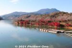
On the right is Sazanami Park lined with autumn maple leaves in November and cherry blossoms in spring. Everything is within a short walk. These photos were taken in November.
|
|
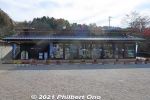
Enakyo Visitors Center has tourist information counter and air-conditioned rest area with tables and chairs.
|
|
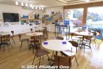
Inside Enakyo Visitors Center.
|
|

Sights in Enakyo Gorge.
|
|

Sights and wildlife in Enakyo Gorge.
|
|
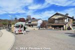
Gift shops at Enakyo.
|
|
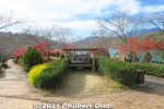
Entering Sazanami Park lined with red maple trees in autumn. "Sazanami" means "water ripples."
|
|
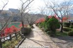
Sazanami Park has a small peninsula with a walking path lined with maple trees (and cherry trees).
|
|
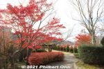
Entering Sazanami Park lined with red maple leaves in mid-November.
|
|
|
|
|
|
|
|
|
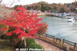
Left side of Sazanami Park facing the boat pier.
|
|
|
|
|
|
|
|
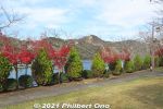
The park has two levels. Lower level is a path along the riverside, and this upper level is a park-like lawn.
|
|
|
|
|
|
|
|
|
|
|
|
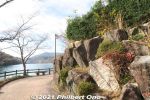
Approaching the tip of Sazanami Park.
|
|
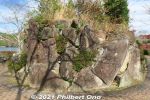
Rocks on the tip of Sazanami Park.
|
|

View of Kiso River from the tip of Sazanami Park. Right below Shinonome Ohashi Bridge (東雲大橋) in the distance is Oi Dam built in 1924 as Japan's first hydroelectric dam. The dam created this reservoir in Ena Gorge.
|
|
|
|
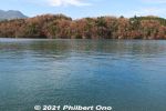
View of the river from the right side of Sazanami Park.
|
|

Upstream toward Enakyo Ohashi Bridge.
|
|
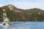
On the right side of Sazanami Park, Ena-kyo Wonderland can be seen on the mountain. An amusement park, closed for winter from Nov. to Feb..
|
|
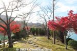
On the upper level of Sazanami Park, looking toward the tip.
|
|
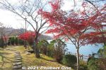
On the upper level of Sazanami Park, looking toward the tip.
|
|
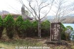
Tanka poetry monument on the tip of Sazanami Park. Lower monument commemorates the development of Enakyo.
|
|
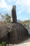
Tanka poem monument for poet Kitahara Hakushu.
|
|
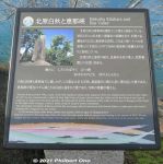
About the tanka poem by poet Kitahara Hakushu.
|
|
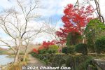
Red maple leaves on the right side of Sazanami Park.
|
|
|
|
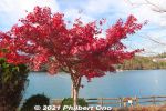
Most maple trees aren't that large, but the river in the background makes them scenic.
|
|
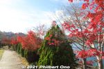
Definitely the right place for red maple leaves. Most were already very red.
|
|
|
|
|
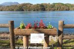
Flowers grown and groomed by Ena Agricultural High School students studying landscape design.
|
|
|
|
|
|
|
|
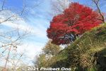
Big maple tree.
|
|
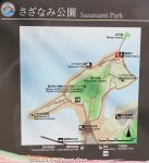
Map of Sazanami Park. You can walk around it in 15-20 min. (Longer if you like to take pictures.)
|
|
|
|
|
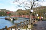
From Sazanami Park, a bridge to Benten Island.
|
|

Bridge to Benten Island.
|
|

Benten Island has a statue of the goddess Benzaiten.
|
|
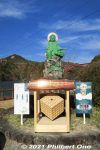
Statue of the goddess Benzaiten and shiny offertory box.
|
|
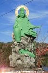
Statue of the goddess Benzaiten, protector against floods and water accidents. Goddess of anything that flows, including music.
|
|
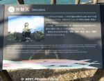
Benten Island is the tip of a mountain now submerged by the dammed river.
|
|
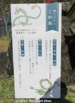
Pray to Benzaiten for success in life, passing exams, love, and art and design.
|
|
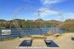
Upper level of Sazanami Park.
|
|

View of Benten Island.
|
|
|
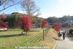
Going back down from Sazanami Park.
|
|
|
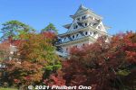
Gujo-Hachiman Castle is on a small mountain named Mt. Hachiman in central Gujo-Hachiman. The main tenshu tower is a 1933 reconstruction made of wood and surrounded by autumn foliage in November.Takes about 15 minutes to climb up. It's a fairly easy climb. The castle has a commanding view of the city.
|
|
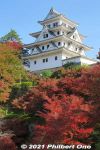
The main tower is now a museum exhibiting local history and culture. The top floor gives commanding views of Gujo-Hachiman.
|
|
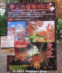
Small admission is charged to enter the castle's main tower. A combination ticket ¥700 is recommended to also see Jion-zenji Temple
|
|
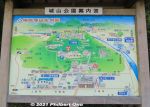
Map around Gujo-Hachiman Castle. The castle is a short uphill hike from the bus stop at Gujo-Hachiman Jokamachi Plaza, a local tourist shop. Gujo-Hachiman used to be a separate town (municipality) called "Hachiman-cho" until it merged with several neighboring towns and villages to form the city of Gujo (pop. 38,000) in 2004.
|
|
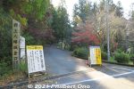
Entrance to the road going up to the castle. Both cars and pedestrians use this narrow, single-lane road, so we all need to be careful.
|
|
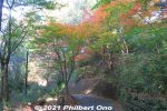
Takes about 15 min. of uphill walking. Cars can go up to the parking lot near the castle. People in wheelchairs should take a taxi. However, the castle grounds still has a lot of stone steps. Castle tower has no elevator.
|
|
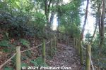
The road snakes up the mountain, but pedestrians can also go up a few shortcuts. Steeper than the road though.
|
|
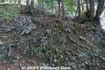
Unusual rock formations.
|
|
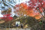
Finally reached the bottom of the castle grounds. Fall leaves already pretty in mid-November.
|
|
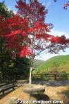
Gujo-Hachiman Castle has lots of red maples.
|
|
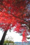
Nice red momiji maple leaf gradation from light to dark.
|
|
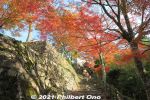
The pedestrian approach to the castle entrance is also pretty with autumn leaves.
|
|
|
|
|
|
|
|
|
|
|

Major spot to view and photograph the castle. The stone monument is connected with Nichiren.
|
|
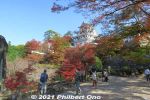
View of Gujo-Hachiman Castle and fall leaves.
|
|
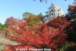
Gujo-Hachiman Castle and red maple leaves.
|
|
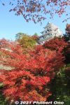
Gujo-Hachiman Castle and autumn foliage.
|
|

Gujo-Hachiman Castle and autumn foliage.
|
|
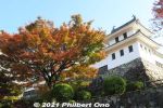
Gujo-Hachiman Castle corner turret.
|
|
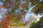
Autumn view of Gujo-Hachiman Castle from a path along the castle wall.
|
|
|
|
|
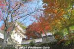
Another corner turret.
|
|
|
|
|
|
|
|
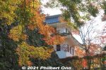
Gujo-Hachiman Castle turret and autumn foliage.
|
|
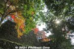
Gujo-Hachiman Castle turret and autumn foliage.
|
|
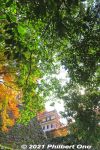
Gujo-Hachiman Castle turret and autumn foliage still green.
|
|
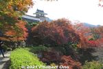
Gujo-Hachiman Castle corner turret and autumn foliage.
|
|
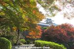
Gujo-Hachiman Castle corner turret and autumn foliage.
|
|
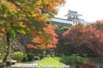
Gujo-Hachiman Castle corner turret and autumn foliage.
|
|
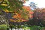
Gujo-Hachiman Castle corner turret and autumn foliage.
|
|
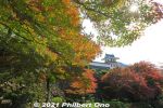
Gujo-Hachiman Castle corner turret and autumn foliage.
|
|
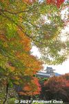
Gujo-Hachiman Castle corner turret and autumn foliage.
|
|
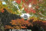
Gujo-Hachiman Castle corner turret and autumn foliage.
|
|
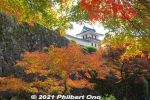
Gujo-Hachiman Castle corner turret and autumn foliage.
|
|
|
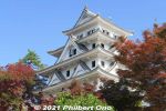
Gujo-Hachiman Castle main tower.
|
|
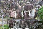
Chikara-ishi stones.
|
|
|
|
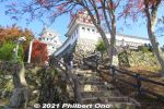
Steps to the castle's main keep.
|
|
|
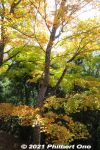
Lots of autumn colors along the way.
|
|
|
|
|
|
|
|
|
|