 Image search results - "makino" Image search results - "makino" |

Kaizu-Osaki is a peninsula easily accessible from Makino or Nishi-Azai Station. You can rent a bicycle at Makino Station on the Kosei Line or at Nagahara Station. Makino Station is closer so I rented a bicycle there at the tourist info office.
|
|

You can see a line of pink along the shore of the peninsula in the distance.
|
|
|

A few cherry trees along the way to Kaizu-Osaki.
|
|

The Kaizu-Osaki welcome sign marks the start of the cherry tree-lined road. Beware of cars. MAP
|
|

On weekends, the road is bumper-to-bumper traffic when the cherries are in full bloom. The road also becomes a one-way road from west to east.
|
|
|

Kaizu-Osaki cherry blossoms. These cherry trees were first planted in 1936 to commemorate the opening of Osaki Tunnel. Some 600 cherry trees were planted along a 4-kilometer route along the lakeshore.
|
|

If you're walking, there's a side path here. (Some people walk from Makino Station.)
|
|

Footpath along the lake at Kaizu-Osaki.
|
|

Large, cracked rocks along the footpath.
|
|

The cherry blossom boat cruises either just cruise or they stop at Kaizu-Osaki Port where you can get off and walk around.
|
|

Soon you will reach this rest stop and the Kaizu-Osaki boat pier.
|
|

Kaizu-Osaki Port. Boat cruises along the Kaizu-Osaki coast are offered during the cherry blossom season.
|
|

The boats come from Hikone, Nagahama, and Imazu Ports during cherry blossom season.
|
|

Kaizu-Osaki port. Cherry blossom (sakura) cruises are great because you can get to the sakura without fighting traffic.Best to take the cruise that lets you get off and walk around for 30 min. at Kaisu-Osaki Port. Better than the boats that only cruise and do not enter port.
|
|

Near the boat pier is Osaki temple.
|
|

There's a slope that goes up to the temple.
|
|

View of the boat pier.
|
|

Entrance to Osaki temple. 100 yen donations are requested.
|
|
|
|

Osaki temple 大崎寺
|
|

Osaki temple 大崎寺
|
|
|
|
|
|
|
|

Beyond the temple is a short trail going further north along the shore below.
|
|

A few scenic views from the trail.
|
|

View of Kaizu-Osaki.
|
|
|

The trail then goes down to the Osaki Camping Grounds.
|
|

Osaki Camping Grounds
|
|

Kaizu-Osaki and Chikubushima.
|
|

Kaizu-Osaki
|
|
|
|
|
|
|

Kaizu-Osaki and Chikubushima island
|
|
|

Kaizu-Osaki cherry blossoms, one of Japan's 100 Best Spots for cherry blossoms.
|
|

Entrance to Osaki Camp grounds.
|
|

There are a few tunnels along the road.
|
|

During cherry blossom season, pedestrians will walk through this dark, narrow tunnel. No sidewalks, so be careful. Cars whiz by. Best to carry a flashlight.
|
|

After the tunnel, some the best parts of the sakura-lined road/shore lie ahead.
|
|

These sunny photos were taken in April 2009 during a long string of sunny days right during the full bloom period.
|
|

Usually it rains or storms during cherry blossom season. We were lucky in April 2009.
|
|
|
|

Chikubushima island and cherry blossoms at Kaizu-Osaki, Lake Biwa.
|
|
|
|
|
|
|
|
|
|
|
|
|
|
|
|

Sad to see a few cherry trees keeled over. In recent years, some trees have not been blooming so well due to sickness or age. A local NPO is trying to preserve the trees and plant new ones.
|
|

Note that the cars are bumper-to-bumper and the road has no sidewalk for pedestrians or bicycles. Be careful when walking/cycling on the road.
|
|
|
|
|
|
|

Kaizu-Osaki cherry blossoms in northern Lake Biwa.
|
|
|
|
|
|
|
|
|
|
|
|
|
|
|
|

Chikubushima
|
|
|
|
|
|
|
|
|
|
|
|
|
|
|
|
|
|
|
|
|

Across the water are more cherry trees along the Oku-Biwako Parkway road.
|
|

A black kite is perched in a cherry tree.
|
|
|

Welcome sign to Makino (as seen from Nishi-Azai).
|
|

Kaizu-Osaki as seen from the lake.
|
|
|

In summer, the cherry trees are very green.
|
|
|
|

Marker showing the way to Kaizuten Jinja Shrine on a busy highway in Makino. Kaizuten Jinja holds the annual Kaizu Matsuri (nicknamed Kaizu Rikishi Matsuri) on April 29. Rikishi means sumo wrestler.
|
|

The festival started with a Shinto ceremony at the shrine with two mikoshi portable shrines present. Then at 1 pm, they left the shrine and carried the mikoshi in their neighborhoods.
|
|

Kaizuten Jinja. If you're walking from Makino Station, be careful as part of the highway along the way has no sidewalk. At night, bring a flashlight so the cars can see you. MAP
|
|

The two mikoshi portable shrines. They are carried by the two neighborhoods (Kaizu and Nishihama) during the day (1 pm - 3 pm) and in the evening. They rest from 3 pm to 5 pm.
|
|

At 5 pm, they started to carry the mikoshi again in their neighborhoods. This local festival features men dressed as sumo wrestlers (rikishi) carrying the two mikoshi portable shrines. This is the Nishihama group.
|
|

They wear kesho mawashi ceremonial aprons normally worn by sumo wrestlers. These aprons are possessed by local families and passed down to successive generations.
|
|

The Nishihama (西浜) group go through their neighborhood along the shore of Lake Biwa. About 30 men carry the mikoshi.
|
|

They shout "Yo-ya-sa-ja!." (ヨーヤサージャー). They take several rest breaks along the way.
|
|

Now the Kaizu mikoshi group starts their way at 5 pm. They go in the opposite direction (north) from the Nishihama group. 海津
|
|

These photos were taken from 5 pm so they look rather dark. If you want brighter photos, go during the day. But then, the festival climax is at night when they gather at the shrine.
|
|

Three centuries ago, the Kaizu was a port for small cargo boats plying Lake Biwa to deliver goods from Hokuriku to Kyoto. Local young men working for these boats started sumo wrestling in the shrine and making these kesho mawashi aprons.
|
|

The festival started with these young men dressed like sumo wrestlers.
|
|

Many of the aprons have a kanji character for dragon, tiger, or other macho themes.
|
|
|
|
|
|

The Kaizu mikoshi proceeds along the shore of Lake Biwa, heading toward Kaizu.
|
|
|

Some local people come out to watch.
|
|
|
|

They sometimes jostle the mikoshi up and down.
|
|
|
|
|
|
|

Rest break for Kaizu mikoshi.
|
|

The Nishihama mikoshi on its way to Kaizuten Shrine.
|
|
|
|
|

At Kaizuten Shrine, kids light their torches.
|
|
|
|
|

One mikoshi arrives at Kaizuten Shrine.
|
|

Another arrives at Kaizuten Shrine at about 9 pm.
|
|

They run around the shrine with the mikoshi and shout.
|
|

In front of a large crowd, they dramatically raise and lower the mikoshi.
|
|

This was the climax of the Kaizu Rikishi festival.
|
|

They did this repeatedly until they went further up the shrine.
|
|
|
|
|

Unfortunately, I had to leave to catch the last train home (after 10 pm) before the climax ended.
|
|

I never got to see the torches with the mikoshi. For more info, call the shrine in Japanese: 0740-28-0051
|
|

Makino Station on the JR Kosei Line. The only train station in the Makino area of Takashima. MAP
|
|

Makino Station. Makino was the first town in Japan whose name used katakana. The town was established in 1955 upon the merger of a few villages. The new town was named after its most famous spot, the Makino Ski Grounds which used katakana for "Makino
|
|

The original kanji for Makino was 牧野. However, the ski grounds used katakana to give an imported feel since skiing was imported back then in the 1920s. Photo: Makino Station's cherry trees.
|
|

Makino is only one of two towns in Japan whose name uses katakana (the other is Niseko in Hokkaido). マキノ町
|
|

Makino Station turnstile/gate
|
|

Makino Station corridor with a photo showcase.
|
|

Old-style train on Kosei Line at Makino Station.
|
|

Kosei Line train going to Makino Station.
|
|

Makino Station platform in winter. This was in Jan. 2006.
|
|

In spring when the cherry blossoms bloom at Kaizu-Osaki, a makeshift food stall is setup outside Makino Station selling local foods.
|
|

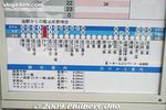
Diagram showing how many minutes it takes to go from Makino Station to other stations. Around 68 min. to/from Kyoto and 32 min. to Omi-Takashima. Makino is also accessible from Maibara via Omi-Shiotsu Station.
|
|

Makino Station looking from the west. Very little development on this side of the station.
|
|

Right across Makino Station is this building which houses the local tourist information office. This is where you can rent a bicycle and obtain sightseeing maps.
|
|

Map of Makino. Makino used to be an independent town until it merged with neighboring towns to form the city of Takashima.
|
|

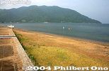
Makino Sunny Beach is a major swimming beach on Lake Biwa in summer.
|
|
|

Makino Sunny Beach is a major swimming beach on Lake Biwa in summer. MAP
|
|

Makino Sunny Beach
|
|

Makino Sunny Beach looks best on a sunny day...
|
|

Monument for Takagihama beach.
|
|

Kaizu stone wall is what you see along the way to Kaizu-Osaki on the distance.
|
|

Several hundred meters of stone wall was built in the early 18th century along the lake shore to prevent high waves from damaging homes.
|
|

Kaizu
|
|

Makino Station is the closest station to Kaizu-Osaki in northern Lake Biwa. Famous for cherry blossoms in mid-April. Best to rent a bicycle at Makino Station. Kaizu-Osaki photos here.
|
|

On the west side of Makino Station, you can visit Makino Highland. I went by bicycle.
|
|
|
|
|
|

Another noted sight of Makino is this neat row of Metasequoia (dawn redwood) trees. MAP
|
|

Metasequoia (dawn redwood) trees on the way to Makino Highland.
|
|
|

There's a walking path along both sides of the trees.
|
|

Road to Makino Highland. From here, it's an upward slope (if you're bicycling). Not too bad though. Otherwise, take a bus from Makino Station.
|
|

Entrance to Makino Highland (Makino Kogen). Free admission. マキノ高原
|
|
|

Map of Makino Highland. Quite a large area.
|
|

Makino Highland. MAP
|
|

Putting golf course during non-winter months.
|
|

Makino Highland is quite large, includes a small skiiing ground and hiking trails to a waterfall. A great place to relax to get away.
|
|

Onsen hot spring facility in Makino Highland.
|
|

River in Makino Highland.
|
|
|
|
|
|

Yae-zakura cherry blossoms in late April in Makino Highland in Takashima.
|
|
|
|

Yae-zakura cherry blossoms are fluffy-looking.
|
|

Makino manhole, Takashima, Shiga Pref.
|
|

Makino Pic-land
|
|

Makino in winter
|
|

Attached lake in Makino in winter.
|
|
|
|
|
|