 Image search results - "kohoku" Image search results - "kohoku" |

Memorial for the war dead
|
|
|

Maruyama Tumulus 丸山古墳
|
|

Maruyama Tumulus in Torahime, Nagahama.
|
|

Maruyama Tumulus monument
|
|

Maruyama Tumulus next to Jiyukan Hall. MAP
|
|

Sign welcoming you to the Kohoku Town Waterfowl Park along the northeastern shore of Lake Biwa, directly north of Nagahama. MAPThis is slightly north of Hayasaki Biotope.
|
|

Map of Kohoku-cho Waterfowl Park that includes a bird-watching center called Kohoku Wild Bird Center and the Biwako Waterfowl and Wetland Center.
|
|

Kohoku Wild Bird Center and the Biwako Waterfowl and Wetland Center (A-frame building on the left). 湖北野鳥センター・琵琶湖水鳥・湿地センター
|
|

Kohoku Wild Bird Center, admission 200 yen. This center was established by Shiga Prefecture in Nov. 1988 and it is operated by Kohoku town. 湖北野鳥センター
|
|

Inside Kohoku Wild Bird Center. It has large picture windows facing Lake Biwa and high-powered binoculars enabling you to clearly see the waterfowl. 湖北野鳥センター
|
|

View from the Kohoku Wild Bird Center.
|
|

The birds rest on a small island close to the shore.
|
|

On this day in Feb., I saw ducks and gray heron (ao-sagi).
|
|

Ducks
|
|

Tundra swans from Siberia at Lake Biwa.
|
|
|
|

The Kohoku Wild Bird Center is well equipped for bird-watching and also features exhibits of stuffed birds.
|
|

Bulletin board indicating the bird species observed that day and where they were seen in the area. The center keeps track of bird locations in Lake Biwa, Hayasaki Naiko Biotope, and Mt. Yamamoto-yama.
|
|

Display of various bird nests.
|
|

On the opposite side of the center is Mt. Yamamoto-yama. On this day in Feb., we saw the Steller's sea eagle perched on a tree on this mountain.
|
|

Actual-size cutout of Steller's sea eagle. The center has two telescopes aimed at the bird for a clear view. It is a very large bird with a wingspan of over 2 meters. You need a very large telephoto lens to photograph the bird on the mountain.オオワシ
|
|

Explanation of Steller's sea eagle and its movement in the area.
|
|

Migratory patterns in the Kohoku area.
|
|

Connected via a passageway to the Kohoku Wildbird Center is the Biwako Waterfowl and Wetland Center set up by the Ministry of the Environment in 1997. It is also operated by Kohoku town.
|
|

Viewing room in the Biwako Waterfowl and Wetland Center.
|
|

Autographs of various prominent people who visited the Kohoku Wild Bird Center.
|
|
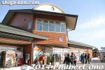
Kohoku Mizudori Station, a local roadside shop/restaurant for tourists traveling by car.
|
|

Kohoku Mizudori Station, a local roadside shop/restaurant for tourists traveling by car.
|
|
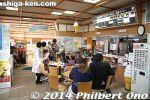
Inside Kohoku Mizudori Station, with a food stand and restaurant.
|
|
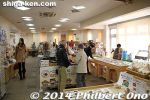
Inside Kohoku Mizudori Station, selling local products and souvenirs.
|
|
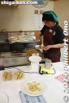
This booth had ko-ayu sweetfish tempura.
|
|
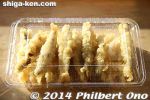
Ko-ayu sweetfish tempura, fresh out of the oil. Yummy!
|
|
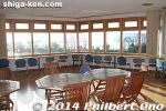
The 2nd floor of the Kohoku Mizudori Station for resting and dining. Also views of the lake and birds.
|
|
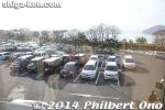
From the 2nd floor of the Kohoku Mizudori Station.
|
|
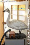
Stuffed tundra swan.
|
|
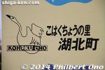
This area is called Kohoku-cho which used to be a separate town before merging with Nagahama.
|
|
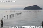
A defunct eri fish trap.
|
|

Some nice lakeside scenery while cycling further north from Kohoku Waterfowl Park.
|
|

Nice cycling path along the shore.
|
|
|
|
|
|
|

Yamamoto-yama mountain
|
|
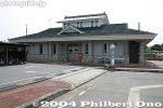
Kawake Station, on the JR Hokuriku Line, is the nearest train station to Odani Castle. There are buses from this station going to Odani Castle, but very few runs. Bicycles are available for rent though inside the station.More info on getting to Odani castle: https://shiga-ken.com/blog/2021/11/odani-castle-shuttle-buses/
|
|
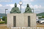
Outside Kawake Station is a statue of Lord Azai Nagamasa and wife Ichi who was Oda Nobunaga's younger sister. They lived in Odani Castle and had three famous daughters: Chacha, Hatsu, and Go.
|
|
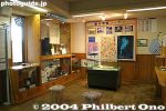
Inside Kawake Station.
|
|
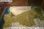
Inside Kawake Station is this model of the Odani area (formerly Kohoku town).
|
|
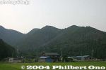
Mt. Odani has a series of peaks and the castle was built along the ridge. Odani Castle is one of Japan's five most famous mountain castles.
|
|
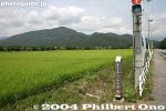
Mt. Odani in the distance. The first time I visited Odani Castle, I walked from Kawake Station. Took about 30 min. (2.4 km).
|
|
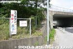
Warning sign for flashers.
|
|
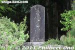
Odani Castle stone marker near the entrance to the paved road going up the mountain.
|
|
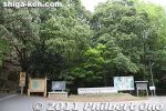
Entrance to the paved road going up the mountain. There's a small parking lot, small park, restrooms, and resthouse here.
|
|
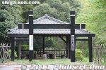
Rest house at foot of Mt. Odani.
|
|

Map and history of Mt. Odani and Odani Castle, a National Historic Site. Odani Castle was built around 1523.
|
|
|
|
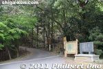
Road going up Mt. Odani. You can walk uphill (taking 30 min.), but easier if you have a car. I don't recommend walking up in the heat (and flying insects) of summer. MAP
|
|
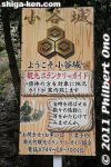
Welcome sign and phone No. for a volunteer tour guide. But even if you call, you have to make reservations and it makes no sense if you're already there.
|
|
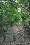
Otemichi path is apparently an alternate way up, but it is closed off to visitors.
|
|
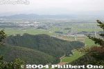
As you go higher up, the views get better.
|
|

Map of Mt. Odani and Odani Castle (National Historic Site). There is a series of castle keeps (maru) along the mountain ridge. Odani Castle was thus a yamajiro or mountain castle.
|
|
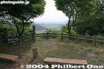
If you're walking up Mt. Odani, this is one of the best scenic viewpoints on Odani. Good place to rest too.
|
|
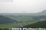
View of Lake Biwa and Chikubushima island.
|
|

View of Lake Biwa and Chikubushima island from Mt. Odani.
|
|
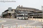
In 2011, the Go and Azai Sisters Expo was held in Nagahama. The west side of Nagahama Station had shuttle buses going to the Odani pavilion. Buy the roundtrip bus ticket at the little office near the bus stop at the train station.
|
|
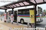
The 1,000 yen ticket includes admission to all three pavilions and roundtrip shuttle bus fare. Best to go the Odani pavilion first, then take another shuttle bus to Odani Castle.
|
|
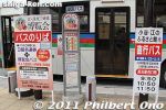
The shuttle bus leaves once or twice an hour from Nagahama Castle. It comes with a bus guide.
|
|
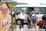
At the Odani pavilion at the foot of Mt. Odani, a shuttle bus with a bus guide is provided for 500 yen roundtrip during 2011. A lot easier than walking up the mountain.
|
|
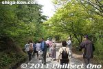
The shuttle bus goes almost halfway up Mt. Odani. We then got off the bus and walked as the tour guide led us. I went on this tour on my second visit to Odani Castle. Lot easier than the first time when I walked all the way from Kawake Station.
|
|
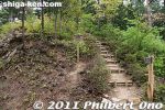
The first thing we saw was this, the Kingo-maru keep, a hill. Named after Asakura Norikage (Soteki) (朝倉 教景) who was stationed here while defending the castle against Rokkaku Takayori (六角高頼) in 1525.
|
|

About the Kingo-maru keep in Japanese.
|
|
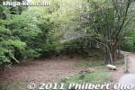
After a short walk was the Bansho guard house site here. 番所
|
|
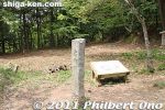
Bansho guard house site at Odani Castle. It was a security gate for castle visitors.
|
|
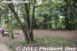
Bansho guard house site
|
|

Illustration of Bansho guard house.
|
|

About the Bansho in Japanese.
|
|
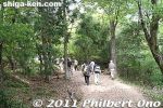
Walking further along the castle tour. The tour guide explained each site in Japanese with a megaphone. The tours were quite popular.
|
|
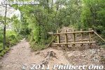
Trail blocked off.
|
|
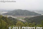
View of Mt. Toragozen (near Torahime Station on the JR Hokuriku Line) where Oda Nobunaga's troops were perched prior to their attack on Odani Castle in 1573.
|
|
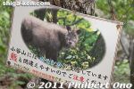
Beware of wild goats (kamoshika) on Mt. Odani.
|
|
|
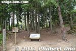
Site of the Ochaya which was right above the Bansho. It was Odani Castle's first castle keep or bailey within the castle's central area. 御茶屋跡
|
|

Illustration of the Ochaya (on the lower left terrace). The area was divided into two by a dirt wall and had an L shape. It was a military outpost and included a small garden. 御茶屋跡
|
|

About the Ochaya in Japanese.
|
|
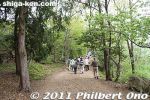
The trail is pretty level most of the way. It's not a strenuous tour.
|
|
|
|

Horse-washing Pond. There were two ponds, this bottom one to wash off the main dirt and another pond behind this one on the upper level for cleaner washing. On the left was the Horse Stable. 馬洗池
|
|

About the Horse Washing Pond and Horse Stable in Japanese.
|
|

Next to the Horse-washing Pond is a large area called the Ouma-ya or Horse Stable. It is not known if there actually was a horse stable here. This was enclosed on three sides by high earthen walls.
|
|
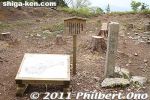
Site of the Ouma-ya Horse Stable. This castle keep was used to defend the castle's Honmaru keep. There was a water well in the center.
|
|

About the Horse Stable in Japanese.
|
|

Illustration of the Ouma-ya Horse Stable (center terrace). You can see the two Horse-washing Ponds at the foot of the stone wall.
|
|
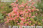
Azaleas blooming around the Horse Stable in May.
|
|
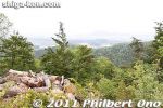
View from the Ouma-ya.
|
|
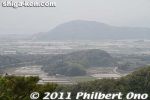
View from the Ouma-ya. That's Yamamoto-yama in the distance.
|
|
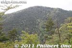
Peak of Mt. Odani as seen from the Ouma-ya.
|
|
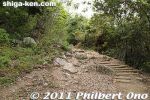
Some steps. Since the trail is not paved, it would get muddy on rainy days.
|
|
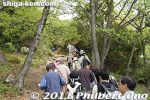
The tour was quite interesting. Our tour guide was a retired local person. It's too bad these tours would last only in 2011. It should be continued.
|
|
|
|
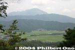
View of Mt. Ibuki from Mt. Odani.
|
|
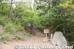
The next point of interest is a little more grisly.
|
|
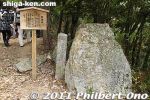
Head Display Stone is where Azai Sukemasa (first lord of Odani Castle) displayed the beheaded head of a traitor (Imai Hidenobu 今井秀信) among his samurai retainers in 1533. 首据石
|
|

About the Head Display Stone in Japanese.
|
|
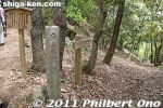
We soon came to the path leading to the Akao Yashiki residence where Azai Nagamasa committed suicide in the face of defeat by Oda Nobunaga in 1573.
|
|
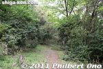
Short path to the Akao Yashiki residence. This was not part of the guided tour so I went here after the tour was over and stayed behind.
|
|

About the Akao Yashiki residence.
|
|
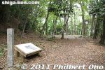
Marker for the Akao Yashiki residence. The Akao family was one of the Azai's important samurai retainers. The proximity of the residence to the Honmaru is indicative of this.
|
|
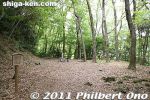
The Akao Yashiki residence was on a terraced area on the mountain slope near the foot of the Honmaru stone wall.
|
|
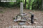
Stone marker indicating the place where Azai Nagamasa committed seppuku on Sept. 1, 1573 at age 29. Under siege by Nobunaga's forces, Nagamasa was unable to get back to the Honmaru and instead entered the Akao residence to cut his belly.
|
|

About the place where Azai Nagamasa committed seppuku and left behind his wife and three daughters who were allowed to escape.
|
|

Illustration of the Akao Yashiki residence.
|
|
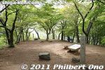
Now here is Sakura-no-Baba or Sakura Horse Grounds. This is one of the main highlights of Odani Castle due to its scenic views.
|
|
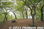
Sakura-no-Baba is where they filmed the scene in the NHK Taiga Drama "Go--Himetachi no Sengoku" when Nagamasa proposed marriage to Ichi.
|
|
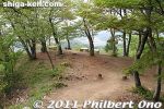
Sakura-no-Baba is between the Oumaya Horse Stable and the Ohiroma Hall.
|
|

About Sakura-no-Baba in Japanese.
|
|
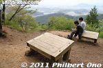
Sakura-no-Baba is also one of the best spots for scenic views atop Mt. Odani. These wooden "benches" are actually explanatory panels which never got completed.
|
|
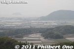
View from Sakura-no-Baba. Yamamoto-yama is on the right.
|
|
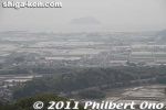
View from Sakura-no-Baba with Lake Biwa and Chikubushima island.
|
|

Illustration of Sakura-no-Baba Horse Grounds, seen on the slender terrace on the right, overlooking the Ouma-ya.
|
|
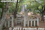
Within the Sakura-no-Baba is this memorial for the Azai clan.
|
|
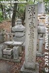
Memorial for the Azai clan in the Sakura-no-Baba. It's not a grave. Azai Nagamasa's grave (along with this father and grandfather's graves) is at Tokushoji temple in central Nagahama (photos at bottom).
|
|
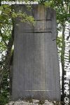
Can't read this.
|
|
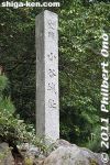
Marker for Odani Castle.
|
|
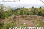
Sakura-no-Baba also overlooks the Ouma-ya Horse Stable.
|
|
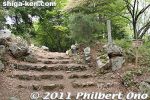
Site of Kurogane-mon Gate that was the entrance to the O-hiroma bailey. They also filmed a scene here for the NHK Taiga Drama, "Go." 黒金門
|
|

About the Kurogane-mon Gate in Japanese.
|
|
|
|
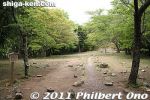
O-hiroma is Odani Castle's largest bailey. The site of a large hall where Azai Nagamasa and Ichi held their wedding. See the illustration. On the far end is the Honmaru.
|
|
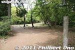
Stone marker for O-hiroma. The enclosure is about 85 meters long and 35 meters wide.
|
|

Illustration of O-hiroma hall that was next to the Honmaru seen on the left.
|
|

About the O-hiroma hall in Japanese.
|
|
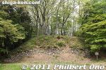
Stone wall of the Honmaru at the far end of the O-hiroma. There are steps on the right to go atop the Honmaru.
|
|
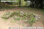
Well in the O-hiroma bailey.
|
|
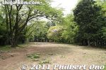
The O-hiroma Hall was said to have had 1,000 tatami mats. As seen from the Honmaru.
|
|
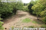
O-hiroma as seen from atop the Honmaru. Lots of rocks, not sure if any of them were foundation stones.
|
|

About the Honmaru.
|
|
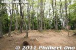
Top of the Honmaru which was the castle's central keep and focal point. Covered with trees now. This is where Azai Nagamasa lived until his defeat and the fall of the castle.
|
|
|

About the Honmaru grounds in Japanese.
|
|
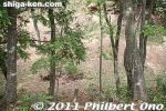
Beyond the top of the Honmaru is a deep ravine. The guided tour ended at the Honmaru, but Odani Castle has other castle keeps beyond, and I left the tour to see them by myself.
|
|
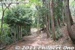
Trail going beyond the Honmaru.
|
|
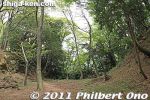
This is the deep moat right beyond the Honmaru which divided the main area of the castle into two sections.
|
|

About the large moat.
|
|

More pictures of Mt. Toragozen taken years earlier.
|
|

Foot of Mt. Toragozen-yama.
|
|

Trail entrance to Toragozen-yama. It actually leads to Yaai Shrine.
|
|

Map of Toragozen-yama.
|
|
|

Yaai Shrine torii on Toragozen-yama.
|
|

Path to Yaai Shrine on Toragozen-yama.
|
|
|
|

Yaai Shrine
|
|

In the old days, Yaai Shrine had rituals where they shot arrows. 矢愛神社
|
|

Statue of a Japanese archer at Yaai Shrine, Toragozen-yama. 矢愛神社
|
|

Statue of a Japanese archer at Yaai Shrine, Toragozen-yama, Torahime, Shiga.
|
|

Yaai Shrine main hall
|
|

About Yaai Shrine 矢愛神社
|
|

Tumulus on Toragozen-yama.
|
|

Tumulus on Toragozen-yama.
|
|
|
|

Trail to camping grounds..
|
|

Kobo Daishi Road
|
|
|
|
|

Trail to camping grounds
|
|

Toragozen-yama Educational Camping facilities on Toragozen-yama.
|
|

Map of camping facilities. Cabins in two wings.
|
|

Lookout tower on Toragozen-yama.
|
|

Lookout deck
|
|

View of Toragozen-yama from the lookout deck.
|
|

View of Torahime from Toragozen-yama.
|
|

Mt. Ibuki and signs
|
|

Camping grounds for tents.
|
|
|

Camping grounds for tents.
|
|

Lookout point
|
|
|
|

View from Toragozen-yama toward Lake Biwa. Hokuriku Line in foreground.
|
|

View of Mt. Toragozen-yama from the Hokuriku Line train. Cherry blossoms on the mountain.
|
|

Toragozen-yama was the site of a battle.
|
|
|
|
|
|
|
|
|