 Image search results - "geopark" Image search results - "geopark" |

Tango Peninsula in northern Kyoto Prefecture is scenic along the coast with a number of natural features and formations.Much of the coast is part of the San'in Kaigan Geopark (山陰海岸ジオパーク) that extends from the western half (Kyotango city) of Tango Peninsula to Tottori Prefecture. San'in Kaigan Geopark is also a UNESCO Global Geopark.
|
|

These photos were taken while cycling along the Tango Peninsula.
|
|

Tango Peninsula coast.
|
|

Tango Matsushima (pine islands).
|
|
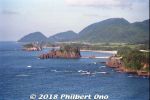
Tango Matsushima (pine islands).
|
|

Byobu Iwa rock.
|
|
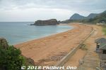
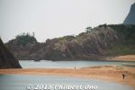
Tateiwa Rock on the Tango Peninsula, northern Kyoto. The swimming beach leading to Tateiwa is named Tateiwa Nochigahama (立岩後ヶ浜海水浴場).
|
|
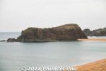
Tateiwa Rock on Tango Peninsula.Map (Tateiwa): https://goo.gl/maps/QDHmG1qArez
|
|
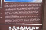
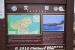
About Tateiwa Rock.
|
|

How Tateiwa Rock formed. This large mass of volcanic rock formed when the magma erupted and accumulated within the earthen strata below the surface. The magma didn't break the surface. However, the surrounding strata was soft and eventually eroded to expose only this hard volcanic rock called Tateiwa (Standing Rock).
|
|
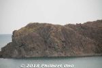
Tateiwa Rock
|
|
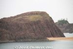
Tateiwa Rock
|
|
|
|
|

San'in Kaigan Geopark (山陰海岸ジオパーク) area.
|
|
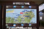
San'in Kaigan Geopark (山陰海岸ジオパーク)
|
|
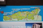
San'in Kaigan Geopark (山陰海岸ジオパーク) from Kyoto to Tottori.
|
|
|
|
|
|
|


