 Image search results - "forest" Image search results - "forest" |

Trail to Hossawa Falls
|
|

Trail to Hossawa Falls is very lush
|
|

Beware of falling rocks
|
|

It's a short trail, but very nature-rich
|
|
|
|

Small river below, fed by the waterfall
|
|

Entrance to the bamboo grove at Takebayashi Park. 竹林公園
|
|

Boundary between Ome city and Hinode-machi town. I was hiking from Mt. Mitake in neighboring Ome.
|
|

Monuments
|
|

Higashikurume's farming homes used to each have a bamboo grove.
|
|
|

However, due to urban development, the bamboo groves were fast disappearing. So from 1974, the city decided to preserve this one bamboo grove.
|
|

Very close to the summit of Hinode-yama. Only one lodge is here.
|
|

A nice short trail goes through the bamboo forest.
|
|

Last flight of steps to the summit.
|
|
|
|
|

Bamboo forest, Higashikurume, Tokyo
|
|

Top of Mt. Hinode-yama
|
|
|

Top of Mt. Hinode-yama
|
|
|

Benches all over for us to gaze at the panorama.
|
|
|

Alpine map pointing the way to various areas
|
|

Kami Josui Park
|
|

In the bamboo forest is one of Tokyo's 57 Famous Natural Springs.
|
|
|

One of Tokyo's 57 Famous Natural Springs 竹林公園・東京の名湧水57選
|
|

Mt. Hinode-yama summit has a little picnic pavilion
|
|

Clear water, but I could not find any spot where the water was gushing out.
|
|

Benches for hikers who had lunch.
|
|

Spectacular views from the top of Mt. Hinode-yama, Tokyo. But I couldn't recognize any landmarks.
|
|

Views from the top of Mt. Hinode-yama, Tokyo
|
|

Views from the top of Mt. Hinode-yama, Tokyo
|
|

Views from the top of Mt. Hinode-yama. The large white building is the Seibu baseball dome in Tokorozawa.
|
|

Surrounding mountains in pastel colors
|
|
|

Trail to go down
|
|

Going down
|
|
|
|
|
|
|
|
|

Lots of steps, glad I was going down instead of up.
|
|
|

Lots of trees.
|
|

Fork in the road. Turned left for the waterfall trail.
|
|

Log bridge
|
|
|

Pine cone
|
|

Okuno village was here.
|
|

Beware of bears...
|
|

Looking up a slope...
|
|
|

Finally a waterfall
|
|

More waterfalls...
|
|

And more...
|
|

Entrance to Ritto Nature Observation Forest. 栗東自然観察の森 MAP
|
|
|
|

Nature Center, also serves as a birdwatching station and nature classroom (mainly for kids).
|
|

This is the famous Shiraiwa Waterfall. 白岩の滝
|
|

Inside Nature Center. Many nature exhibits.
|
|

Shiraiwa Waterfall. 白岩の滝
|
|

Stuffed boar.
|
|
|

Reading room.
|
|

It's actually a series of small waterfalls. Mt. Hinodeyama, Tokyo.
|
|

Display of different rocks.
|
|
|

Nature trail
|
|

Trail to Shiraiwa Waterfalls
|
|

Nature trail
|
|

Trail to Shiraiwa Waterfalls
|
|

Nature trail into bamboo forest.
|
|

Entrance to trail to Shiraiwa Waterfalls and Mt. Hinode-yama
|
|

View of Mt. Mikami from Omi-Fuji Karyoku Koen Park in spring.
|
|

View of Mt. Mikami-yama amid rice paddies in Yasu. Elevation 432 meters.
|
|

View of Mt. Mikami from Karasaki, across Lake Biwa.
|
|
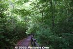
After seeing Ao-Ike blue pond, you can either backtrack and go back to Kyororo Gift Shop or go further and walk through the Japanese beech forest (highly recommended).
|
|
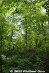
Experience forest bathing in this lush beech forest. Lots of ferns too.
|
|
|
|
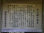
How Juniko Lakes were formed and named.
|
|
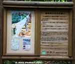
Forest rules: Do not stray away from the trail. Take your trash home, etc.
|
|

Walking trails and roads around Juniko Lakes.
|
|
|
|
|
|
|
|
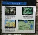
The flora around Juniko Lakes.
|
|
|
|
|
|
|
|
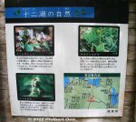
Flowers at Juniko Lakes.
|
|
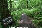
Way to Wakitsubo-no-Ike Pond 沸壺の池(沸壷の池), another blue pond.
|
|
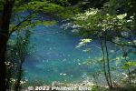
Wakitsubo-no-Ike Pond 沸壺の池(沸壷の池)is another blue pond along the beech forest trail.
|
|
The Music of Water...
|
|

Wakitsubo-no-Ike Pond 沸壺の池(沸壷の池).
|
|
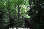
The beech forest trail eventually goes to the main road.
|
|

After passing through a bamboo grove, there is a clearing with the Tempo Gimin Monument.
|
|

At the foot of Mt. Mikami is Tempo Gimin Monument dedicated to the farmers who were tortured to death after the 1842 Tempo Ikki (天保一揆) uprising against the government's unfair land taxation surveys..
|
|

Gate to the Back Mountain Path. Be sure to close the gate after entering. I don't know how it would prevent monkeys from climbing over the low gate. Between Sept. 23 and Nov. 3 during mushroom season, 500 yen admission is charged for the Front/Back pa
|
|

Hiking up the Back Mountain Path. The trail actually goes mainly toward the side of the mountain rather than the back. The back of the mountain has a trail going down toward Kibogaoka Bunka Koen Park.
|
|

Two wooden signs pointed in opposite directions both say "To Mt. Mikami summit." Go right to continue on the easier Back Mountain Path. Or go left to get on the steeper Front Mountain Path. The large white sign says "Take home your trash.&q
|
|

Sacred tree. The bark from this tree is used for the roofing of the shrine. Do not scratch or damage it.
|
|

Steps
|
|

The trail is rocky and rooty, with lots of tree roots.
|
|

Sometimes log steps are provided.
|
|

Halfway point called Uchikoshi 打越. It's a small clearing and crossroads for multiple trails. Also a good place to harvest matsutake mushrooms during the fall (Sept. 23-Nov. 3).
|
|

Sign
|
|

This trail goes around the side of the mountain. Not recommended.
|
|

Trail to summit.
|
|

500 meters until the peak.
|
|

Roots
|
|

Chain railing is helpful.
|
|

Roots
|
|

Steel railing to grab.
|
|

Small torii and shrine.
|
|

No sign for this little shrine.
|
|

Kokegatani Valley. There's a small dip in the trail, going down and up again. This is a small valley near the peak. Visible as a small notch next to the peak. 苔が谷
|
|

Kokegatani
|
|

View from the dip. There should be a better view on the other side too, but too many trees block the view.
|
|

Yuba-no-Futokoro
|
|

The sign is almost totally unreadable.
|
|

Summit in sight.
|
|

Shrine and torii at the summit.
|
|

Shrine and torii at the summit.
|
|

A shrine with a view.
|
|

Gods here must be happy to see such grand views.
|
|

This is almost near the mountain's peak.
|
|

Sacred rock where the god lives.
|
|

Great view, but hazy when I was there. Ishibe is toward the left, and the shinkansen tracks toward the right.
|
|

Sign pointing to a lookout point, slightly below the shrine.
|
|

Going down to the lookout point.
|
|

Lookout point on Mt. Mikami in Yasu.
|
|

View from Mt. Mikami, Yasu. Ishibe is toward the left.
|
|
|

Looking toward Ritto
|
|

View from Mt. Mikami, Yasu.
|
|

On the right, Route 8 can be seen crossing Yasu River.
|
|

Route 8 crossing Yasu River
|
|

The path on the left leads to the mountain's peak.
|
|
|

To the peak.
|
|

Just beyond the tree is the peak.
|
|

Summit of Mt. Mikami. Only a small clearing with a bench. It was a great day for hiking. It is quite a popular mountain for climbers. Even for families with little kids. Didn't see any monkeys. No bears.
|
|

Sign at the summit.
|
|

"Take home your trash"
|
|

Going down from the summit.
|
|
|
|

Log steps
|
|

Large stone walls
|
|

Chain railing
|
|

Chain railing really helps.
|
|

Lots of ferns.
|
|

1.4 km to Karyoku Koen Park
|
|
|

Downward slope and trail. This trail is called the Karyoku Koen-gawa Tozando which starts from the Karyoku Koen flower park. 花緑公園側登山道
|
|

Tree trunk
|
|
|

850 meters to Karyoku Koen flower park.
|
|

Entrance/Exit to Karyoku Koen-gawa Tozando
|
|

Getting close to civilization.
|
|

Beware of snakes (mamushi). Never saw any. Never saw any monkeys either.
|
|
|
|

Prevent forest fires.
|
|
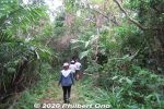
Iriomote has many hiking trails through the tropical forest or jungle. The popular trails usually lead to a waterfall, but we went on a short nature trail in Otomi that didn't lead to anything. 大富林道大正池
|
|
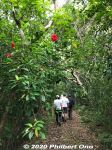
Iriomote's forests are a mishmash of all kinds of flora growing wild everywhere in all directions. It's not like the neat, orderly forests of trees on mainland Japan. 大富林道大正池
|
|
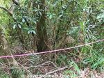
Beehive roped off. (Do not disturb.)
|
|
|
|
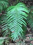
Ferns
|
|
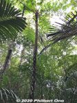
Tree fern, common in Okinawa. The fronds break off. 木生シダ
|
|
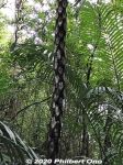
The trunk of a tree fern shows the remains of branches that broke off. 木生シダ
|
|
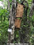
Bird feeder for research purposes.
|
|
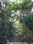
When going on hikes, best to wear long sleeves and long pants so the tree branches, leaves, etc., don't scratch you. Also protection from bugs.
|
|
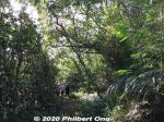
Guided tours are recommended. Local guides know the flora and fauna and the difficult or slightly hazardous sections of hiking trails. Local tour guide: https://www.motti-iriomotejima.com/
|
|
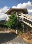
Otomi Lookout Deck 大富展望台
|
|
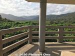
Otomi Lookout Deck 大富展望台
|
|
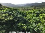
Great views of the greenery from the Otomi Lookout Deck.
|
|
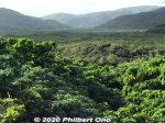
Nakama River is beyond this area.
|
|
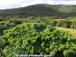
Great views of the greenery from the Otomi Lookout Deck.
|
|
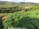
Great views of the greenery from the Otomi Lookout Deck.
|
|
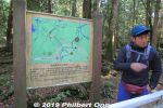
Aokigahara Forest is on the northwestern foot/slope of Mt. Fuji. This forest is also known as "Suicide Forest" since some people have committed suicide in Aokigahara.But apparently not in the part of the forest we hiked in. Our guides assured us that we wouldn't see any bodies...(and we didn't.) This is our English-speaking guide from this company:
https://www.the-highestpeak.com/english
|
|
|
|
|
|
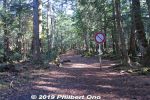
Despite its reputation, Aokigahara Forest didn't look or feel spooky or scary at all. It looked like any other forest in Japan. There are distinct trails and signs to follow. It's possible to get dangerously lost if you stray too far (more than 200 meters) from the trails. The forest has multiple trail entrances, and I was told a few of them have signs trying to discourage suicide.
|
|
|
|
|
|
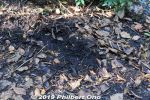
Lots of wildlife here too. Deer, bears, boars, woodpeckers, and squirrels. But we didn't see any, only their foot prints, digs in the ground, chipped tree trunks, etc.
|
|
|
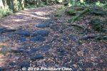
Aokigahara Forest is on a large lava flow of Mt. Fuji, so the ground is solid lava rock.
|
|
|
|
|
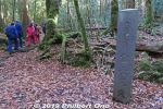
After walking about 15 min., we got to the Fuji Wind Cave (Fuji Fuketsu). This is the stone marker for it. There's no "wind" in the cave. It's just a name. 富士風穴 (ふじふうけつ)
|
|
|
|
|

Fuji Wind Cave first appears to be a big hole in the ground. It's a lava tube. You need a permit to enter. That's why having a licensed guide is good.
|
|
|
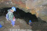
Our guide gave us overalls, a helmet with headlight, and rubber gloves for this excursion. The cave entrance is narrow, steep, and dark. But once inside, you can walk upright most of the way. This lava tube is about 230 meters long, 5 to 10 meters wide, 5 meters high (except for the small entrance). Advance permission is required from the local Board of Education to enter.
|
|

There are many lava tubes around Mt. Fuji. This one is less touristy, and not to be confused with the more touristy ones called Fugaku Wind Cave (富岳風穴) and Narusawa Ice Cave (鳴沢氷穴) near Lake Saiko.
|
|

Remains from a commercial activity.
|
|
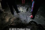
This part of the cave had ice all over the bottom.
|
|
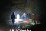
The helmet headlight was essential to see where we walked on craggy rocks and ice. When we all gathered here at the end of the lava tube, our guide told us to turn off our headlights to see how dark it was. Yes, it was pitch black. Our ears then concentrated on the water drops falling from the ceiling. Great place to meditate. The temperature was near freezing, but we had enough clothing. I wanted to ask the guide what would happen if there were a big earthquake while we were inside. But I refrained from doing so because I didn't want to alarm the others...
|
|
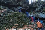
Getting out.
|
|
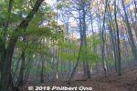
After the lava tube, we hiked further and came to a nice forest of Japanese beech trees nicknamed "Climax Forest." ブナ林
|
|
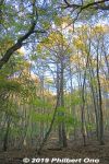
Forest of Japanese beech trees nicknamed "Climax Forest." ブナ林
|
|
|

Forest of Japanese beech trees nicknamed "Climax Forest." ブナ林
|
|
|
|
|
|
|