 Image search results - "canal" Image search results - "canal" |

Water intake for Lake Biwa Canal No. 2. Near Mihogasaki in Otsu, and adjacent to the boat racing arena.
|
|

The cherry blossoms lining Sotobori Moat also look stunning from the road, Sotobori-dori in front of Kagurazaka.
|
|

People in a long line waiting to enter Canal Cafe to either dine or rent a rowboat.
|
|

Canal Cafe is right below the cherries. But notice empty tables despite the long line.
|
|

Empty rowboats too.
|
|
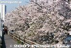
Cherry trees along the Sotobori Moat. Formerly a moat of Edo Castle, this canal stretching from Iidabashi Station to Ichigaya Station along the Chuo Line.
|
|

Tamagawa Josui floodgate. Hamura is noted as the starting point of the Tamagawa Josui Aqueduct built by the Tamagawa farmer brothers in 1653 to supply water to the growing and thirsty city of Edo.
|
|
|

Entry point of Tamagawa Josui Aqueduct straight ahead. This water has been diverted from the Tamagawa River (on the right).
|
|
|

Start of Tamagawa Josui Aqueduct. The Aqueduct was built in 1653, 50 years after Shogun Tokugawa Ieyasu moved to Edo. 玉川上水
|
|

Rowboats and low-hanging cherries.
|
|

Tamagawa Josui Aqueduct entrance.
|
|

The end of the moat is also a good viewpoint.
|
|

Floodgate. The position and length is almost the same as the original one built in the 17th century. Only the materials have been replaced with concrete. Water from the Tamagawa River going to Tamagawa Josui canal/Aqueduct.
|
|

The end of the moat is also a good viewpoint.
|
|
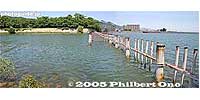
Water intake for Lake Biwa Canal No. 2. The Lake Biwa Canal (Biwako Sosui) supplies water from Lake Biwa in Otsu to Kyoto. After four years of monumental construction, the canal was completed in 1890.
|
|

Tamagawa River is dammed here by Hamura Intake Weir. Some of the diverted water is released back into Tamagawa River on the right.
|
|

How it looks from the end of the moat.
|
|

Tamagawa River
|
|

How it looks from the end of the moat.
|
|

Map of Tamagawa Josui Aqueduct
|
|
|

Park adjacent to Tamagawa Josui Aqueduct
|
|

The moat is parallel to the Chuo Line. View from Shin-Mitsuke Bridge. 新見附橋
|
|

Statue of the Tamagawa brothers who were consigned to build the Tamagawa Josui Aqueduct.
|
|

Sobu Line passes through.
|
|

Sobu Line passes through.
|
|

Statue of the Tamagawa brothers
|
|

Tamagawa Josui canal in Fussa
|
|

Materials and technique used for the Tamagawa Josui floodgate in the Edo Period.
|
|

Chuo Line passes through. 中央線
|
|

Tamagawa Josui Aqueduct required constant repair and maintenance during the Edo Period. It created new jobs for Hamura residents (mostly farmers).
|
|
|

Tamagawa Josui Aqueduct lined with cherry trees. I missed the full bloom period.
|
|

Photographers who love trains and cherries flock here.
|
|

Walking path parallel to Tamagawa Josui Aqueduct. These are all cherry trees.
|
|
|

Water intake for Lake Biwa Canal No. 2
|
|

Cherry trees
|
|

Canal Cafe
|
|

Tamagawa Josui Aqueduct
|
|

Sotobori Park on the other side of the moat. 外濠公園
|
|

Tamagawa Josui Aqueduct goes on for over 40 km to Yotsuya in Tokyo.
|
|

Water intake for Lake Biwa Canal No. 2
|
|

Water intake for Lake Biwa Canal No. 2
|
|

Water intake for Lake Biwa Canal No. 2. The canal is covered. The water supply for Kyoto and Osaka.
|
|

Water intake for Lake Biwa Canal No. 2. This is the second, almost parallel canal constructed in 1912.
|
|

Water intake for Lake Biwa Canal No. 1
|
|

Water intake for Lake Biwa Canal No. 1 at Mihogasaki
|
|

Water intake for Lake Biwa Canal No. 1. Kyoto was thereby revitalized with electric power and a stable water supply. A second, almost parallel canal for drinking water was also constructed in 1912.
|
|
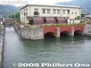
Lake Biwa Canal No. 1
|
|

Lake Biwa Canal No. 1
|
|

Lake Biwa Canal No. 1. The Lake Biwa Canal (Biwako Sosui) supplies water from Lake Biwa in Otsu to Kyoto. After four years of monumental construction, the canal was completed in 1890.
|
|
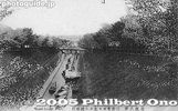
Lake Biwa Canal on vintage postcard. Notice the boats in the canal. Boat rides were initially offered.
|
|

Biwako Sosui. The city of Otsu is thinking about resurrecting a tourist boat service on this canal. MAP
|
|
|
|

The Biwako Sosui or Lake Biwa Canal in Otsu is also noted for cherry blossoms.
|
|
|
|
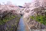
Lake Biwa Canal (Biwako Sosui) and cherry blossoms. This is one of two canals which supply water from Lake Biwa to Kyoto. National Historic Site
|
|

Lake Biwa Canal and cherry blossoms in full bloom. They also light up the trees at night from 6:30 pm-9:30 pm. Beautiful and serene.
|
|
|

Lake Biwa Canal and cherry blossoms.
|
|
|
|

Lake Biwa Canal and cherry blossoms above the tunnel entrance.
|
|

No. 1 Tunnel entrance. The first and longest tunnel under a mountain. The entrance is very artistic.
|
|
|
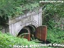
No. 1 Tunnel entrance.
|
|
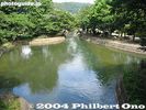
The canal in Kyoto near Yamashina.
|
|
|
|
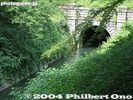
No. 1 Tunnel exit
|
|
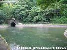
Yamashina
|
|
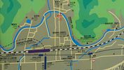
Yamashina map showing the exposed portion of the Lake Biwa Canal near JR Yamashina Station in Kyoto.
|
|

Yamashina
|
|
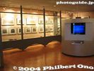
Lake Biwa Canal Museum in KyotoAt the end of the canal, there's this museum in Kyoto tracing the history of the canal.
|
|
|
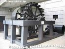
Pelton water wheel at Lake Biwa Canal MuseumUsed at the Keage Power Plant to generate electricity. The Keage Plant was Japan's first hydroelectric power plant.
|
|
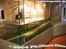
Lake Biwa Canal MuseumModel of Keage Incline.
|
|

Bottom of Keage Incline in Kyoto
|
|
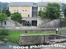
Lake Biwa Canal Museum at bottom of Keage InclineThe museum opened in 1996.
|
|

Map of canal route
|
|

Bottom of Keage InclineThe Keage Incline was a dry slope which connected the upper part of the canal with the lower part of the canal. Since the canal was disconnected by this dry slope, boat trolleys on rails ferried boats between the upper and lower sections of the canal. It was in operation until 1948.
|
|

Keage InclineThe Keage Incline was a dry slope which connected the upper part of the canal with the lower part of the canal. Since the canal was disconnected by this dry slope, boat trolleys on rails ferried boats between the upper and lower sections of the canal. It was in operation until 1948.
|
|
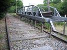
Keage Incline boat trolleyThe Keage Incline was a dry slope which connected the upper part of the canal with the lower part of the canal. Since the canal was disconnected by this dry slope, boat trolleys on rails ferried boats between the upper and lower sections of the canal. It was in operation until 1948.
|
|
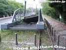
Keage Incline boat trolley
|
|

Keage Incline boat trolleyThe Keage Incline was once restored in 1977. However, the sample boats are in poor condition.
|
|
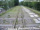
Keage Incline
|
|

Statue of Sakuro Tanabe, the canal engineerIn the park near top of Keage Incline. The canal is lined with various monuments and writings, especially on the canal tunnel entrances.
|
|
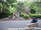
Park near top of Keage Incline
|
|

Keage Hydroelectric Power Plant pipes
|
|
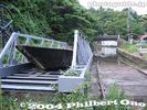
Top of Keage InclineThe boat would be loaded onto the trolley here, then taken down the incline. Or vice versa.
|
|

Top of Keage InclineThe boat would be loaded onto the trolley here, then taken down the incline. Or vice versa.
|
|

Grand Canal and Ponte di Rialto bridgeThis is the main bridge crossing the Grand Canal. The middle of the bridge has a row of shops.
|
|
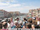
Atop Ponte di Rialto bridgeThis is one of three bridges crossing the Grand Canal.
|
|
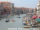
View from Ponte di Rialto bridge
|
|
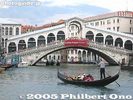
Ponte di Rialto bridge and gondola
|
|
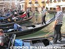
Gondola stationA gondola ride is not exactly cheap, but affordable with 5 or 6 people.
|
|

Gondola
|
|
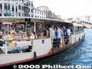
Common boatThis is one of the most common means of public transportation in Venice. Many of the canals have heavy boat traffic.
|
|
Boat crew
|
|

Boat captain
|
|

Otaru Canal is a short walk from Otaru Station.
|
|

Otaru Canal has a large walkway alongside.
|
|
|

Some artists show their work here.
|
|

Otaru Canal
|
|

Otaru Unga. "Unga" means canal.
|
|
|

Murals showing some history of Otaru's marine transportation.
|
|
|

Otaru Canal
|
|

East end of Otaru Canal
|
|

East end of Otaru Canal
|
|

Warehouse along the Otaru Canal
|
|

Restaurant near Otaru Canal.
|
|
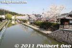
Hachiman-bori is quite long and it even connects to Lake Biwa. The main part of moat is about 1 km long. I started walking here on the west end near the Omi-Hachiman Public Library. MAP
|
|
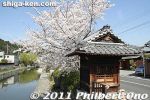
Hachiman-bori is also part of the National Important Traditional Townscape Preservation District (重要伝統的建造物群保存地区).
|
|
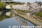
If the cherry blossoms are in bloom, I recommend walking along the canal from the west end since the sun will be on your back and on the flowers.
|
|
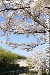
The cherry trees start from near the Omi-Hachiman Public Library. They continue all the way to the main torii of Himure Hachimangu Shrine.
|
|

Also during sakura season, the yakata-bune boats offer moat rides for 1,000 yen for adults. Boats leave from near The Kawara Roof Tile Museum on the east end of the moat.
|
|
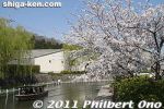
I was in Omi-Hachiman to see the Hachiman Matsuri fire festival on April 14. I was lucky to find the cherries in full bloom at Hachiman-bori moat on a sunny day.
|
|

Perfect day to shoot cherry blossoms.
|
|
|
|
|
|
|
|
|
|
|
|
|
|
|
|
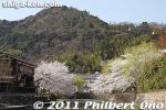
Mt. Hachiman-yama is in the background. An aerial tramway goes up the mountain which was the site of Hachiman Castle.
|
|
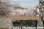
A few bridges also cross the moat. This is Meijibashi Bridge. 明治橋
|
|
|
|
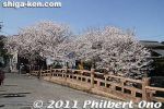
Bridge in Osugi-cho. 大杉町
|
|
|
|
|
|
|
|
|
|
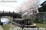
Yakata-bune tourist boat cruising through Hachiman-bori moat in Omi-Hachiman.
|
|
|
|
|
|
|
|
|
|
|
|
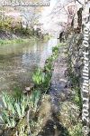
You can easily walk along the entire moat except for this section which is a little flooded. My waterproof shoes came in handy.
|
|
|
|
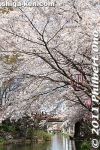
Hachiman-bori's highest concentration of cherry blossoms is near Hakuunbashi Bridge.
|
|
|
|
|
|
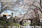
This bridge leads to Himure Hachimangu Shrine (to the left). This is the heart of Hachiman-bori moat.
|
|
|
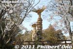
Near Hakuunbashi Bridge, you can see two of the giant torches to be lit for the Hachiman Matsuri fire festval later in the evening.
|
|
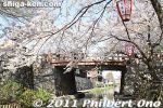
Being the heart of Hachiman-bori, Hakuunbashi Bridge is where the sakura is concentrated the most. 白雲橋
|
|
|
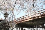
Hakuunbashi Bridge and stone lantern. 白雲橋
|
|
|
|
|

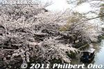
View from Hakuunbashi Bridge. 白雲橋
|
|
View from Hakuunbashi Bridge. 白雲橋
|
|
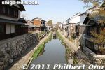
Beyond Hakuunbashi Bridge, the moat goes to Kawara Roof Tile Museum and the moat boat dock. The cherry trees also stop, but there a few more on the far end of the most.
|
|
|
|
|
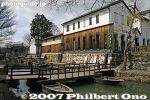
Unique, but controversial, bridge supported by two boats underneath.
|
|
|
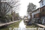
Near the Kawara Roof Tile Museum is this dock where you board the moat boat. Fare is 1,000 yen for adults.
|
|
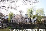
Kawara Roof Tile Museum
|
|
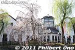
Kawara Roof Tile Museum in spring.
|
|
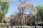
Kawara Roof Tile Museum's weeping cherry tree.
|
|
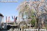
Kawara Roof Tile Museum's koinobori carp streamers and weeping cherry tree.
|
|
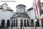
Kawara Roof Tile Museum
|
|
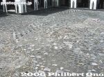
Kawara Roof Tile Museum's ground is covered with roof tiles, looking like cobblestones.
|
|
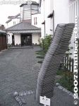
Outdoor sculpture at Kawara Roof Tile Museum, Omi-Hachiman, Shiga
|
|
|
|
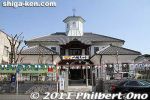
Formerly a primary school built in 1877, Haku'unkan is now a tourist info office, souvenir shop, and exhibition space (2nd floor). 白雲館
|
|
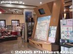
Inside 1st floor of Haku'unkan. The building was beautifully restored in 1994.
|
|

2nd floor exhibition space of Haku'unkan.
|
|
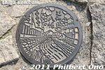
Omi-Hachiman's manhole depicts Hachiman-bori moat adorned with cherry blossoms. Shiga Prefecture.
|
|
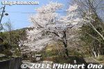
Another sakura spot is Hachiman Park next to Omi-Hachiman Pubic Library on the west end of the moat. 八幡公園
|
|
|
|
|
|
|
|
|
|
|
|
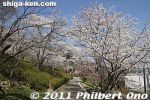
Hachiman Park cherry blossoms.
|
|
|
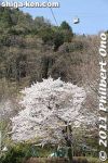
Hachiman Park is at the foot of Mt. Hachiman-yama.
|
|
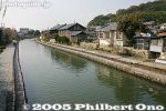
Hachiman-bori goes all the way to Lake Biwa. This is toward the west end of the moat.
|
|

Keage Incline postcardThe Keage Incline was in operation until 1948.
|
|
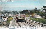
Keage Incline postcardThe Keage Incline was in operation until 1948.
|
|
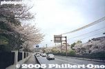
Keage today, incline is on the right of road
|
|
|
|
|
|
|

Site of Ogaki Castle's Takebashi-guchi Gate
|
|
|
|
|
|
|
|

The building in the background is the Oku no Hosomichi Musubi no chi Memorial Hall.
|
|
|
|
|

Tarai-bune wooden tub boats and cherry blossoms.
|
|

End of the boat ride.
|
|
|
|
|
|
|

Inside Oku no Hosomichi Musubi no chi Memorial Hall. Many exhibits about Basho and haiku.
|
|
|

Model of what Ogaki Castle looked like.
|
|
|

Road marker indicating the way to Edo (right) and Kyoto (left).
|
|
|
|
|
|
|
|

Boat landing
|
|

End of the road/journey for Basho's Okuno Hosomichi.
|
|

Statue of Matsuo Basho who ended his Okuno hosomichi journey in Ogaki.
|
|

Historical marker for Oku no Hosomichi.
|
|
|
|
|
|
|
|
|
|
|
|
|

Ogaki manhole, Gifu Pref.
|
|
|
|
|
|
|
|
|