 Image search results - "Towers" Image search results - "Towers" |
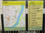
Directions at Ichikawa Station.
|
|
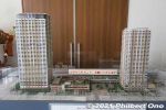
Scale model of the skyscraper buildings next to JR Ichikawa Station. On the left is The Towers West building and on the right is The Towers East. The West building has a nice lookout deck on the 45th floor.
|
|
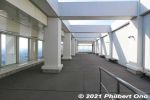
The 45th floor of The Towers West building is named "I-Link Town Observatory." It's a panoramic lookout deck on all four sides of the building. Free admission. This is open-air. If it's raining, there's also an indoor lookout deck
|
|
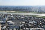
View from I-Link Town Observatory, looking west toward Edogawa River. This deck is open 9 am to 10 pm. Closed on the first Monday of the month and during Dec. 29 to Jan. 3.
|
|
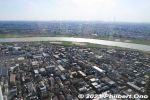
Looking west toward Edogawa River. On clear days, Mt. Fuji can also be seen.
|
|
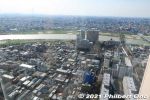
Looking west toward Edogawa River. The JR Sobu Line can be seen.
|
|

Looking west toward Edogawa River. The JR Sobu Line (left) and Keisei Line (extreme right) over Edogawa River can be seen. The bridge in the middle is Route 14.
|
|

Looking further upstream on Edogawa River. Left of the river is Edogawa (Koiwa) and Katsushika (Shibamata) Wards.
|
|
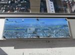
Guide to visible landmarks.
|
|

Looking north.
|
|
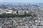
"Temple" marks the location of Guhoji Temple, famous for a 400-year-old weeping cherry blossom tree. See this album.
|
|
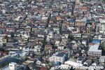
High-density housing.
|
|
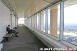
Another side of the lookout deck.
|
|

Looking east toward Chiba. The tall building in the foreground is The Towers East. The JR Sobu Line tracks can be seen on the left.
|
|
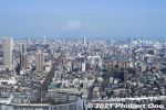
Looking east toward Chiba. The JR Sobu Line tracks can be seen on the left going to Moto-Yawata Station.
|
|
|
|
|