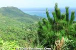
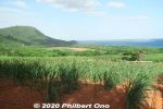
 Image search results - "Nosokodake" Image search results - "Nosokodake" |

Mt. Nosokodake (野底岳), Ishigaki’s second highest mountain at 282 m. Can be climbed up a steep, narrow trail in about 15 min. We didn't climb it though.
|
|
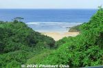
On the way to Mt. Nosoko, spotted a nice beach.
|
|
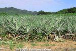
Some pineapple on Ishigaki. No fruit in autumn though.
|
|
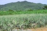
Some pineapple on Ishigaki.
|
|

Entering Iriomote-Ishigaki National Park. Nosokodake is part of the national park.
|
|

Nosokodake Lookout Point in northern Ishigaki. Under the roof is a side view of Mt. Nosokodake. 野底岳展望台
|
|
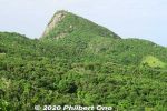
Side view of Mt. Nosokodake. This mountain is associated with a famous local folk tale about a girl named Maape. The mountain is nicknamed after her, "Nosoko Maape" (野底マーペー).On the nearby island of Kuroshima (黒島) in the 18th century, Maape and her childhood sweetheart, Kanimui, were happily living as farmers. They were to be married someday.
However, one day, a Ryukyu government decree ordered half the island's residents to move here near Nosokodake on Ishigaki while the other half could remain on Kuroshima. The island's population was split along the island's main road. Maape and Kanimui lived on the opposite sides of the road, and Maape was on the side where people had to move to Ishigaki.
|
|
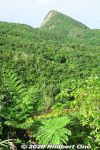
So she and her family were forced to move here to Nosokodake to start a new farming village and clear the thick jungle for farming. It was a hard life. Maape desperately missed her beloved Kanimui and couldn't forget him.
One day, she wanted to at least see Kuroshima where he lived, so she climbed up Mt. Nosokodake. At the top, she looked for Kuroshima, but her view of the island was blocked by Mt. Omotodake, Ishigaki's highest mountain. She collapsed on her knees and wailed in sorrow. Later, a worried villager looked for Maape who never returned home. On the top of the mountain, he found a crying rock gazing in the direction of Kuroshima. Maape had turned into stone.
|
|
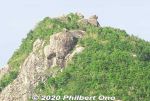
Even today, people who climb the mountain look for the Maape rock and assume this or that rock is her.This story is based on historical fact. The Ryukyu government sometimes forced people to migrate to undeveloped lands to start farming to increase agricultural production so they could pay more taxes. The kingdom was being heavily taxed by the Satsuma Domain in Kagoshima, and taxes had to paid in rice per head.
Read more about the folk tale here: https://photoguide.jp/log/2020/12/yaeyama-folk-songs-nosokodake-maape/
|
|

View from Nosokodake Lookout Point in northern Ishigaki.
|
|
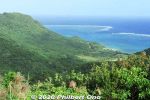
View from Nosokodake Lookout Point in northern Ishigaki.
|
|
|
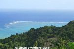
View of coral reefs from Nosokodake Lookout Point in northern Ishigaki.
|
|

View of coral reef from Nosokodake Lookout Point in northern Ishigaki.
|
|
|
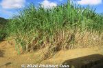
Lots of sugar cane in Yaeyama.
|
|

Stargazing at Nosokodake Lookout Point. Photo by National Astronomical Observatory of Japan.
|
|

Stargazing at Nosokodake Lookout Point. Photo by National Astronomical Observatory of Japan.
|
|

Stargazing near Nosokodake. Photo by National Astronomical Observatory of Japan.
|
|
|
|
|


