 Image search results - "Nakasendo" Image search results - "Nakasendo" |

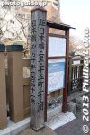
Road marker. Established in 1642, Moriyama-juku was the sixty-seventh of the sixty-nine stations or shukuba post towns on the Nakasendo Road. It is the eighth Nakasendo station in Shiga (following Musa-juku in Omi-Hachiman).
|
|
Toriimoto-juku is the sixty-third of the sixty-nine stations or shukuba post towns on the Nakasendo Road. It is the fourth Nakasendo station in Shiga (following Bamba-juku in Maibara), and one of ten Nakasendo stations in Shiga.
|
|

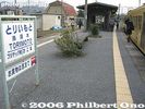
Road marker. Go right for the Nakasendo Road. MAP
|
|
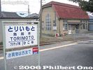
Although the Honjin is long gone, there are a few reminders of its shukuba past. Near Ohmi Railways Toriimoto Station. Map
|
|

Rear of road marker
|
|
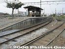
Ohmi Railways Toriimoto Station platform
|
|

Marker for the Kabuto-ya inn
|
|

Ohmi Railways Toriimoto Station building
|
|

Old Nakasendo Road and Dobashi Bridge. Supposedly, this is the bridge from where Hiroshige drew his print of Moriyama-juku.
|
|

Ohmi Railways Toriimoto Station building
|
|

Dobashi Bridge
|
|
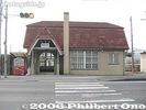
Toriimoto Station building built in 1931 when the station opened and still in use.
|
|

Tomon-in temple built by Buddhist Priest Saicho (Dengyo Daishi) to protect his Enryakuji temple on Mt. Hiei from demons from the east. 東門院
|
|

Toriimoto-juku is the sixty-third of the sixty-nine stations or shukuba post towns on the Nakasendo Road. It is the fourth Nakasendo station in Shiga (following Bamba-juku in Maibara), and one of ten Nakasendo stations in Shiga.
|
|

Kaeru frog to wish you a safe return. 東門院
|
|
|

樹下神社
|
|

Site of Honjin Lodge
|
|

Musa-juku was the sixty-sixth of the sixty-nine stations or shukuba post towns on the Nakasendo Road. It is the seventh Nakasendo station in Shiga (following Echigawa-juku in Aisho). MAPMusa was one of ten Nakasendo stations in Shiga. There is very little left. Near Ohmi Railways Musa Station, a short ride from Omi-Hachiman.
|
|
|
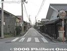
Nakasendo Road
|
|
|
|

Stone for safe childbirth
|
|
|
|

Tenmangu Shrine
|
|
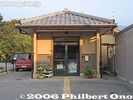
Police station
|
|

Tenmangu Shrine
|
|
|
|
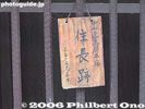
Plaque
|
|
|
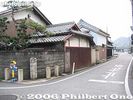
Road marker
|
|
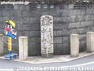
Road marker: Go left for the Nakasendo Road or right for the Hikone Road.
|
|
|
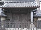
Yakuimon Gate at the Arikawa machiya home. Emperor Meiji rested at the Arikawa home. A family still lives in this home. 有川家住宅 薬医門
|
|
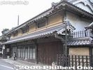
Main building of the Arikawa home, Toriimoto's most distinguished-looking building. This main building was built in 1759. The Arikawa family were a drug manufacturer. The home was designated as an Important Cultural Property in 2012.
|
|
|
|

Hatago inn called Nakamura-ya, this was the only remaining inn in Musa-juku. Unfortunately, this inn was destroyed by an early morning fire on Dec. 10, 2010. No one was hurt. The inn owners were sleeping on the 1st floor and they escaped.
|
|

Inn sign. The 200-year-old Nakamura-ya inn burned down on Dec. 10, 2010.
|
|

Musa-juku 武佐宿
|
|
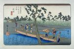
Hiroshige's woodblock print of Musa-juku (67th post town on the Nakasendo) from his Kisokaido series. A bridge of boats.
|
|

Bamba-juku (Banba-juku) does not have any train stations within walking distance. The closest is Maibara and Samegai Stations. Buses and taxi available. From Samegai, go on Route 21 until you reach this intersection (3 km from Bamba) where you turn left.
|
|

You will soon see this Hokuriku Highway overpass. Go under it.
|
|

Then you'll see a fork in the road. Take the smaller right road which is the former Nakasendo Road.
|
|

The island in the middle has a Bamba-juku monument.
|
|

Bamba-juku monument marking the location of the Kure Ichirizuka milestone. 久禮の一里塚 MAP
|
|

Old Nakasendo Road to Bamba-juku, the sixty-second station or post town (shukuba) of the sixty-nine stations on the Nakasendo Road.
|
|

Bamba-juku is the third Nakasendo station in Shiga, following Samegai-juku which is also in Maibara.
|
|

Finally a small sign on the left declaring "Nakasendo Bamba-no-juku."
|
|

Marker for site of a Toiya-ba which was a travel logistics office where you can get pack horses, forward your baggage, and find a place to stay in Bamba. 問屋場
|
|

Bamba today is a quiet, rural settlement. It is divided into east Bamba and west Bamba.
|
|

Another welcome sign in Bamba-juku.
|
|

Welcome sign in Nakasendo Bamba-juku. (The orange object is a mailbox.)
|
|

Site of another Toiya-ba.
|
|

Intersection with a Bamba-juku stone monument. A good place to rest and eat your box lunch.
|
|

Bamba-juku stone monument.
|
|

Next to the Bamba-juku stone monument is an old map of Bamba-juku.
|
|

Stone marker with a finger pointing the way to Maibara Port where you can board a boat to go to Otsu via Lake Biwa. This is at the same intersection across from the Bamba-juku stone monument.
|
|

Site of the Waki-Honjin on the right. Now a modern house. The Waki Honjin was the town's second-best lodge. 脇本陣跡
|
|

Close-up of stone marker for the Waki-Honjin. There are no original buildings left in Bamba-juku related to the post town, except for Rengeji temple.
|
|

Site of the Honjin, the town's most exclusive inn for daimyo lords and other VIPs. This is not the original building. Just a private house. Near the Waki Honjin. 本陣跡
|
|

Going further down the road in Bamba.
|
|

Place where Emperor Meiji took a break. It was the site of another Toiya-ba.
|
|

Marker indicating that Emperor Meiji took a break here once.
|
|

On the left of the road is the path to Rengeji temple.
|
|

Path to Rengeji temple.
|
|

Smack dab in front of Rengeji temple is this monstrosity that is the Meishin Expressway.
|
|

Right after passing under the Meishin Expressway, you see Rengeji's Sanmon Gate. 蓮華寺 山門
|
|

Rengeji is famous as the place where Hojo Nakatoki 北条仲時 and over 430 of his men committed suicide after being defeated by Ashikaga Takauji's forces during the fall of the Kamakura shogunate in 1333. This is a monument for this tragic event.
|
|

On the left of the Sanmon Gate is the "River of Blood." When Hojo Nakatoki and 430 of his men slit themselves on May 9, 1333, the blood became a river flowing here. It was during the Genko War when the Emperor Go-Daigo fought the Kamakura shogun
|
|

"River of Blood" sign. In charge of national security, Hojo Nakatoki was the last Rokuhara Tandai Kitakata chief from the Hojo clan in the Kamakura shogunate. When tourists see this sign, they become scared to enter the temple.
|
|

Rest assured, it's very peaceful in the temple. Rengeji's Sanmon Gate (right) and bell tower on left.
|
|

Wooden insignia on Sanmon Gate with the Imperial crest on the left. The temple was originally founded by Prince Shotoku Taishi about 1,300 years ago. He named it Horyuji 法隆寺. After being struck by lightning, it was rebuilt in 1284.
|
|

Rengeji temple belongs to the Jodo-shu Buddhist sect. The founding priest was Saint Ikko. With support from the lord of Kamaha Castle near Bamba, he was able to rebuild the temple and renamed it Rengeji. 一向上人
|
|

Rengeji Hondo Hall, Banba-juku, Maibara, Shiga. Quite a few emperors favored this temple. The 95th Emperor Hanazono (1297-1348) gave the temple an Imperial sanction to receive Imperial prayers. Hence, the temple's Imperial crest. 蓮華寺
|
|

Until 1943, the temple was a dojo for the Jishu Ikko sect. It then converted to Jodo-shu. Admission is charged, I think 300 yen. There's a unmanned collection box near the entrance.
|
|

Red plum blossoms in front of Rengeji Hondo Hall, in early April.
|
|

Inside Rengeji Hondo Hall, left altar.
|
|

Inside Rengeji Hondo Hall, main altar at the center. There are two figures: Amida Nyorai and Shaka Nyorai. Jodo-shu Buddhist sect. 蓮華寺 本堂
|
|

Inside Rengeji Hondo Hall, main altar at the center. 蓮華寺 本堂
|
|

Inside Rengeji Hondo Hall, right altar.
|
|

Rengeji Hondo Hall's framed nameplate. The temple's name was written by Emperor Go-Mizunoo (1596–1680).
|
|

This is the area where Hojo Nakatoki and his men committed seppuku.
|
|
|

Bell tower. Cast during the time of Saint Ikko, the bell is an Important Cultural Property.
|
|

Inside is a Jizo-son statue worshipped for transportation safety.
|
|
|

Memorial for victims of the Pacific War.
|
|

Monument for a poem by Saito Mokichi (1882-1953). 斉藤茂吉の歌碑 「松風の音を聞くときは 古への 聖の如く 我は寂しむ」
|
|

Grave of the lord of Kamaha Castle who helped to rebuild the Rengeji temple.
|
|

Way to the graves of Hojo Nakatoki and his men who committed suicide.
|
|

A few steps up a slope.
|
|

Memorial for Hojo Nakatoki and his men. They had lost to Ashikaga Takauji in the battle at Kyoto and were trying to escape to Kamakura, but was caught by Takauji's forces at Bamba.
|
|

Over 430 gravestones. Hojo Nakatoki and his men were besieged in Bamba by Southern Imperial Court forces. They fought back, but lost and slit their bellies in front of Rengeji's Hondo main hall.
|
|

The temple's third priest wrote the names and age (youngest was 14) of the known fallen warriors in a scroll. He also made these gravestones for them. Visuallly, it's very impressive edifice.
|
|

Graves of Hojo Nakatoki and his men from the Rokuhara Tandai. 北条仲時一行の墓
|
|

The gravestones have five levels. In fall, the surrounding maple leaves turn blood red.
|
|

There are more steps which lead to graves of temple priests and Saint Ikko's mausoleum.
|
|

Graves of previous temple priests.
|
|

Mausoleum of Saint Ikko Shunsho.
|
|

Small mausoleum for Saint Ikko. 一向上人の御廟
|
|

Side of the Hondo
|
|

Behind the Hondo hall is a small hill with the Bamba Chutaro Jizo-son statue.
|
|
|

Bamba Chutaro Jizo-son statue, based on a character in the novel "Mabuta-no-Haha" 瞼の母 by Hasegawa Shin (1884-1963) 長谷川伸. 番場忠太郎
|
|

View behind the Hondo.
|
|

Also behind the Hondo is this Ikko-sugi tree, 700 years old. Named after the temple's founding priest Saint Ikko, it was planted where Ikko was cremated. Over 30 meters high and 5 meters wide. 一向杉
|
|

Temple garden. Best during spring when the flowers bloom.
|
|

View from Hondo hall.
|
|

From Rengeji temple, a short distance away on the Nakasendo Road is this path to Naotaka Shrine.
|
|

Naotaka Shrine, dedicated to Lord Ii Naotaka, the third lord of Hikone Castle. 直孝神社
|
|

Naotaka Shrine torii
|
|

There's no explanation about the shrine.
|
|

Naotaka Shrine
|
|

The shrine has no human staff, but a security camera operates.
|
|

Naotaka Shrine Honden Hall
|
|
|
|
|

Turn left to hike to Kamaha Castle ruins. 鎌刃城
|
|

Map of Kamaha Castle. 鎌刃城
|
|

Path to Kamaha Castle, a mountaintop castle in the distance. Only stone walls remain. 鎌刃城
|
|

Kitano Shrine
|
|

Bamba-juku monument
|
|

A stone found in a river bank. Since it has a hole, it is thought to be a foundation stone for a building's pillar.
|
|
|
|

Echigawa-juku was the sixty-sixth station or post town (shukuba) of the sixty-nine stations on the Nakasendo Road. It is the sixth Nakasendo station in Shiga (following Takamiya-juku in Hikone), and one of ten Nakasendo stations in Shiga.In front of Echigawa Station, a sign point the way to Echigawa-juku (go right).
|
|

Entrance to Echigawa-juku at the northern end. Echigawa-juku was the sixty-sixth station or post town (shukuba) of the sixty-nine stations on the Nakasendo Road. Map
|
|

This is a high-class ryotei restaurant called Omi Shonin-tei (近江商人亭). Built in the 1920s, it used to be an Omi Merchant's second home who sold hemp cloth.This is also one location where the film Idai Naru, Shurararabon (偉大なる、しゅららぼん The Great Shu Ra Ra Boom) was filmed. The Natsume family's dojo scene.
|
|

Nakasendo in Echigawa-juku
|
|

Large intersection has an Echigawa-juku monument.
|
|

The street corner has a pocket park for an Echigawa-juku monument showing an ukiyoe print of the town. A stone marker also points the way to Takamiya-juku.
|
|

The ukiyoe print by Hiroshige shows a bridge across Echigawa River. It was toll-free (Muchin-bashi).
|
|

Meiji Period-style mail box. It's a real mail box so you can deposit your mail here.
|
|

Pocket park in Echigawa-juku.
|
|

Heading south on the Nakasendo in Echigawa-juku.
|
|

Traditional-style building
|
|

Marker indicating that St. Shinran, founder of the Jodo Shinshu Buddhist Sect, once stayed at this temple.
|
|

Way to Homanji temple where St. Shinran once stayed.
|
|

Gate to Homanji temple.
|
|

Homanji temple Hondo hall in Echigawa-juku, Shiga. 宝満寺
|
|

Statue of St. Shinran (1173-1263) in front of the plum tree which he planted. The temple also has a scroll written by Shinran.
|
|

While traveling, St. Shinran was unable to cross the Echigawa River since there was a flood. So he stayed at this temple temporarily. During that time, he planted a plum tree which bloom red plum blossoms.
|
|

St. Shinran statue and plum tree.
|
|

The plum tree blooms in March.
|
|
|
|

Homanji Hondo
|
|

Inside Homanji Hondo main hall in Echigawa-juku, Shiga Prefecture
|
|

View from Hondo hall.
|
|

Some modern buildings along the Nakasendo in Echigawa-juku
|
|

Looks like a former bank building.
|
|

Hachiman Jinja Shrine in Echigawa-juku, Shiga
|
|

Way to Hachiman Shrine.
|
|

Hachiman Jinja Shrine, Echigawa-juku
|
|

The shrine has ties to Prince Shotoku Taishi who hid here from an enemy during a war. In appreciation, he donated rice paddies to the shrine.
|
|

Hachiman Jinja Shrine Honden main hall is a Shiga Prefecture Cultural Property.
|
|

Shops along the Nakasendo
|
|

Manhole in Echigawa-juku, Shiga, with a temari (thread ball) design.
|
|

Another famous building remaining in Echigawa-juku. This is the Takeheiro restaurant where Emperor Meiji once stayed.
|
|

Entrance to Takeheiro. It's not open to the public unless you want to dine there. 竹平楼
|
|

Stone monument at Takeheiro indicating that Emperor Meiji was here.
|
|

Takeheiro on the left, along the Nakasendo Road in Echigawa-juku, Shiga.
|
|

Toward the south end of Echigawa-juku. Bridge has a temari decoration.
|
|

Temari decoration on bridge.
|
|

South end gate of Echigawa-juku.
|
|

Imasu-juku was the fifty-ninth of the sixty-nine stations or shukuba post towns of the Nakasendo Road. It follows Sekigahara-juku and comes before Kashiwabara-juku in Shiga Pref. Hiroshige woodblock print of Imasu.
|
|

The tall tree on a hill indicates the site of Imasu-juku's Ichirizuka or milestone. 今須宿の一里塚
|
|

Imasu-juku's Ichirizuka or milestone. Today, Imasu is a small, sleepy cluster of houses. It has no train station, but you could walk it from Kashiwabara Station. 今須宿の一里塚
|
|

Imasu-juku's Ichirizuka or milestone on the west end of Imasu. 今須宿の一里塚
|
|

Site of Imasu-juku's Honjin lodge.
|
|

Site of Imasu-juku's Honjin lodge. 今須宿本陣跡
|
|

Site of Imasu-juku's Honjin lodge. 今須宿本陣跡
|
|

Site of Imasu-juku's Honjin lodge. 今須宿本陣跡
|
|

Entrance to Imasu Elementary and Junior High School. This was the site of the two Waki-Honjin lodges. 今須小中学校
|
|

Imasu-juku's most notable shukuba-era building called the Toiyaba. It is the only Toiyaba still existing among the 16 post towns in Mino (Gifu). 今須宿問屋場
|
|

The Toiyaba was like the town's logistics management office where they arranged lodging, horses, document deliveries, etc., for officials and travelers. Today, this building is a private residence. 今須宿問屋場
|
|

Imasu-juku's Toiyaba. 今須宿問屋場
|
|

Imasu-juku's Toiyaba. 今須宿問屋場
|
|

Path to Myooji temple. 妙応寺
|
|
|
|
|
|

Imasu Post Office
|
|

Shinshuji temple 真宗寺
|
|

Imasu-juku on the Nakasendo
|
|

Hydrangea along the river in Imasu.
|
|

Imasu-juku on the Nakasendo
|
|

Hachiman Jinja Shrine in Imasu.
|
|

Imasu-juku has many stone lanterns.
|
|

Imasu-juku's most famous stone lantern is this Eitai Joyato or Eternal Lantern which lit the road at night for travelers. 永代常夜灯
|
|

Marker indicating the west entrance of Imasu-juku.
|
|

Itabashi-shuku (or Itabashi-juku) was the first post town on the Nakasendo Road from Nihonbashi to Kyoto. It was where travelers lodged and arranged travel logistics. Today, Itabashi-juku is totally modern, basically a shopping and residential area.Ukiyoe print of Itabashi-juku by Eisen.
|
|
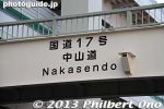
But I was able to find a few remnants of the old post town or at least stone markers. Itabashi-juku had three sections, Hirao-shuku, Naka-shuku, and Kami-shuku. Naka-shuku was in the middle and the busiest part of the town.
|
|
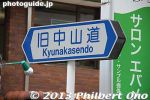
There is also Itabashi Bridge after which Itabashi Ward takes its name. You can walk along Itabashi-juku from Shin-Itabashi Station to Itabashi-Honcho Station on the Mita subway line.
|
|
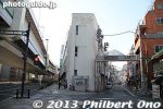
I walked from Shin-Itabashi Station to this entrance to Itabashi-shuku on the right. In the middle, they used to have the old Itabashi Police Station until 1933.
|
|
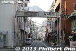
Entrance to Itabashi-shuku. Itabashi-shuku had one Honjin lodge for VIPs, three Waki-honjin, and 54 other lodges.
|
|
|
|
|

About Itabashi-shuku.
|
|
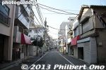
Today, Itabashi-shuku is a hodgepodge of shops, restaurants, and condominiums.
|
|
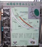
Roadside map showing places of interest. Temples are the main remnants still remaining from the old days.
|
|
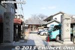
Entrance to Kanmyoji temple.
|
|
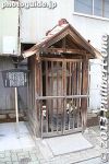
Koshin-to stone monument 庚申塔
|
|
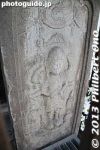
Koshin-to stone monument at Kanmyoji temple in Itabashi-shuku, Tokyo 庚申塔
|
|

About the Koshin-to stone monument 庚申塔
|
|
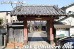
Another gate at Kanmyoji temple.
|
|
|
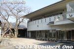
Kanmyoji temple social hall
|
|
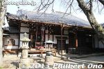
Kanmyoji temple main hall
|
|

About Kanmyoji
|
|
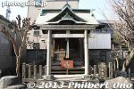
Shrine at Kanmyoji temple
|
|
|
|
|
|
|
|
|
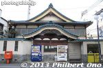
A sento public bath in Itabashi-shuku, Tokyo.
|
|
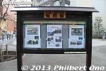
Signboard at a small park.
|
|
|
|

In pink is the area that was once the Kaga samurai clan's estate in Itabashi. The Kaga clan was from present-day Ishikawa Prefecture (Kanazawa).
|
|

Itabashi Tourist Information office.
|
|
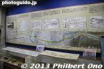
Inside Itabashi Tourist Information office. They had friendly guides explaining about Itabashi-shuku.
|
|

A 3D map of the old Nakasendo Road from Tokyo to Kyoto with all the shukuba post towns marked. The road winds through many valleys.
|
|
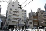
Part of Itabashi-shuku that was the small red-light district.
|
|
|
|
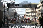
End of Hirao-shuku section of Itabashi-shuku.
|
|
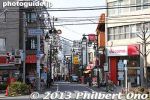
Entrance to the Naka-shuku section of Itabashi-shuku. This was and still is the main section of Itabashi-shuku.
|
|
|
|
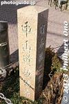
Nakasendo Road marker
|
|
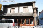
Old building in Naka-shuku
|
|
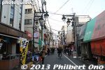
Nakashuku in Itabashi-shuku.
|
|
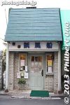
Coffee shop in an old building.
|
|
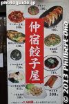
Gyoza dumpling shop in Naka-shuku, Itabashi-shuku.
|
|
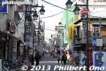
Approaching the center of Naka-shuku.
|
|
|

The brown building on the right was where Itabashi-shuku's Honjin was. (There's a sign and stone marker.) The Honjin was the special lodge for VIP travelers such as daimyo and emperors.
|
|

The brown building was where the Honjin was. (There's a sign and stone marker.)
|
|
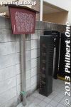
Sign and stone marker for Itabashi-shuku's Honjin.
|
|

Sign for Itabashi-shuku's Honjin.
|
|
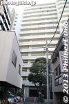
Site of the Waki-Honjin in Naka-shuku in Itabashi-shuku. A huge condominium now stands here. The landowner lives on the top floor.
|
|
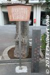
Sign and stone marker for Itabashi-shuku's Waki-Honjin in Naka-shuku in Itabashi-shuku. There were two other Waki-Honjin in Itabashi-shuku, but I couldn't find them.
|
|

Sign for Itabashi-shuku's Waki-Honjin in Naka-shuku in Itabashi-shuku.
|
|
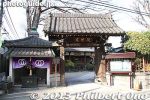
文殊院
|
|
|
|
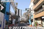
Straight ahead is Itabashi Bridge.
|
|
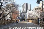
Itabashi Bridge goes over the Shakujii River. Itabashi-shuku (and Itabashi-ku Ward) got its name from this bridge. The first Itabashi Bridge was built during the Heian Period.
|
|
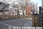
Itabashi means wooden plank bridge. The Itabashi Bridge during the Edo Period was a wooden arch bridge 16.4 meters long and 5.5 meters wide. In 1932, it was rebuilt with concrete. This current bridge was built in 1972.
|
|
Sign post next to Itabashi Bridge indicating the distance to Nihonbashi.
|
|
| 974 files on 4 page(s) |
1 |
 |
|