 Image search results - "Mizu" Image search results - "Mizu" |
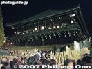
Every evening during March 1-14, Todaiji temple priests carry torches on the balcony of Nigatsu-do Hall. Sparks falling from the torches bring good health. Todaiji temple 二月堂
|
|
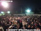
Large crowd behind us. Tripods are not allowed.
|
|
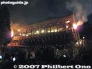
The torch is positioned at the corners. It is totally dark when the torches are lit.
|
|
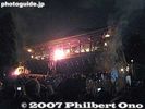
The priest runs while spinning the torch on the balcony. Also see the video at YouTube.
|
|

Only 10 torches are lit. Most photos show a time-lapse shot which lights up the entire hall. Tripod required though, and you need to be a press photographer.
|
|

The torch walk ends in 20 min. Police and firemen are present.
|
|
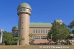
Mizu no Yakata (Water Pavilion) facing Lake Teganuma is a local community center with a local produce market, meeting rooms, and a lookout tower.
|
|
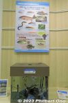
Mizu no Yakata also has a small exhibition room of local wildlife. Lake fish here.
|
|
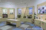
Mizu no Yakata also has a small exhibition room of local wildlife.
|
|
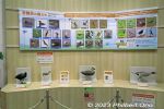
Mizu no Yakata also has a small exhibition room of local wildlife.
|
|
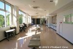
Second floor of Mizu no Yakata is where you can rest.
|
|

Book about Abiko's past celebrities.
|
|
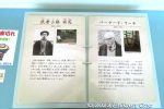
Book about Abiko's past celebrities.
|
|
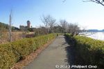
Walking along Lake Tega to Lake Tega Park.
|
|
|
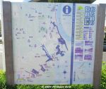
Water & Greenery Corridor (Mizu-to-Midori-no-Kairo) is a semi-urban, hiking trail in the northwestern part of Ichikawa fronting the border with Tokyo along Edogawa River.This part of Ichikawa is dotted with patches, hills, and slithers of small forests, parks, and ponds. This "Corridor" links all this greenery and bodies of water to help protect and preserve the flora and fauna in a coordinated effort by local environmental groups.
This is a map of the trail. Download the official map here: https://www.city.ichikawa.lg.jp/gre01/1111000022.html
|
|
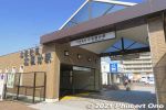
The corridor is 6 km and takes a few hours to walk it between Kita-Kokubun Station (photo) and Konodai Station both in Ichikawa.There are also side treks to other nearby sights. Enjoyable especially when the cherry blossoms are in bloom or during the autumn foliage.
|
|
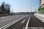
From Kita-Kokubun Station, we walked about 600 meters along this highway until we reached the first green belt.Local environmental groups have been active in trying to preserve and protect the city's nature, but it's an uphill struggle with the encroaching urban development, especially when the Hokuso train line was built through Ichikawa in 1979.
|
|
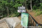
For the most part, the trail has signage in both Japanese and English. We soon got to some greenery called Horinouchi Ryokuchi green belt. There's this fork in the trail. Go left to see the shell mound in Horinouchi Kaizuka Park.
|
|
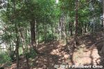
Horinouchi Ryokuchi green belt. 堀之内緑地
|
|
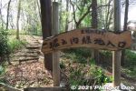
Horinouchi Ryokuchi green belt. 堀之内緑地
|
|
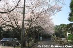
After the small green belt, walk on the street to the Shell Mound.
|
|
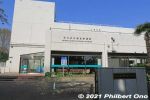
You will pass by the Ichikawa Municipal Museum of History. Free admission, but it was closed when we were there. Horinouchi Kaizuka Shell Mound Park has two museums. 市川歴史博物館
|
|
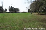
Horinouchi Kaizuka Park is a flat hill where shells, animal bones, and other food waste were discarded by Jomon people 4,000 years ago. "Kaizuka" means "shell mound." 堀之内貝塚公園This hill was also the site of a Jomon Period human settlement 2,500 to 4,000 years ago. A number of excavations were made since 1904 and ancient human remains, pottery, etc., have been found. National Historic Site.
|
|
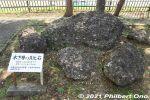
Hardened shell rocks from the ocean 150,000 years ago displayed in Horinouchi Kaizuka Park. These are not shells discarded by humans. 堀之内貝塚公園
|
|
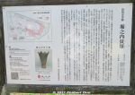
It's hard to discern, but Horinouchi Kaizuka Shell Mound is as long as 225 meters and 100 meters wide. Pink portion in the diagram on the upper left shows where the shells, animal bones (mostly boar and deer) and other food waste were tossed on the hillsides during 4,000 to 2,500 years ago (Jomon Period). They form a horseshoe shape on the hill.
The mound was a central feature of the Jomon Period cluster of homes in this area. Since the late 19th century (Meiji Period), many digs and research on this shell mound have been conducted by archaeologists. However, there are still unknown things about mound.
|
|
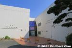
The other museum in the park is the Ichikawa Archaeology Museum displaying shell mound remains as old as 3,000 years (Jomon Period). Pottery & human remains found here are also exhibited. Good to have this museum next to the shell mound. 市川考古�
|
|
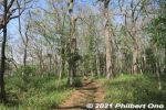
Walking through Horinouchi Kaizuka Shell Mound, larger than what meets the eye. The shell mound's immediate area was the ocean shallows where it was easy to harvest shellfish.
|
|
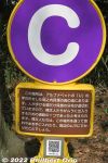
The mound has these alphabetized markers to indicate where the shells are. They form a horseshoe shape (or U shape) on the mound.
|
|

While walking through Horinouchi Kaizuka Shell Mound, we indeed saw many pieces of shell or pottery on the ground.
|
|
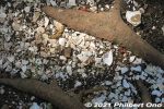
While walking through Horinouchi Kaizuka Shell Mound, many pieces of shell or pottery on the ground. Still here, after thousands of years!Read more about this shell mound here: https://ichikawashi.jp/horinouchi/index_en.html
|
|
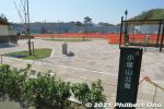
Next was Kozuka-yama Park. There are restrooms. 小塚山公園
|
|
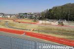
Kozuka-yama Park was still under construction. 小塚山公園
|
|
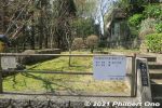
Sawara Park, we walked through here.
|
|
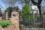
Small athletics field.
|
|
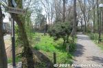
Follow the sign to Konodai Ryokuchi green belt.
|
|
|
|
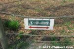
Signage for the hiking trail.
|
|
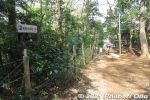
Follow the sign.
|
|

Water hose manhole for firemen.
|
|

Rules for using Junsai-ike Ryokuchi Park. No bicycle riding, dogs must be leashed, etc.
|
|
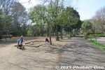
Junsai-ike Ryokuchi green belt park. じゅん菜池緑地
|
|
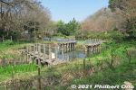
Junsai-ike Ryokuchi green belt park じゅん菜池緑地
|
|

Junsai-ike Ryokuchi Park is a nature area where the flora and fauna are not to be disturbed. じゅん菜池緑地
|
|

If you started the hike at Kita-Kokubun Station, Junsai-ike Pond Ryokuchi green belt park is the first substantial park where you can rest or have lunch. Large pond and cherry blossoms. じゅん菜池緑地
|
|
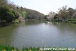
Junsai-ike Pond じゅん菜池
|
|
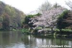
Junsai-ike Pond じゅん菜池
|
|
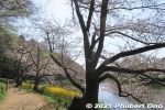
Some cherry blossoms along Junsai-ike Pond in late March. じゅん菜池
|
|
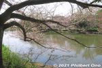
じゅん菜池
|
|
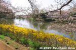
Cherry blossoms along Junsai-ike Pond.
|
|
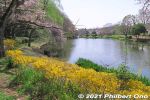
In autumn, Junsai-ike Pond is also noted for fall leaves.
|
|

Some cherry blossoms along Junsai-ike Pond. じゅん菜池
|
|

Small bridge in the middle of Junsai-ike Pond.
|
|
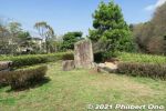
Small island in the middle of the pond.
|
|
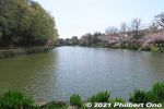
Junsai-ike Pond. No swan boats or rowboats. Only ducks. じゅん菜池
|
|
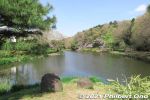
Some cherry blossoms along Junsai-ike Pond. じゅん菜池
|
|

Cherry blossoms along Junsai-ike Pond in late March. じゅん菜池
|
|
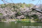
Cherry blossoms along Junsai-ike Pond. じゅん菜池
|
|
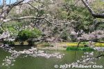
Cherry blossoms along Junsai-ike Pond. じゅん菜池
|
|
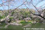
Cherry blossoms along Junsai-ike Pond. じゅん菜池
|
|
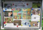
Photos of the park's flora and fauna by a local environmental group.
|
|
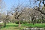
Plum blossom trees near Junsai-ike Pond.
|
|
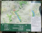
Map and where we are now.
|
|
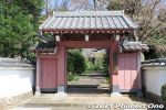
The trail passes by a few temples like Ekoin Betsuin Temple. This is the temple gate. 回向別院
|
|
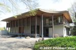
Ekoin Betsuin Temple's main hall rebuilt in 2009. There's actually a cafe (Cafe Terrace Ekoin) on the 2nd floor. It belongs to the Jodo-shu Buddhist sect and is a branch of Ekoin Temple in Ryogoku, Tokyo. 回向院市川別院源光寺
|
|
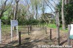
Follow the trail to Satomi Park next.
|
|
|
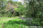
Lush trees and shrubs in Konodai Ryokuchi Park. 国府台緑地
|
|
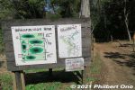
We came out of this trail which goes through into a small forest of different species of trees.
|
|
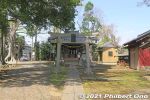
Konodai Tenmangu Shrine dedicated to Michizane, scholar deity. Stone lanterns behind the torii date from 1863. 国府台天満宮
|
|
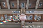
Ceiling and bell.
|
|
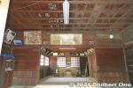
Inside Konodai Tenmangu Shrine. 国府台天満宮
|
|
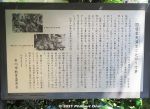
About Konodai Tenmangu Shrine and an event called Tsujikiri.
|
|
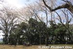
Next is Satomi Park, another large park with different areas. This part is undeveloped and quiet. 里見公園
|
|
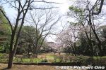
Satomi Park is the site of Konodai Castle occupied by the Satomi Clan who ruled the Boso domain in present-day Chiba during the 16th century. Almost nothing remains though. 国府台城
|
|
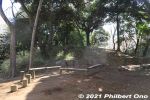
Places to sit in the park.
|
|
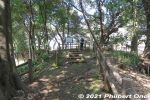
Satomi Park also has the Akedo Kofun burial mound complete with two stone coffins exposed on the mound. 明戸古墳石棺
|
|
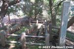
Two stone coffins on Akedo Kofun burial mound. Experts believe that they contained the remains of local nobility who ruled this area in the 6th to 7th century. Chiba Prefecture has many of these stone coffins. 明戸古墳石棺
|
|
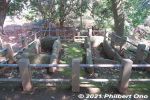
The Akedo Kofun burial mound stone coffins date from the 6th century. They were discovered in 1479. The dirt mound over the coffins fell away to expose the coffins which contained samurai armor, swords, etc. 明戸古墳石棺
|
|
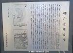
About the Akedo Kofun burial mound. The diagram shows a keyhole-shaped burial mound. The stone coffins are on the top of the round hill. This burial mound has been a noted site since the Edo Period. 明戸古墳石棺
|
|
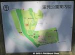
Map of Satomi Park. The burial mound is on the upper part next to the red, dotted oval on the map. The park is next to Edogawa River.
|
|
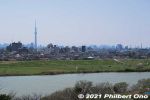
View of Edogawa River from Satomi Park. Across the river is Koiwa and Shibamata. Tokyo Skytree can also be seen. 江戸川
|
|
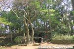
Satomi Park, near the burial mound.
|
|
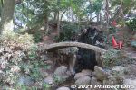
Satomi Park
|
|
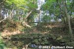
Konodai Castle remains in Satomi Park. Embankments and rocks. 国府台城
|
|
|
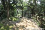
At the top of this small hill is Ichikawa city's highest point (elevation).
|
|
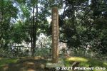
Marker indicating Ichikawa city's highest point (elevation). A whopping 30.1 meters above sea level.
|
|
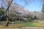
Cherry blossoms in Satomi Park.
|
|
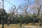
Cherry blossoms in Satomi Park.
|
|
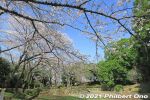
Cherry blossoms in Satomi Park.
|
|
|

Sign on a cherry tree saying that no hanami flower-viewing picnics are not allowed here due to Covid-19.
|
|
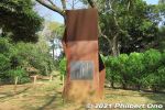
Poetry Monument for So Sakon's poem. 宗 左近
|
|

Poetry Monument for So Sakon's Ichikawa poem. He was a longtime resident and honorary citizen of Ichikawa . 宗 左近
|
|
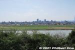
Edogawa River.
|
|
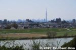
Edogawa River and Tokyo Skytree as seen from Satomi Park.
|
|
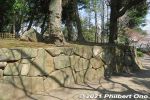
Castle-like stone foundation.
|
|
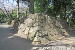
Castle-like stone foundation. Satomi Park is the site of Konodai Castle. However, this stone foundation is not original.
|
|
|
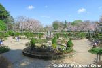
Satomi Park water fountain. This is another area of the park. Totally different landscape. This was the main site of Konodai Castle. 国府台城
|
|
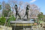
Satomi Park water fountain.
|
|
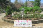
Satomi Park visit date.
|
|
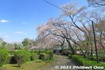
Satomi Park cherry blossoms.
|
|
|
|
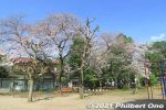
Satomi Park playground.
|
|
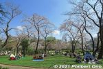
This is where most people enjoyed Satomi Park, under the cherry blossoms.
|
|
Being the site of Konodai Castle, Satomi Park was also the site of the Battles of Konodai fought twice between the local Satomi Clan (ruler of Awa Province in present-day Chiba) and the invading Hojo Clan (from Odawara) in the 16th century. The Hojo won the final battle and thereby took control of present-day Chiba. The Hojo is said to have expanded and reinforced Konodai Castle.
However, when Tokugawa Ieyasu took control of Japan, he had Konodai Castle dismantled because it had a intimidating view of his own Edo Castle.
|
|

During World War II, Satomi Park was an Imperial Army base camp. It finally became a public park in 1959. Flower beds now cover the site of Konodai Castle.
|
|
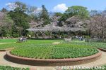
Satomi Park is also noted for roses in early summer and fall. The rose is Ichikawa's official flower.
|
|
|
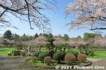
Flowery site of Konodai Castle in Ichikawa, Chiba. No castle buildings. 国府台城跡
|
|
|
|
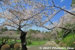
Nice cherry blossoms at Satomi Park, Ichikawa.
|
|
|
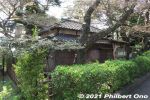
Satomi Park also has Shien-soja (紫烟草舎), the former home of famous tanka poet named Kitahara Hakushū (1885–1942) (北原白秋). He lived in this house for only a year in 1916.
|
|

About Shien-soja. It was originally located in Koiwa (Edogawa Ward, Tokyo) and moved here. (紫烟草舎).
|
|
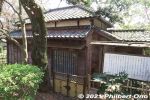
Shien-soja (紫烟草舎).
|
|
|
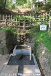
Old well on the fringe of Satomi Park named "Rakan-no-I". 羅漢の井
|
|
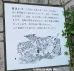
The Rakan-no-I well was actually depicted in this 1834 illustration, part of Illustrations of Edo's Noted Sights. 羅漢の井
|
|

Toyama Prefecture's main port is actually three separate ports collectively named Fushiki Toyama Port (伏木富山港). The three ports are Fushiki Port (伏木港) in Takaoka, Toyama Port (富山港) in Toyama city, and Toyama Shinko Port.
|
|
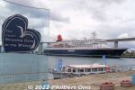
Cruise ships usually dock here at Toyama Shinko Port (富山新港). In Oct. 2014, Toyama Bay was admitted to the "Most Beautiful Bays In The World Club." This is one monument for it. https://world-bays.com/category/bays/asia/japan/
|
|
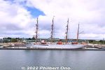
Toyama Shinko Port (also called Toyama New Port) has a major tourist attraction in the Kaiwo Maru (海王丸) museum ship brought here in July 1992.
|
|
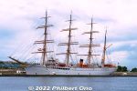
Kaiwo Maru was built in 1930 as an officer training ship for Japan's merchant marine. Its sister ship was the original Nippon Maru sailing ship also built in 1930 as a training ship. Kaiwo Maru was retired in 1989 and replaced by a new Kaio Mar
|
|
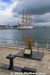
The Kaiwo Maru was launched on Feb. 14, 1930, Valentine's Day, so people have associated the ship with love. Yumi Katsura Lover's Sanctuary Monument and Kaiwo Maru in the background.
|
|
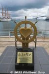
Yumi Katsura Lover's Sanctuary Monument built in 2006. Yumi Katsura is a wedding dress designer.
|
|
|
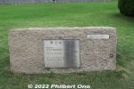
Monument for awards bestowed on Kaiwo Maru Park for waterfront park design and concept.
|
|
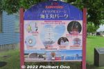
Kaiwo Maru Park sign of love especially for Valentine's Day.
|
|
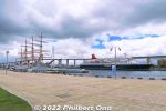
Kaiwo Maru and a Japanese cruise ship at Toyama Shinko Port.
|
|
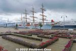
About 10 times a year, they unfurl Kaio Maru's sails. Lucky if you see it with all the sails out.
|
|
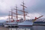
For a small admission fee, you can board and tour inside Kaiwo Maru. Well worth it.
|
|
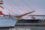
Bow of Kaiwo Maru.
|
|
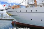
Stern of Kaiwo Maru.
|
|
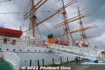
Gangway to board Kaiwo Maru.
|
|

About Kaiwo Maru. It's 97 meters long. "Kaiwo" (or Kaio) means "King of the Seas."
|
|

Brief history of Kaiwo Maru.
|
|
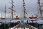
Boarding the Kaiwo Maru museum ship.
|
|

Visitors can tour the top deck (forecastle and poop decks), upper deck, and 2nd deck. Upper deck has the dining/lecture room, Captain's quarters, and officer's saloon. The 2nd deck has cadet cabins.
|
|
|
|
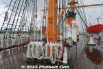
Walking on the top deck.
|
|
|
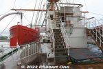
The stairs go to the bridge.
|
|
|
|
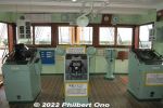
Inside the bridge of the Kaiwo Maru.
|
|
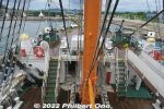
Forward view from the bridge of the Kaiwo Maru.
|
|
|
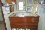
Inside the bridge.
|
|
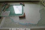
Map charts inside the bridge.
|
|
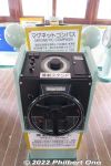
Magnetic compass on the bridge.
|
|
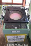
Radar inside the bridge.
|
|
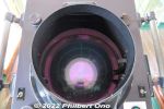
Radar
|
|
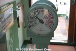
Speed control
|
|
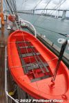
Life boat
|
|
|
|
|
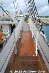
Narrow bridge to the bow.
|
|
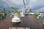
Forecastle deck near the bow.
|
|
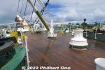
Forecastle deck
|
|
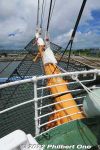
Bow
|
|
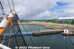
Kaiwo Maru Park as seen from the bow.
|
|
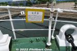
On the right is a speaking tube.
|
|
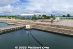
Kaiwo Maru Park as seen from the bow.
|
|
|
|
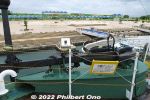
Anchor
|
|
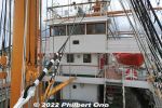
Bridge
|
|
|
|
|
|
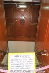
Cadet entrance to go below.
|
|
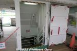
Stairway to go below deck.
|
|
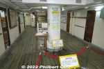
On the 2nd deck which is the cadet's quarters.
|
|

Cadet's cabin with 8 bunk beds. They spent 6 months at sea as trainees.
|
|
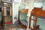
Cadet's cabin with bunk beds 185 cm long and 65 cm wide. This is smaller than the standard futon (90 cm x 200 cm) we sleep on today.
|
|
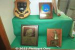
Plaques from various ports including Hawaii.
|
|
|
|
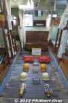
Helmets and other gear used by cadets.
|
|
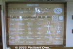
Knots
|
|

Staircase to upper deck.
|
|
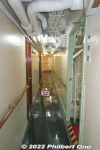
Hallway on upper deck.
|
|
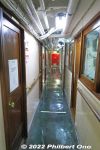
Hallway on upper deck.
|
|
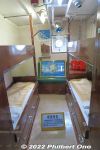
Cook's cabin. Four bunk beds and a round window. Crew cabins were a little roomier than cadet cabins.
|
|
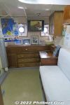
Head nurse
|
|
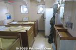
Medical clinic
|
|

Dispensary
|
|
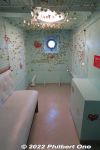
Love Sanctuary. Perhaps many visiting couples kissed or hugged each other here.
|
|
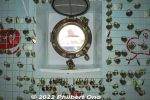
Love Sanctuary room. The Kaiwo Maru was launched on Feb. 14 Valentine's Day, so people have associated the ship with love.
|
|
|
|
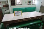
Mess hall for engine crew.
|
|
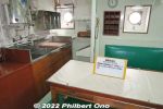
Mess hall for engine crew.
|
|
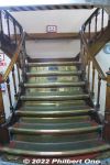
Staircase to upper deck.
|
|
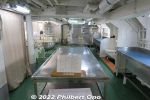
Galley
|
|
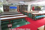
Dining/lecture room on upper deck.
|
|
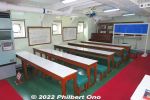
Dining/lecture room on upper deck.
|
|
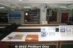
Dining/lecture room.
|
|
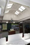
Skylight in above the dining/lecture room.
|
|
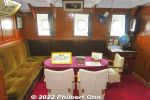
Captain's quarters is a two-room suite plus bathroom. This is his Day Room with three windows.
|
|
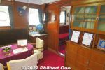
Captain's Day Room. Door on the right goes to his bedroom.
|
|
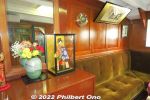
Captain's Day Room has a oiran Japanese doll.
|
|
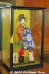
Captain's Day Room has a oiran Japanese doll.
|
|

List of all Kaiwo Maru captains from 1930 to 1989. Most served only one to three years.
|
|
|
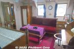
Captain's bedroom.
|
|
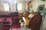
Captain's bedroom and desk.
|
|

Captain's bathroom and toilet too.
|
|
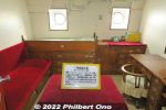
Chief Officer's cabin is only one room with two windows
|
|
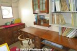
Chief Officer's desk.
|
|
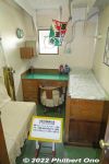
Jr. Third Officer's cabin.
|
|
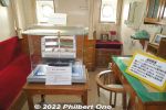
Chief Radio Officer's quarters. No Internet in those days.
|
|
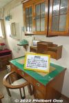
Chief Radio Officer's desk.
|
|
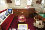
Senior Navigation Professor's cabin.
|
|
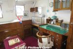
Senior Navigation Professor's cabin.
|
|
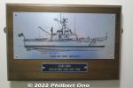
Plaque from Hilo, Hawaii for Kaiwo Maru's July 1988 visit.
|
|
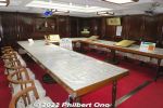
Officer's saloon where ship officers dined and held meetings.
|
|

Officer's saloon where ship officers dined and held meetings. Very luxurious. This is the head table where the captain would sit in the middle.
|
|
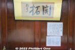
It says 開拓 or "Pave the Way."
|
|
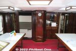
Officer's saloon
|
|

Galley for officers.
|
|
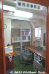
Purser's Office
|
|
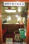
Senior Engineering Professor's cabin.
|
|
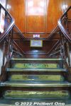
Staircase to top deck.
|
|
|
|
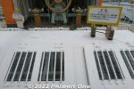
Skylight over the dining/lecture hall.
|
|
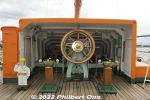
Steering wheel selfie spot.
|
|
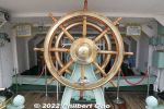
Steering wheel was controlled by two or four sailors.
|
|
|
|
|
|
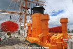
Life boats and funnel.
|
|
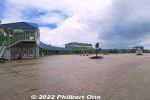
Kaiwo Maru Park
|
|
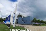
Also in Kaiwo Maru Park is the Japan Sea Culture Center (日本海交流センター) has an exhibition space showing models of sailing ships from around the world. (世界の帆船模型展)
|
|
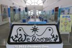
Inside Japan Sea Culture Center (日本海交流センター) showing models of sailing ships from around the world.
|
|

Scale model of the new Kaiwo Maru.
|
|
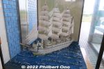
Scale model of Kaiwo Maru.
|
|

Types of sailing ships.
|
|

In Oct. 2014, Toyama Bay was designated as one of the most beautiful bays in the world.
|
|

Types of ships.
|
|

History of Toyama Shinko Port.
|
|

Construction of Shin-Minato Ohashi Bridge at Toyama Shinko Port.
|
|
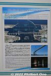
Design of Shin-Minato Ohashi Bridge.
|
|
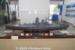
Battleship Yamato too.
|
|
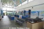
Japan Sea Culture Center (日本海交流センター) exhibition space. It's also a community center with meeting rooms, etc.
|
|
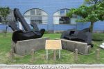
Outside the Japan Sea Culture Center, anchors are displayed.
|
|
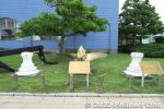
Kaiwo Maru's spare propeller and capstan.
|
|
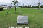
Tree planted to mark the Most Beautiful Bays In The World Club meeting held in Toyama in Oct. 2019.
|
|
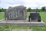
Monument for a poem by Emperor Akihito when he visited here in 2015 for the Marine Environment Convention. It refers to deep-sea fish fry (which he released) growing up in Toyama.
|
|
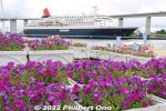
Japanese cruise ship and flowers at Toyama Shinko Port.
|
|
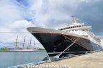
Kaiwo Maru museum ship and Japanese cruise ship at Toyama Shinko Port.
|
|
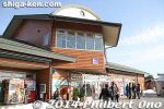
Kohoku Mizudori Station, a local roadside shop/restaurant for tourists traveling by car.
|
|
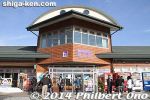
Kohoku Mizudori Station, a local roadside shop/restaurant for tourists traveling by car.
|
|
|
|