 Image search results - "Island" Image search results - "Island" |

Sign for boat going to the islands (no longer in service)
|
|
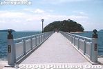
400-meter long bridge to Takeshima island near JR Gamagori Station. The island is made of granite. Circumference is 680 meters. There's a walking path around the island.
|
|

Rabbit Island
|
|
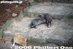
Rabbits
|
|

Feeding a rabbit
|
|
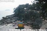
Rabbit Island
|
|
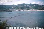
View from Rabbit Island
|
|
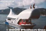
Boat to Rabbit and Monkey islands (no longer in service)
|
|
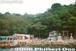
Monkey Island (Sarugashima)
|
|
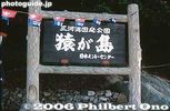
Monkey Island (Sarugashima)
|
|

Boat for Taketomi at Ishigaki Port.
|
|

Monkeys
|
|

On Taketomi, the best way to get around.
|
|
|
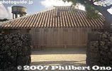
Okinawan house, Taketomi. Taketomi is a National Important Traditional Townscape Preservation District (重要伝統的建造物群保存地区).
|
|
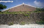
Okinawan house and rock wall, Taketomi
|
|

Lookout tower
|
|

On Taketomi, residential homes are toward the middle of the island, not along the beaches. The middle part of the island is built on hard rock called chert. Freshwater wells can be dug along this rock to provide water. View from lookout tower.
|
|
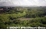
Outside the middle part of Taketomi, the ground is on limestone where water seeps through. Difficult to have rice paddies or wells on limestone.
|
|
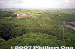
View from lookout tower
|
|
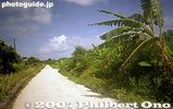
White coral road
|
|
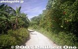
White coral road, one of Taketomi's trademarks.
|
|
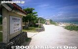
Kondoi Picnic Site
|
|
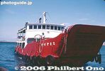
Ferry boat from Takamatsu to Megishima. 20 min. ride.
|
|
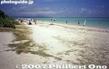
Kondoi beach
|
|
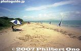
Be aware that these parasols are not free.
|
|
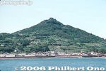
Megishima is associated with Momotaro, a famous folk tale.
|
|

Kondoi beach
|
|
|
|

Megishima beach 女木島
|
|
|
|
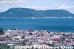
View from lookout deck
|
|
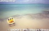
Hoshi Sunahama or Star Sand Beach
|
|

Seto Inland Sea as seen from Megishima, Kagawa Pref.
|
|
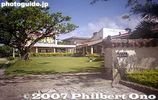
Taketomi Primary School
|
|
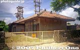
Power voltage station
|
|
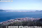
Looking toward Takamatsu
|
|

Okinoshima in sight
|
|
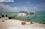
Taketomi Port boat for Ishigaki
|
|

Misty Okinoshima
|
|
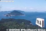
Looking toward Ogishima in Seto Inland Sea. 男木島
|
|

Entering Okinoshima Port. Okishima is the largest island in Lake Biwa. MAP
|
|
|
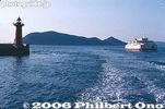
Leaving Megishima
|
|

Side of boat
|
|

Okinoshima Port
|
|

Okinoshima Port and boat schedule
|
|

Okishima Port
|
|

Sea wall
|
|
|
|

Shore road
|
|

Steps to the larger hill
|
|

Neck of Okishima.
|
|

Okinoshima Port
|
|

Narrow alley
|
|

Renmyo was here.
|
|
|
|
|
|
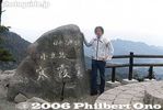
Kankakei Gorge marker and lookout 寒霞渓
|
|

Aoshima in the distance.
|
|
|
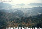
View of Kankakei
|
|
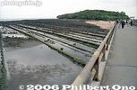
Bridge to Aoshima.
|
|

Leaving Okinoshima (we'll be back).
|
|
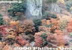
Autumn colors seen from the ropeway.
|
|

Straight rows of layered rock.
|
|
|
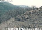
Monkeys
|
|

Aoshima Shrine torii and Devil's Washboard, Miyazaki
|
|

Misty Omi-Hachiman coast
|
|

Foggy Okayama Port and ferry from Shodoshima. 岡山港
|
|
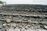
Aoshima Shrine torii and Devil's Washboard, Miyazaki 青島
|
|
|
|
|
|

Marvelous contrast between the torii and layered rock.
|
|
|
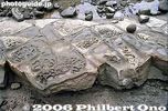
Close-up of rock
|
|
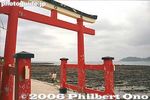
Aoshima Shrine torii
|
|

Aoshima Shrine torii
|
|
|
|
|

Aoshima Shrine, Miyazaki
|
|
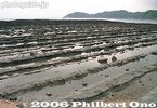
Aoshima's Devil's Washboard
|
|
|
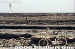
Not my bicycle
|
|

Trail around the island
|
|
|
|
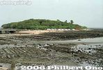
Aoshima from a distance.
|
|
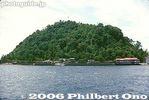
Kashima island, small, but very scenic island 400 meters off the coast of Matsuyama.
|
|
|
|

Path around the island
|
|
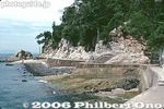
Due to falling rocks, the waling path around the island has been closed.
|
|

Swimming beach
|
|

Swimming beach
|
|
|
|

Iyo-Hojo Station
|
|

Chikubushima is Lake Biwa's most famous, historic, and sacred island. National Historic Site MAP
|
|
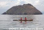
East view of Chikubushima in 2007, whose trees are badly ravaged by kawau cormorants. Over 30,000 of these birds live on the island.
|
|
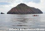
North face of Chikubushima in 2007 was also badly damaged and going bald. The cormorant bird droppings and nesting activities (breaking off branches) are killing off the trees.
|
|
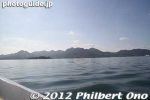
Etajima island in view.
|
|
|
|
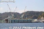
Etajima also has shipbuilding facilities.
|
|
|
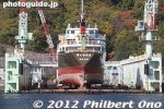
Shipbuilding on Etajima, Hiroshima.
|
|
|
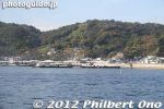
Approaching Etajima's Koyo Port.
|
|

Etajima's Koyo Port.
|
|
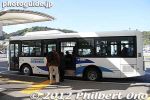
From Koyo Port, take a bus for a 5-min. ride to the Naval Academy. Or take a taxi if a bus is not available.
|
|
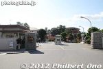
Entrance to the Naval Academy on Etajima.
|
|
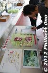
Reservations are not required, but you have to get there and sign up 5 min. before the 90-min. tour starts.
|
|

The Naval Academy conducts free guided tours of the school 3 or 4 times a day. The tour takes you around the campus and allows you to enter a few of the imposing buildings.
|
|

Map of the Naval Academy or Japanese Maritime Self Defense Force First Service School (海上自衛隊第1術科学校).
|
|
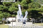
You cannot tour the Naval Academy on your own. You have to join the guided tour. There is a dress code: No miniskirts or provocative clothing by women.
|
|
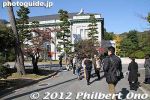
Two Naval Academy students served as our tour guide.
|
|
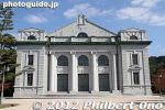
Ceremonial Hall. Built in 1917 and designed for holding ceremonies and moral education. One of the few buildings which we could enter. Etajima, Hiroshima.
|
|
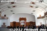
Inside the Ceremonial Hall. It can fit 2,000 people.
|
|
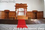
Stage inside the Ceremonial Hall.
|
|
|
|
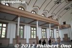
Ceremonial Hall
|
|
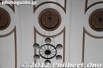
The lights look like a ship's wheel on the ceiling of the Ceremonial Hall.
|
|
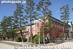
The academy's pine tree trunks grow straight up. They say that even the pine trees stand at attention at the school.
|
|
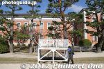
Stand for gatherings.
|
|
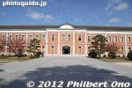
The academy's most distinctive building is this Students’ Hall dubbed the "Red Brick Building." We weren't allowed to go inside. Etajima, Hiroshima.
|
|
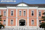
Built in 1893 and used for classrooms and living quarters for students. Today, it is part of the Officer Candidate School and used as classrooms and students' living quarters. Etajima, Hiroshima.
|
|
|
|
|
|
|
|
|
|
|

Students' Hall west wing. Built in 1938, it is used as the main students’ hall of the First Service School.
|
|

Students' Hall west wing. We weren't allowed to enter this building. The Academy also has female students, but after graduating they do not serve on navy ships. They work only on land.
|
|
|
|
|
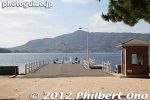
Front Pier. This is considered the school's front gate instead of the gate on land. Officer Candidate School graduates are sent off here by school staff and a military band and transferred to a training fleet anchored offshore in Etauchi inlet.
|
|
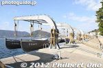
Training boats
|
|
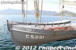
Training boats
|
|
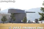
Battleship gun, life-size.
|
|
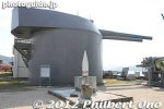
The Gun turret was a part of the main gunnery system of Battleship Mutsu and was transferred to Imperial Naval Academy for use as a study aide in 1935.
|
|
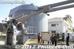
Gun turrets
|
|
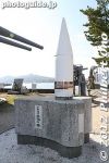
Projectile of a "Mutsu" class battleship.
|
|

Torpedoes
|
|
|
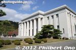
Naval History Museum on Etajima. Built in 1936, the museum is substantial with detailed exhibits tracing Japan's naval history (including the Pearl Harbor attack).
|
|
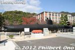
The Naval History Museum on Etajima has this outdoor display of one of the five midget submarines used in the Pearl Harbor attack.
|
|
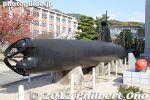
One of the five midget submarines used in the Pearl Harbor attack. On display at the Naval History Museum on Etajima island, Hiroshima.
|
|
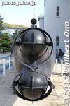
Torpedo bay of midget submarine used in Pearl Harbor attack.
|
|
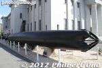
The midget sub displayed here was found in 1960 off Keehi Lagoon east of Pearl Harbor's entrance. The sub had been damaged by a depth charge attack and abandoned by its crew before it could fire its torpedoes.
|
|
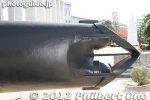
It was subsequently salvaged and restored for display at Etajima in 1962. The front part of the sub was severed, so the front part was reconstructed by a Kure shipbuilder for this display.
|
|

Midget sub's conning tower and periscope. The sub had only two crew members.
|
|
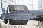
Midget sub's rudder and propeller.
|
|
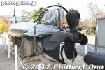
They eventually found all five subs (the fifth one was finally found in 2009) used at Pearl Harbor. Two of them are on display. One of them is here and the other is at the National Museum of the Pacific War in Fredericksburg, Texas.
|
|
|
|
|
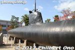
This midget sub was transported by boat from Pearl Harbor to Yokosuka (Kanagawa Pref.), then to Etajima in 1961.
|
|
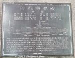
About this midget sub: Length: 23.9 meters, Weight: 46 tons, Inner diameter: 1.85 meter, Underwater speed: 19 knots (600 horsepower)
|
|
|
|
|
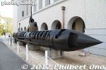
Behind the midget sub used in Pearl Harbor, another different type of midget sub is displayed.
|
|
|
|
|
|
|
|
|
|
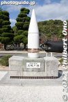
A projectile used by battleship Yamato during WWⅡ.
|
|
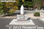
Projectile used in Japan-China War in 1894.
|
|
|
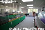
Last stop on the tour was the Etajima Club where there is a gift shop, restaurant, and this small museum on the 2nd floor.
|
|
|
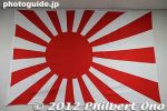
Japanese navy rising sun flag
|
|
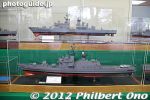
Models of navy warships.
|
|
|
|
|
|

Etajima Club exhibition room.
|
|
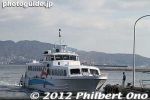
Back at Koyo Port to board this boat for Kure, across the Seto Inland Sea.
|
|
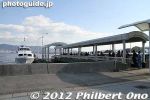
Koyo Port on Etajima, Hiroshima.
|
|
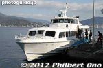
Our boat for Kure from Etajima island.
|
|
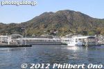
Leaving Koyo Port, Etajima.
|
|

Takeshima ("Island of Many Views") is a small island (600 m circumference) in Lake Biwa off Hikone, accessible by a short boat ride from Hikone Port.
|
|

Takeshima shows many different shapes depending on your viewpoint. A Nichiren temple and the priest's family are on the island. Boat for Takeshima at Hikone Port. The island is only 6.5 km from Hikone.
|
|

Hikone Port
|
|

Hikone Castle as seen from Lake Biwa.
|
|

Cormorants. There are to many of them and they deplete fisheries in the lake and cause forest damage.
|
|

Kawau cormorants. Shiga has over 40,000 of these birds, and 30,000 of them live on Chikubushima whose trees are being destroyed by the droppings and branches broken off to make bird nests.
|
|

To Takeshima
|
|

Almost no one in the boat
|
|

Takeshima in Hikone, Shiga. Map
|
|

Nichiren Monument on Takeshima. This giant stone monument is inscribed with the prayer words "Namu Myo-horenge-kyo" from the Lotus Sutra. 南無妙法蓮華経
|
|
|
|

Enter Takeshima
|
|

Nichiren temple
|
|
|
|
|
|
|
|
|

Lotus Sutra monument. In the early 17th century when the temple was built here, it took 3 years to carve out these characters on this stone slab. According to legend, this monument oozed blood when Ii Naosuke, Lord of Hikone, was assassinated in Tokyo.
|
|

Nichiren statue. Nichiren was the founder of the Nichiren Sect of Japanese Buddhism.
|
|

Nichiren statue is next to the giant stone monument.
|
|
|
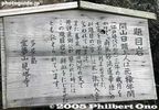
It says that the stone monument oozed blood when Ii Naosuke, Lord of Hikone, was assassinated in Tokyo by samurai radicals from Mito, Ibaraki Prefecture.
|
|
|
|
|
|
|

View of Takeshima. Before the boat left, it circled around the island to show how different it looked from different angles.
|
|

View of Takeshima
|
|

View of Takeshima
|
|

View of Takeshima
|
|

View of Takeshima, an island with many shapes.
|
|

Another view of Takeshima
|
|
|
|
|
|
|
|
|
|

Chikubushima
|
|
|
|
|
|
|
|
|
|
|
|
|
|
|
|
|
|
|
|
|

Across the water are more cherry trees along the Oku-Biwako Parkway road.
|
|
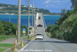
Kouri Island is a small, round island easily accessible by car on this scenic highway bridge over the ocean from Yagaji Island off the coast of Motobu Peninsula.
|
|
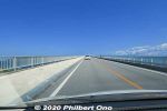
Kouri Ohashi Bridge to Kouri Island goes right over the ocean. Built in 2005, the bridge is 1,960 meters long, the longest bridge near Okinawa island. 古宇利大橋
|
|
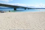
Kouri Island's best beach is Kouri Beach next to Kouri Bridge. There's a parking lot and snack bar and gift shop. Also shower faciilties. This was autumn, so too cold to swim. Beach is 300m long. 古宇利ビーチ
|
|
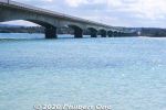
Kouri Bridge 古宇利大橋
|
|
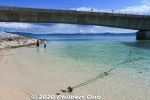
Kouri Bridge at Kouri Beach.
|
|
|
| 1262 files on 6 page(s) |
1 |
 |
 |
 |
|