 Image search results - "Ishigaki" Image search results - "Ishigaki" |

Banna Park on Banna Hill (230m elevation) in the northern fringe of central Ishigaki is a large nature & recreational park. This is one of the main lookout points. Named "Emerald Ocean Lookout Point" overlooking the city center and nearby isThis is in Zone B of the park along the Banna Skyline road. This photo was taken before the stargazing platform was built next to it. エメラルドの海を見る展望台
|
|

View of central Ishigaki from Banna Park.
|
|

View of central Ishigaki from Banna Park.
|
|

View of central Ishigaki from Banna Park.
|
|

View of central Ishigaki from Banna Park. Taketomi Island can be seen on upper right.
|
|

View of Sakieda Peninsula from Banna Park.
|
|

View of Sakieda Peninsula from Banna Park.
|
|

View of the mountains north of Banna Park.
|
|

View of the mountains north of Banna Park.
|
|

Rest house in Banna Park. It's a large park with a variety of sights, playgrounds, lookout points, and nature.
|
|
|

Bird of Paradise flower in Banna Park.
|
|

Butterfly in Banna Park.
|
|
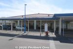
Ishigaki Port is on the southern coast of Ishigaki island. It's the marine gateway to other Yaeyama islands such as Taketomi, Iriomote, Kuroshima, and Aragusuku.Ishigaki Port consists of multiple port facilities. For tourists, the facility for tourist boats going to other Yaeyama islands might be called "Ishigaki Port Remote Island Terminal" or nicknamed "Euglena Ishigaki Port Remote Island Terminal" (ユーグレナ石垣港離島ターミナル) since a company named Euglena bought the naming rights for 5 years in 2018.
|
|

Ishigaki Port for tourist boats to other Yaeyama islands. Terminal building is on the right with the front entrance on the right side. On the left are four floating piers.Taketomi island can be seen in the distance. Photo from Wikipedia.
|
|
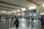
Inside the Ishigaki Port terminal building. One big hallway with doors to the boat docks and ticket windows and tour agency counters.
|
|
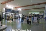
Inside the Ishigaki Port terminal building. This building opened on Jan. 31, 2007 after the terminal and boat docks were moved here from the old port only 200 meters east. On the right is a planetarium.
|
|
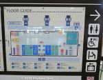
Floor plan of Ishigaki Port terminal building which opened in Jan. 2007 after moving from the old port 200 meters from here.
|
|
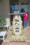
Tour agency office near the port terminal.
|
|
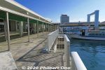
At the docks.
|
|
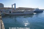
There are four floating boat docks where boats can dock on both sides. They have red roof tiles.
|
|
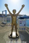
Statue of Gushiken Yoko at Ishigaki Port, former pro boxer and local hero from Ishigaki. He held the WBA light-flyweight title from 1976 to 1981.
|
|

Statue of Gushiken Yoko at Ishigaki Port, former pro boxer and local hero from Ishigaki. This statue was unveiled in Dec. 2013.
|
|
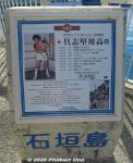
About Gushiken Yoko. Born 1955.
|
|
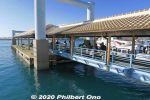
Ishigaki Port boat dock.
|
|
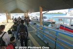
Ishigaki Port boat dock. Anei Kanko (安栄観光) and Yaeyama Kanko Ferry (八重山観光フェリー) are the two main boat companies operating here.
|
|
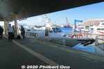
Our Anei Kanko high-speed boat to Iriomote. 第12あんえい号総トン数19t 旅客定員89名 航海速力38.0ノット 2003年12月進水・2004年1月就航
|
|
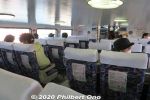
Inside our Anei Kanko high-speed boat to Iriomote, No. 12 Anei with a capacity for 89 passengers. 第12あんえい号
|
|
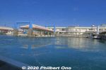
Departing Ishigaki Port.
|
|
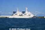
Japan Coast Guard boat. They have the hard job of patrolling and protecting the nearby Senkaku Islands, part of Ishigaki.
|
|

Anei Kanko high-speed boat named "Paijima" for 181 passengers. We rode this boat from Ohara, Iriomote back to Ishigaki Port. ぱいじま
|
|
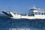
Car ferry named "Kariyushi" which is an Okinawan tropical shirt.
|
|

In front of Ishigaki Port is Hotel Miyahira. Went there for lunch.
|
|
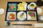
Hirugi Restaurant in Hotel Miyahira, Ishigaki. Notice the chopstick rest made of a shell.
|
|
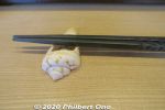
Chopstick rest made of a shell at Hirugi Restaurant in Hotel Miyahira, Ishigaki.
|
|

Old Ishigaki Port for tourist boats. This old port was in operation until 2006 before the new and current terminal was built for tourist boats. 旧石垣離島桟橋。
|
|

Old Ishigaki Port for tourist boats. This is only 200 meters away from the new Ishigaki Port terminal building. The high-rise Hotel East China Sea is under construction. 旧石垣離島桟橋。ホテルイーストチャイナシー建設中。
|
|

Old Ishigaki Port for tourist boats. 旧石垣港。
|
|

Old Ishigaki Port for tourist boats. Only one floating dock for the larger boats. This dock has been dismantled when the new Ishigaki Port was built.
|
|

Floating dock at the old Ishigaki Port. 離島桟橋
|
|

Leaving the old Ishigaki Port.
|
|

Old Ishigaki Port for tourist boats. It didn't have a passenger terminal building like today, only tour agent offices.
|
|

In front of Ishigaki City Hall, a tree planted to reaffirm sister-city relations in 1999 between Ishigaki and Kauai, Hawaii. Planted by then Kauai Mayor Maryanne Kusaka. Ishigaki and Kauai have been sister cities since May 1963.
|
|

Yaeyama Post Office Ishigaki Port in central Ishigaki.
|
|

Entrance to Ishigaki Yaeyama Museum that opened in 1972 to mark the reversion of Okinawa to Japan. It's right near Ishigaki Port. 石垣市立八重山博物館
|
|

Inside Ishigaki Yaeyama Museum. Exhibits Yaeyama's archaeology, history, art, and folk customs. 石垣市立八重山博物館
|
|

Euglena Mall years ago. A small shopping arcade very near Ishigaki Port.
|
|

Ishigaki is the gateway to Okinawa Prefecture's Yaeyama Islands. Ishigaki Airport near central Ishigaki is how most visitors get to Yaeyama.Bird's eye view of central Ishigaki from a jet plane going to land at Ishigaki Airport.
|
|

Descending toward Ishigaki Airport adjacent to farmland.
|
|

Landed on Ishigaki Airport's runway.
|
|

Ishigaki Airport's runway.
|
|
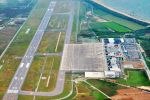
Bird's eye view of New Ishigaki Airport. Only one runway, 2,000 meters long, long enough for widebody jets. Terminal has four jet bridges.(Photo from Wikipedia.)
|
|

This new Ishigaki Airport opened in March 2013. Due to the Yaeyama islands becoming a popular tourist destination, there were calls to built a bigger airport since 1979.
|
|

It took years to decide where to build the new airport. One disturbing plan was to reclaim part of Shiraho coral reef. Fortunately, this plan was scratched.In 2000, the location was finally decided inland on the island's east side and more northerly from the old airport. Construction began in 2006 with a 2,000-meter runway. New Ishigaki Airport opened in March 2013. Airport terminal with the control tower on the right.
|
|

Approaching the jet bridge.
|
|

View of Ishigaki Airport terminal from the jet bridge.
|
|
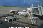
Our JTA plane that landed at Ishigaki Airport.
|
|
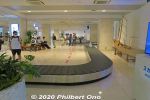
Baggage claim at Ishigaki Airport.
|
|

At Ishigaki Airport, a large welcome and warning sign after getting out of baggage claim in fall 2020. It says to please wear masks, wash your hands, avoid crowds, etc., to protect local residents. We of course took all the necessary precautions.
|
|

Ishigaki Airport Arrivals gate on the frist floor. Where local friends or tour guides can meet you after you arrive.
|
|
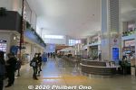
First floor of Ishigaki Airport terminal also has a restaurant and gift shops.
|
|
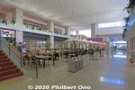
First floor of Ishigaki Airport terminal has a restaurant and gift shops.
|
|
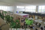
First floor of Ishigaki Airport terminal has a restaurant and gift shops.
|
|
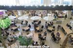
First floor of Ishigaki Airport terminal has a restaurant and gift shops.
|
|
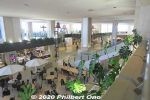
First floor of Ishigaki Airport terminal has a restaurant and gift shops. Second floor is the departure gates.
|
|
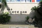
Ishigaki Airport's nickname is "Painushima Ishigaki Airport" (南ぬ島 石垣空港) which means "Southern Island Ishigaki Airport." When it first opened, it was also commonly called "New Ishigaki Airport" to distinguis
|
|
|
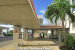
Outside Ishigaki Airport terminal for ground transportation.
|
|
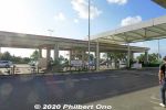
Car rentals across the road.
|
|
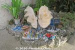
Giant clam decoration at Ishigaki Airport.
|
|
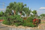
Some tropical plants at Ishigaki Airport.
|
|

The drive between the airport and central Ishigaki is largely rural with farmland and cattle.
|
|

Bales of grass for cattle feed.
|
|
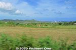
Ishigaki Airport can be seen.
|
|
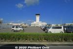
Ishigaki Airport's control tower.
|
|
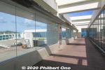
Ishigaki Airport terminal lookout deck on the top floor.
|
|
|
|
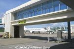
Jet way
|
|
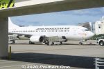
JTA plane
|
|
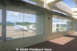
Another lookout deck at Ishigaki Airport.
|
|
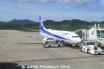
ANA at Ishigaki Airport.
|
|
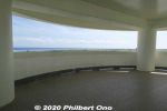
Another lookout deck, round, open-air structure.
|
|
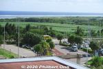
Oceanside from Ishigaki Airport.
|
|
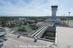
Ishigaki Airport control tower.
|
|
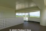
Lookout deck, round, open-air structure.
|
|
|
|

Ishigaki Airport
|
|
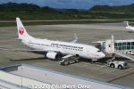
JTA Boeing 737-800 plane at Ishigaki Airport.
|
|
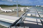
Ishigaki Airport
|
|
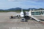
Our JTA Boeing 737-800 plane at Ishigaki Airport.
|
|
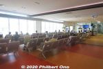
Passenger waiting area in front of the boarding gate. Very modern.
|
|
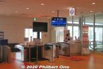
Boarding gate at Ishigaki Airport for our flight to Naha. We just scan the QR code on our smartphone screen.
|
|
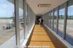
Jet bridge
|
|

View of Ishigaki Airport from the jet bridge.
|
|

RAC commuter plane.
|
|
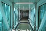
Jet bridge
|
|
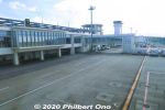
View of Ishigaki Airport terminal from the jet bridge. The circular structure above the roof toward the control tower is a lookout deck.
|
|
|
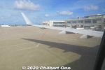
Pushback at Ishigaki Airport on JTA Boeing 737-800 for Naha. Didn't see any ground crew waving goodbye to us.
|
|
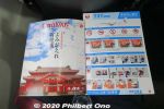
JTA in-flight magazine "Coralway" had a nice Japanese article about the reconstruction of Shuri Castle in Naha.
|
|
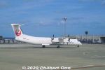
RAC (Ryukyu Air Commuter) prop plane.
|
|
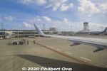
Leaving Ishigaki Airport.
|
|
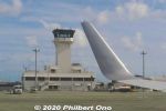
Boeing 737 winglet waving goodbye to the control tower at Ishigaki Airport.
|
|
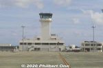
Ishigaki Airport control tower.
|
|

Runway traffic stop for an incoming plane.
|
|

Here it comes for a smooth landing.
|
|

ANA Boeing 787 landing at Ishigaki Airport, probably from Haneda, Tokyo. Thanks to the new airport's longer runway, such wide-body jets can land here.
|
|

Cleared for takeoff, Captain. Roger!
|
|

Taking off from the runway at Ishigaki Airport.
|
|

Up, up and away...
|
|

Lots of farmland next to the airport.
|
|

Flying over Shiraho, Ishigaki.
|
|

Coral reef along Ishigaki.
|
|

Looking at the Nosoko area of Ishigaki. Mt. Nosokodake can be seen. Bye-bye Ishigaki...
|
|
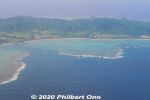
Aerial view of Nosoko, Ishigaki.
|
|
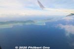
Aerial view of Ibaruma Coast, Ishigaki.
|
|
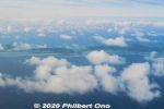
Aerial view of Ibaruma and Hirakubo, Ishigaki.
|
|

This is the old Ishigaki Airport before it closed in March 2013 and was replaced by the new and current airport slightly north of this old airport.
|
|

Approaching the old Ishigaki Airport terminal.
|
|

Old Ishigaki Airport terminal, Arrivals. No jet bridges. Jets (Boeing 737) started flying here only from 1979.
|
|

Old Ishigaki Airport terminal for JTA, Arrivals. No jet bridges.
|
|

Old Ishigaki Airport terminal for JTA. Small building. The old airport first opened in 1943 for military use. It became a civilian airport in 1956.This passenger terminal building was built in 1961 and used mainly by JTA (Japan Transocean Air) and RAC (Ryukyu Air Commuter). ANA had its own adjacent terminal.
|
|

At the old Ishigaki Airport, inside the JTA passenger waiting area at the boarding gate.
|
|

At the old Ishigaki Airport, JTA boarding gate. One of the check-in staff wears a yukata. Also notice the old digital signage.
|
|
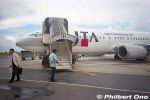
No jet bridge, but it wasn't a problem when it didn't rain.
|
|

I liked walking on the tarmac to the plane at Ishigaki Airport.
|
|

Walking on the tarmac to the JTA plane at Ishigaki Airport.
|
|

JTA plane's see-sa at Ishigaki Airport.
|
|

Inside JTA plane, flight attendants figuring out what to tell us.
|
|

Ground crew at the old Ishigaki Airport waving goodbye to us. I waved back.
|
|

Runway at the old Ishigaki Airport. The slanty white building visible is the ANA hotel on the beach. That's how close the old airport was to town.
|
|
|
|
|

On Runway 04 at the old Ishigaki Airport. At 1,500 meters, it was too short for jets larger than a Boeing 737. So the new airport was built on a different location.
|
|

Taking off at the old Ishigaki Airport.
|
|

Taking off at the old Ishigaki Airport.
|
|

Taking off at the old Ishigaki Airport.
|
|
|

The center of this photo shows the site where the new airport was going to be built.
|
|

Shiraho
|
|
|

Shiraho coral reefs on Ishigaki.
|
|

Shiraho coral reefs on Ishigaki.
|
|

Shiraho coral reefs on Ishigaki.
|
|

Kabira Bay on Ishigaki, perhaps the island's most famous tourist spot. Glass bottom boats to see coral and tropical fish in shallow water.
|
|
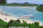
Kabira Bay, Ishigaki. It's actually a large bay and this is only a small part of it. Scenic with white beach, blue ocean, small islands and coral on the bottom.
|
|

There are many glass bottom boats that operate here.
|
|

Kabira Bay beach.
|
|
|
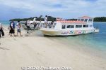
Boarding a glass bottom boat. Your feet don't get wet.
|
|

Typical glass bottom boat in Kabira Bay, Ishigaki.
|
|

Glass bottom boat in Kabira Bay, Ishigaki.
|
|
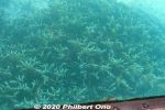
Glass bottom boat in Kabira Bay, Ishigaki.
|
|
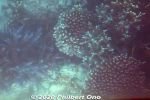
Glass bottom boat in Kabira Bay, Ishigaki.
|
|
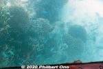
Glass bottom boat in Kabira Bay, Ishigaki.
|
|
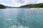
The cruise is scenic with tropical ocean and small islands.
|
|
|
|
|
|
|
|
|
|

Parrot fish in Kabira Bay.
|
|
|
|
|
|
|
|
|
|
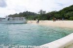
Back to the beach.
|
|
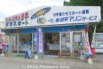
Glass bottom boat tour vendor.
|
|
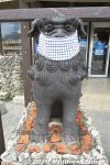
Seesa lion dog with mask, Ishigaki.
|
|
|
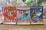
Photo cutouts
|
|
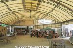
Souvenir shops
|
|

On another part of Kabira Bay, typical low-tide beach in Yaeyama. Ahead is the main part of Kabira Bay with the glass bottom boats and former Kabira Village.
|
|
|
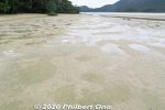
While walking here, I looked down since my intuition told me I might find something...
|
|
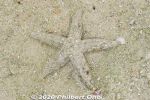
Sure enough, a well-disguised starfish moving in slow motion. Hope it's not the kind that eats coral or other native species. Kabira Bay, Ishigaki.
|
|

On the opposite side of Kabira on the other side of the peninsula is another stretch of white sands called Sukuji Beach. One of Ishigaki's major swimming beaches. 底地ビーチ.
|
|

Sukuji Beach has a lot of shallow water, so it's safe to swim. But at low tide, there's lots of rocks. Be sure to swim within the designated area protected against jellyfish with underwater nets. 底地ビーチ
|
|

Sukuji Beach is 1 km long. It has showers and changing rooms for the public. It's also where the Ishigaki Seaside Hotel is located. 底地ビーチ
|
|

Mt. Nosokodake (野底岳), Ishigaki’s second highest mountain at 282 m. Can be climbed up a steep, narrow trail in about 15 min. We didn't climb it though.
|
|
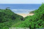
On the way to Mt. Nosoko, spotted a nice beach.
|
|
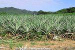
Some pineapple on Ishigaki. No fruit in autumn though.
|
|
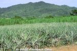
Some pineapple on Ishigaki.
|
|

Entering Iriomote-Ishigaki National Park. Nosokodake is part of the national park.
|
|

Nosokodake Lookout Point in northern Ishigaki. Under the roof is a side view of Mt. Nosokodake. 野底岳展望台
|
|
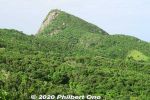
Side view of Mt. Nosokodake. This mountain is associated with a famous local folk tale about a girl named Maape. The mountain is nicknamed after her, "Nosoko Maape" (野底マーペー).On the nearby island of Kuroshima (黒島) in the 18th century, Maape and her childhood sweetheart, Kanimui, were happily living as farmers. They were to be married someday.
However, one day, a Ryukyu government decree ordered half the island's residents to move here near Nosokodake on Ishigaki while the other half could remain on Kuroshima. The island's population was split along the island's main road. Maape and Kanimui lived on the opposite sides of the road, and Maape was on the side where people had to move to Ishigaki.
|
|
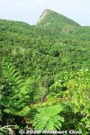
So she and her family were forced to move here to Nosokodake to start a new farming village and clear the thick jungle for farming. It was a hard life. Maape desperately missed her beloved Kanimui and couldn't forget him.
One day, she wanted to at least see Kuroshima where he lived, so she climbed up Mt. Nosokodake. At the top, she looked for Kuroshima, but her view of the island was blocked by Mt. Omotodake, Ishigaki's highest mountain. She collapsed on her knees and wailed in sorrow. Later, a worried villager looked for Maape who never returned home. On the top of the mountain, he found a crying rock gazing in the direction of Kuroshima. Maape had turned into stone.
|
|
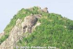
Even today, people who climb the mountain look for the Maape rock and assume this or that rock is her.This story is based on historical fact. The Ryukyu government sometimes forced people to migrate to undeveloped lands to start farming to increase agricultural production so they could pay more taxes. The kingdom was being heavily taxed by the Satsuma Domain in Kagoshima, and taxes had to paid in rice per head.
Read more about the folk tale here: https://photoguide.jp/log/2020/12/yaeyama-folk-songs-nosokodake-maape/
|
|

View from Nosokodake Lookout Point in northern Ishigaki.
|
|
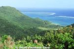
View from Nosokodake Lookout Point in northern Ishigaki.
|
|
|
|
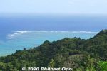
View of coral reefs from Nosokodake Lookout Point in northern Ishigaki.
|
|

View of coral reef from Nosokodake Lookout Point in northern Ishigaki.
|
|
|
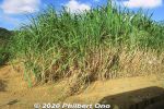
Lots of sugar cane in Yaeyama.
|
|

Stargazing at Nosokodake Lookout Point. Photo by National Astronomical Observatory of Japan.
|
|

Stargazing at Nosokodake Lookout Point. Photo by National Astronomical Observatory of Japan.
|
|

Stargazing near Nosokodake. Photo by National Astronomical Observatory of Japan.
|
|
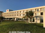
On the southern coast of Ishigaki, we stayed at Ishigakijima Beach Hotel Sunshine for one night. It's a nice hotel. About 30 min. by car from the airport. 本館 https://www.ishigakijima-sunshine.net/
|
|
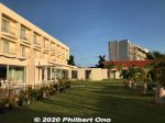
Ishigakijima Beach Hotel Sunshine has the main building on the left. We stayed in the newer annex seen in the distance. Both buildings face the ocean.Including breakfast, it costs ¥8,000/person for two people in a room in the main building.
|
|

Ishigakijima Beach Hotel Sunshine's newer Ocean Garden annex. 新館
|
|
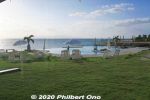
Hotel pool if you want to swim. Because you cannot swim in the ocean...
|
|

My nice room at Ishigakijima Beach Hotel Sunshine's Ocean Garden annex.
|
|
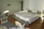
Very modern room.
|
|

Room rate is about ¥15,000/person in this new annex. Pricing also depends on the season.
|
|
|
|
|
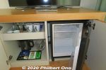
Refrigerator.
|
|

Roomy balcony of my hotel room.
|
|
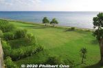
View from my room.
|
|
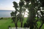
View from my room, partially obstructed by a big tree.
|
|

Tropical plant.
|
|
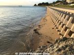
Although the hotel's name has the word "Beach," there's no beach and it's not for swimming. In summer, they have marine activities, but no ocean swimming or sunbathing on a beach. There's a pool and lawn though.
|
|
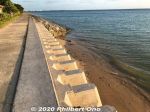
Walked along the oceanfront.
|
|
|
|
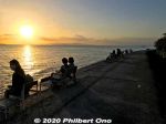
An adjacent hotel had chairs on the waterfront for the sunset.
|
|
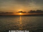
Ishigaki sunset.
|
|
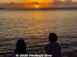
The hotel's oceanfront does have great Ishigaki sunset views.
|
|
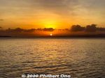
Ishigaki sunset.
|
|
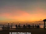
Hotel restaurant terrace at sunset. オープンレストラン 海辺のテラス
|
|
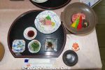
Dinner at the hotel's Nami no Shi (波の詩) restaurant. Dinner was kaiseki ryori (会席料理) including Okinawan beef. 赤瓦レストラン 波の詩にがなの白和え、グルクン南蛮漬、小松菜の胡麻和え、お造り 2 点盛、島魚の煮つけ、県産和牛の 陶板焼き、ゆし豆腐のすまし汁
|
|
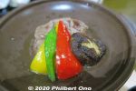
Dinner at the hotel's restaurant.
|
|
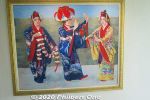
Painting of Okinawan dancers in the hotel.
|
|
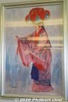
Painting of Okinawan yotsudake dancer in the hotel corridor.
|
|
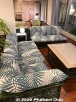
Hotel lobby sofas.
|
|
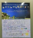
Stargazing on the Ishigakijima Beach Hotel Sunshine's roof. This tour option is called "Shani-shani Hoshizora Tour" (しゃにしゃに星空ツアー). Info in Japanese: https://www.utakuna-ishigakijima.com/hoshizoratour
|
|
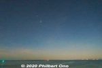
Starry night from Ishigakijima Beach Hotel Sunshine's roof.
|
|
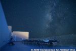
We're lying flat on cots and staring at the sky as our stargazing guide used a laser pointer to point out stars and constellations.
|
|

They also had a telescope to see Saturn and the moon.
|
|
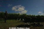
Another stargazing spot on Ishigaki, in the middle of sugar cane. We were with a large group of people also sitting on camping chairs.The guide standing on the left talked nonstop in Japanese with a microphone. He used a laser pointer to point out constellations and stars.
|
|
|
|
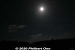
Moon was nice too.
|
|
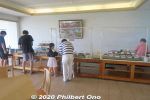
Breakfast buffet at the hotel restaurant in the main building. Plastic partitions protect the food. ブーゲンの浜
|
|
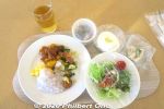
My buffet breakfast at at the hotel restaurant in the main building. Most dishes are covered with Saran wrap.
|
|
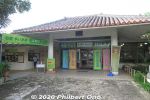
Yaima Mura is a small architectural park of traditional Yaeyama homes overlooking Nagura Bay. Open 9:00 am–5:30 pm. Adult admission ¥1,000, kids ¥500. https://www.yaimamura.com/
|
|
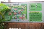
Several traditional Yaeyama homes in a park-like setting with lush greenery. "Yaima" means Yaeyama in the local Yaeyama dialect.
|
|
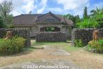
Makishi Residence is a traditional Yaeyama home. 旧牧志邸
|
|
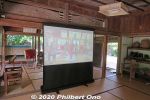
Inside Makishi Residence. 旧牧志邸
|
|
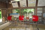
They hold traditional music performances in Makishi Residence. 旧牧志邸
|
|

Sanshin in Makishi Residence. 旧牧志邸
|
|
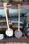
Can-type sanshin in Makishi Residence. 旧牧志邸
|
|
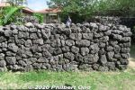
Makishi Residence privacy wall. 旧牧志邸
|
|
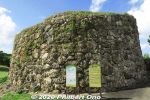
Reconstruction of a 17th-century Amparu Lookout tower used to look out for shipwrecked ships from China, Japan, and Okinawa. They were many of these towers in Ryukyu.There's a spiral slope going around the tower to reach the top.
|
|
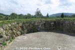
Top of Amparu Lookout gives nice views of the lush greenery in the park.
|
|
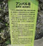
About Amparu Lookout in Japanese. アンパル塔
|
|
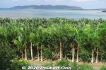
Sakieda Peninsula in the distance as seen from Amparu Lookout.
|
|
|
|