 Image search results - "Hokkaido" Image search results - "Hokkaido" |

Mt. Akaiwa
|
|

View of Otaru as we head toward Akaiwa
|
|
|
|
|
|

View from Akaiwa of Cape Takashima. Todo Rock island on the left.
|
|

Climbing Mt. Akaiwa. Almost rock climbing with a ladder and rope.
|
|
|

View of the coast.
|
|
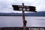
Part of Akan-Mashu National Park, Lake Akan (Akanko) is a serene crater lake in Hokkaido. In winter, the entire lake freezes over to enable ice skating and other winter sports. Winter festival is also held.
|
|
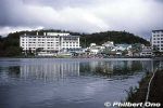
On the southern shore is Akanko Onsen hot spring with hotels and inns. Boat cruises also operate. These photos were taken years ago, so a few buildings might look different today. 阿寒湖温泉
|
|

Lake Akan's average air temperature is a low 3.7˚C. Winter temps can go as low as -17˚C. In summer, it can be as warm as 16˚C or 17˚C.
|
|

Lake Akan at sunset.
|
|

Lake Akan at sunset.
|
|

Akan-Kohan Youth Hostel was once here too. Not here anymore. 阿寒湖畔ユースホステル(既に閉館)
|
|

Bunk beds in Akan-Kohan Youth Hostel. 阿寒湖畔ユースホステル
|
|

Akanko Ainu Kotan is an Ainu village lined with gift shops and Ainu attractions. The path still had dirt when I visited, but it's now completely cobblestones. 阿寒湖アイヌコタン
|
|
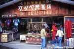
Akanko Ainu Kotan gift shop.
|
|

Akanko Ainu Kotan gifts.
|
|
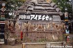
Ainu home (no longer here) was also in the Ainu village. 阿寒湖アイヌコタン
|
|

Akanko Ainu Kotan Ainu village. 阿寒湖アイヌコタン
|
|
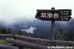
Near Lake Akan are two other small lakes, Lake Penketo (foreground) and Lake Panketo in the rear (not really visible due to fog). From Sokodai Scenic Point. 双湖台、ペンケトー
|
|
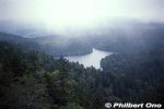
Only part of Lake Penketo can be seen from the road. Part of the Akan Volcanic Complex. ペンケトー
|
|

Lake Penketo's water flows to Panketo and ends up in Lake Akan. ペンケトー
|
|

The ocean seen from the JR Nemuro Line going to Kushiro.
|
|

Waste vegetable oil collection box sign.
|
|

One supermarket in Date, Hokkaido which has a waste vegetable oil collection box.
|
|

Near the entrance of the supermarket is the waste vegetable oil collection box.
|
|

Waste vegetable oil collection box with a few plastic bottles of waste oil left by customers.
|
|

A worker from Date Cosmos 21 comes to collect the waste oil.
|
|

Other waste oil containers.
|
|

This small building next to the Date Cosmos 21 Center is a waste oil conversion plant.
|
|

Waste oil tanks, each holding 1000 liters. The waste oil is first filtered.
|
|

The waste oil is fed to the conversion plant.
|
|

Through a chemical process, the waste oil is converted to biodiesel fuel.
|
|

Glycerine is removed from the waste oil.
|
|

The biodiesel fuel goes into this barrel.
|
|

The plant's control panel.
|
|

Bottles showing the waste oil conversion process from left to right.
|
|

Biodiesel fuel tank connected to a gas pump.
|
|

Filling up the gas tank with biodiesel fuel.
|
|

The non-toxic auto exhaust smells like tempura.
|
|

Bihoro Pass (Bihoro Toge) is on Route 243 going through the mountains on the border of Bihoro (north) and Teshikaga (south) Towns. Major tourist stop with great panoramic views of Lake Kussharo, Japan's largest caldera lake. The island in the lake is named Nakajima.
|
|

Bihoro Pass wooden marker at the scenic point. 美幌峠の標柱
|
|

Bihoro Pass is within Akan-Mashu National Park.
|
|

Lake Kussharo as seen from Bihoro Pass.
|
|
|

Bihoro Pass Scenic Point has two lookout points a short walk from each other. This is from the second lookout point. Both have similar views of Lake Kussharo. Bihoro Pass is within Akan-Mashu National Park in Hokkaido.
|
|
|
|
|

When I visited in autumn years ago, a few Ainu dressed in colorful costumes were at the Bihoro Pass scenic point posing for photos for paying tourists. アイヌ
|
|

Sapporo Station, morning train for Otaru.
|
|

Inside train to Otaru. It takes about 40 min. by regular train, and costs a mere 620 yen.
|
|

Milk shake with a Yubari melon flavor.
|
|

My favorite train station name: Zenibako Station. Zenibako means money box.
|
|
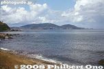
Otaru in sight from the train window.
|
|

Sign promoting the Hokkaido Shinkansen to be built.
|
|

Otaru Station
|
|

Otaru Station platform
|
|

Otaru Station
|
|

Inside Otaru Station
|
|

JR Otaru Station
|
|

Otaru Station
|
|

Otaru Station and bus terminal on the left.
|
|

Chuo bus terminal next to Otaru Station.
|
|

Billboard bus
|
|

Sign promoting the shinkansen to be built to Hokkaido.
|
|

View of Chuo-dori road from Otaru Station. Walk down this road to reach Otaru Canal.
|
|

Sign in English, Chinese, Korean, and Russian.
|
|

The former Temiya Line, Hokkaido's first rail line linking Otaru and Sapporo. It was discontinued in 1985.
|
|

Temiya Line
|
|
|

Karaoke place designed to blend in and conform to the area's building code.
|
|

Miyako shopping arcade
|
|

Miyako shopping arcade
|
|

Chuo-dori road looking toward Otaru Station
|
|

At the end of Chuo-dori is Unga Plaza which used to be Otaru Warehouse. Now find tourist info counter and gift shop.
|
|

Inside Unga Plaza
|
|

Unga Plaza inner courtyard.
|
|

Otaru Canal is a short walk from Otaru Station.
|
|

Otaru Canal has a large walkway alongside.
|
|
|

Some artists show their work here.
|
|

Otaru Canal
|
|

Otaru Unga. "Unga" means canal.
|
|
|

Murals showing some history of Otaru's marine transportation.
|
|
|

Otaru Canal
|
|

East end of Otaru Canal
|
|

East end of Otaru Canal
|
|

Warehouse along the Otaru Canal
|
|

Restaurant near Otaru Canal.
|
|

Rickshaw service available at the canal.
|
|

On approach to New Chitose Airport on an Air Do Boeing 767.
|
|

Landing on New Chitose Airport's runway 19L from a northerly approach.
|
|

Hello Hokkaido, it's been a long time since I've been here.
|
|

Arrival at the New Chitose Airport terminal.
|
|

The baggage crew worked very quickly. That's my bag rolling off the plane while I was still sitting in my seat waiting to get off.
|
|

New Chitose Airport, Hokkaido's main gateway, is the first place you see G8 Hokkaido Toyako Summit Welcome signs as we get off the plane.
|
|

Air Do Boeing 767 at New Chitose Airport.
|
|

New Chitose Airport, another Welcome sign as we head for the baggage claim area.
|
|

New Chitose Airport, another Welcome sign as we head for the baggage claim area.
|
|

Inside New Chitose Airport's Central Plaza, more G8 Hokkaido Toyako Summit Welcome signs.
|
|

Inside New Chitose Airport's Central Plaza, more G8 Hokkaido Toyako Summit Welcome signs.
|
|

New Chitose Airport's Central Plaza
|
|

New Chitose Airport's beautiful Central Plaza.
|
|

New Chitose Airport's Central Plaza
|
|

New Chitose Airport's Central Plaza
|
|

Inside New Chitose Airport's Central Plaza, G8 Hokkaido Toyako Summit countdown.
|
|

Inside New Chitose Airport at the check-in terminal, more G8 Hokkaido Toyako Summit Welcome signs.
|
|

The airport has a huge shopping area full of gift shops.
|
|

G8 Hokkaido Toyako Summit merchandise. They all seem to be unofficial goods. They don't bear the official logo.
|
|

Ramen shop sign.
|
|

Minami-Chitose Station
|
|

New Chitose Airport terminal
|
|

Going through the boarding gate at New Chitose Airport, Hokkaido.
|
|

Ze plane...
|
|

On the boarding bridge to the plane. Notice the G8 Hokkaido Toyako Summit Welcome signs.
|
|

In my seat. Calbee is a sponsor, selling potatoes and potato chips.
|
|

Rainy night for take-off.
|
|

Bye-bye Hokkaido...
|
|

The famous Clock Tower or Tokeidai is overshadowed by much bigger and modern buildings in central Sapporo. A short walk from Sapporo Station and Odori Park.
|
|

The Clock Tower was built in 1878 as part of the Sapporo Agricultural College established largely by three Americans from Massachusetts: Dr. Willian S. Clark, William Wheeler, and David P. Penhallow.
|
|

The Clock Tower was used as a drill hall and ceremony hall. After the college moved, the building was used by local citizens for cultural purposes such as a library and lecture hall.
|
|

The construction of the tower and installation of the clock was completed in 1881. The clock was made by Howard Clock Co. of Boston, MA. It is still in the Clock Tower, sounding its original chime.
|
|

Front entrance of the Clock Tower.
|
|

The Sapporo Clock Tower is an Important Cultural Property.
|
|

The clock inside the tower is Japan's oldest. The gears and other main parts are also still the original ones. Thanks to excellent care and maintenance, the clock has come this far.
|
|
|
|

Inside the Sapporo Clock Tower. The first floor has various display panels and exhibits.
|
|

The exhibits explain about the history of Hokkaido's early settlement and development.
|
|

Scale model of what the Sapporo Agricultural College looked like. Notice the Clock Tower. In those days, Sapporo's population was only 2,600.
|
|

Records of songs which mention the Clock Tower.
|
|
|

Panel showing foreign instructors who taught at Sapporo Agricultural College.
|
|

Second floor of the Clock Tower. Mostly pews for a lecture hall.
|
|

A working clock
|
|

On New Year's Eve, a crowd gathers to hear the Clock Tower ring in the New Year.
|
|

JR Date-Mombetsu Station on the Muroran Line. Date's main train station. 伊達紋別駅
|
|

Inside JR Date-Mombetsu Station
|
|

Date: Town of Bushido. Warrior's helmet on JR Date-Mombetsu Station train platform. The city has a samurai past.
|
|

JR Date-Mombetsu Station overpass
|
|

JR Date-Mombetsu Station stairs have wood.
|
|

JR Date-Mombetsu Station overpass. The station has a certain weathered, rustic charm.
|
|

JR Date-Mombetsu Station stairs to the train platform.
|
|

JR Date-Mombetsu Station train platform.
|
|

Train at JR Date-Mombetsu Station
|
|

Street corner sculpture of a couple in love. Perhaps in reference to a romantic "date."
|
|

Bus stop in central Date.
|
|

Bus for Toyako Onsen Spa. They don't run that often, but are more convenient than a train if you want to go to Lake Toya.
|
|

Donan Bus company provides bus service in this area. 道南バス
|
|

Date Onsen Spa and cherry blossoms. There is a hot spring lodge with 58 rooms and a sauna. Reasonable rates. Non-guests can bath in the hot spring for 390 yen. Phone: 0142-25-1919
|
|

The new JR Sapporo Station is definitely the city's most noticeable change in recent years. It is a huge complex, a far cry from the old train station.
|
|

This is Minami-guchi or the South Exit. On the far right is the JR Tower.
|
|

Sapporo Station is nicknamed "Satsu-eki."
|
|
|

Sapporo Station front and center on the south side.
|
|

One of the entrances to Sapporo Station on the south side.
|
|

This symbolic sculpture has been retained from the old Sapporo Station.
|
|

Sculpture in front of Sapporo Station, south exit.
|
|
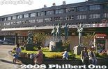
See the same sculpture in front of the old Sapporo Station, which really was a train station with almost none of the shops and restaurants found in the new station building.
|
|

Daimaru Dept. Store on the west side. Notice the entrance sign celebrating the 5th anniversary of the new train station.
|
|

JR Tower
|
|

Also on the south side of Sapporo Station is this countdown display for the G8 Hokkaido Toyako Summit to be held in early July 2008.
|
|

Sapporo Station Kita-guchi or North Exit.
|
|

Bus stops on the north side of Sapporo Station.
|
|

Sapporo Station, North Exit.
|
|

Sapporo Station's North Entrance has a sculpture and water fountain.
|
|

Sapporo Station's North Entrance has a sculpture and water fountain.
|
|

View from Sapporo Station's North Exit
|
|

Inside Sapporo Station building
|
|
|

Tourist information office inside Sapporo Station. Very spacious with numerous racks or tourist pamphlets.
|
|

Waiting area in Sapporo Station.
|
|

Sapporo Station train platform. The platform looks dark (black) since entire station is covered. The ceiling is black. The roof is also a parking lot.
|
|

Train platform in Sapporo Station. Well protected from snow.
|
|

Above the train platforms is this roof and parking lot.
|
|

View of Sapporo Station's north side from JR Tower. Admission to JR Tower lookout deck on the 38th floor is 700 yen.
|
|

View of Sapporo Station's north side from JR Tower.
|
|

View of Sapporo Station's north side from JR Tower.
|
|

View of Sapporo Station's south side from JR Tower.
|
|

View of Sapporo Station's west side from JR Tower.
|
|

View of Sapporo Station's west side from JR Tower. See the roof of Daimaru Dept. Store.
|
|

View of Sapporo Station's west side from JR Tower.
|
|

JR Tower lookout deck (temboshitsu) called JR Tower Observatory T38. JRタワー展望室
|
|

View from JR Tower looking south toward Odori Park.
|
|

View from JR Tower looking south toward Odori Park. Sapporo TV Tower on the left.
|
|

View from JR Tower toward Hokkaido University.
|
|

View from JR Tower looking east.
|
|

View from JR Tower looking east.
|
|

Toilet with a view in JR Tower
|
|

Urinal with a view in JR Tower
|
|

On the west side is Kinokuniya Bookstore.
|
|

Elevated train tracks on west side.
|
|

Yodobashi Camera store on west side of Sapporo Station.
|
|

Yodobashi, Hokkaido's largest camera and electronics store.
|
|
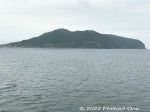
Approaching Hakodate with Mt. Hakodate in view.
|
|
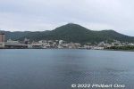
Approaching Hakodate Port with Mt. Hakodate in view.
|
|
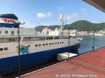
Hakodate Port's Wakamatsu Dock where cruise ships dock next to the Mashu Maru museum ship.
|
|
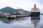
Hakodate Port's Wakamatsu Dock where cruise ships dock.
|
|
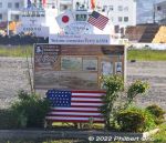
Monument for Commodore Perry's visit to Hakodate.
|
|

Map of Hakodate.
|
|

Map of the area around JR Hakodate Station.
|
|
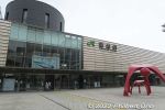
JR Hakodate Station is right next to Hakodate Port because train ferries used to dock and bring the trains to the station.
|
|
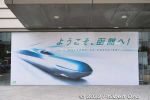
Hokkaido Shinkansen does not stop at JR Hakodate Station. It stops at Shin-Hakodate-Hokuto Station slightly north. Also stops at Kikonai Station slightly south.
|
|
|
|
|
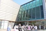
JR Hakodate Station entrance.
|
|
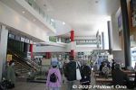
Inside JR Hakodate Station.
|
|
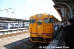
South Hokkaido Railway (Donan Isaribi Railway) going to JR Kikonai Station (end of the line) and shinkansen station.
|
|
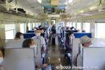
Inside the South Hokkaido Line train.
|
|
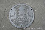
Hakodate manhole with a cuttlefish design.
|
|
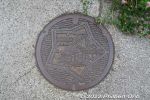
Hakodate manhole with a Goryokaku Castle design.
|
|
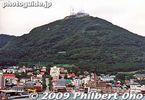
Hakodate's main attraction and landmark is Mt. Hakodate-yama, accessible by ropeway.
|
|
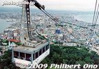
Going up Hakodate-yama, Hakodate, Hokkaido.
|
|
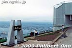
Hakodate-yama
|
|
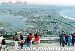
Lookout deck on Hakodate-yama.
|
|

A bird's eye view of Hakodate from Hakodate-yama. The city is pretty compact. Easy to tour on bicycle.
|
|

At night from Hakodate-yama is the Million-Dollar View.
|
|

Hakodate Port
|
|
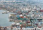
Hakodate Port
|
|

Fireworks as seen from Hakodate-yama. The fireworks were part of the annual Hakodate Minato (Port) Matsuri festival in early Aug.
|
|
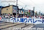
Hakodate Minato (Port) Matsuri parade
|
|
|
|
|
|
|

Old Hakodate Station. A new station was built in 2003.
|
|

Old Hakodate Station.
|
|
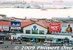
Old Hakodate Station.
|
|
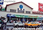
Old Hakodate Station.
|
|

Mashu Maru, a ferry which plied between Hakodate and Aomori.
|
|
|

Hakodate Morning Market
|
|
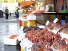
Morning Market. Photo by Hokkaido Tourist Organization.
|
|
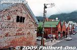
Hakodate Red Brick Warehouses
|
|
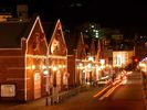
Hakodate Red Brick Warehouses at night. Photo by Hokkaido Tourist Organization.
|
|
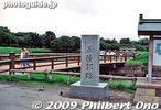
Goryokaku Castle Park
|
|

Goryokaku Castle Park
|
|

Goryokaku Castle Park. Frustrating that you cannot photograph the entire star-shaped castle. Unless you're in an airplane.
|
|
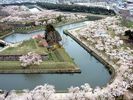
Photo by Hokkaido Tourist Organization.
|
|

Sea gulls in Hokkaido all face the same direction. They must be Japanese birds who like to conform to the group.
|
|
|
|
|
|
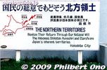
Give back the Northern Territories
|
|

Ticket gate and entrance to Hitsujigaoka Observation Hill (Hitsujigaoka Tembodai). 500 yen admission is charged so someone from the ticket office boarded our bus to collect admission fees.
|
|

Approaching Hitsujigaoka Observation Hill. The place is open every day from 8:30 am to 6 pm or 7 pm during spring and summer. Slightly shorter hours during winter (Oct.-April).
|
|

The place has a large parking lot and restaurant, shops, and wedding chapels. A little tourist village has formed over the years since the Hitsujigaoka Observation Hill opened in 1959.
|
|

Hitsujigaoka Observation Hill is accessible by a 10-min. bus ride from Fukuzumi Station (Toho subway line). See the famous statue of William Clark on the fringe beyond the parking lot.
|
|
| 1782 files on 8 page(s) |
1 |
 |
 |
 |
 |
|