 Last additions - HOKKAIDO 北海道 Last additions - HOKKAIDO 北海道 |
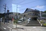
Approaching Yokozuna Chiyonoyama and Chiyonofuji Memorial Hall.From JR Kikkonai Station, take a bus to Matsumae and get off at Fukushima bus stop. Takes alomst an hour. Open 9 am–5 pm. Admission ¥500. Cloeed Dec. 1 to March 15. https://be-happy-fukushima.com/attractions/yokozuna-kinenkan/Dec 06, 2022
|
|
Road signs in Fukushima, Matsumae indicate you're in a Yokozuna town.Dec 06, 2022
|
|
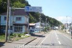
Road signs in Fukushima, Matsumae point the way to Yokozuna Chiyonoyama and Chiyonofuji Memorial Hall.Dec 06, 2022
|
|
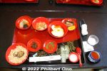
For lunch in Matsumae, we had the same food that was served to the Matsumae samurai. Very good. Served at a hot spring ryokan named "Yano." (温泉旅館 矢野) https://www.matsumae-yano.comJul 17, 2022
|
|

Matsumae Town Hall is near the castle. The previous building caught fire in 1949 which spread to the castle's main tower.Jul 17, 2022
|
|
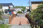
From the 1990s, further excavations were conducted and pieces of castle roof tiles and stone wall remnants were discovered.Jul 17, 2022
|
|

Map of Matsumae Park. In spring, the park is noted for cherry blossoms.Jul 17, 2022
|
|
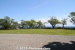
Front lawn with cherry blossom trees which bloom in late April to mid-May.Jul 17, 2022
|
|

Matsumae Castle's Honmaru Gomon Gate.Jul 17, 2022
|
|
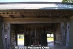
Matsumae Castle's Honmaru Gomon Gate.Jul 17, 2022
|
|
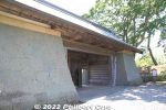
Matsumae Castle's Honmaru Gomon Gate, the castle's only surviving, original structure.Jul 17, 2022
|
|
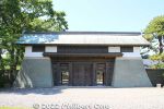
Matsumae Castle's Honmaru Gomon Gate, a National Important Cultural Property. 本丸御門Jul 17, 2022
|
|
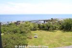
View from the top floor of Matsumae Castle's main tower. The castle grounds have 10,000 sakura trees, making it one of Japan's Top 100 Cherry Blossom Spots. 日本さくら名所100選Jul 17, 2022
|
|
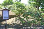
Near the Gate is a Fugenzo (普賢象) cherry tree that was planted by Prince Nobuhito Takamatsu (younger brother of the late Emperor Hirohito) in 1974. It has fluffy light pink or white flowers. ('Albo-rosea' Makino)Jul 17, 2022
|
|

View from the top floor of Matsumae Castle's main tower.Jul 17, 2022
|
|
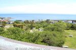
View from the top floor of Matsumae Castle's main tower.Jul 17, 2022
|
|

Jul 17, 2022
|
|
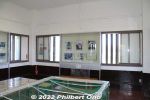
Top floor of Matsumae Castle's main tower. Windows on all four sides give good views of the park.Jul 17, 2022
|
|
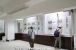
Jul 17, 2022
|
|
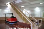
Go upstairs to the upper floors.Jul 17, 2022
|
|
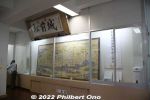
Inside Matsumae Castle's main tower (1st floor). The castle was rebuilt with donations and money from the town government. Ferroconcrete structure.Jul 17, 2022
|
|
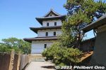
After the Edo Period, much of Matsumae Castle was dismantled except for the main tower which was a National Treasure. Unfortunately, the main tower caught fire from embers from the burning Matsumae Town Hall nearby in 1949.Jul 17, 2022
|
|
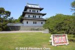
The top floor has good views of the area. This is Matsumae Castle's selfie spot. The main tower was a National Treasure until it was destroyed by fire.Jul 17, 2022
|
|
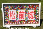
Fancy selfie sign says "Matsumae Castle." Since the current castle tower is aging and not earthquake-resistant, there are plans to replace it with another reconstruction with wood. Due to be completed in 2035.Jul 17, 2022
|
|
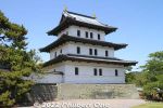
Matsumae Castle's main tower is a pretty accurate reconstruction with 3 floors on the original location. Originally named "Fukuyama Castle" since the area was named "Fukuyama." To avoid confusion with Fukuyama Castle in Hiroshima,Jul 17, 2022
|
|
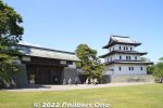
Matsumae Castle's main tower was destroyed by a fire in 1949. The current castle tower is a 1960 reconstruction, serving as a local museum. Only the gate on the left is an original structure from the 19th century. National Important Cultural PropertyJul 17, 2022
|
|
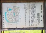
Matsumae Castle was the last Japanese castle to be built (1854) during the samurai's Edo Period. It was the base of the Matsumae Clan who ruled Hakodate and this Matsumae area (formerly named "Fukuyama"). The castle was an expansion of theiJul 17, 2022
|
|
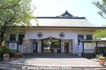
Being on the Tsugaru Strait, Matsumae was a strategic defensive position for northern Japan during the samurai era. This is the Matsumae Castle ticket gate. Small admission fee charged.Jul 17, 2022
|
|
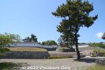
Approaching Matsumae Castle within Matsumae Park. Hokkaido's one and only Japanese-style castle. Nearest train station is Kikonai Station from where you take the Hakodate Bus and get off at "Matsushiro."Jul 17, 2022
|
|
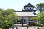
To strengthen Japan's maritime defense against foreign ships, the Tokugawa government in 1849 ordered the Matsumae Clan to build Matsumae Castle in this coastal town. Matsumae Castle's main tower peers above the ticket office.Jul 17, 2022
|
|

Nearest train station is JR Kawayu Onsen Station. Take the Akan Bus to Kawayu Onsen to reach Lake Kussharo.Apr 04, 2022
|
|

Wakoto Peninsula east side.Apr 04, 2022
|
|

Lake Kussharo's water surface looks artistic.Apr 04, 2022
|
|

Wakoto PeninsulaApr 04, 2022
|
|

Apr 04, 2022
|
|

Wakoto PeninsulaApr 04, 2022
|
|

Wakoto Peninsula's west side.Apr 04, 2022
|
|

Wakoto Peninsula has this free outdoor hot spring bath on the lake shore. Open to both men and women, most bathers wear a swimsuit.Apr 04, 2022
|
|
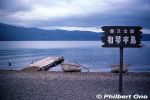
Wakoto Peninsula is another tourist part of Lake Kussharo. It's a small peninsula (2.5 km shoreline) with natural hot springs. 和琴半島Apr 04, 2022
|
|

Apr 04, 2022
|
|

Apr 04, 2022
|
|

Apr 04, 2022
|
|
Apr 04, 2022
|
|

Boats for rent at Sunayu, Lake Kussharo, Hokkaido. In winter, the lake freezes over.Apr 04, 2022
|
|

The lake circumerence is 57 km. Deepest point is 125 meters. In the middle of the lake is Nakajima island, a volcano. Japan's largest island in a lake. The island is uninhabited by humans.Apr 04, 2022
|
|

When I visited, there were Ainu on the Sunayu beach posing for tourists for a fee. Apr 04, 2022
|
|

Boating on Lake Kussharo, Hokkaido.Apr 04, 2022
|
|
Lake Kussharo, HokkaidoApr 04, 2022
|
|

By the 2000s, the water acidity decreased enough to introduce fish which could endure the acidity. Only small stocks of rainbow trout, Kokanee, and Masu salmon are now in the lake. The lake has no fishing industry.Apr 04, 2022
|
|

Lake Kussharo is noted for its mystical atmosphere. There's a lakeshore road along the southern half of the lake. Water surface covers 79.7 sq. km.You can dig into the sand and find hot spring water.Apr 04, 2022
|
|

Boats can be rented at Sunayu. In May 1938, the Kussharo Earthquake had sulfates seep into the lake from the lake bottom, making the water too acidic (pH4) for fish which got wiped out. Apr 04, 2022
|
|
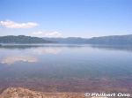
Lake Kussharo as seen from Sunayu. Lake Kussharo's caldera volcano started forming over one million years ago. The caldera lake formed over 40,000 years ago. Part of the caldera lake was filled in by Mashu volcano eruptions, making Kussharo lose its round shape and become bean-shaped.Apr 04, 2022
|
|
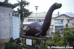
Lake Kussharo was also known for the "Kusshi" legend similar to the Loch Ness Monster, "Nessie." Credible sightings of Kussi were widely reported from 1973-1974, but stopped after the 2000s.This is an old statue displayed at JR Bihoro Station. Newer statue is at Sunayu near the lake shore.Apr 04, 2022
|
|
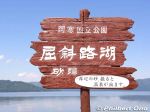
Lake Kussharo has two tourist areas. One is here at Sunayu. 砂湯Apr 04, 2022
|
|

Lake Kussharo is another scenic lake in Akan-Mashu National Park in eastern Hokkaido. Japan's largest caldera lake. Unlike Lake Mashu, Kussharo is accessible to tourists like here at Sunayu.Apr 04, 2022
|
|
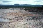
Back to the visitor's center.Apr 01, 2022
|
|

Apr 01, 2022
|
|

Note that there are other mountains named Mt. Io (Io-zan). This one is near Kawayu Onsen hot spring in Hokkaido.Apr 01, 2022
|
|

Sulphur mining ended altogether in Hokkaido in 1963.Apr 01, 2022
|
|

In 1887, a railway was built from Mt. Io to Shibecha, 41 km away. It was Hokkaido's second railway to be built after the railway between Sapporo and Otaru.Apr 01, 2022
|
|
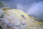
After the mining operation closed in 1896, the Hokkaido government bought the railway. Today, this railway is connected to JR Senmo Line which opened in 1931.Apr 01, 2022
|
|

Since there was no machinery in those days, mining operations were done manually with a pick and shovel. Prison labor was used for the mining. The sulphur was then loaded on horseback and boats to Kushiro.Apr 01, 2022
|
|
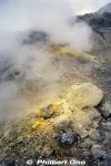
Mt. Io, Hokkaido. You can get quite close to the sulphur vents.Apr 01, 2022
|
|

The mining operations here and in other nearby mountain quickly developed local industry in eastern Hokkaido which had been largely undeveloped.Apr 01, 2022
|
|
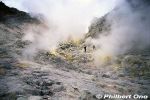
Mt. Io is Kawayu Onsen's hot spring source. It was also a sulphur mine from 1877 to 1896. At the time, sulphur was widely used in cigarette matches and gunpowder. Apr 01, 2022
|
|
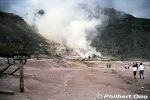
Literally nicknamed "Sulfur Mountain," Mt. Io is a convenient, steaming tourist attraction between Lake Kussharo and Lake Mashu. The mountain's Ainu name is "Atosa-nupuri," meaning "naked mountain" since it hardly has anApr 01, 2022
|
|

Mt. Io, meaning "Sulphur Mountain," is a lava dome spewing steam and sulphur gases. Tourists can walk and easily see the sulphur and steam vents. Apr 01, 2022
|
|

Apr 01, 2022
|
|
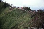
Trail to a scenic lookout point on Lake Mashu.Apr 01, 2022
|
|
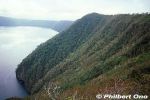
Apr 01, 2022
|
|

Beautiful shades of blue.Apr 01, 2022
|
|

Apr 01, 2022
|
|
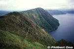
Apr 01, 2022
|
|
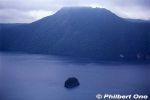
Lake Mashu and Kamuishu island.Apr 01, 2022
|
|
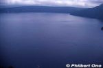
View from Scenic Lookout 3.Apr 01, 2022
|
|
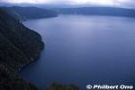
Apr 01, 2022
|
|

Apr 01, 2022
|
|
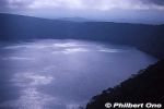
Apr 01, 2022
|
|
Apr 01, 2022
|
|
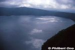
Sunlight peeking through the clouds is reflected on the lake surface.Apr 01, 2022
|
|
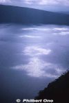
Apr 01, 2022
|
|
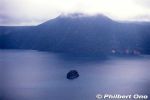
Apr 01, 2022
|
|
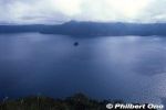
Lake Mashu in eastern Hokkaido is my favorite lake in Japan.Apr 01, 2022
|
|
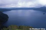
Apr 01, 2022
|
|
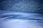
Apr 01, 2022
|
|
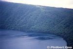
Apr 01, 2022
|
|

View of Lake Mashu from Scenic Point 1.Apr 01, 2022
|
|
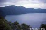
Too bad it was a cloudy day. Lake Mashu has no outflowing river.Apr 01, 2022
|
|

The small island in the lake is named "Kamuishu." It's the tip of a lava dome. View of Lake Mashu from Scenic Point 1. カムイシュ島Apr 01, 2022
|
|
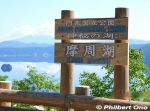
Newer Lake Mashu sign at a lookout point. Apr 01, 2022
|
|
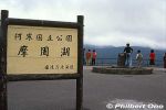
Lake Mashu has two scenic points along the crater rim where tourists can see the lake. Old sign at a lookout point. Apr 01, 2022
|
|
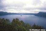
One of the most unpolluted lakes in Japan or the world. The water transparency is one of the deepest in the world at 20 to 30 meters. Part of the Akan-Mashu National Park.Apr 01, 2022
|
|
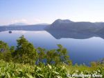
One of the most famous lakes in Japan, Lake Mashu is a crater lake devoid of boats, resorts, and other tourist traps. In fact, people are prohibited from going to the lake. We can view it, but no touching. Apr 01, 2022
|
|

Shintoku Ski Grounds as seen from the train in autumn. The lawn is decorated with しんとく (Shintoku).Mar 30, 2022
|
|

Shintoku Ski Grounds as seen from the train in autumn. The building is the ski lodge where you buy lift tickets, etc.Near JR Shintoku Station (JR Nemuro Line).Mar 30, 2022
|
|

The ocean seen from the JR Nemuro Line going to Kushiro.Mar 30, 2022
|
|

Lake Penketo's water flows to Panketo and ends up in Lake Akan. ペンケトーMar 30, 2022
|
|
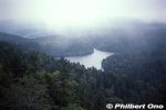
Only part of Lake Penketo can be seen from the road. Part of the Akan Volcanic Complex. ペンケトーMar 30, 2022
|
|
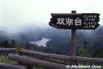
Near Lake Akan are two other small lakes, Lake Penketo (foreground) and Lake Panketo in the rear (not really visible due to fog). From Sokodai Scenic Point. 双湖台、ペンケトーMar 30, 2022
|
|

Akanko Ainu Kotan Ainu village. 阿寒湖アイヌコタンMar 30, 2022
|
|
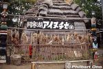
Ainu home (no longer here) was also in the Ainu village. 阿寒湖アイヌコタンMar 30, 2022
|
|

Akanko Ainu Kotan gifts.Mar 30, 2022
|
|
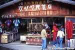
Akanko Ainu Kotan gift shop.Mar 30, 2022
|
|

Akanko Ainu Kotan is an Ainu village lined with gift shops and Ainu attractions. The path still had dirt when I visited, but it's now completely cobblestones. 阿寒湖アイヌコタンMar 30, 2022
|
|

Bunk beds in Akan-Kohan Youth Hostel. 阿寒湖畔ユースホステルMar 30, 2022
|
|

Akan-Kohan Youth Hostel was once here too. Not here anymore. 阿寒湖畔ユースホステル(既に閉館)Mar 30, 2022
|
|

Lake Akan at sunset.Mar 30, 2022
|
|

Lake Akan at sunset.Mar 30, 2022
|
|

Lake Akan's average air temperature is a low 3.7˚C. Winter temps can go as low as -17˚C. In summer, it can be as warm as 16˚C or 17˚C.Mar 30, 2022
|
|
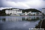
On the southern shore is Akanko Onsen hot spring with hotels and inns. Boat cruises also operate. These photos were taken years ago, so a few buildings might look different today. 阿寒湖温泉Mar 30, 2022
|
|
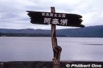
Part of Akan-Mashu National Park, Lake Akan (Akanko) is a serene crater lake in Hokkaido. In winter, the entire lake freezes over to enable ice skating and other winter sports. Winter festival is also held.Mar 30, 2022
|
|
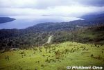
Mar 30, 2022
|
|

When I visited in autumn years ago, a few Ainu dressed in colorful costumes were at the Bihoro Pass scenic point posing for photos for paying tourists. アイヌMar 30, 2022
|
|

Mar 30, 2022
|
|

Bihoro Pass Scenic Point has two lookout points a short walk from each other. This is from the second lookout point. Both have similar views of Lake Kussharo. Bihoro Pass is within Akan-Mashu National Park in Hokkaido. Mar 30, 2022
|
|

Mar 30, 2022
|
|

Lake Kussharo as seen from Bihoro Pass.Mar 30, 2022
|
|

Bihoro Pass is within Akan-Mashu National Park. Mar 30, 2022
|
|

Bihoro Pass wooden marker at the scenic point. 美幌峠の標柱Mar 30, 2022
|
|

Bihoro Pass (Bihoro Toge) is on Route 243 going through the mountains on the border of Bihoro (north) and Teshikaga (south) Towns. Major tourist stop with great panoramic views of Lake Kussharo, Japan's largest caldera lake. The island in the lake is named Nakajima.Mar 30, 2022
|
|

Niseko Moiwa ski run. We skiied here at night. ニセコモイワMar 29, 2022
|
|
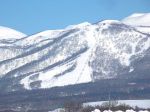
Niseko Moiwa was near our lodge. ニセコモイワMar 29, 2022
|
|

Views from Niseko Annupuri. ニセコアンヌプリMar 29, 2022
|
|

Views from Niseko Annupuri at close to sunset.Mar 29, 2022
|
|

Niseko Annupuri.Mar 29, 2022
|
|

Skiing on Niseko Annupuri, Hokkaido.Mar 29, 2022
|
|
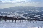
Views while skiing on Niseko Annupuri. ニセコアンヌプリMar 29, 2022
|
|

Views while skiing on Niseko Annupuri, Hokkaido. ニセコアンヌプリMar 29, 2022
|
|

Views while skiing on Niseko Annupuri. ニセコアンヌプリMar 29, 2022
|
|

Skiing on Niseko Annupuri. ニセコアンヌプリMar 29, 2022
|
|
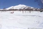
Niseko Annupuri Mar 29, 2022
|
|
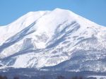
Niseko Annupuri is another famous ski resort in Niseko. This was another large area with long ski runs. ニセコアンヌプリMar 29, 2022
|
|

Niseko Annupuri ski grounds has a different view of Mt. Yotei compared to Hirafu. ニセコアンヌプリMar 29, 2022
|
|

Niseko Hirafu ski lift. ニセコ ヒラフMar 29, 2022
|
|

Niseko Hirafu ski lift. ニセコ ヒラフMar 29, 2022
|
|

Niseko Hirafu has both easy and steep (moguls) slopes. ニセコ ヒラフMar 29, 2022
|
|

Niseko Hirafu. ニセコ ヒラフMar 29, 2022
|
|

Yotei-zan as seen from Niseko Hirafu. ニセコ ヒラフ・羊蹄山Mar 29, 2022
|
|

Mt. Yotei-zan can be clearly seen from Niseko Hirafu. Hokkaido's Mt. Fuji. ニセコ ヒラフ・羊蹄山Mar 29, 2022
|
|
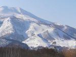
For many years, even before Niseko became popular among overseas skiers, Niseko was long known in Japan as offering the best powder snow. There are multiple ski resorts in Niseko and I skiied on three of them. This is Niseko Hirafu. ニセコ ヒラフMar 29, 2022
|
|

Mt. Yotei as seen from Niseko Hirafu, Niseko's largest ski grounds. Yotei-zan is dubbed as Hokkaido's Mt. Fuji. ニセコ ヒラフ・羊蹄山Mar 29, 2022
|
|

Ika cuttlefish boat in Kutsugata Port in Rishiri, Hokkaido. Bright lights at night attract the cuttlefish to the surface. 沓形港Sep 03, 2020
|
|
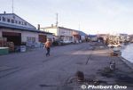
We stopped in Kutsugata Port in Rishiri briefly on our way to Rebun. 沓形港Sep 03, 2020
|
|

Kutsugata Port in Rishiri. 沓形港Sep 03, 2020
|
|

Otaru Maru at Kutsugata Port in Rishiri. 沓形港 おたる丸Sep 03, 2020
|
|

Kutsugata Port Ferry Terminal in Rishiri when we visited. This building is now a restaurant after a new ferry terminal building was built nearby.沓形港フェリーターミナルSep 03, 2020
|
|

Kutsugata Port in Rishiri.Sep 03, 2020
|
|
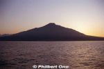
Rishiri at dawn.Sep 03, 2020
|
|

Approaching Kutsugata Port in Rishiri. 沓形港Sep 03, 2020
|
|

Wakkanai ahead.Aug 31, 2020
|
|

Bye-bye Rishiri.Aug 31, 2020
|
|

Ferry to Wakkanai. Souya Maru No. 5 第五宗谷丸Aug 31, 2020
|
|

Ferry from Rishiri to Wakkanai. Souya Maru No. 5 第五宗谷丸Aug 31, 2020
|
|
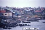
Aug 31, 2020
|
|

Aug 31, 2020
|
|

View from Cape Peshi.Aug 31, 2020
|
|

View from Cape Peshi.Aug 31, 2020
|
|

Rishiri's Oshidomari Port or ferry terminal. 鴛泊港Aug 31, 2020
|
|

Rishiri's Oshidomari Port. 鴛泊港Aug 31, 2020
|
|

Oshidomari Lighthouse on Rishiri, Hokkaido. 鴛泊灯台 Aug 31, 2020
|
|

On Cape Peshi, Oshidomari Lighthouse overlooking Oshidomari Port. 鴛泊灯台 ペシ岬Aug 31, 2020
|
|

We did some hiking on Rishiri in early autumn, nothing strenuous.Aug 31, 2020
|
|

Aug 31, 2020
|
|
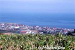
Aug 31, 2020
|
|

We did some easy hiking on Rishiri in early autumn.Aug 31, 2020
|
|

Rishiri forestAug 31, 2020
|
|

Rishiri's Oshidomari Port. 鴛泊港Aug 31, 2020
|
|

These photos were taken quite some years ago, so some things may look different now.Aug 31, 2020
|
|
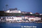
Rishiri's Oshidomari Port. 鴛泊港Aug 31, 2020
|
|

Approaching Rishiri's Oshidomari Port in northern Rishiri, closest to Wakkanai. 鴛泊港Aug 31, 2020
|
|

Approaching Rishiri by ferry.Aug 31, 2020
|
|

From Rebun, took the ferry to Rishiri, approaching Oshidomari Port.Aug 31, 2020
|
|

Aug 31, 2020
|
|

Aug 31, 2020
|
|
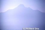
Mt. Rishiri is nicknamed "Rishiri-Fuji" since it's conical like Mt. Fuji.Aug 31, 2020
|
|
|

Rishiri is about 63 km in circumference and has a population of about 5,000. Like Rebun, best to rent a car on Rishiri and drive around. Aug 31, 2020
|
|

Approaching Rishiri by ferry. There are ferries from Wakkanai and Rebun going to Rishiri. Lighthouse near the port. Mt. Rishiri is 1,721 meters high.Aug 31, 2020
|
|

Rishiri is one of Japan's northernmost islands off Wakkanai, Hokkaido. Round island with a distinctive cone-shaped mountain Mt. Rishiri (photo) in the middle. Part of Rishiri-Rebun-Sarobetsu National Park.Aug 31, 2020
|
|

Leaving Rebun.Aug 31, 2020
|
|

Leaving Rebun.Aug 31, 2020
|
|

Aug 31, 2020
|
|

Rebun's east coast.Aug 31, 2020
|
|

Rebun sunset in Hokkaido.Aug 31, 2020
|
|

Rebun sunset in Hokkaido.Aug 31, 2020
|
|

Rebun sunset in Hokkaido.Aug 31, 2020
|
|

Watching the sunset on Rebun.Aug 31, 2020
|
|

Konbu kelp seaweed dried on Rebun.Aug 31, 2020
|
|

Cuttlefish (ika) on Rebun.Aug 31, 2020
|
|

Cuttlefish (ika) on Rebun.Aug 31, 2020
|
|

So many cuttlefish (ika).Aug 31, 2020
|
|
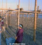
Needless to say, fishing is one of the major industries on Rebun. This was a meeting by pure chance, and they were smiling and giggling at us foreigners. So friendly.Aug 31, 2020
|
|

One of the most charming moments of our trip. Meeting friendly local women hanging cuttlefish to dry in the sun.Aug 31, 2020
|
|

Aug 31, 2020
|
|

Rishiri as seen from Rebun.Aug 31, 2020
|
|

Rishiri as seen from Rebun.Aug 31, 2020
|
|

Rishiri as seen from Rebun.Aug 31, 2020
|
|

Aug 31, 2020
|
|

Aug 31, 2020
|
|

Aug 31, 2020
|
|
Aug 31, 2020
|
|

Rishiri as seen from Rebun.Aug 31, 2020
|
|

Rebun is part of Rishiri-Rebun-Sarobetsu National Park.Aug 31, 2020
|
|

Rishiri as seen from Rebun.Aug 31, 2020
|
|
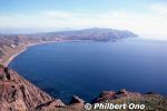
Amazing how this little island of Rebun can pack so many sights. Must be wondrous when the flowers are in bloom.Aug 31, 2020
|
|

Looking down a sheer cliff. Very dramatic...Aug 31, 2020
|
|
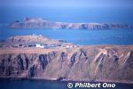
Aug 31, 2020
|
|

Aug 31, 2020
|
|

Aug 31, 2020
|
|

Did some hiking.Aug 31, 2020
|
|

Aug 31, 2020
|
|

Aug 31, 2020
|
|

Very scenic island.Aug 31, 2020
|
|

Aug 31, 2020
|
|

Aug 31, 2020
|
|

Aug 31, 2020
|
|

Aug 31, 2020
|
|

Aug 31, 2020
|
|

Aug 31, 2020
|
|

Aug 31, 2020
|
|

Cape Sukoton スコトン岬. Island in the distance is Todo island.Aug 31, 2020
|
|

Another scenc point on Rebun.Aug 31, 2020
|
|

Rishiri as seen from Rebun.Aug 31, 2020
|
|

Cape Sukoton is Rebun's northernmost tip, about 30 km from Kafuka Port. スコトン岬Aug 31, 2020
|
|
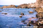
Aug 31, 2020
|
|

Aug 31, 2020
|
|

Aug 31, 2020
|
|

Fisherman with an underwater looking glass.Aug 31, 2020
|
|

Aug 31, 2020
|
|

Aug 31, 2020
|
|

Aug 31, 2020
|
|

There was this scenic spot on Rebun, so we got out of the car and took a look (and swim).Aug 31, 2020
|
|

Rebun's rolling hills and Mt. Rishiri on nearby Rishiri island. Aug 31, 2020
|
|

Rishiri as seen from Rebun. If you visit Rebun, also visit Rishiri and vice versa. They are almost like wedded islands. Rishiri is male (tall and distinct stature), Rebun is female (curvaceous).Aug 31, 2020
|
|

Aug 31, 2020
|
|

Aug 31, 2020
|
|

Aug 31, 2020
|
|

Fishing port on Rebun.Aug 31, 2020
|
|

Aug 31, 2020
|
|

On the left is Lake Kushu, and ocean on the right.Aug 31, 2020
|
|

Rebun has lots of rolling hills. This was in autumn, offpeak season with no flowers.Aug 31, 2020
|
|

Lake Kushu in northern Rebun, Hokkaido. 久種湖Aug 31, 2020
|
|

Rebun's east coast.Aug 31, 2020
|
|

Beachside road on Rebun's east coast. The best way to tour Rebun is by rental car or a local tour.Aug 31, 2020
|
|

Kafuka Port 香深港Aug 31, 2020
|
|

Kafuka Port 香深港Aug 31, 2020
|
|

Aug 31, 2020
|
|

These photos were taken quite some years ago, so some things may look different now.Aug 31, 2020
|
|
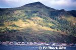
Aug 31, 2020
|
|

Aug 31, 2020
|
|

Rebun's east coast near Kafuka Port.Aug 31, 2020
|
|
|
| 1864 files on 8 page(s) |
2 |  |
 |
 |
 |
|