 Last additions Last additions |

Looking down a sheer cliff. Very dramatic...Aug 31, 2020
|
|
Aug 31, 2020
|
|

Aug 31, 2020
|
|

Aug 31, 2020
|
|

Did some hiking.Aug 31, 2020
|
|

Aug 31, 2020
|
|

Aug 31, 2020
|
|

Very scenic island.Aug 31, 2020
|
|

Aug 31, 2020
|
|

Aug 31, 2020
|
|

Aug 31, 2020
|
|

Aug 31, 2020
|
|

Aug 31, 2020
|
|

Aug 31, 2020
|
|

Aug 31, 2020
|
|

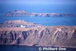
Cape Sukoton スコトン岬. Island in the distance is Todo island.Aug 31, 2020
|
|

Another scenc point on Rebun.Aug 31, 2020
|
|

Rishiri as seen from Rebun.Aug 31, 2020
|
|

Cape Sukoton is Rebun's northernmost tip, about 30 km from Kafuka Port. スコトン岬Aug 31, 2020
|
|
Aug 31, 2020
|
|

Aug 31, 2020
|
|

Aug 31, 2020
|
|

Fisherman with an underwater looking glass.Aug 31, 2020
|
|

Aug 31, 2020
|
|

Aug 31, 2020
|
|

Aug 31, 2020
|
|

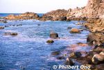
There was this scenic spot on Rebun, so we got out of the car and took a look (and swim).Aug 31, 2020
|
|

Rebun's rolling hills and Mt. Rishiri on nearby Rishiri island. Aug 31, 2020
|
|

Rishiri as seen from Rebun. If you visit Rebun, also visit Rishiri and vice versa. They are almost like wedded islands. Rishiri is male (tall and distinct stature), Rebun is female (curvaceous).Aug 31, 2020
|
|

Aug 31, 2020
|
|

Aug 31, 2020
|
|

Aug 31, 2020
|
|

Fishing port on Rebun.Aug 31, 2020
|
|

Aug 31, 2020
|
|

On the left is Lake Kushu, and ocean on the right.Aug 31, 2020
|
|

Rebun has lots of rolling hills. This was in autumn, offpeak season with no flowers.Aug 31, 2020
|
|

Lake Kushu in northern Rebun, Hokkaido. 久種湖Aug 31, 2020
|
|

Rebun's east coast.Aug 31, 2020
|
|

Beachside road on Rebun's east coast. The best way to tour Rebun is by rental car or a local tour.Aug 31, 2020
|
|

Kafuka Port 香深港Aug 31, 2020
|
|

Kafuka Port 香深港Aug 31, 2020
|
|

Aug 31, 2020
|
|

These photos were taken quite some years ago, so some things may look different now.Aug 31, 2020
|
|
Aug 31, 2020
|
|

Aug 31, 2020
|
|

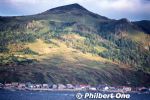
Rebun's east coast near Kafuka Port.Aug 31, 2020
|
|
|

Rebun's population is about 2,250. "Rebun" comes from the Ainu word "repun-sir" meaning "island offshore."Aug 31, 2020
|
|

If you rent a car, you can pretty much see the entire island in one day.Aug 31, 2020
|
|

Rebun is part of Rishiri-Rebun-Sarobetsu National Park which means it's very scenic. It's 29 km long and 8 km wide.Aug 31, 2020
|
|

Approaching Rebun, Japan's northernmost inhabited island near the northern tip of Hokkaido. It's quite remote, but well-known as a "Flower Island" among tourists when in bloom.Aug 31, 2020
|
|

JR Sunami Station (JR Kure Line) is the closest to Mt. Fudekage. Then it's a 50-min. hike up. 須波駅Aug 31, 2020
|
|

View of central Mihara (area around Mihara Station) from Mt. Fudekage in Mihara, Hiroshima.Aug 31, 2020
|
|
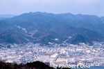
View of central Mihara (area around Mihara Station) from Mt. Fudekage in Mihara, Hiroshima.Aug 31, 2020
|
|

Aug 31, 2020
|
|

View of Seto Inland Sea from Mt. Fudekage in Mihara, Hiroshima.Aug 31, 2020
|
|

Aug 31, 2020
|
|
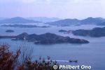
Aug 31, 2020
|
|
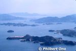
View of Seto Inland Sea from Mt. Fudekage in Mihara, Hiroshima.Aug 31, 2020
|
|

Mt. Fudekage has a lookout deck for great views.Aug 31, 2020
|
|

View of Seto Inland Sea from Mt. Fudekage in Mihara, Hiroshima. you can see Kosagi in the foreground, Sagi, and Hoso islands. In the distance on the right is Innoshima and part of the Shimanami Kaido bridge connecting Shikoku (Imabari) and Hiroshima.Aug 31, 2020
|
|

View of Seto Inland Sea from Mt. Fudekage in Mihara, Hiroshima.Aug 31, 2020
|
|
|
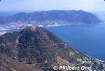
Looking east. Aug 31, 2020
|
|

From JR Mihara Station, there's a local bus that goes up to Mt. Fudekage taking 7 min. Otherwise, it's a 50-min. hike from JR Sunami Station (JR Kure Line).Aug 31, 2020
|
|
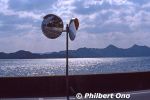
Mt. Fudekage is 313 meters high and part of the Seto Inland Sea National Park. Great views of Seto Inland Sea and Shikoku from Mihara, Hiroshima.Aug 31, 2020
|
|

My video of Yamagata Hanagasa Matsuri in Aug. 2009.Aug 29, 2020
|
|
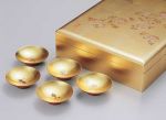
Lacquerware with gold leaf.写真提供:©石川県観光連盟Aug 15, 2020
|
|

Seki-juku was the 47th station or lodging/post town on the old Tokaido Road. It well retains a traditional townscape with a good number of traditional Edo Period buildings including the Honjin and Waki Honjin. Seki-juku is preceded by Kameyama-juku and followed by Sakashita-juku. All three are in the present-day city of Kameyama. Hiroshige also created this woodblock print of Seki-juku in the 1830s. It depicts daimyo staff preparing to leave the Honjin lodge before dawn (notice the still dark sky). Unknown which Honjin it is. (Seki had two Honjin.)Aug 15, 2020
|
|
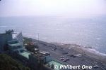
View from Omaezaki Lighthouse looking east.Jul 04, 2020
|
|
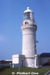
Omaezaki Lighthouse is on Cape Omaezaki. It was designed by British engineer Richard Henry Brunton and completed in 1874. Japan's first lighthouse to use a Fresnel lens.Jul 04, 2020
|
|
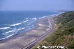
View from Omaezaki Lighthouse looking west. The lighthouse is open to the public.Jul 04, 2020
|
|
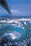
Naruto whirlpool.JNTO photo.Jul 02, 2020
|
|

Samurai house 長町武家屋敷跡野村家Jul 02, 2020
|
|

Omi-cho Market crab vendor.Jul 02, 2020
|
|

Omi-cho Market Jul 02, 2020
|
|

Omi-cho Market Jul 02, 2020
|
|

Omi-cho Market is full of seafood vendors.Jul 02, 2020
|
|

Tokikuni-ke home.写真提供:©石川県観光連盟Jul 02, 2020
|
|

Inside Kami Tokikuni-ke home.写真提供:©石川県観光連盟Jul 02, 2020
|
|

Two Tokikuni-ke (¥520) thatched-roof homes in Sosogi. Built in 1831, Kami Tokikuni-ke was the residence of a wealthy farmer descended from Tokikuni who was related to the Taira Clan. The house has stately rooms and a garden. 上時国家写真提供:©石川県観光連盟Jul 02, 2020
|
|
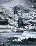
Tarumi Falls in winter. 垂水の滝写真提供:©石川県観光連盟Jul 02, 2020
|
|
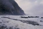
In winter, the Sosogi Coast is famous for Nami-no-Hana (wave flowers) which are bits of ocean foam that get blown around in the air like flowers.写真提供:©石川県観光連盟Jul 02, 2020
|
|
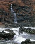
Tarumi Falls 垂水の滝写真提供:©石川県観光連盟Jul 02, 2020
|
|
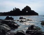
Mado-iwa (Window Rock) has a through hole in the rock. Rough waves have eroded the Sosogi Coast into fantastic rock formations largely made of rhyolite.写真提供:©石川県観光連盟Jul 02, 2020
|
|
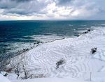
Senmaida in winter.写真提供:©石川県観光連盟Jul 02, 2020
|
|

Senmaida with candlelights during an event.写真提供:©石川県観光連盟Jul 02, 2020
|
|
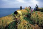
At Senmaida, harvesting rice.写真提供:©石川県観光連盟Jul 02, 2020
|
|

At Senmaida, harvesting rice.写真提供:©石川県観光連盟Jul 02, 2020
|
|
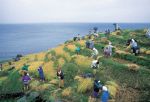
At Senmaida, harvesting rice.写真提供:©石川県観光連盟Jul 02, 2020
|
|

写真提供:©石川県観光連盟Jul 02, 2020
|
|

Senmaida in fall.写真提供:©石川県観光連盟Jul 02, 2020
|
|

写真提供:©石川県観光連盟Jul 02, 2020
|
|

写真提供:©石川県観光連盟Jul 02, 2020
|
|

写真提供:©石川県観光連盟Jul 02, 2020
|
|

写真提供:©石川県観光連盟Jul 02, 2020
|
|

写真提供:©石川県観光連盟Jul 02, 2020
|
|

写真提供:©石川県観光連盟Jul 02, 2020
|
|
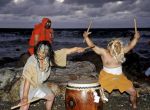
They beat taiko drums when they invaded Lord Uesugi Kenshin's base camp. They used sickles and hoes to chase away the army who was enroute to capture Nanao Castle. The villagers lived happily afterward.写真提供:©石川県観光連盟Jul 02, 2020
|
|
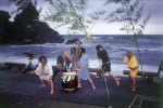
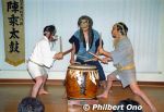
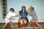
The taiko drummers wear fearsome masks while drumming. Gojinjo daiko commemorate the day when villagers in Nabunemachi in Wajima, Ishikawa Prefecture used crude and frightening masks made of tree bark and seaweed dangling from their heads.写真提供:©石川県観光連盟Jul 02, 2020
|
|

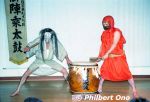
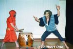
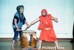
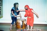
Gojinjo-Daiko is powerful, crazied drumming performance by several men donning demon masks and wigs. They are based in a small village called Nabune in Wajima where Gojinjo-daiko originated.Legend has it that their drumming and fierce-looking masks drove off the invading forces of Uesugi Kenshin, ruler of Echigō Province (Niigata Pref.) during the Warring States Period in the 16th century.
写真提供:©石川県観光連盟Jul 02, 2020
|
|
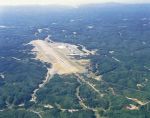
Noto Airport写真提供:©石川県観光連盟Jul 02, 2020
|
|
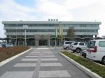
Noto Airport写真提供:©石川県観光連盟Jul 02, 2020
|
|

Sojiji Soin Temple.写真提供:©石川県観光連盟Jul 02, 2020
|
|
The new headquarters temple was transferred to the one in Yokohama in 1911. Sojiji Soin Temple is now a regional headquarters temple (betsuin).写真提供:©石川県観光連盟Jul 02, 2020
|
|
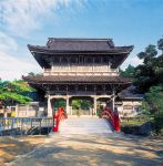
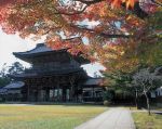
Sojiji Soin Temple in Wajima used to be one of the headquarters temple for the Soto Zen Buddhist sect until a fire razed most of the temple in 1898. 總持寺祖院This is the Sanmon Gate.
写真提供:©石川県観光連盟Jul 02, 2020
|
|
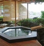
写真提供:©石川県観光連盟Jul 02, 2020
|
|
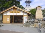
Wajima onsen foot bath.写真提供:©石川県観光連盟Jul 02, 2020
|
|
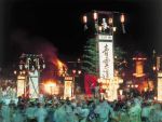
Wajima Taisai Festival with kiriko floats. Wajima has four kiriko festivals. Most kiriko lantern festivals in the Noto Peninsula are held at night. 輪島大祭https://www.hot-ishikawa.jp/kiriko/en/kiriko/wajimataisai.php
写真提供:©石川県観光連盟Jul 02, 2020
|
|
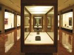
石川県輪島漆芸美術館写真提供:©石川県観光連盟Jul 02, 2020
|
|
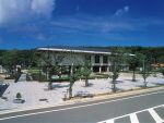
Wajima Museum of Urushi Art is the only museum in Japan specializing in lacquerware. Besides Wajima-nuri, it also shows lacquerware from other parts of Japan. 石川県輪島漆芸美術館https://www.city.wajima.ishikawa.jp/art/
写真提供:©石川県観光連盟Jul 02, 2020
|
|
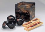
Wajima-nuri lacquerware写真提供:©石川県観光連盟Jul 02, 2020
|
|

Wajima Asa-ichi Morning Market 写真提供:©石川県観光連盟Jul 02, 2020
|
|
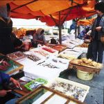
Wajima Asa-ichi Morning Market 写真提供:©石川県観光連盟Jul 02, 2020
|
|
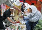
Wajima Asa-ichi Morning Market 写真提供:©石川県観光連盟Jul 02, 2020
|
|
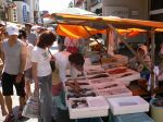
Wajima Asa-ichi Morning Market has lots of seafood.写真提供:©石川県観光連盟Jul 02, 2020
|
|
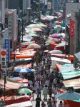
Wajima Asa-ichi Morning Market 写真提供:©石川県観光連盟Jul 02, 2020
|
|
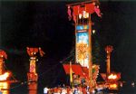
Hôryu Tanabata Kiriko Festival held on Aug. 7 in Suzu. 宝立七夕キリコ祭https://www.hot-ishikawa.jp/kiriko/en/kiriko/houryu.php
写真提供:©石川県観光連盟Jul 02, 2020
|
|
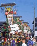
Takojima Kiriko Festival held in autumn in Suzu. Floats have lots of lacquered parts. 蛸島キリコ祭りhttps://www.hot-ishikawa.jp/kiriko/en/kiriko/takojima.php
写真提供:©石川県観光連盟Jul 02, 2020
|
|
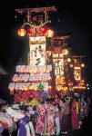
Takojima Kiriko Festival in Suzu. 蛸島キリコ祭りhttps://www.hot-ishikawa.jp/kiriko/en/kiriko/takojima.php
写真提供:©石川県観光連盟Jul 02, 2020
|
|
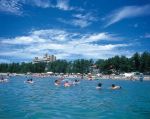
Hachigasaki Beach 鉢ヶ崎海水浴場写真提供:©石川県観光連盟Jul 02, 2020
|
|
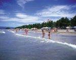
Hachigasaki Beach 鉢ヶ崎海水浴場写真提供:©石川県観光連盟Jul 02, 2020
|
|
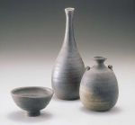
Suzu pottery写真提供:©石川県観光連盟Jul 02, 2020
|
|
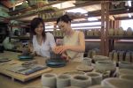
珠洲市陶芸センター写真提供:©石川県観光連盟Jul 02, 2020
|
|
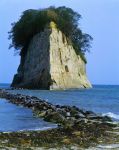
Mitsukejima island has a rock bridge for easy access. There's Mitsuke Shrine and wild birds like crows and cormorants. Uninhabited by humans.写真提供:©石川県観光連盟Jul 02, 2020
|
|
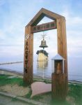
Lover's bell at Mitsukejima. The nearby beach has a swimming beach park, rest house, and camping grounds. Accessible by local bus from Wajima and Kanazawa.写真提供:©石川県観光連盟Jul 02, 2020
|
|

Made of white, diatomite rock, Mitsukejima island is 150 meters long, 50 meters wide, 28 meters high, and a perimenter of 400 meters, capped with Japanese pine trees. Free admission.写真提供:©石川県観光連盟Jul 02, 2020
|
|

Nicknamed "Battleship Island" (Gunkanjima), Mitsukejima island is Suzu's most famous attraction about 200 meters from shore. 見附島"Mitsukejima" means "Found Island," supposedly named by the priest Kukai (Shingon Buddhist sect founder) when it was the first island that he "found" on his way back from Sado island in Niigata. It was also "found" by a deity who descended here.
写真提供:©石川県観光連盟Jul 02, 2020
|
|
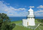
It took 2 years to build Rokkozaki Lighthouse. Made of highly durable stones hauled in 60 km by boat from Anamizu. From the boat, the stones were carried up the high cliff on a cable system.The lighthouse became automated (unmanned) in 1963. After over a century, this lighthouse still stands and operates. The light is visible for 33 km at sea.
写真提供:©石川県観光連盟Jul 02, 2020
|
|

Hatago Iwa wedded rocks face west, so it's great for sunsets. 機具岩写真提供:©石川県観光連盟Jul 02, 2020
|
|
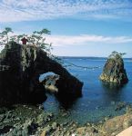
Hatago Iwa wedded rocks are nicknamed "Noto Futami" (能登二見) because they are similar to the famous wedded rocks in Futami, Mie Prefecture. 機具岩写真提供:©石川県観光連盟Jul 02, 2020
|
|

Hatago Iwa wedded rocks. The larger, female rock (with the hole) stands 16 meters high and has a small shrine. Smaller male rock is 12 meters high. The Kongo Coast sure has lots of rocks with a hole in them. 機具岩 (Noto Futami)写真提供:©石川県観光連盟Jul 02, 2020
|
|
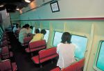
Tsukumo Bay glass bottom boat.写真提供:©石川県観光連盟Jul 02, 2020
|
|

Tsukumo Bay 九十九湾写真提供:©石川県観光連盟Jul 02, 2020
|
|

Tsukumo Bay 九十九湾写真提供:©石川県観光連盟Jul 02, 2020
|
|
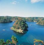
Tsukumo Bay has this island called Horaijima. 蓬莱島 九十九湾写真提供:©石川県観光連盟Jul 02, 2020
|
|
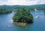
Tsukumo Bay 九十九湾写真提供:©石川県観光連盟Jul 02, 2020
|
|
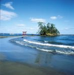
Bentenjima island on the Koiji Coast. Benten or Benzaiten is the goddess of music and water and anything that flows. The beach is popular with swimmers in summer.写真提供:©石川県観光連盟Jul 02, 2020
|
|

Tsukumo Bay is a ria or coastal inlet. Boat cruises are available. 九十九湾写真提供:©石川県観光連盟Jul 02, 2020
|
|
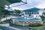
Notojima Aquarium's dolphin show. のとじま水族館https://www.notoaqua.jp/
写真提供:©石川県観光連盟Jul 02, 2020
|
|

Notojima Aquarium has a whale shark. のとじま水族館・ジンベイザメ写真提供:©石川県観光連盟Jul 02, 2020
|
|

Notojima Aquarium's glass tunnel is a highlight. のとじま水族館写真提供:©石川県観光連盟Jul 02, 2020
|
|

Notojima Aquarium displays 500 species of marine life from near Noto Peninsula. のとじま水族館写真提供:©石川県観光連盟Jul 02, 2020
|
|

Notojima Aquarium is on Notojima island in Nanao. Opened in July 1982 as Ishikawa Prefecture's sole aquarium. のとじま水族館・のとじま臨海公園水族館From Nanao Station, local buses run to the aquarium taking 45 min. Address: 石川県七尾市能登島曲町15部40
Phone: 0767-84-1271
Closed: Dec. 29–Jan. 31
写真提供:©石川県観光連盟Jul 02, 2020
|
|
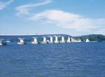
Notojima Bridge links central Nanao to Notojima island. It's 1,050 meters long. 能登島写真提供:©石川県観光連盟Jul 02, 2020
|
|
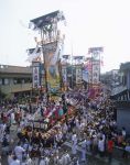
Nanao has a lot of kiriko lantern float festivals. This one is Issaki Hoto Festival with six floats held in Aug. Largest one is 15 meters tall. 石崎奉燈祭https://www.hot-ishikawa.jp/kiriko/en/kiriko/issaki.php
写真提供:©石川県観光連盟Jul 02, 2020
|
|
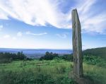
Site of Nanao Castle.写真提供:©石川県観光連盟Jul 02, 2020
|
|
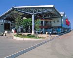
Nanao Fisherman's Wharf has lots of seafood shops and restaurants. 10-min. walk from JR Nanao Station. 七尾フィッシャーマンズワーフ・能登食祭市場http://www.shokusai.co.jp/
写真提供:©石川県観光連盟Jul 02, 2020
|
|
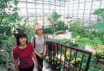
Nanao Flower Park Noto Orchid Land has a large greehouse of flowers and outdoor putting golf course. 七尾フラワーパークのと蘭の国写真提供:©石川県観光連盟Jul 02, 2020
|
|

Ishikawa Nanao Art Museum 石川県七尾美術館写真提供:©石川県観光連盟Jul 02, 2020
|
|

Nanao Flower Park Noto Orchid Land 七尾フラワーパークのと蘭の国http://www.notorannokuni.com/
写真提供:©石川県観光連盟Jul 02, 2020
|
|

Ishikawa Nanao Art Museum 石川県七尾美術館https://nanao-art-museum.jp/
写真提供:©石川県観光連盟Jul 02, 2020
|
|

Wakura Onsen foot bath. 和倉温泉・妻恋舟の湯写真提供:©石川県観光連盟Jul 02, 2020
|
|

Wakura Onsen Public Bath. 和倉温泉・妻恋舟の湯・総湯http://www.wakura.co.jp/
写真提供:©石川県観光連盟Jul 02, 2020
|
|
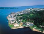
Wakura Onsen 和倉温泉写真提供:©石川県観光連盟Jul 02, 2020
|
|

Wakura Onsen Public Bath is great for day trippers. Low-cost hot spring bath. 和倉温泉・総湯http://www.wakura.co.jp/
写真提供:©石川県観光連盟Jul 02, 2020
|
|

Myojoji Temple's Main hall写真提供:©石川県観光連盟Jul 02, 2020
|
|

Myojoji Temple in Hakui belongs to the Nichiren Buddhist sect. It is the Nichiren headquarters temple for the Hokuriku Region. 妙成寺Myojoji Temple gate.写真提供:©石川県観光連盟Jul 02, 2020
|
|

Myojoji Temple's Main hall写真提供:©石川県観光連盟Jul 02, 2020
|
|
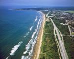
Aerial view of Chirihama Nagisa Driveway in Hakui, Ishikawa.写真提供:©石川県観光連盟Jul 02, 2020
|
|
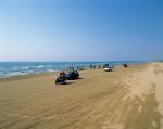
Chirihama Nagisa Driveway in Hakui, Ishikawa. You can also park your car and wade in the water.写真提供:©石川県観光連盟Jul 02, 2020
|
|

Chirihama Nagisa Driveway in Hakui, Ishikawa.写真提供:©石川県観光連盟Jul 02, 2020
|
|
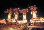
Anamizu's kiriko lantern festival called Maenami Hikiyama Festival. Lantern floats are paraded in the evening. Prayer for a good harvest and fish catch. Held in Sept. 前波曳山祭https://www.hot-ishikawa.jp/kiriko/en/kiriko/maenami.php
写真提供:©石川県観光連盟Jul 02, 2020
|
|
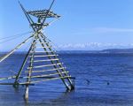
Bora-machi yagura. This fishing method died out in the mid-1990s, but you might still see the tower built for tourists. (ボラ待ちやぐら)写真提供:©石川県観光連盟Jul 02, 2020
|
|
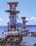
Anamizu's kiriko lantern festival, called Okinami Tairyo Festival, is held in the ocean during the day to pray for a good catch and safety of fishermen.. 沖波大漁祭https://www.hot-ishikawa.jp/kiriko/en/kiriko/okinami.php
写真提供:©石川県観光連盟Jul 02, 2020
|
|

Ōnaruto BridgeJul 01, 2020
|
|

Ōnaruto Bridge and Naruto whirlpool.Jul 01, 2020
|
|

Naruto whirlpoolJul 01, 2020
|
|

Naruto whirlpools can also be seen from the bridge.Jul 01, 2020
|
|

How impressive the Naruto whirlpools are depend on the day and time. Check the website for best times to go: https://www.uzusio.com/en/Jul 01, 2020
|
|

The boat has a higher deck, so you can see the whirlpools better.Jul 01, 2020
|
|

Ōnaruto Bridge was completed in 1985 and stretches for 876 meters (2,874 ft) over the ocean. 大鳴門橋Jul 01, 2020
|
|

The Ōnaruto Bridge spans over Naruto Strait connecting Naruto and Awaji island. 大鳴門橋Jul 01, 2020
|
|

Short boat cruise to Naruto Strait. 大鳴門橋Jul 01, 2020
|
|

Boat to see Naruto whirlpools. Boats leave about twice an hour from around 9:15 am to 4:15 pm. Cruise time is about 30 min., fare is around ¥2,400.Jul 01, 2020
|
|

You can see the whirlpools from a boat run by Naruto Kanko Kisen (Uzushio Kancho-sen). Local buses run from Tokushima Station and Naruto Station to Naruto Kanko-ko (鳴門観光港) where the boat leaves. (The boat terminal looks different from this old pPort location: https://goo.gl/maps/7jxi9mDKaWgz8JM77Jul 01, 2020
|
|

Naruto whirlpools in Naruto, Tokushima Prefecture are very famous and a major tourist attracton in Shikoku. The whirlpools occur in Naruto Strait between Naruto and Awaji island.Jul 01, 2020
|
|

View from the lookout deck on the top floor of Shimabara Castle's main tower.Jul 01, 2020
|
|

Shimabara Station train.Jul 01, 2020
|
|

Shimabara Station turnstile.Jul 01, 2020
|
|

Shimabara Station looks like a castle building. Shimabara Castle is a short walk near Shimabara Station.Jul 01, 2020
|
|

Way to Shimabara Castle. The sign says "Beware of slippery surface of volcanic ash." 火山灰のためスリップ注意Jul 01, 2020
|
|

Shimabara Castle moat.Jul 01, 2020
|
|

After the Mt. Fugen-dake's eruption in 1991, Shimabara Castle grounds served as the command headquarters for a small contingent of Self-Defense Forces monitoring the mountain 24 hours a day.Jul 01, 2020
|
|

View from the turret.Jul 01, 2020
|
|

Jul 01, 2020
|
|

View from the lookout deck on the top floor of Shimabara Castle's main tower. Looking toward Shimabara Station (end of straight road).Jul 01, 2020
|
|

View from the lookout deck on the top floor of Shimabara Castle's main tower.Jul 01, 2020
|
|

Lookout deck on the top floor of Shimabara Castle's main tower.Jul 01, 2020
|
|

After the Mt. Fugen-dake's eruption in 1991, Shimabara Castle grounds served as the command headquarters for a small contingent of Self-Defense Forces monitoring the mountain 24 hours a day.Jul 01, 2020
|
|

Shimabara Castle and koinobori carp streamers.Jul 01, 2020
|
|

Shimabara Castle's castle donjon or main tower.Almost 40,000 peasants occupied Hara Castle to protest their religious and economic oppression. The rebellion lasted for about three months until the shogunate's troops overpowered and slaughtered the rebels. This effectively ended the propagation of Christianity in feudal Japan.Jul 01, 2020
|
|

The castle donjon or main tower (tenshu) is a museum of Christian relics and folkcrafts. The top floor gives a fine view of the entire city and part of Mt. Fugen-dake.Jul 01, 2020
|
|

Shimabara Castle is often mistaken as the site of the Shimabara Rebellion (1637-8). The rebellion actually took place at Hara Castle (now in ruins near Hara-jo Station on the Shimabara Railway) in the southern part of Shimabara Peninsula.However, the Shimabara Rebellion was sparked by the construction of Shimabara Castle when the local people were charged high taxes to finance the construction.Jul 01, 2020
|
|

Shimabara Castle was the government headquarters of the Shimabara Domain until 1871. Shimabara Castle's tenshu main tower and a corner turret (foreground).Jul 01, 2020
|
|

In Nagasaki Prefecture, Shimabara Castle is the picturesque symbol of the city. Short walk from Shimabara Station (Shimabara Railway that starts from Isahaya Station).Jul 01, 2020
|
|

Besides the moat and stone walls, Shimabara Castle has two castle buildings. The tenshu main tower (rebuilt in 1964) and a corner turret (foreground).Jul 01, 2020
|
|

Old video of gojinjo-daiko drummers performing in Wajima.Jun 30, 2020
|
|
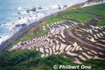
http://senmaida.wajima-kankou.jp/Jun 29, 2020
|
|

Jun 29, 2020
|
|
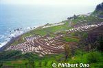
From Kanazawa Station, there are buses that go to Senmaida. Takes about 2 hours.Jun 29, 2020
|
|

Jun 29, 2020
|
|

Designated as Globally Important Agricultural Heritage Systems (GIAHS).Jun 29, 2020
|
|

Volunteers plant and harvest the rice here. The rice paddies are owned by multiple owners who meet ownership requirements. Jun 29, 2020
|
|

The smallest rice terace is only 0.2 sq. meter. The land is very fertile and minimal fertilizer is required. Senmaida is one of the most picturesque and impressive spots on the Noto Peninsula.Address: 石川県輪島市白米町99-5Jun 29, 2020
|
|

Senmaida in Shiroyone, Wajima is one of Japan's most famous terraced rice paddies. It's in a remote location (10 km from central Wajima), but very picturesque with the ocean (Sea of Japan) right below it. Senmaida literally means "One-thousand rice terraces."Jun 29, 2020
|
|
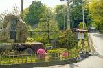
Entrance to Komaruyamajoshi Park, the site of an old castle. Famous for azaleas in May. 小丸山城址公園Jun 29, 2020
|
|
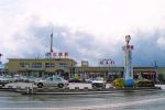
JR Nanao Station on the JR Nanao Line. 七尾駅Jun 29, 2020
|
|
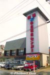
The old Wakura Onsen Center was a large public hot spring bath which charged ¥1,300. It had three hot spring baths. 和倉温泉Jun 29, 2020
|
|

Wakura Onsen Station on the JR Nanao Line from Kanazawa. 和倉温泉駅Jun 29, 2020
|
|

Kita-keJun 29, 2020
|
|

Near JR Menda Station.Jun 29, 2020
|
|

Kita-ke is a district governor's residence with a 350-year history. It is now a museum exhibiting documents and artifacts of its past. The house and front gate (photo) are National Important Cultural Properties.Jun 29, 2020
|
|
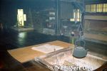
Inside Kita-ke.Jun 29, 2020
|
|

The old Ushitsu Station before the Noto train line was abolished in March 2005. The site is now a tourist info center. Part of the tracks in memorialized in concrete. 宇出津駅Jun 29, 2020
|
|
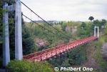
On a small cape is Toshimayama Park with a variety of landscapes and ocean views and walking paths. Local museums too. Former castle site with lots of flowering plants including cherry blossoms.. 遠島山公園This is Shirasagi Bridge spanning 67 meters. Great views from this bridge. しらさぎ橋 Jun 29, 2020
|
|

Tsukumo Bay. Tsukumo means "99," after the many inlets in the cove which is one of Japan's "100 Famous Views." 九十九湾Jun 29, 2020
|
|

Tsukumo Bay boat cruises are available. 九十九湾Jun 29, 2020
|
|

Bentenjima island on the Koiji Coast that stretches for 1 km. It's a lover's beach because "Koiji" means "lovers' road." It comes from a lovers' tragedy legend. Lots of couples come here. 恋路海岸 弁天島In the foreground is a Kannon statue. 恋路観音像Jun 29, 2020
|
|

Koinobori carp streamers.Jun 29, 2020
|
|

Kihe'e-don is the former residence of the Sakurai family who engaged in salt and lacquer production. The "don" is the highest honorific in the Noto dialect. 喜兵衛どんBuilt in the mid-Meiji Period, it is a museum which attempts to show how the upper-class farmers of that time lived.Jun 29, 2020
|
|

Marker for "Center of the Japanese Archipelago" near Rokkosaki Lighthouse.Jun 29, 2020
|
|

Cape Rokkosaki is at the northernmost tip of Noto Peninsula and famous as where you can see both the sunrise and sunset over the ocean.On clear days, Sado island in Niigata Prefecture can also be seen.
Address: 石川県珠洲市狼煙町イ-51Jun 29, 2020
|
|
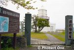
Rokkosaki Lighthouse is on the northern tip of Noto Peninsula in Ishikawa Prefecture. Built in July 1883 and designed by a British engineer named Richard Henry Brunton. It is also pronounced "Rokkozaki."Richard Henry Brunton (1841–1901) came to Japan in July 1868 to design lighthouses. He designed 26 lighthouses in Japan and was dubbed "Father of Japanese lighthouses".Jun 29, 2020
|
|
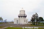
Rokkosaki Lighthouse is unmanned and normally closed to the public. A few times a year, it's open to the public. Stands on a cliff 50 meters above the sea.Many boats got lost or shipwrecked in this area until a bon fire was kept lit at night from the 18th century before this lighthouse was built. The light was first fueled by oil, then electricity in 1940.Jun 29, 2020
|
|

In winter, strong winds blow Tarumi Falls upward so much that the water does not fall into the plunge pool. 垂水の滝Location: https://goo.gl/maps/WLYQ6LZaHR8E9h9d9Jun 29, 2020
|
|

In Wajima, Sosogi Coast is a National Place of Scenic Beauty with craggy and unusual rock formations. Sights include Window Rock (Mado-iwa) here. 窓岩Location: https://goo.gl/maps/KJcj2X6BmeETgTE57Jun 29, 2020
|
|

Tarumi Falls flow directly into the ocean. 垂水の滝Sosogi Coast in Wajima is a scenic area of craggy and unusual rock formations. Sights include Window Rock (Mado-iwa) and Tarumi Falls.Jun 29, 2020
|
|

A short walk away is the less grand Shimo-Tokikuni-ke, the residence of a branch family of the Tokikuni. 下時国家Jun 29, 2020
|
|

Inside Kami Tokikuni-ke home.Jun 29, 2020
|
|

Kami Tokikuni-ke home. Both Tokikuni-ke homes are National Important Cultural Properties.Jun 29, 2020
|
|

Jun 29, 2020
|
|
Jun 29, 2020
|
|

Jun 29, 2020
|
|
Jun 29, 2020
|
|

Jun 29, 2020
|
|

Jun 29, 2020
|
|
Jun 29, 2020
|
|
Jun 29, 2020
|
|

Jun 29, 2020
|
|

Jun 29, 2020
|
|
Jun 29, 2020
|
|
Jun 29, 2020
|
|

Jun 29, 2020
|
|

Gojinjo-Daiko drummers. Jun 29, 2020
|
|
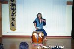
They also perform indoors for free on weekend evenings (or every evening in summer) at Wajima Kiriko Art Museum.Jun 29, 2020
|
|

Old Wajima Station before it closed in 2001 when the Noto Railway line between Wajima and Anamizu Stations was abolished. It's now a Michi-no-Eki Wajima Roadside Station selling local produce.Jun 29, 2020
|
|

Wajima Kiriko Art Museum. Kiriko lantern floats can be as tall as 15 meters and weigh 2 tons. They are pulled around town. 輪島キリコ会館https://wajima-kiriko.com/en/Jun 29, 2020
|
|

Wajima Kiriko Art Museum exhibits floats from the Noto Kiriko Matsuri. Kiriko are tall lanterns. The festival is held in many locations on the Noto Peninsula during July to Oct. 輪島キリコ会館Address: 石川県輪島市マリンタウン6-1
Open 8 am–5 pm
Admission charged.Jun 29, 2020
|
|

Washing fishing boat at Wajima port.Jun 29, 2020
|
|

Sodegaura 鴨ヶ浦Jun 29, 2020
|
|

Sodegaura 鴨ヶ浦Jun 29, 2020
|
|
| 71466 files on 284 page(s) |
 |
 |
29 |  |
 |
|