 Last additions Last additions |
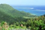
View from Nosokodake Lookout Point in northern Ishigaki. Jan 10, 2021
|
|

View from Nosokodake Lookout Point in northern Ishigaki. Jan 10, 2021
|
|
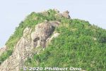
Even today, people who climb the mountain look for the Maape rock and assume this or that rock is her.This story is based on historical fact. The Ryukyu government sometimes forced people to migrate to undeveloped lands to start farming to increase agricultural production so they could pay more taxes. The kingdom was being heavily taxed by the Satsuma Domain in Kagoshima, and taxes had to paid in rice per head.
Read more about the folk tale here: https://photoguide.jp/log/2020/12/yaeyama-folk-songs-nosokodake-maape/Jan 10, 2021
|
|
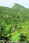
So she and her family were forced to move here to Nosokodake to start a new farming village and clear the thick jungle for farming. It was a hard life. Maape desperately missed her beloved Kanimui and couldn't forget him.
One day, she wanted to at least see Kuroshima where he lived, so she climbed up Mt. Nosokodake. At the top, she looked for Kuroshima, but her view of the island was blocked by Mt. Omotodake, Ishigaki's highest mountain. She collapsed on her knees and wailed in sorrow. Later, a worried villager looked for Maape who never returned home. On the top of the mountain, he found a crying rock gazing in the direction of Kuroshima. Maape had turned into stone.Jan 10, 2021
|
|
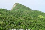
Side view of Mt. Nosokodake. This mountain is associated with a famous local folk tale about a girl named Maape. The mountain is nicknamed after her, "Nosoko Maape" (野底マーペー).On the nearby island of Kuroshima (黒島) in the 18th century, Maape and her childhood sweetheart, Kanimui, were happily living as farmers. They were to be married someday.
However, one day, a Ryukyu government decree ordered half the island's residents to move here near Nosokodake on Ishigaki while the other half could remain on Kuroshima. The island's population was split along the island's main road. Maape and Kanimui lived on the opposite sides of the road, and Maape was on the side where people had to move to Ishigaki.Jan 10, 2021
|
|

Nosokodake Lookout Point in northern Ishigaki. Under the roof is a side view of Mt. Nosokodake. 野底岳展望台Jan 10, 2021
|
|

Entering Iriomote-Ishigaki National Park. Nosokodake is part of the national park.Jan 10, 2021
|
|
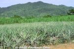
Some pineapple on Ishigaki.Jan 10, 2021
|
|
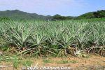
Some pineapple on Ishigaki. No fruit in autumn though.Jan 10, 2021
|
|
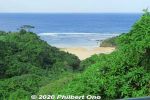
On the way to Mt. Nosoko, spotted a nice beach.Jan 10, 2021
|
|

Mt. Nosokodake (野底岳), Ishigaki’s second highest mountain at 282 m. Can be climbed up a steep, narrow trail in about 15 min. We didn't climb it though.Jan 10, 2021
|
|
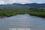
Maira River, Iriomote. There's a waterfall upstream, but we didn't have time.Jan 09, 2021
|
|
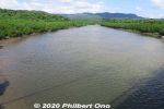
Maira River, Iriomote.Jan 09, 2021
|
|
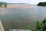
Mouth of Maira River at low tide when we passed by the day before.Jan 09, 2021
|
|
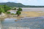
Mouth of Maira River at low tide when we passed by the day before.Jan 09, 2021
|
|
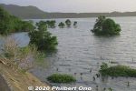
Mouth of Maira River at high tide. The brackish water is quite shallow, no more than 1 or 2 feet deep.Jan 09, 2021
|
|

Lovely morning, too bad we didn't have time to kayak more upstream on Maira River, Iriomote.Jan 09, 2021
|
|
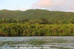
Maira River lined with mangroves.Jan 09, 2021
|
|

After the sunrise, we paddled along the mangroves on the river's edge.Jan 09, 2021
|
|

After the sunrise, we paddled along the mangroves on the river's edge.Jan 09, 2021
|
|
Jan 09, 2021
|
|
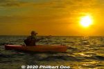
Our guide was Harubaru, but he doesn't normally do sunrise kayaking unless you ask him to: http://harubaru-iriomote.okinawa/course/Jan 09, 2021
|
|

Sunrise kayaking on Iriomote, Yaeyama, Okinawa.Jan 09, 2021
|
|
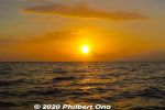
Iriomote sunrise at Maira River.Jan 09, 2021
|
|
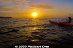
Sunrise kayaking on Iriomote, Yaeyama, Okinawa.Jan 09, 2021
|
|
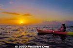
Sunrise kayaking on Iriomote, Yaeyama, Okinawa.Jan 09, 2021
|
|
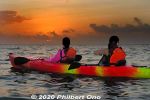
A few clouds, but the sunrise was getting to be nice.Jan 09, 2021
|
|
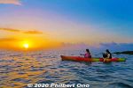
We anchored to watch the sunrise.Jan 09, 2021
|
|

We were on time for the sunrise.Jan 09, 2021
|
|
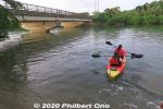
Off we go. The water was shallow, but we still wore lifejackets.Jan 09, 2021
|
|
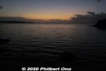
Mouth of Maira River (マイラ川) before sunrise, short drive from the main town of Ohara. Sunrise was about 6:50 am. Jan 09, 2021
|
|
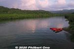
There was this dock where we could get on our kayaks. Maira River, Iriomote.Jan 09, 2021
|
|
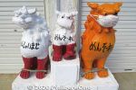
Near the Himeyuri site, Seesa lions with masks.Jan 09, 2021
|
|

Poetry by Ii Fumiko (1917–2004 井伊文子) who was a great granddaughter of the last Ryukyu King, Sho Tai. She was married to the mayor of Hikone, Shiga Prefecture who was a descendant of the Ii Clan.井伊文子の歌碑Jan 09, 2021
|
|

Statue of a Himeyuri high school student nurse.Jan 09, 2021
|
|
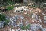
Himeyuri Cenotaph site is very rocky.Jan 09, 2021
|
|

Origami at Himeyuri Cenotaph site.Jan 09, 2021
|
|
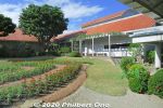
Himeyuri Peace Museum courtyard.Jan 09, 2021
|
|
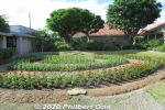
Himeyuri Peace Museum courtyard.Jan 09, 2021
|
|
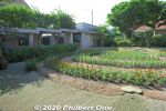
Himeyuri Peace Museum courtyard.Jan 09, 2021
|
|
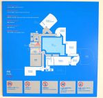
Himeyuri Peace Museum layout. Photography not allowed inside the museum.Jan 09, 2021
|
|
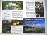
About the Himeyuri Peace Museum. It opened in June 1989.Jan 09, 2021
|
|
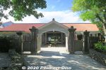
Near the Himeyuri Cenotaph is the Himeyuri Peace Museum. The building was modeled after one of the Himeyuri schools. ひめゆり平和祈念資料館http://www.himeyuri.or.jp/EN/info.htmlJan 09, 2021
|
|
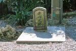
Sekishin Cenotaph 赤心之塔Jan 09, 2021
|
|
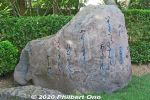
Iwa-makura Monument has a tanka poem by Nakasone Seizen who was one of the teachers of the Himeyuri students. いわまくら碑Jan 09, 2021
|
|

About the Himeyuri Cenotaph in English.Jan 09, 2021
|
|
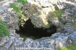
The cave goes down deep by 14 meters. They used a ladder for access.Jan 09, 2021
|
|

Below the Himeyuri monument, this cave is one of numerous natural caves in this area where the student nurses and local people took shelter. Jan 09, 2021
|
|
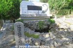
The white Himeyuri Cenotaph was renovated in 2009.Jan 09, 2021
|
|
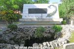
Himeyuri Cenotaph (white). The white monument is more recent, also inscribed with an updated list of names of the deceased student nurses and stores their remains in the back.Jan 09, 2021
|
|
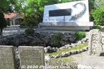
Himeyuri Cenotaph (white) and older monuments. Seen on the left is the Himeyuri Peace Museum. 第三外科壕Jan 09, 2021
|
|
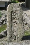
Original Himeyuri Cenotaph monument built here in 1946.Jan 09, 2021
|
|
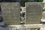
The two monuments were also placed here in 1946 inscribed with the names of the deceased student nurses.Himeyuri student nurses were Okinawan high school conscripts trained by the Japanese Army to serve at the Army Field Hospital which was a muddy and filthy underground bunker in a place called Haebaru from late March 1945. The hospital was slightly north of this area. As US forces advanced south, the hospital and nurses evacuated south to this area. Patients who couldn't walk overnight to evacuate were left behind.Jan 09, 2021
|
|
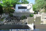
Himeyuri Cenotaph (white) built in 1957 and older monuments. The small stone monument on the right is the original Himeyuri Monument that was placed here in 1946. ひめゆりの塔This monument stands over the entrance of the cave where 80 people died on June 19, 1945 when US troops searching for Japanese soldiers threw in white phosphorus grenades. It's like a smoke bomb that suffocates people. Those who died included 38 Himeyuri high school student nurses and four of their teachers. US troops didn't know who were in the caves.Jan 09, 2021
|
|
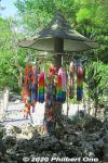
Origami displayJan 09, 2021
|
|
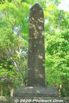
Monument for medical staff who died in the Battle of Okinawa.Jan 09, 2021
|
|
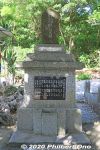
Monument for the Army Field Hospital's Third Surgical Staff. Jan 09, 2021
|
|

Monument for the medical staff who died in the Battle of Okinawa. Jan 09, 2021
|
|
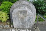
Monument for the land donation.Jan 09, 2021
|
|

Harry Shinichi Gima worked as an engineer on a US military base in Okinawa and visited Himeyuri Monument in 1951. He wanted the story and place to be presented more properly, so he quietly donated the money to the Himeyuri Alumini Association to buy the land.
This area was originally just a grassy area. None of the asphalt or cement we see here today. The land was privately owned.Jan 09, 2021
|
|

Monument for Harry Shinichi Gima (儀間真一), an Okinawan-American nisei from Hawaii who donated money to buy the land here to build the Himeyuri memorials and museum. His parents immigrated to Hawaii from Yomitan.Jan 09, 2021
|
|
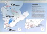
The war's progression.Jan 09, 2021
|
|
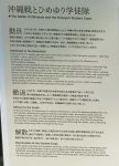
About the Himeyuri-no-Tou monuments.Jan 09, 2021
|
|
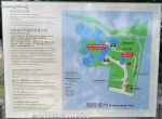
Map of Himeyuri Monument site.Jan 09, 2021
|
|
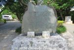
Himeyuri Chronology, inscribed with what happened here.Jan 09, 2021
|
|
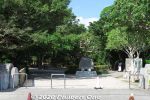
Himeyuri Monument and Cenotaph is one of Okinawa's most famous war sites and memorials.Jan 09, 2021
|
|
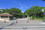
Entrance to Himeyuri Monument and Cenotaph (ひめゆり慰霊碑) in southern Okinawa in the city of Itoman. Building on the left is a flower vendor (closed).Jan 09, 2021
|
|
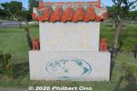
"Life is a Treasure..."Jan 09, 2021
|
|
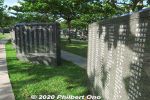
Jan 09, 2021
|
|
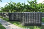
Jan 09, 2021
|
|
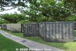
Jan 09, 2021
|
|
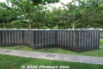
Jan 09, 2021
|
|
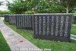
Jan 09, 2021
|
|
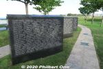
Slabs for 14,000+ Americans who died in Okinawa.Jan 09, 2021
|
|
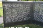
Names of 14,000+ Americans who died in Okinawa.Jan 09, 2021
|
|
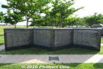
Names of 14,000+ Americans who died in Okinawa.Jan 09, 2021
|
|
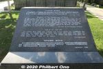
About the Cornerstone of Peace.Jan 09, 2021
|
|
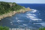
Mabuni CliffJan 09, 2021
|
|
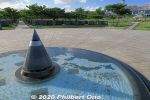
Flame of Peace in the world map. Japan can be seen in the map. 平和の火 Jan 09, 2021
|
|
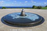
Flame of Peace in the world map. 平和の火Jan 09, 2021
|
|

Flame of Peace at the center of the Peace Plaza on the oceanfront. 平和の火Jan 09, 2021
|
|
Jan 09, 2021
|
|
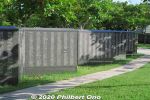
Jan 09, 2021
|
|
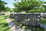
Jan 09, 2021
|
|
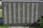
Jan 09, 2021
|
|
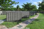
Jan 09, 2021
|
|

Map of where people's names are inscribed. Okinawans are inscribed according to their hometowns. Nearby are also war memorials for each prefecture.Jan 09, 2021
|
|
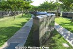
Stone slabs are like folding screens in a slight zig-zag pattern.Jan 09, 2021
|
|
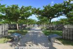
Japanese victims are inscribed by prefecture. Foreign nationals are inscribed by country.Jan 09, 2021
|
|
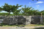
Stone slabs inscribed with over 240,000 names of people who died in the battle. Civilians and military, Japanese and foreign.Jan 09, 2021
|
|
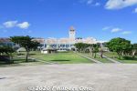
Okinawa Prefectural Peace Memorial Museum (沖縄県平和祈念資料館)Jan 09, 2021
|
|
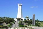
Peace Prayer Memorial Hall in the Okinawa Prefectural Peace Park.Jan 09, 2021
|
|
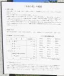
About the Cornerstone of Peace. http://www.peace-museum.pref.okinawa.jp/Jan 09, 2021
|
|
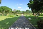
Walking to the Cornerstone of Peace.Jan 09, 2021
|
|
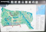
Map of Cornerstone of Peace witin the Okinawa Peace Prayer Park.Jan 09, 2021
|
|
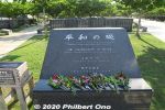
Cornerstone of Peace (平和の礎) in Mabuni, a large oceanfront memorial park full of these stone slabs inscribed with over 240,000 names of people who died in the battle. Jan 09, 2021
|
|

ANA InterContinental Manza Beach Resort as seen from Manzamo. Jan 09, 2021
|
|

Jan 09, 2021
|
|

View from Manzamo.Jan 09, 2021
|
|
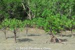
Iriomote mangroves.Jan 09, 2021
|
|
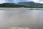
Iriomote across the shallow water.Jan 09, 2021
|
|
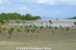
Iriomote mangroves.Jan 09, 2021
|
|
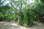
Jan 09, 2021
|
|
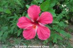
HibiscusJan 09, 2021
|
|
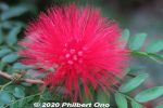
Jan 09, 2021
|
|
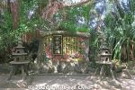
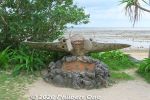
Water Buffalo MonumentJan 09, 2021
|
|
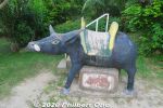
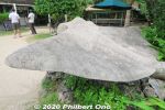
Lots of water buffalo sculptures on Yubu.Jan 09, 2021
|
|
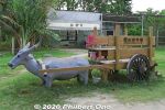
Lots of water buffalo monuments and sculptures on Yubu.Jan 09, 2021
|
|
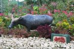
Lots of water buffalo monuments and sculptures on Yubu.Jan 09, 2021
|
|
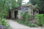
Old elementary and jr. high school on Yubu.Jan 09, 2021
|
|
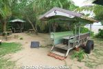
A nice cafe at Manta Beach on Yubu. Sit on old water buffalo carts.Jan 09, 2021
|
|
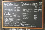
A nice cafe at Manta Beach on Yubu.Jan 09, 2021
|
|
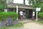
A nice cafe at Manta Beach on Yubu. マンタの浜Jan 09, 2021
|
|
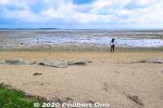
Manta Beach on Yubu. マンタの浜Jan 09, 2021
|
|
Manta Beach on Yubu. マンタの浜Jan 09, 2021
|
|
Manta Beach on Yubu. マンタの浜Jan 09, 2021
|
|
Jan 09, 2021
|
|

Gift shop inside the restaurant. The Iriomote Wildcat is used as a tourist smbol everywhere, but we can never see the real cat.Jan 09, 2021
|
|
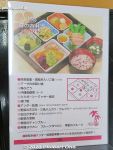
Our Okinawan lunch (Makunouchi Bento Akabana). Very good.Jan 09, 2021
|
|
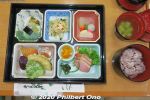
Lunch was named, "Okinawa Makunouchi Bento Akabana" (沖縄幕の内弁当「アカバナ」. ("Akabana" means "hibiscus" in Okinawan.) Price was ¥1,320.Iriomote black rice, champuru, brown sugar yokan: 西表産黒紫米入りごはん、アーサのお吸い物、うみぶどう、ミミガー、漬物、沖縄黒糖煮、 アンダー味噌、野菜天ぷら、ウムクジ(紅イモを米粉であえて揚げたもの)、かまぼこ、チャンプ ルー、黒糖羊羹Jan 09, 2021
|
|
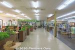
Inside the restaurant on YubuJan 09, 2021
|
|
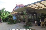
There's a restaurant on Yubu.Jan 09, 2021
|
|
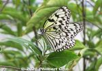
Large tree nymph (Ogomadara), Japan's largest butterfly. Wingspan 95mm or more. Very eye-catching and elegant glider. オオゴマダラ(大胡麻斑) Butterfly hothouse in Yubu (蝶々園).Jan 09, 2021
|
|
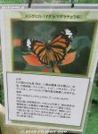
About the common tiger butterfly or Danaus genutia. スジグロカバマダラ Butterfly hothouse in Yubu (蝶々園).Jan 09, 2021
|
|
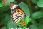
Common tiger butterfly (from India) or Danaus genutia. Looks like the monarch butterfly common in Hawaii. スジグロカバマダラ Butterfly hothouse in Yubu (蝶々園).Jan 09, 2021
|
|
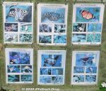
Kinds of butterflies in the butterfly garden (蝶々園). It's a greehouse full of flowers and plants, so it's quite warm.Jan 09, 2021
|
|

Way to butterfly hothouse (蝶々園).Jan 09, 2021
|
|
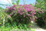
Bougainvillea on Yubu, in bloom year round.Jan 09, 2021
|
|
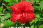
Red hibiscusJan 09, 2021
|
|
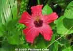
Red hibiscusJan 09, 2021
|
|
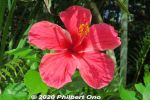
Red hibiscusJan 09, 2021
|
|
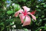
Lots of tropical flowers on Yubu Island, especially hibiscus.Jan 09, 2021
|
|

Jan 09, 2021
|
|
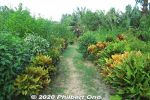
Jan 09, 2021
|
|
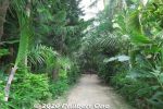
Jan 09, 2021
|
|
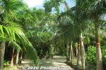
Yubu is a very lush, green island.Jan 09, 2021
|
|
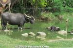
Water buffalo pond on Yubu.Jan 09, 2021
|
|
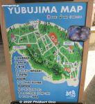
Map of Yubu sights and attractions.Jan 09, 2021
|
|
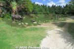
Water Buffalo Pond (水牛の池) on Yubu.Jan 09, 2021
|
|
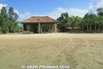
Yubu arrival station. (Admission charged, included in the water buffalo cart ride.) https://yubujima.com/Jan 09, 2021
|
|
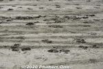
Water buffalo hoof prints.Jan 09, 2021
|
|

Water buffalo footprints.Jan 09, 2021
|
|
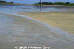
Also possible to walk over to Yubu and not pay for the water buffalo ride, but no one does this.Jan 09, 2021
|
|

Water buffalo taking toursts to Yubu Island from Iriomote.Jan 09, 2021
|
|
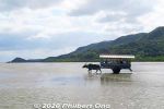
Water buffalo cart ride (水牛車 suigyusha) from Mihara (美原) to Yubu island (Yubu-jima 由 布島) takes 15 min.*Water buffalo cart roundtrip and Yubu island admission for adults: ¥1,760, Children (elementary school and below): ¥880 https://yubujima.com/Jan 09, 2021
|
|
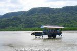
Water buffalo taking tourists to Yubu Island from Iriomote.Jan 09, 2021
|
|

The water buffalo all have names and are highly trained to put on the harness by itself. They originally came from Taiwan.Jan 09, 2021
|
|
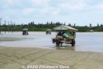
Water buffalo carts coming back from Yubu.Jan 09, 2021
|
|
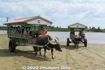
The cart is driven by a guide who usually plays the sanshin for passengers as the water buffalo sloshes to the island.Jan 09, 2021
|
|
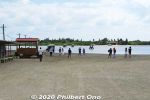
We ride these water buffalo carts to the island across shallow water. Jan 09, 2021
|
|
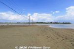
Yubu is a small, sandbar island near Mihara, Iriomote. They converted the island into a lush botanical garden. Jan 09, 2021
|
|
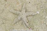
Sure enough, a well-disguised starfish moving in slow motion. Hope it's not the kind that eats coral or other native species. Kabira Bay, Ishigaki.Jan 09, 2021
|
|
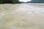
While walking here, I looked down since my intuition told me I might find something...Jan 09, 2021
|
|
Jan 09, 2021
|
|

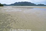
On another part of Kabira Bay, typical low-tide beach in Yaeyama. Ahead is the main part of Kabira Bay with the glass bottom boats and former Kabira Village.Jan 09, 2021
|
|
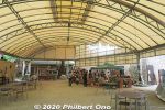
Souvenir shopsJan 09, 2021
|
|
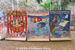
Photo cutoutsJan 09, 2021
|
|
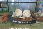
Jan 09, 2021
|
|
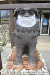
Seesa lion dog with mask, Ishigaki.Jan 09, 2021
|
|
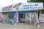
Glass bottom boat tour vendor.Jan 09, 2021
|
|
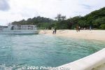
Back to the beach.Jan 09, 2021
|
|
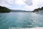
Jan 09, 2021
|
|
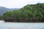
Jan 09, 2021
|
|
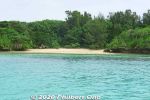
Jan 09, 2021
|
|
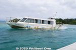
Jan 09, 2021
|
|

Jan 09, 2021
|
|

Jan 09, 2021
|
|

Jan 09, 2021
|
|

Parrot fish in Kabira Bay.Jan 09, 2021
|
|
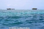
Jan 09, 2021
|
|
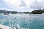
Jan 09, 2021
|
|
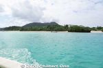
Jan 09, 2021
|
|

Jan 09, 2021
|
|
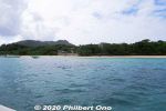
Jan 09, 2021
|
|
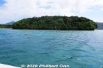
Jan 09, 2021
|
|
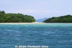
Jan 09, 2021
|
|
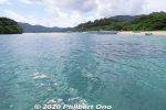
The cruise is scenic with tropical ocean and small islands.Jan 09, 2021
|
|
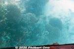
Glass bottom boat in Kabira Bay, Ishigaki.Jan 09, 2021
|
|
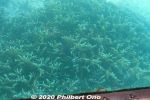
Glass bottom boat in Kabira Bay, Ishigaki.Jan 09, 2021
|
|
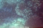
Glass bottom boat in Kabira Bay, Ishigaki.Jan 09, 2021
|
|

Glass bottom boat in Kabira Bay, Ishigaki.Jan 09, 2021
|
|

Typical glass bottom boat in Kabira Bay, Ishigaki.Jan 09, 2021
|
|
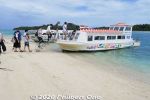
Boarding a glass bottom boat. Your feet don't get wet.Jan 09, 2021
|
|
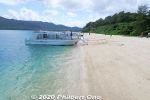
Jan 09, 2021
|
|

Kabira Bay beach.Jan 09, 2021
|
|

There are many glass bottom boats that operate here.Jan 09, 2021
|
|

Kabira Bay on Ishigaki, perhaps the island's most famous tourist spot. Glass bottom boats to see coral and tropical fish in shallow water.Jan 09, 2021
|
|
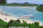
Kabira Bay, Ishigaki. It's actually a large bay and this is only a small part of it. Scenic with white beach, blue ocean, small islands and coral on the bottom.Jan 09, 2021
|
|

Ika cuttlefish boat in Kutsugata Port in Rishiri, Hokkaido. Bright lights at night attract the cuttlefish to the surface. 沓形港Sep 03, 2020
|
|
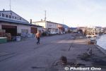
We stopped in Kutsugata Port in Rishiri briefly on our way to Rebun. 沓形港Sep 03, 2020
|
|

Kutsugata Port in Rishiri. 沓形港Sep 03, 2020
|
|

Otaru Maru at Kutsugata Port in Rishiri. 沓形港 おたる丸Sep 03, 2020
|
|

Kutsugata Port Ferry Terminal in Rishiri when we visited. This building is now a restaurant after a new ferry terminal building was built nearby.沓形港フェリーターミナルSep 03, 2020
|
|

Kutsugata Port in Rishiri.Sep 03, 2020
|
|
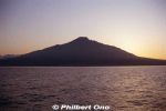
Rishiri at dawn.Sep 03, 2020
|
|

Approaching Kutsugata Port in Rishiri. 沓形港Sep 03, 2020
|
|

Wakkanai ahead.Aug 31, 2020
|
|

Bye-bye Rishiri.Aug 31, 2020
|
|

Ferry to Wakkanai. Souya Maru No. 5 第五宗谷丸Aug 31, 2020
|
|

Ferry from Rishiri to Wakkanai. Souya Maru No. 5 第五宗谷丸Aug 31, 2020
|
|
Aug 31, 2020
|
|

Aug 31, 2020
|
|

View from Cape Peshi.Aug 31, 2020
|
|

View from Cape Peshi.Aug 31, 2020
|
|

Rishiri's Oshidomari Port or ferry terminal. 鴛泊港Aug 31, 2020
|
|

Rishiri's Oshidomari Port. 鴛泊港Aug 31, 2020
|
|

Oshidomari Lighthouse on Rishiri, Hokkaido. 鴛泊灯台 Aug 31, 2020
|
|

On Cape Peshi, Oshidomari Lighthouse overlooking Oshidomari Port. 鴛泊灯台 ペシ岬Aug 31, 2020
|
|

We did some hiking on Rishiri in early autumn, nothing strenuous.Aug 31, 2020
|
|

Aug 31, 2020
|
|
Aug 31, 2020
|
|

We did some easy hiking on Rishiri in early autumn.Aug 31, 2020
|
|

Rishiri forestAug 31, 2020
|
|

Rishiri's Oshidomari Port. 鴛泊港Aug 31, 2020
|
|

These photos were taken quite some years ago, so some things may look different now.Aug 31, 2020
|
|
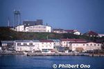
Rishiri's Oshidomari Port. 鴛泊港Aug 31, 2020
|
|

Approaching Rishiri's Oshidomari Port in northern Rishiri, closest to Wakkanai. 鴛泊港Aug 31, 2020
|
|

Approaching Rishiri by ferry.Aug 31, 2020
|
|

From Rebun, took the ferry to Rishiri, approaching Oshidomari Port.Aug 31, 2020
|
|

Aug 31, 2020
|
|

Aug 31, 2020
|
|
Mt. Rishiri is nicknamed "Rishiri-Fuji" since it's conical like Mt. Fuji.Aug 31, 2020
|
|
|

Rishiri is about 63 km in circumference and has a population of about 5,000. Like Rebun, best to rent a car on Rishiri and drive around. Aug 31, 2020
|
|

Approaching Rishiri by ferry. There are ferries from Wakkanai and Rebun going to Rishiri. Lighthouse near the port. Mt. Rishiri is 1,721 meters high.Aug 31, 2020
|
|

Rishiri is one of Japan's northernmost islands off Wakkanai, Hokkaido. Round island with a distinctive cone-shaped mountain Mt. Rishiri (photo) in the middle. Part of Rishiri-Rebun-Sarobetsu National Park.Aug 31, 2020
|
|

Leaving Rebun.Aug 31, 2020
|
|

Leaving Rebun.Aug 31, 2020
|
|

Aug 31, 2020
|
|

Rebun's east coast.Aug 31, 2020
|
|

Rebun sunset in Hokkaido.Aug 31, 2020
|
|

Rebun sunset in Hokkaido.Aug 31, 2020
|
|

Rebun sunset in Hokkaido.Aug 31, 2020
|
|

Watching the sunset on Rebun.Aug 31, 2020
|
|

Konbu kelp seaweed dried on Rebun.Aug 31, 2020
|
|

Cuttlefish (ika) on Rebun.Aug 31, 2020
|
|

Cuttlefish (ika) on Rebun.Aug 31, 2020
|
|

So many cuttlefish (ika).Aug 31, 2020
|
|
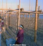
Needless to say, fishing is one of the major industries on Rebun. This was a meeting by pure chance, and they were smiling and giggling at us foreigners. So friendly.Aug 31, 2020
|
|

One of the most charming moments of our trip. Meeting friendly local women hanging cuttlefish to dry in the sun.Aug 31, 2020
|
|

Aug 31, 2020
|
|

Rishiri as seen from Rebun.Aug 31, 2020
|
|

Rishiri as seen from Rebun.Aug 31, 2020
|
|

Rishiri as seen from Rebun.Aug 31, 2020
|
|

Aug 31, 2020
|
|

Aug 31, 2020
|
|

Aug 31, 2020
|
|
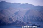
Aug 31, 2020
|
|

Rishiri as seen from Rebun.Aug 31, 2020
|
|

Rebun is part of Rishiri-Rebun-Sarobetsu National Park.Aug 31, 2020
|
|

Rishiri as seen from Rebun.Aug 31, 2020
|
|
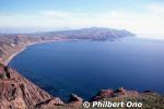
Amazing how this little island of Rebun can pack so many sights. Must be wondrous when the flowers are in bloom.Aug 31, 2020
|
|
| 71466 files on 284 page(s) |
 |
 |
28 |  |
 |
|