 Last additions Last additions |
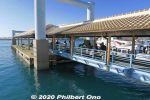
Ishigaki Port boat dock.Jan 22, 2021
|
|
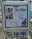
About Gushiken Yoko. Born 1955.Jan 22, 2021
|
|

Statue of Gushiken Yoko at Ishigaki Port, former pro boxer and local hero from Ishigaki. This statue was unveiled in Dec. 2013.Jan 22, 2021
|
|
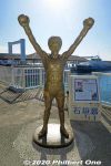
Statue of Gushiken Yoko at Ishigaki Port, former pro boxer and local hero from Ishigaki. He held the WBA light-flyweight title from 1976 to 1981.Jan 22, 2021
|
|
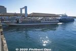
There are four floating boat docks where boats can dock on both sides. They have red roof tiles.Jan 22, 2021
|
|
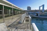
At the docks.Jan 22, 2021
|
|
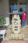
Tour agency office near the port terminal.Jan 22, 2021
|
|
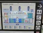
Floor plan of Ishigaki Port terminal building which opened in Jan. 2007 after moving from the old port 200 meters from here.Jan 22, 2021
|
|
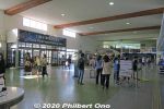
Inside the Ishigaki Port terminal building. This building opened on Jan. 31, 2007 after the terminal and boat docks were moved here from the old port only 200 meters east. On the right is a planetarium.Jan 22, 2021
|
|

Inside the Ishigaki Port terminal building. One big hallway with doors to the boat docks and ticket windows and tour agency counters.Jan 22, 2021
|
|

Ishigaki Port is on the southern coast of Ishigaki island. It's the marine gateway to other Yaeyama islands such as Taketomi, Iriomote, Kuroshima, and Aragusuku.Ishigaki Port consists of multiple port facilities. For tourists, the facility for tourist boats going to other Yaeyama islands might be called "Ishigaki Port Remote Island Terminal" or nicknamed "Euglena Ishigaki Port Remote Island Terminal" (ユーグレナ石垣港離島ターミナル) since a company named Euglena bought the naming rights for 5 years in 2018.Jan 22, 2021
|
|

Shiraho coral reefs on Ishigaki.Jan 22, 2021
|
|

Shiraho coral reefs on Ishigaki.Jan 22, 2021
|
|

Shiraho coral reefs on Ishigaki.Jan 22, 2021
|
|

Jan 22, 2021
|
|

ShirahoJan 22, 2021
|
|

The center of this photo shows the site where the new airport was going to be built.Jan 22, 2021
|
|

Jan 22, 2021
|
|

Taking off at the old Ishigaki Airport.Jan 22, 2021
|
|

Taking off at the old Ishigaki Airport.Jan 22, 2021
|
|

Taking off at the old Ishigaki Airport.Jan 22, 2021
|
|

On Runway 04 at the old Ishigaki Airport. At 1,500 meters, it was too short for jets larger than a Boeing 737. So the new airport was built on a different location.Jan 22, 2021
|
|

Jan 22, 2021
|
|

Jan 22, 2021
|
|

Runway at the old Ishigaki Airport. The slanty white building visible is the ANA hotel on the beach. That's how close the old airport was to town.Jan 22, 2021
|
|

Ground crew at the old Ishigaki Airport waving goodbye to us. I waved back.Jan 22, 2021
|
|

Inside JTA plane, flight attendants figuring out what to tell us.Jan 22, 2021
|
|

JTA plane's see-sa at Ishigaki Airport.Jan 22, 2021
|
|

Walking on the tarmac to the JTA plane at Ishigaki Airport.Jan 22, 2021
|
|

I liked walking on the tarmac to the plane at Ishigaki Airport.Jan 22, 2021
|
|
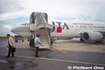
No jet bridge, but it wasn't a problem when it didn't rain.Jan 22, 2021
|
|

At the old Ishigaki Airport, JTA boarding gate. One of the check-in staff wears a yukata. Also notice the old digital signage.Jan 22, 2021
|
|

At the old Ishigaki Airport, inside the JTA passenger waiting area at the boarding gate.Jan 22, 2021
|
|

Old Ishigaki Airport terminal for JTA. Small building. The old airport first opened in 1943 for military use. It became a civilian airport in 1956.This passenger terminal building was built in 1961 and used mainly by JTA (Japan Transocean Air) and RAC (Ryukyu Air Commuter). ANA had its own adjacent terminal.Jan 22, 2021
|
|

Old Ishigaki Airport terminal for JTA, Arrivals. No jet bridges.Jan 22, 2021
|
|

Old Ishigaki Airport terminal, Arrivals. No jet bridges. Jets (Boeing 737) started flying here only from 1979. Jan 22, 2021
|
|

Approaching the old Ishigaki Airport terminal.Jan 22, 2021
|
|

This is the old Ishigaki Airport before it closed in March 2013 and was replaced by the new and current airport slightly north of this old airport.Jan 22, 2021
|
|
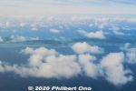
Aerial view of Ibaruma and Hirakubo, Ishigaki.Jan 22, 2021
|
|
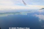
Aerial view of Ibaruma Coast, Ishigaki.Jan 22, 2021
|
|
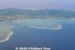
Aerial view of Nosoko, Ishigaki.Jan 22, 2021
|
|

Looking at the Nosoko area of Ishigaki. Mt. Nosokodake can be seen. Bye-bye Ishigaki...Jan 22, 2021
|
|

Coral reef along Ishigaki.Jan 22, 2021
|
|

Flying over Shiraho, Ishigaki.Jan 22, 2021
|
|

Lots of farmland next to the airport.Jan 22, 2021
|
|

Up, up and away...Jan 22, 2021
|
|

Taking off from the runway at Ishigaki Airport.Jan 22, 2021
|
|

Cleared for takeoff, Captain. Roger!Jan 22, 2021
|
|

ANA Boeing 787 landing at Ishigaki Airport, probably from Haneda, Tokyo. Thanks to the new airport's longer runway, such wide-body jets can land here.Jan 22, 2021
|
|

Here it comes for a smooth landing.Jan 22, 2021
|
|

Runway traffic stop for an incoming plane.Jan 22, 2021
|
|
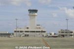
Ishigaki Airport control tower.Jan 22, 2021
|
|

Boeing 737 winglet waving goodbye to the control tower at Ishigaki Airport.Jan 22, 2021
|
|

Leaving Ishigaki Airport.Jan 22, 2021
|
|

RAC (Ryukyu Air Commuter) prop plane.Jan 22, 2021
|
|
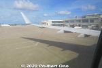
Pushback at Ishigaki Airport on JTA Boeing 737-800 for Naha. Didn't see any ground crew waving goodbye to us.Jan 22, 2021
|
|
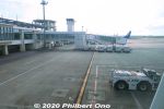
Jan 22, 2021
|
|
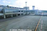
View of Ishigaki Airport terminal from the jet bridge. The circular structure above the roof toward the control tower is a lookout deck.Jan 22, 2021
|
|

RAC commuter plane.Jan 22, 2021
|
|
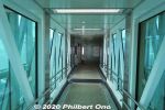
Jet bridgeJan 22, 2021
|
|

View of Ishigaki Airport from the jet bridge.Jan 22, 2021
|
|
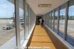
Jet bridgeJan 22, 2021
|
|
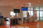
Boarding gate at Ishigaki Airport for our flight to Naha. We just scan the QR code on our smartphone screen.Jan 22, 2021
|
|
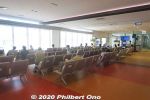
Passenger waiting area in front of the boarding gate. Very modern.Jan 22, 2021
|
|

Jan 22, 2021
|
|
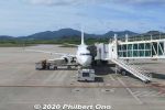
Our JTA Boeing 737-800 plane at Ishigaki Airport.Jan 22, 2021
|
|
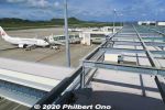
Ishigaki Airport Jan 22, 2021
|
|
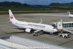
JTA Boeing 737-800 plane at Ishigaki Airport.Jan 22, 2021
|
|

Ishigaki Airport Jan 22, 2021
|
|
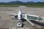
Jan 22, 2021
|
|
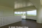
Lookout deck, round, open-air structure.Jan 22, 2021
|
|
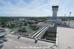
Ishigaki Airport control tower.Jan 22, 2021
|
|
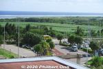
Oceanside from Ishigaki Airport.Jan 22, 2021
|
|
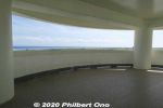
Another lookout deck, round, open-air structure.Jan 22, 2021
|
|
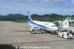
ANA at Ishigaki Airport.Jan 22, 2021
|
|
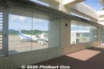
Another lookout deck at Ishigaki Airport.Jan 22, 2021
|
|

JTA planeJan 22, 2021
|
|
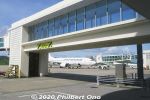
Jet wayJan 22, 2021
|
|
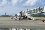
Jan 22, 2021
|
|
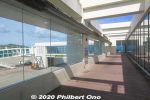
Ishigaki Airport terminal lookout deck on the top floor.Jan 22, 2021
|
|

Ishigaki Airport's control tower.Jan 22, 2021
|
|
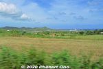
Ishigaki Airport can be seen.Jan 22, 2021
|
|

Bales of grass for cattle feed.Jan 22, 2021
|
|

The drive between the airport and central Ishigaki is largely rural with farmland and cattle.Jan 22, 2021
|
|
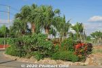
Some tropical plants at Ishigaki Airport.Jan 22, 2021
|
|
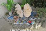
Giant clam decoration at Ishigaki Airport.Jan 22, 2021
|
|

Car rentals across the road.Jan 22, 2021
|
|
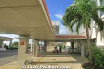
Outside Ishigaki Airport terminal for ground transportation.Jan 22, 2021
|
|
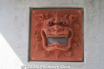
Jan 22, 2021
|
|

Ishigaki Airport's nickname is "Painushima Ishigaki Airport" (南ぬ島 石垣空港) which means "Southern Island Ishigaki Airport." When it first opened, it was also commonly called "New Ishigaki Airport" to distinguisJan 22, 2021
|
|
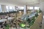
First floor of Ishigaki Airport terminal has a restaurant and gift shops. Second floor is the departure gates.Jan 22, 2021
|
|
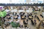
First floor of Ishigaki Airport terminal has a restaurant and gift shops.Jan 22, 2021
|
|
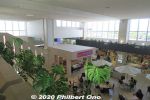
First floor of Ishigaki Airport terminal has a restaurant and gift shops.Jan 22, 2021
|
|

First floor of Ishigaki Airport terminal has a restaurant and gift shops.Jan 22, 2021
|
|
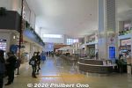
First floor of Ishigaki Airport terminal also has a restaurant and gift shops.Jan 22, 2021
|
|

Ishigaki Airport Arrivals gate on the frist floor. Where local friends or tour guides can meet you after you arrive.Jan 22, 2021
|
|

At Ishigaki Airport, a large welcome and warning sign after getting out of baggage claim in fall 2020. It says to please wear masks, wash your hands, avoid crowds, etc., to protect local residents. We of course took all the necessary precautions.Jan 22, 2021
|
|
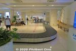
Baggage claim at Ishigaki Airport.Jan 22, 2021
|
|
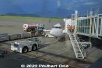
Our JTA plane that landed at Ishigaki Airport.Jan 22, 2021
|
|

View of Ishigaki Airport terminal from the jet bridge.Jan 22, 2021
|
|

Approaching the jet bridge.Jan 22, 2021
|
|

It took years to decide where to build the new airport. One disturbing plan was to reclaim part of Shiraho coral reef. Fortunately, this plan was scratched.In 2000, the location was finally decided inland on the island's east side and more northerly from the old airport. Construction began in 2006 with a 2,000-meter runway. New Ishigaki Airport opened in March 2013. Airport terminal with the control tower on the right.Jan 22, 2021
|
|

This new Ishigaki Airport opened in March 2013. Due to the Yaeyama islands becoming a popular tourist destination, there were calls to built a bigger airport since 1979.Jan 22, 2021
|
|

Bird's eye view of New Ishigaki Airport. Only one runway, 2,000 meters long, long enough for widebody jets. Terminal has four jet bridges.(Photo from Wikipedia.)Jan 22, 2021
|
|

Ishigaki Airport's runway.Jan 22, 2021
|
|

Landed on Ishigaki Airport's runway.Jan 22, 2021
|
|

Ishigaki is the gateway to Okinawa Prefecture's Yaeyama Islands. Ishigaki Airport near central Ishigaki is how most visitors get to Yaeyama.Bird's eye view of central Ishigaki from a jet plane going to land at Ishigaki Airport.Jan 22, 2021
|
|

Descending toward Ishigaki Airport adjacent to farmland.Jan 22, 2021
|
|

Butterfly in Banna Park.Jan 16, 2021
|
|

Bird of Paradise flower in Banna Park.Jan 16, 2021
|
|

Jan 16, 2021
|
|

Rest house in Banna Park. It's a large park with a variety of sights, playgrounds, lookout points, and nature.Jan 16, 2021
|
|

View of the mountains north of Banna Park.Jan 16, 2021
|
|

View of the mountains north of Banna Park.Jan 16, 2021
|
|

View of Sakieda Peninsula from Banna Park.Jan 16, 2021
|
|

View of Sakieda Peninsula from Banna Park.Jan 16, 2021
|
|

View of central Ishigaki from Banna Park. Taketomi Island can be seen on upper right.Jan 16, 2021
|
|

View of central Ishigaki from Banna Park.Jan 16, 2021
|
|

View of central Ishigaki from Banna Park.Jan 16, 2021
|
|

View of central Ishigaki from Banna Park.Jan 16, 2021
|
|

Banna Park on Banna Hill (230m elevation) in the northern fringe of central Ishigaki is a large nature & recreational park. This is one of the main lookout points. Named "Emerald Ocean Lookout Point" overlooking the city center and nearby isThis is in Zone B of the park along the Banna Skyline road. This photo was taken before the stargazing platform was built next to it. エメラルドの海を見る展望台Jan 16, 2021
|
|

Northern Iriomote coast.Jan 15, 2021
|
|

Iriomote Hoshizuna Beach.Jan 15, 2021
|
|

Iriomote Hoshisuna Beach.Jan 15, 2021
|
|

Bus stop (Urauchihashi) for the Urauchi River boat dock. In the background is our tour bus.Jan 15, 2021
|
|

On the northern tip of Iriomote is scenic Hoshi-suna Beach. Famous for star-shaped sand grains, but hard to find. 西表 星砂の浜Map hereJan 15, 2021
|
|

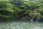
Mangroves near the mouth of Urauchi River, seen from Urauchi Bridge.Jan 15, 2021
|
|

Jan 15, 2021
|
|

Urauchi River boat dock as seen from Urauchi Bridge near the mouth of the river.Jan 15, 2021
|
|

River cruise back to the dock.Jan 15, 2021
|
|

Hiking back. The lady in front of me was wearing rubber slippers on this muddy trail. She kept slipping and almost falling. Her dainty feet got all muddy.Jan 15, 2021
|
|

Kanbire (Kanpire) Falls on Urauchi River, near the center of Iriomote. This is about 2 km from the Gunkan-iwa boat dock. Or 30-40-min. hike. You can get quite close to the falls. カンビレーの滝Instead of having one big drop, Kanbire Falls flow down on a series of steps on the river for about 200 meters. The riverside also has small potholes. Kanbire (Kanpire) means "where gods sit." This spot was considered to be a sacred site where the gods gathered.Jan 15, 2021
|
|

Mariyudu Falls. From here, the hiking trail continues to another waterfall, Kanbire (Kanpire) Falls about 250 meters away.Jan 15, 2021
|
|

Behind Mariyudu Falls looking from upstream.Jan 15, 2021
|
|

Mariyudu Falls on Urauchi River. About 20 meters wide and 16-meter drop in total. One of Japan's 100 Famous Waterfalls. マリゥドゥの滝*People can no longer come this close to the falls. There were people who slipped and fell in, so the closeup path is blocked.Jan 15, 2021
|
|

After hiking about 30 min., a scenic point gives a view of Mariyudu Falls. Series of three waterfalls. It empties into a round stream pool. "Mariyudu" means stream pool. マリゥドゥの滝Jan 15, 2021
|
|

Lush forest, but rocky and muddy trail. Hiking shoes or sneakers are good. Sometimes a tree or branch has fallen over the trail. Need to go over/under it.Jan 15, 2021
|
|

Ferns and a nameless mini waterfall.Jan 15, 2021
|
|

Sometimes there are views from the hiking trail.Jan 15, 2021
|
|

Urauchi River hiking trail to waterfalls. It can be quite muddy.Jan 15, 2021
|
|

At Gunkan-iwa dock, there's a hiking trail called Urauchigawa Shizen Kenkyu-ro. A nature trail that goes to two waterfalls.Note that cell phones won't work on the hiking trail. 浦内川自然研究路Jan 15, 2021
|
|

We got off the boat upstream here at Gunkan-iwa, named after a rock slab looking like the side of a battleship. 軍艦岩Jan 15, 2021
|
|

Another Urauchi River cruise boat. 西表島・浦内川 遊覧ボートJan 15, 2021
|
|

Ferns and tree ferns also grow at upstream. シダ類Jan 15, 2021
|
|

Wish we could see the Iriomote wildcat swimming across the river, but they are nocturnal.Jan 15, 2021
|
|

Urauchi River is fed by the runoff from Iriomote's central mountains. Urauchi River jungle cruise is about 30 min. or 8 km upstream to another boat dock called Gunkan-iwa. 西表島・浦内川Jan 15, 2021
|
|
The boat operator narrates the sights along the river. There are even signs indicating the flora. This sign indicates a mangrove species called "me-hirugi" (メヒルギ) in Japanese or Kandelia obovata growing in brackish water.It has white, star-shaped flowers.Jan 15, 2021
|
|

In northern Iriomote, Urauchi River is Okinawa's longest (19 km), widest (200 m), and deepest (15 m) river. It's home to a whopping 400 species of fish or 10 percent of Japan's fish species.Over 20 fish species are endangered. Urauchi River is within Iriomote-Ishigaki National Park. Both sides of the river are lush with mangroves and forests. 西表国立公園Jan 15, 2021
|
|

Boat dock at Urauchi River on Iriomote. If you come on your own, the jungle river cruise is ¥1,800 for adults. 西表島・浦内川The boat cruise takes about 30 min. to a dock upstream where you get off for the waterfall hike. Boats depart here once or twice an hour from morning to early afternoon.Jan 15, 2021
|
|

Northern Iriomote has Okinawa and Iriomote's longest river, Urauchi River (18 km). It's a popular tourist route to go on the jungle cruise, then hike through the forest to see two waterfalls on the river.Near Urauchi-hashi Bridge at the mouth of the river, there's a boat dock for Urauchi jungle river cruises. Since the hiking trail is rocky or muddy, don't wear high heels or slippers. Wear sneakers or hiking shoes. Although there's a restroom along the hiking trail, it's not as clean as you would like. Better to use the toilet at the boat dock before the cruise. Also bring something to drink. The roundtrip cruise and hike will take about 3 hours. Map hereJan 15, 2021
|
|

On the tour bus on Iriomote going north. Lots of sugar cane. Jan 15, 2021
|
|

On Iriomote, one convenient way to tour the island is go on a sightseeing tour by bus. They pick you up when you arrive at the port and take you to the major sights like Urauchi River and Yubu.You can book a tour from Ishigaki.Jan 15, 2021
|
|

Sukuji Beach has a lot of shallow water, so it's safe to swim. But at low tide, there's lots of rocks. Be sure to swim within the designated area protected against jellyfish with underwater nets. 底地ビーチJan 15, 2021
|
|

Sukuji Beach is 1 km long. It has showers and changing rooms for the public. It's also where the Ishigaki Seaside Hotel is located. 底地ビーチJan 15, 2021
|
|

On the opposite side of Kabira on the other side of the peninsula is another stretch of white sands called Sukuji Beach. One of Ishigaki's major swimming beaches. 底地ビーチ.Jan 15, 2021
|
|

On Cape Ogansaki, memorial for the 35 people who died in the Yaeyama Maru that was shipwrecked on Dec. 8, 1952 off this coast. 御神埼Monument was built in Dec. 1976.Jan 13, 2021
|
|

Cape Ogansaki 御神埼Jan 13, 2021
|
|

Cape Ogansaki 御神埼Jan 13, 2021
|
|

Cape Ogansaki 御神埼Jan 13, 2021
|
|

Cape Ogansaki 御神埼Jan 13, 2021
|
|

Drive further around Sakieda Peninsula and see Ishigaki Cape Ogansaki Lighthouse. Built in March 1983. 石垣御神埼灯台Jan 13, 2021
|
|

Cape Ogansaki 御神埼Jan 13, 2021
|
|
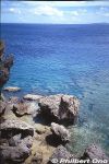
Jan 13, 2021
|
|
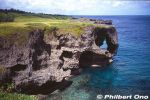
Cape Manzamo, one of Okinawa Island's main tourist attractions. Rock formation with a hole or elephant's trunk. It faces the East China Sea. 万座毛Jan 13, 2021
|
|

Cape Manzamo elephant trunk (rock).Jan 13, 2021
|
|
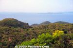
Straight ahead is Kohama island (小浜島) in the distance. The small island in front of it on the right is Kayama (嘉弥真島). The big island on the right is Iriomote.Jan 11, 2021
|
|
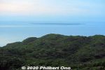
Taketomi island in the distance. Flat, coral outcrop. Quaint, charming island, a short boat ride from Ishigaki Port.Jan 11, 2021
|
|
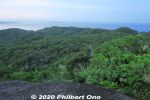
Looking toward Taketomi island in the distance.Jan 11, 2021
|
|
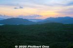
Too cloudy for a nice sunrise, but the views were marvelous on Mt. Yarabudake.Jan 11, 2021
|
|

Beyond the mountain in the center is Kabira Bay.Jan 11, 2021
|
|
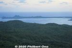
Looking toward Sakieda Bay and Kabira.Jan 11, 2021
|
|
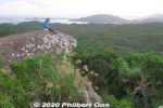
Our tour guide on Troll's Tongue playing his sanshin.Jan 11, 2021
|
|
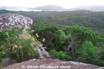
Jan 11, 2021
|
|
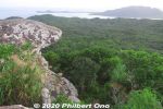
Top of Mt. Yarabudake. This rock is known as Troll's Tongue.Jan 11, 2021
|
|
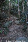
Typical mountain trail on Ishigaki. Jan 11, 2021
|
|

A few steep parts, but ropes help you up.Jan 11, 2021
|
|

Sunrise hike up Mt. Yarabudake (屋良部岳) on Sakieda Peninsula in western Ishigaki. It starts near the summit from this small, easy-to-miss trail.Jan 11, 2021
|
|
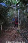
Thick, wild forest and lots of exposed tree roots. The frequent typhoons wash/blow away the soil from the tree roots.Jan 11, 2021
|
|

Stuffed toy Iriomote wildcat.Jan 10, 2021
|
|
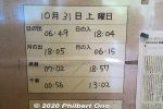
Times for sunrise, sunset, moon rise/set, and high/low tide on Iriomote in Oct.Jan 10, 2021
|
|
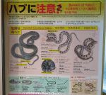
About habu snakes (venomous).Jan 10, 2021
|
|

Bats on Iriomote.Jan 10, 2021
|
|
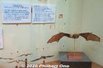
Bats on Iriomote.Jan 10, 2021
|
|
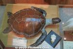
Turtle on Iriomote.Jan 10, 2021
|
|
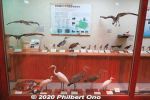
Iriomote's birds.Jan 10, 2021
|
|
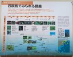
Jan 10, 2021
|
|
Jan 10, 2021
|
|

Roadkill of Iriomote cats is a problem especially since they are nocturnal and Iriomote roads are dark. Residents are told to drive slowly at night.Jan 10, 2021
|
|
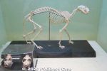
Skeleton of Iriomote wildcat.Jan 10, 2021
|
|

Life cycle of Iriomote wildcat.Jan 10, 2021
|
|
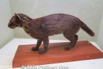
Jan 10, 2021
|
|

Even though the Iriomote cat is all over Iriomote as a tourist symbol, we can't see any live ones.Jan 10, 2021
|
|
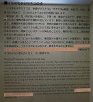
Characteristics of the Iriomote wildcat.Jan 10, 2021
|
|

Characteristics of the Iriomote wildcat.Jan 10, 2021
|
|
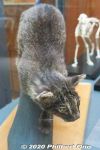
In the past, they did have a live Iriomote cat here, found injured on the road and treated here. Jan 10, 2021
|
|
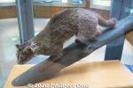
There's no zoo, etc., where we can see a live Iriomote cat. They only have stuffed Iriomote cats here at the Iriomote Wildlife Conservation Center.Jan 10, 2021
|
|
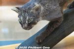
Only 100 or so left on the island. They are nocturnal and have stubby legs and a thick tail. Discovered relatively recently in 1965.Jan 10, 2021
|
|
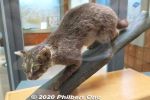
Iriomote is famous for the Iriomote wildcat (イリオモテ ヤマネコ). Endemic to Iriomote and critically endangered. Jan 10, 2021
|
|
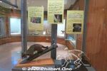
The center's main exhibit is the stuffed Iriomote wildcats.Jan 10, 2021
|
|

Iriomote with the main town of Ohara on the lower right.Jan 10, 2021
|
|

About Iriomote's wildlife.Jan 10, 2021
|
|
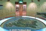
Map of Iriomote.Jan 10, 2021
|
|

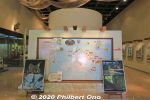
Iriomote map shows where the Iriomote wildcat was sighted (orange tags with date and time) and roadkill locations (red tags). People need to drive carefully.If you see an injured or dead Iriomote wildcat, call 0980-85-5581.Jan 10, 2021
|
|

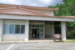
About the Iriomote Wildlife Conservation Center.Jan 10, 2021
|
|
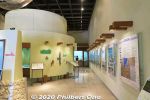
Inside Iriomote Wildlife Conservation Center. One floor full of panel exhibits and stuffed specimens.Jan 10, 2021
|
|
Iriomote Wildlife Conservation Center is a great place to learn about the island's wildlife. There are some English captions too.Jan 10, 2021
|
|

Our waitress in Okinawan dress explaining our lunch at Yaima Mura.Jan 10, 2021
|
|

Yaeyama soba noodlesJan 10, 2021
|
|
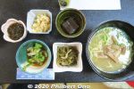
Ishigaki cuisine for lunch. Main dish was soba noodles. Side dishes of pig's ear, goya & tuna, juushi flavored rice (じゅーしー), local seaweed, and brown sugar jelly (dessert). Pig's ear is chewy/crunchy, not really tasty, but has a lot of collagen, so it's a health food.Jan 10, 2021
|
|
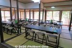
Yaima Mura Restaurant for tour groups.Jan 10, 2021
|
|
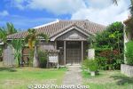
Yaima Mura Restaurant. This is also where you can rent Okinawan clothing.Jan 10, 2021
|
|
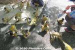
The squirrel monkeys climb all over you.Jan 10, 2021
|
|
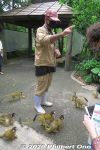
Squirrel Monkey Garden リスザルの森Jan 10, 2021
|
|
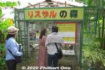
Squirrel Monkey Garden entrance. You need to leave your bags at the entrance. リスザルの森Jan 10, 2021
|
|
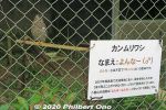
Found only in Yaeyama, Ryukyu serpent eagle that was found injured and being treated here. They like to eat snakes. Called "Ayapani" (あやぱに) in Yaeyama. カンムリワシ保護ケージJan 10, 2021
|
|
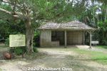
Sugar cane processing factory.Jan 10, 2021
|
|
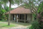
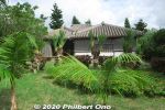
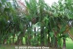
Uechi Residence (Farmer;s house)Jan 10, 2021
|
|
Jan 10, 2021
|
|
Jan 10, 2021
|
|
Jan 10, 2021
|
|
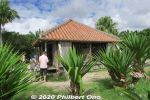
Fisherman's home, side view.Jan 10, 2021
|
|
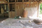
Fisherman's home.Jan 10, 2021
|
|
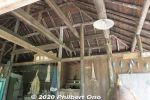
Fisherman's home.Jan 10, 2021
|
|
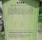
Fisherman's home.Jan 10, 2021
|
|

Fisherman's boat house.Jan 10, 2021
|
|
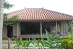
Yaeyama fisherman's home.Jan 10, 2021
|
|
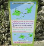
Jan 10, 2021
|
|

Ryukyu matsu pine tree is endemic to Okinawa. It stands straight up and takes an umbrella shape like this. Okinawa's official tree. リュウキュウマツ (琉球松)We don't really see pine trees like this on mainland Japan. Jan 10, 2021
|
|
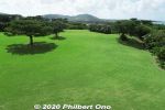
Ryukyu matsu pine treesJan 10, 2021
|
|
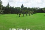
Jan 10, 2021
|
|
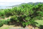
Ryukyu matsu pine trees 琉球松Jan 10, 2021
|
|
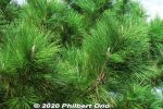
Ryukyu matsu pine treesJan 10, 2021
|
|
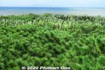
Ryukyu matsu pine trees are native to Okinawa. 琉球松Jan 10, 2021
|
|
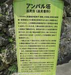
About Amparu Lookout in Japanese. アンパル塔Jan 10, 2021
|
|
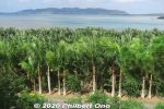
Sakieda Peninsula in the distance as seen from Amparu Lookout.Jan 10, 2021
|
|
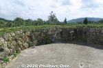
Top of Amparu Lookout gives nice views of the lush greenery in the park.Jan 10, 2021
|
|
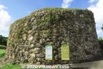
Reconstruction of a 17th-century Amparu Lookout tower used to look out for shipwrecked ships from China, Japan, and Okinawa. They were many of these towers in Ryukyu.There's a spiral slope going around the tower to reach the top.Jan 10, 2021
|
|
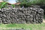
Makishi Residence privacy wall. 旧牧志邸Jan 10, 2021
|
|
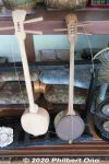
Can-type sanshin in Makishi Residence. 旧牧志邸Jan 10, 2021
|
|

Sanshin in Makishi Residence. 旧牧志邸Jan 10, 2021
|
|
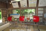
They hold traditional music performances in Makishi Residence. 旧牧志邸Jan 10, 2021
|
|
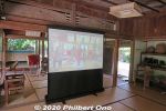
Inside Makishi Residence. 旧牧志邸Jan 10, 2021
|
|
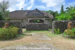
Makishi Residence is a traditional Yaeyama home. 旧牧志邸Jan 10, 2021
|
|
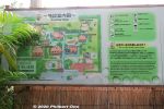
Several traditional Yaeyama homes in a park-like setting with lush greenery. "Yaima" means Yaeyama in the local Yaeyama dialect.Jan 10, 2021
|
|
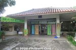
Yaima Mura is a small architectural park of traditional Yaeyama homes overlooking Nagura Bay. Open 9:00 am–5:30 pm. Adult admission ¥1,000, kids ¥500. https://www.yaimamura.com/Jan 10, 2021
|
|

Stargazing near Nosokodake. Photo by National Astronomical Observatory of Japan.Jan 10, 2021
|
|

Stargazing at Nosokodake Lookout Point. Photo by National Astronomical Observatory of Japan.Jan 10, 2021
|
|

Stargazing at Nosokodake Lookout Point. Photo by National Astronomical Observatory of Japan.Jan 10, 2021
|
|
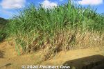
Lots of sugar cane in Yaeyama.Jan 10, 2021
|
|
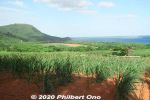
Jan 10, 2021
|
|
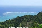
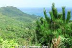
View of coral reefs from Nosokodake Lookout Point in northern Ishigaki. Jan 10, 2021
|
|
Jan 10, 2021
|
|
| 71466 files on 284 page(s) |
 |
 |
27 |  |
 |
|