 Last additions - Lake Biwa Canal 琵琶湖疎水 Last additions - Lake Biwa Canal 琵琶湖疎水 |

Biwako Sosui. The city of Otsu is thinking about resurrecting a tourist boat service on this canal. MAPApr 23, 2009
|
|

Lake Biwa Canal No. 1. The Lake Biwa Canal (Biwako Sosui) supplies water from Lake Biwa in Otsu to Kyoto. After four years of monumental construction, the canal was completed in 1890. Apr 23, 2009
|
|
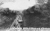
Lake Biwa Canal on vintage postcard. Notice the boats in the canal. Boat rides were initially offered.Apr 23, 2009
|
|
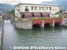
Lake Biwa Canal No. 1Apr 23, 2009
|
|

Lake Biwa Canal No. 1Apr 23, 2009
|
|

Lake Biwa Canal and cherry blossoms.Apr 23, 2009
|
|

No. 1 Tunnel entrance. The first and longest tunnel under a mountain. The entrance is very artistic.Apr 23, 2009
|
|

Apr 23, 2009
|
|
Apr 23, 2009
|
|

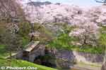
Lake Biwa Canal and cherry blossoms in full bloom. They also light up the trees at night from 6:30 pm-9:30 pm. Beautiful and serene.Apr 23, 2009
|
|

Lake Biwa Canal and cherry blossoms above the tunnel entrance.Apr 23, 2009
|
|

Apr 23, 2009
|
|

The Biwako Sosui or Lake Biwa Canal in Otsu is also noted for cherry blossoms.Apr 23, 2009
|
|
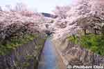
Lake Biwa Canal (Biwako Sosui) and cherry blossoms. This is one of two canals which supply water from Lake Biwa to Kyoto. National Historic SiteApr 23, 2009
|
|

Apr 23, 2009
|
|

Apr 23, 2009
|
|

Apr 23, 2009
|
|
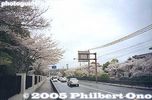
Keage today, incline is on the right of roadOct 24, 2005
|
|

Keage Incline postcardThe Keage Incline was in operation until 1948.Oct 24, 2005
|
|
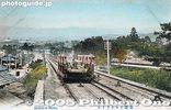
Keage Incline postcardThe Keage Incline was in operation until 1948.Oct 24, 2005
|
|

Water intake for Lake Biwa Canal No. 1 at MihogasakiOct 23, 2005
|
|

Water intake for Lake Biwa Canal No. 1. Kyoto was thereby revitalized with electric power and a stable water supply. A second, almost parallel canal for drinking water was also constructed in 1912. Oct 23, 2005
|
|

Water intake for Lake Biwa Canal No. 1Oct 23, 2005
|
|
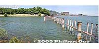
Water intake for Lake Biwa Canal No. 2. The Lake Biwa Canal (Biwako Sosui) supplies water from Lake Biwa in Otsu to Kyoto. After four years of monumental construction, the canal was completed in 1890.Oct 23, 2005
|
|

Water intake for Lake Biwa Canal No. 2Oct 23, 2005
|
|

Water intake for Lake Biwa Canal No. 2. Near Mihogasaki in Otsu, and adjacent to the boat racing arena.Oct 23, 2005
|
|

Water intake for Lake Biwa Canal No. 2Oct 23, 2005
|
|

Top of Keage InclineThe boat would be loaded onto the trolley here, then taken down the incline. Or vice versa.Oct 21, 2005
|
|
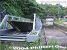
Top of Keage InclineThe boat would be loaded onto the trolley here, then taken down the incline. Or vice versa.Oct 21, 2005
|
|

Keage Hydroelectric Power Plant pipesOct 21, 2005
|
|
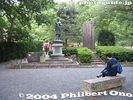
Park near top of Keage InclineOct 21, 2005
|
|

Statue of Sakuro Tanabe, the canal engineerIn the park near top of Keage Incline. The canal is lined with various monuments and writings, especially on the canal tunnel entrances.Oct 21, 2005
|
|
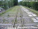
Keage InclineOct 21, 2005
|
|

Keage Incline boat trolleyThe Keage Incline was once restored in 1977. However, the sample boats are in poor condition.Oct 21, 2005
|
|
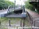
Keage Incline boat trolleyOct 21, 2005
|
|
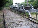
Keage Incline boat trolleyThe Keage Incline was a dry slope which connected the upper part of the canal with the lower part of the canal. Since the canal was disconnected by this dry slope, boat trolleys on rails ferried boats between the upper and lower sections of the canal. It was in operation until 1948.Oct 21, 2005
|
|

Keage InclineThe Keage Incline was a dry slope which connected the upper part of the canal with the lower part of the canal. Since the canal was disconnected by this dry slope, boat trolleys on rails ferried boats between the upper and lower sections of the canal. It was in operation until 1948.Oct 21, 2005
|
|

Bottom of Keage InclineThe Keage Incline was a dry slope which connected the upper part of the canal with the lower part of the canal. Since the canal was disconnected by this dry slope, boat trolleys on rails ferried boats between the upper and lower sections of the canal. It was in operation until 1948.Oct 21, 2005
|
|

Map of canal routeOct 21, 2005
|
|

Bottom of Keage Incline in KyotoOct 21, 2005
|
|
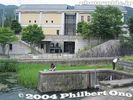
Lake Biwa Canal Museum at bottom of Keage InclineThe museum opened in 1996.Oct 21, 2005
|
|
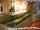
Lake Biwa Canal MuseumModel of Keage Incline.Oct 21, 2005
|
|
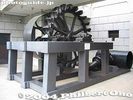
Pelton water wheel at Lake Biwa Canal MuseumUsed at the Keage Power Plant to generate electricity. The Keage Plant was Japan's first hydroelectric power plant.Oct 21, 2005
|
|

Oct 21, 2005
|
|

Lake Biwa Canal Museum in KyotoAt the end of the canal, there's this museum in Kyoto tracing the history of the canal.Oct 21, 2005
|
|

YamashinaOct 21, 2005
|
|
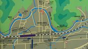
Yamashina map showing the exposed portion of the Lake Biwa Canal near JR Yamashina Station in Kyoto.Oct 21, 2005
|
|
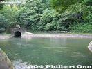
YamashinaOct 21, 2005
|
|
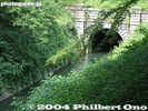
No. 1 Tunnel exitOct 21, 2005
|
|

Oct 21, 2005
|
|
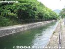
Oct 21, 2005
|
|
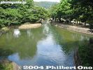
The canal in Kyoto near Yamashina.Oct 21, 2005
|
|
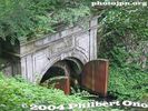
No. 1 Tunnel entrance. Oct 21, 2005
|
|

Water intake for Lake Biwa Canal No. 2. This is the second, almost parallel canal constructed in 1912.Oct 21, 2005
|
|

Water intake for Lake Biwa Canal No. 2. The canal is covered. The water supply for Kyoto and Osaka.Oct 21, 2005
|
|

Water intake for Lake Biwa Canal No. 2Oct 21, 2005
|
|
|
|