 Most viewed - YAEYAMA ISLANDS 八重山諸島 Most viewed - YAEYAMA ISLANDS 八重山諸島 |
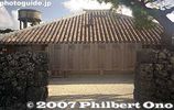
Okinawan house, Taketomi. Taketomi is a National Important Traditional Townscape Preservation District (重要伝統的建造物群保存地区).311 views
|
|
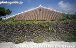
Okinawan house and rock wall, Taketomi300 views
|
|

Hoshi Sunahama or Star Sand Beach223 views
|
|
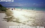
Kondoi beach214 views
|
|

Taketomi Primary School210 views
|
|
207 views
|
|
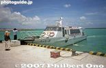
Taketomi Port boat for Ishigaki206 views
|
|
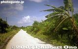
White coral road199 views
|
|

Boat for Taketomi at Ishigaki Port.194 views
|
|
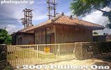
Power voltage station186 views
|
|

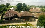
On Taketomi, residential homes are toward the middle of the island, not along the beaches. The middle part of the island is built on hard rock called chert. Freshwater wells can be dug along this rock to provide water. View from lookout tower.180 views
|
|
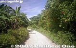
White coral road, one of Taketomi's trademarks.179 views
|
|
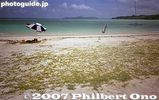
Kondoi beach177 views
|
|
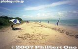
Be aware that these parasols are not free.176 views
|
|

173 views
|
|
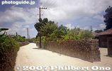
172 views
|
|
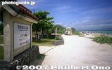
Kondoi Picnic Site171 views
|
|
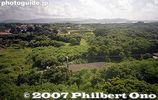
Outside the middle part of Taketomi, the ground is on limestone where water seeps through. Difficult to have rice paddies or wells on limestone.162 views
|
|

Lookout tower159 views
|
|
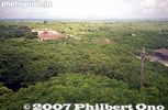
View from lookout tower155 views
|
|

On Taketomi, the best way to get around.154 views
|
|
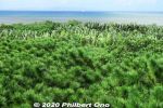
Ryukyu matsu pine trees are native to Okinawa. 琉球松68 views
|
|
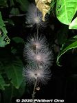
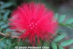
White powder-puff flowers or sagari-bana in Japanese (サガリバナ) and a small moth. There are pink ones too. 68 viewsDuring summer, they bloom for only one night, then the flowers fall off the next morning. It was early Nov. (still warm), so maybe we got lucky to see it.
|
|
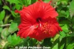
Red hibiscus67 views
|
|
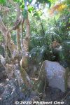
In the old days, part of the root was used as a rudder on Okinawan sabani fishing boats. (サキシマスオウノキ 先島蘇芳木 Heritiera littoralis)67 views
|
|
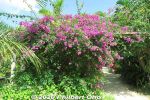
Bougainvillea on Yubu, in bloom year round.66 views
|
|
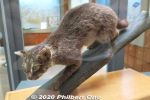
Iriomote is famous for the Iriomote wildcat (イリオモテ ヤマネコ). Endemic to Iriomote and critically endangered. 66 views
|
|
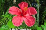
Red hibiscus65 views
|
|
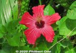
Red hibiscus64 views
|
|
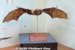
Bats on Iriomote.63 views
|
|
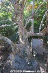
An exotic plant on Iriomote called "looking-glass mangrove" (Sakishima suounoki) with huge roots that look like a byobu folding screen. (サキシマスオウノキ 先島蘇芳木 Heritiera littoralis)63 views
|
|
62 views
|
|
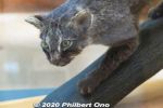
Only 100 or so left on the island. They are nocturnal and have stubby legs and a thick tail. Discovered relatively recently in 1965.62 views
|
|
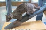
There's no zoo, etc., where we can see a live Iriomote cat. They only have stuffed Iriomote cats here at the Iriomote Wildlife Conservation Center.62 views
|
|
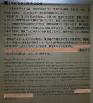
Characteristics of the Iriomote wildcat.61 views
|
|
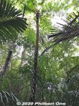
Tree fern, common in Okinawa. The fronds break off. 木生シダ61 views
|
|
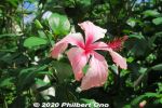
Lots of tropical flowers on Yubu Island, especially hibiscus.60 views
|
|
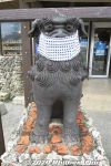
Seesa lion dog with mask, Ishigaki.59 views
|
|
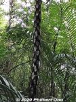
The trunk of a tree fern shows the remains of branches that broke off. 木生シダ59 views
|
|
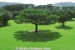
Ryukyu matsu pine tree is endemic to Okinawa. It stands straight up and takes an umbrella shape like this. Okinawa's official tree. リュウキュウマツ (琉球松)57 viewsWe don't really see pine trees like this on mainland Japan.
|
|

Mt. Nosokodake (野底岳), Ishigaki’s second highest mountain at 282 m. Can be climbed up a steep, narrow trail in about 15 min. We didn't climb it though.54 views
|
|
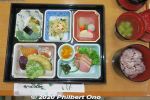
Lunch was named, "Okinawa Makunouchi Bento Akabana" (沖縄幕の内弁当「アカバナ」. ("Akabana" means "hibiscus" in Okinawan.) Price was ¥1,320.50 viewsIriomote black rice, champuru, brown sugar yokan: 西表産黒紫米入りごはん、アーサのお吸い物、うみぶどう、ミミガー、漬物、沖縄黒糖煮、 アンダー味噌、野菜天ぷら、ウムクジ(紅イモを米粉であえて揚げたもの)、かまぼこ、チャンプ ルー、黒糖羊羹
|
|
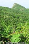
So she and her family were forced to move here to Nosokodake to start a new farming village and clear the thick jungle for farming. It was a hard life. 48 viewsMaape desperately missed her beloved Kanimui and couldn't forget him.
One day, she wanted to at least see Kuroshima where he lived, so she climbed up Mt. Nosokodake. At the top, she looked for Kuroshima, but her view of the island was blocked by Mt. Omotodake, Ishigaki's highest mountain. She collapsed on her knees and wailed in sorrow. Later, a worried villager looked for Maape who never returned home. On the top of the mountain, he found a crying rock gazing in the direction of Kuroshima. Maape had turned into stone.
|
|
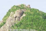
Even today, people who climb the mountain look for the Maape rock and assume this or that rock is her.48 viewsThis story is based on historical fact. The Ryukyu government sometimes forced people to migrate to undeveloped lands to start farming to increase agricultural production so they could pay more taxes. The kingdom was being heavily taxed by the Satsuma Domain in Kagoshima, and taxes had to paid in rice per head.
Read more about the folk tale here: https://photoguide.jp/log/2020/12/yaeyama-folk-songs-nosokodake-maape/
|
|
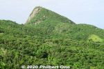
Side view of Mt. Nosokodake. This mountain is associated with a famous local folk tale about a girl named Maape. The mountain is nicknamed after her, "Nosoko Maape" (野底マーペー).47 viewsOn the nearby island of Kuroshima (黒島) in the 18th century, Maape and her childhood sweetheart, Kanimui, were happily living as farmers. They were to be married someday.
However, one day, a Ryukyu government decree ordered half the island's residents to move here near Nosokodake on Ishigaki while the other half could remain on Kuroshima. The island's population was split along the island's main road. Maape and Kanimui lived on the opposite sides of the road, and Maape was on the side where people had to move to Ishigaki.
|
|

Old Ishigaki Airport terminal, Arrivals. No jet bridges. Jets (Boeing 737) started flying here only from 1979. 47 views
|
|

Old Ishigaki Airport terminal for JTA. Small building. The old airport first opened in 1943 for military use. It became a civilian airport in 1956.46 viewsThis passenger terminal building was built in 1961 and used mainly by JTA (Japan Transocean Air) and RAC (Ryukyu Air Commuter). ANA had its own adjacent terminal.
|
|
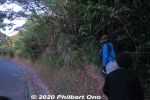
Sunrise hike up Mt. Yarabudake (屋良部岳) on Sakieda Peninsula in western Ishigaki. It starts near the summit from this small, easy-to-miss trail.45 views
|
|

This is the old Ishigaki Airport before it closed in March 2013 and was replaced by the new and current airport slightly north of this old airport.44 views
|
|

At the old Ishigaki Airport, inside the JTA passenger waiting area at the boarding gate.43 views
|
|

Walking on the tarmac to the JTA plane at Ishigaki Airport.42 views
|
|
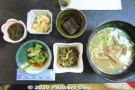
Ishigaki cuisine for lunch. Main dish was soba noodles. Side dishes of pig's ear, goya & tuna, juushi flavored rice (じゅーしー), local seaweed, and brown sugar jelly (dessert). 41 viewsPig's ear is chewy/crunchy, not really tasty, but has a lot of collagen, so it's a health food.
|
|

Old Ishigaki Airport terminal for JTA, Arrivals. No jet bridges.41 views
|
|

Taking off at the old Ishigaki Airport.41 views
|
|

Delicious Okinawan breakfast at Takemori Inn/Ryokan (竹盛旅館).41 views
|
|
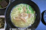
Yaeyama soba noodles40 views
|
|

At the old Ishigaki Airport, JTA boarding gate. One of the check-in staff wears a yukata. Also notice the old digital signage.40 views
|
|

Dinner at Takemori Inn. Chawan-mushi, local fish, Yaeyama soba. The ryokan owner was very friendly. Not English-speaking though.39 views茶碗蒸し、海藻と野菜和え、近海魚の刺身、近海魚の塩煮、煮物(冬瓜)、ソーキ、昆布、こんにゃく、黒紫米入り西表産ひとめぼれごはん、八重山そば
|
|

Inside JTA plane, flight attendants figuring out what to tell us.38 views
|
|

Runway at the old Ishigaki Airport. The slanty white building visible is the ANA hotel on the beach. That's how close the old airport was to town.38 views
|
|

Kanbire (Kanpire) Falls on Urauchi River, near the center of Iriomote. This is about 2 km from the Gunkan-iwa boat dock. Or 30-40-min. hike. You can get quite close to the falls. カンビレーの滝37 viewsInstead of having one big drop, Kanbire Falls flow down on a series of steps on the river for about 200 meters. The riverside also has small potholes. Kanbire (Kanpire) means "where gods sit." This spot was considered to be a sacred site where the gods gathered.
|
|

Approaching the old Ishigaki Airport terminal.37 views
|
|
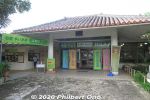
Yaima Mura is a small architectural park of traditional Yaeyama homes overlooking Nagura Bay. Open 9:00 am–5:30 pm. Adult admission ¥1,000, kids ¥500. https://www.yaimamura.com/36 views
|
|

In northern Iriomote, Urauchi River is Okinawa's longest (19 km), widest (200 m), and deepest (15 m) river. It's home to a whopping 400 species of fish or 10 percent of Japan's fish species.36 viewsOver 20 fish species are endangered. Urauchi River is within Iriomote-Ishigaki National Park. Both sides of the river are lush with mangroves and forests. 西表国立公園
|
|

Ferns and tree ferns also grow at upstream. シダ類36 views
|
|

After hiking about 30 min., a scenic point gives a view of Mariyudu Falls. Series of three waterfalls. It empties into a round stream pool. "Mariyudu" means stream pool. マリゥドゥの滝36 views
|
|

Mariyudu Falls on Urauchi River. About 20 meters wide and 16-meter drop in total. One of Japan's 100 Famous Waterfalls. マリゥドゥの滝36 views*People can no longer come this close to the falls. There were people who slipped and fell in, so the closeup path is blocked.
|
|

I liked walking on the tarmac to the plane at Ishigaki Airport.36 views
|
|

JTA plane's see-sa at Ishigaki Airport.36 views
|
|
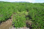
Sakishima suounoki mangroves, Iriomote. サキシマスオウノキ (古見)36 views
|
|
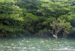
The boat operator narrates the sights along the river. There are even signs indicating the flora. This sign indicates a mangrove species called "me-hirugi" (メヒルギ) in Japanese or Kandelia obovata growing in brackish water.35 viewsIt has white, star-shaped flowers.
|
|

Iriomote Hoshizuna Beach.35 views
|
|

No jet bridge, but it wasn't a problem when it didn't rain.35 views
|
|

Ground crew at the old Ishigaki Airport waving goodbye to us. I waved back.35 views
|
|

Urauchi River is fed by the runoff from Iriomote's central mountains. Urauchi River jungle cruise is about 30 min. or 8 km upstream to another boat dock called Gunkan-iwa. 西表島・浦内川34 views
|
|

On the northern tip of Iriomote is scenic Hoshi-suna Beach. Famous for star-shaped sand grains, but hard to find. 西表 星砂の浜34 viewsMap here
|
|
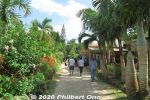
33 views
|
|

Hiking back. The lady in front of me was wearing rubber slippers on this muddy trail. She kept slipping and almost falling. Her dainty feet got all muddy.33 views
|
|

Banna Park on Banna Hill (230m elevation) in the northern fringe of central Ishigaki is a large nature & recreational park. This is one of the main lookout points. Named "Emerald Ocean Lookout Point" overlooking the city center and nearby is33 viewsThis is in Zone B of the park along the Banna Skyline road. This photo was taken before the stargazing platform was built next to it. エメラルドの海を見る展望台
|
|
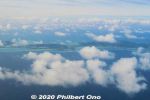
Aerial view of Ibaruma and Hirakubo, Ishigaki.33 views
|
|

Ishigaki Port is on the southern coast of Ishigaki island. It's the marine gateway to other Yaeyama islands such as Taketomi, Iriomote, Kuroshima, and Aragusuku.33 viewsIshigaki Port consists of multiple port facilities. For tourists, the facility for tourist boats going to other Yaeyama islands might be called "Ishigaki Port Remote Island Terminal" or nicknamed "Euglena Ishigaki Port Remote Island Terminal" (ユーグレナ石垣港離島ターミナル) since a company named Euglena bought the naming rights for 5 years in 2018.
|
|
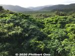
Great views of the greenery from the Otomi Lookout Deck.33 views
|
|
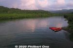
There was this dock where we could get on our kayaks. Maira River, Iriomote.32 views
|
|
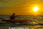
Our guide was Harubaru, but he doesn't normally do sunrise kayaking unless you ask him to: http://harubaru-iriomote.okinawa/course/32 views
|
|

Northern Iriomote has Okinawa and Iriomote's longest river, Urauchi River (18 km). It's a popular tourist route to go on the jungle cruise, then hike through the forest to see two waterfalls on the river.32 viewsNear Urauchi-hashi Bridge at the mouth of the river, there's a boat dock for Urauchi jungle river cruises. Since the hiking trail is rocky or muddy, don't wear high heels or slippers. Wear sneakers or hiking shoes. Although there's a restroom along the hiking trail, it's not as clean as you would like. Better to use the toilet at the boat dock before the cruise. Also bring something to drink. The roundtrip cruise and hike will take about 3 hours. Map here
|
|

Wish we could see the Iriomote wildcat swimming across the river, but they are nocturnal.32 views
|
|

Behind Mariyudu Falls looking from upstream.32 views
|
|
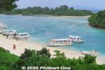
Kabira Bay, Ishigaki. It's actually a large bay and this is only a small part of it. Scenic with white beach, blue ocean, small islands and coral on the bottom.31 views
|
|
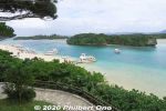
Kabira Bay on Ishigaki, perhaps the island's most famous tourist spot. Glass bottom boats to see coral and tropical fish in shallow water.31 views
|
|
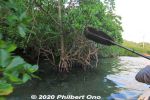
After the sunrise, we paddled along the mangroves on the river's edge.31 views
|
|

Lovely morning, too bad we didn't have time to kayak more upstream on Maira River, Iriomote.31 views
|
|
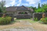
Makishi Residence is a traditional Yaeyama home. 旧牧志邸31 views
|
|

Mariyudu Falls. From here, the hiking trail continues to another waterfall, Kanbire (Kanpire) Falls about 250 meters away.31 views
|
|

31 views
|
|

On Runway 04 at the old Ishigaki Airport. At 1,500 meters, it was too short for jets larger than a Boeing 737. So the new airport was built on a different location.31 views
|
|

Taking off at the old Ishigaki Airport.31 views
|
|

We got off the boat upstream here at Gunkan-iwa, named after a rock slab looking like the side of a battleship. 軍艦岩30 views
|
|

On the southern coast of Ishigaki, we stayed at Ishigakijima Beach Hotel Sunshine for one night. It's a nice hotel. About 30 min. by car from the airport. 本館 https://www.ishigakijima-sunshine.net/30 views
|
|

The old Ohara Port, Iriomote.30 views
|
|
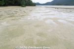
While walking here, I looked down since my intuition told me I might find something...29 views
|
|
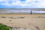
Manta Beach on Yubu. マンタの浜29 views
|
|

A nice cafe at Manta Beach on Yubu.29 views
|
|
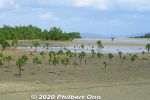
Iriomote mangroves.29 views
|
|
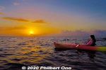
Sunrise kayaking on Iriomote, Yaeyama, Okinawa.29 views
|
|
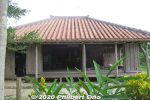
Yaeyama fisherman's home.29 views
|
|
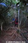
Thick, wild forest and lots of exposed tree roots. The frequent typhoons wash/blow away the soil from the tree roots.29 views
|
|

On the tour bus on Iriomote going north. Lots of sugar cane. 29 views
|
|

Lush forest, but rocky and muddy trail. Hiking shoes or sneakers are good. Sometimes a tree or branch has fallen over the trail. Need to go over/under it.29 views
|
|

Ishigaki is the gateway to Okinawa Prefecture's Yaeyama Islands. Ishigaki Airport near central Ishigaki is how most visitors get to Yaeyama.29 viewsBird's eye view of central Ishigaki from a jet plane going to land at Ishigaki Airport.
|
|

Shiraho29 views
|
|
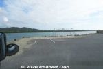
Site of the old Ohara Port near the new one. The old port operated here until 2002.29 views
|
|
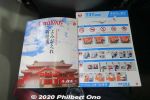
JTA in-flight magazine "Coralway" had a nice Japanese article about the reconstruction of Shuri Castle in Naha.29 views
|
|
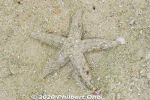
Sure enough, a well-disguised starfish moving in slow motion. Hope it's not the kind that eats coral or other native species. Kabira Bay, Ishigaki.28 views
|
|
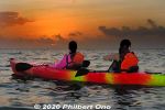
A few clouds, but the sunrise was getting to be nice.28 views
|
|

Urauchi River hiking trail to waterfalls. It can be quite muddy.28 views
|
|

Iriomote Hoshisuna Beach.28 views
|
|

Northern Iriomote coast.28 views
|
|

Bird of Paradise flower in Banna Park.28 views
|
|
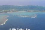
Aerial view of Nosoko, Ishigaki.28 views
|
|

Taking off at the old Ishigaki Airport.28 views
|
|

The center of this photo shows the site where the new airport was going to be built.28 views
|
|

Having tea or ice cream on an old water buffalo cart. (Photo by tour guide motti.)28 views
|
|
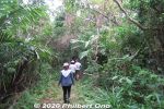
Iriomote has many hiking trails through the tropical forest or jungle. The popular trails usually lead to a waterfall, but we went on a short nature trail in Otomi that didn't lead to anything. 大富林道大正池28 views
|
|
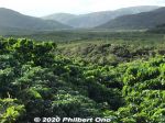
Nakama River is beyond this area.28 views
|
|

Welcome sign.28 views
|
|
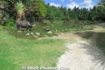
Water Buffalo Pond (水牛の池) on Yubu.27 views
|
|
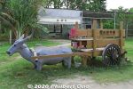
Lots of water buffalo monuments and sculptures on Yubu.27 views
|
|

Boat dock at Urauchi River on Iriomote. If you come on your own, the jungle river cruise is ¥1,800 for adults. 西表島・浦内川27 viewsThe boat cruise takes about 30 min. to a dock upstream where you get off for the waterfall hike. Boats depart here once or twice an hour from morning to early afternoon.
|
|

Another Urauchi River cruise boat. 西表島・浦内川 遊覧ボート27 views
|
|

Sometimes there are views from the hiking trail.27 views
|
|

Ferns and a nameless mini waterfall.27 views
|
|

27 views
|
|

Mangroves near the mouth of Urauchi River, seen from Urauchi Bridge.27 views
|
|

View of central Ishigaki from Banna Park.27 views
|
|

RAC (Ryukyu Air Commuter) prop plane.27 views
|
|

Shiraho coral reefs on Ishigaki.27 views
|
|

Shiraho coral reefs on Ishigaki.27 views
|
|

Ishigakijima Beach Hotel Sunshine has the main building on the left. We stayed in the newer annex seen in the distance. Both buildings face the ocean.27 viewsIncluding breakfast, it costs ¥8,000/person for two people in a room in the main building.
|
|
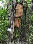
Bird feeder for research purposes.27 views
|
|
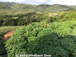
Great views of the greenery from the Otomi Lookout Deck.27 views
|
|
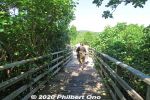
Boardwalk at Sakishima suounoki mangroves in the Komi area. サキシマスオウノキ (古見)27 views
|
|

Boat ticket for Ishigaki Port.27 views
|
|
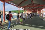
Tourists arriving Ohara Port.27 views
|
|
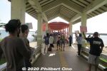
Local tour guides, car rentals, etc., try to attract the attention of arriving tourists at Ohara Port.27 views
|
|

On board Anei Kanko's high-speed boat "Paijima" for Ishigaki Port. ぱいじま27 views
|
|
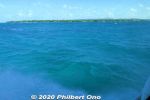
Beautiful ocean between Iriomote and Ishigaki, part of the national park.27 views
|
|
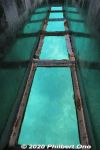
Glass bottom boat in Kabira Bay, Ishigaki.26 views
|
|
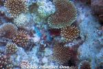
Parrot fish in Kabira Bay.26 views
|
|
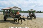
The cart is driven by a guide who usually plays the sanshin for passengers as the water buffalo sloshes to the island.26 views
|
|
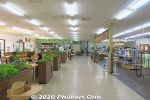
Inside the restaurant on Yubu26 views
|
|
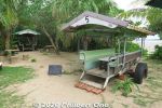
A nice cafe at Manta Beach on Yubu. Sit on old water buffalo carts.26 views
|
|
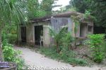
Old elementary and jr. high school on Yubu.26 views
|
|
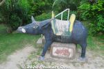
Lots of water buffalo sculptures on Yubu.26 views
|
|

About the Iriomote Wildlife Conservation Center.26 views
|
|
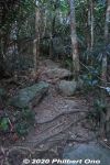
Typical mountain trail on Ishigaki. 26 views
|
|

On Iriomote, one convenient way to tour the island is go on a sightseeing tour by bus. They pick you up when you arrive at the port and take you to the major sights like Urauchi River and Yubu.26 viewsYou can book a tour from Ishigaki.
|
|

Bus stop (Urauchihashi) for the Urauchi River boat dock. In the background is our tour bus.26 views
|
|
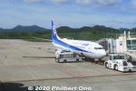
ANA at Ishigaki Airport.26 views
|
|

Ishigaki Airport 26 views
|
|
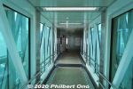
Jet bridge26 views
|
|
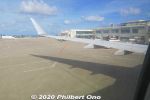
Pushback at Ishigaki Airport on JTA Boeing 737-800 for Naha. Didn't see any ground crew waving goodbye to us.26 views
|
|

Leaving Ishigaki Airport.26 views
|
|

26 views
|
|

26 views
|
|

Shiraho coral reefs on Ishigaki.26 views
|
|
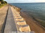
Walked along the oceanfront.26 views
|
|
Low tide puddles.26 views
|
|
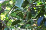
Mangrove seedling.26 views
|
|
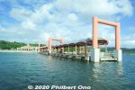
Ohara Port, Iriomote. One floating dock.26 views
|
|
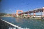
Ohara Port dock.26 views
|
|

Ohara Port's passenger terminal is nicknamed "Nakamarin." Built in 2002 after moving from the old location. This is the main entrance from the street.26 views
|
|
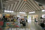
Inside Ohara Port's passenger terminal nicknamed "Nakamarin." It has a gift shop. This building got flooded by typhoons twice in 2005 and once in 2009.26 views
|
|

Departure times for boats going to Ishigaki.26 views
|
|
25 views
|
|
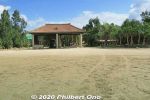
Yubu arrival station. (Admission charged, included in the water buffalo cart ride.) https://yubujima.com/25 views
|
|
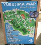
Map of Yubu sights and attractions.25 views
|
|
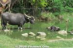
Water buffalo pond on Yubu.25 views
|
|

Sunrise kayaking on Iriomote, Yaeyama, Okinawa.25 views
|
|
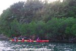
After the sunrise, we paddled along the mangroves on the river's edge.25 views
|
|
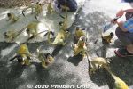
The squirrel monkeys climb all over you.25 views
|
|
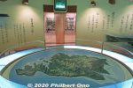
Map of Iriomote.25 views
|
|

Characteristics of the Iriomote wildcat.25 views
|
|
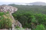
Top of Mt. Yarabudake. This rock is known as Troll's Tongue.25 views
|
|

At Gunkan-iwa dock, there's a hiking trail called Urauchigawa Shizen Kenkyu-ro. A nature trail that goes to two waterfalls.25 viewsNote that cell phones won't work on the hiking trail. 浦内川自然研究路
|
|

River cruise back to the dock.25 views
|
|

Butterfly in Banna Park.25 views
|
|

Descending toward Ishigaki Airport adjacent to farmland.25 views
|
|

This new Ishigaki Airport opened in March 2013. Due to the Yaeyama islands becoming a popular tourist destination, there were calls to built a bigger airport since 1979.25 views
|
|
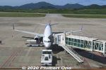
25 views
|
|

View of Ishigaki Airport from the jet bridge.25 views
|
|

ANA Boeing 787 landing at Ishigaki Airport, probably from Haneda, Tokyo. Thanks to the new airport's longer runway, such wide-body jets can land here.25 views
|
|

Flying over Shiraho, Ishigaki.25 views
|
|

25 views
|
|

On the water buffalo cart to Yubu Island from Iriomote. The guide also played the sanshin. (Photo by tour guide motti.)25 views
|
|

Water buffalo walks through shallow water to Yubu Island from Iriomote. (Photo by tour guide motti.)25 views
|
|

Having tea or ice cream on an old water buffalo cart. (Photo by tour guide motti.)25 views
|
|

Inside the butterfly garden (蝶々園) on Yubu. (Photo by tour guide motti.)25 views
|
|
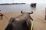
Gentle water buffalo knows the direction. Photo by Kinjo Toru.25 views
|
|
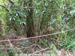
Beehive roped off. (Do not disturb.)25 views
|
|
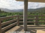
Otomi Lookout Deck 大富展望台25 views
|
|
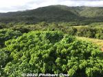
Great views of the greenery from the Otomi Lookout Deck.25 views
|
|
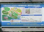
Map of the boardwalk going through the Sakishima suounoki mangroves in the Komi district. Near the mouth of Maira River. サキシマスオウノキ (古見)25 views
|
|
25 views
|
|
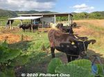
Ishigaki cattle/beef.25 views
|
|
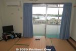
My Japanese-style room at Takemori Inn on Iriomote.25 views
|
|
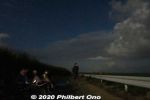
Stargazing amid sugar cane in Mare district, Iriomote. (マーレ地区)25 views
|
|
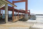
Ohara Port dock built in 2002 after moving from the old location.25 views
|
|
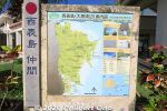
25 views
|
|
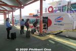
Anei Kanko high-speed boat named "Paijima" for 181 passengers. We rode this boat from Ohara, Iriomote back to Ishigaki Port. ぱいじま25 views
|
|
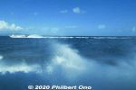
Pretty smooth ride.25 views
|
|
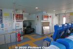
On board Anei Kanko's high-speed boat "Paijima" for Ishigaki Port. The front of the passenger cabin has a space for luggage. ぱいじま25 views
|
|

The old Ohara Port when it was still operating. Tour buses, taxis, etc., await arriving passengers.25 views
|
|
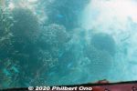
Glass bottom boat in Kabira Bay, Ishigaki.24 views
|
|
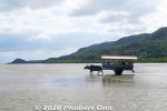
Water buffalo cart ride (水牛車 suigyusha) from Mihara (美原) to Yubu island (Yubu-jima 由 布島) takes 15 min.24 views*Water buffalo cart roundtrip and Yubu island admission for adults: ¥1,760, Children (elementary school and below): ¥880 https://yubujima.com/
|
|

Water buffalo taking toursts to Yubu Island from Iriomote.24 views
|
|
24 views
|
|
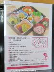
Our Okinawan lunch (Makunouchi Bento Akabana). Very good.24 views
|
|
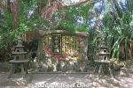
Water Buffalo Monument24 views
|
|
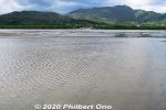
Iriomote across the shallow water.24 views
|
|
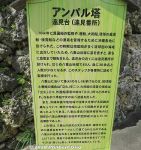
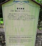
About Amparu Lookout in Japanese. アンパル塔24 views
|
|
24 views
|
|
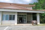
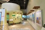
Iriomote Wildlife Conservation Center is a great place to learn about the island's wildlife. There are some English captions too.24 views
|
|
24 views
|
|
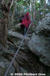
A few steep parts, but ropes help you up.24 views
|
|

Drive further around Sakieda Peninsula and see Ishigaki Cape Ogansaki Lighthouse. Built in March 1983. 石垣御神埼灯台24 views
|
|

Urauchi River boat dock as seen from Urauchi Bridge near the mouth of the river.24 views
|
|

Rest house in Banna Park. It's a large park with a variety of sights, playgrounds, lookout points, and nature.24 views
|
|

Our JTA plane that landed at Ishigaki Airport.24 views
|
|
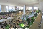
First floor of Ishigaki Airport terminal has a restaurant and gift shops. Second floor is the departure gates.24 views
|
|
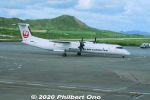
RAC commuter plane.24 views
|
|

Boeing 737 winglet waving goodbye to the control tower at Ishigaki Airport.24 views
|
|

Up, up and away...24 views
|
|
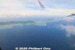
Aerial view of Ibaruma Coast, Ishigaki.24 views
|
|

24 views
|
|
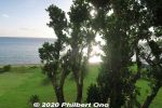
View from my room, partially obstructed by a big tree.24 views
|
|
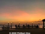
Hotel restaurant terrace at sunset. オープンレストラン 海辺のテラス24 views
|
|
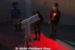
They also had a telescope to see Saturn and the moon.24 views
|
|
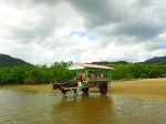
Our water buffalo's name was Musashi. (Photo by tour guide motti.)24 views
|
|
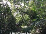
Guided tours are recommended. Local guides know the flora and fauna and the difficult or slightly hazardous sections of hiking trails. Local tour guide: https://www.motti-iriomotejima.com/24 views
|
|
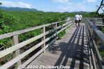
24 views
|
|

Entrance to Takemori Inn/Ryokan (竹盛旅館) in Otomi, where we stayed for a night. Photo by Kinjo Toru. https://www.takemori-inn.net/24 viewsMap: https://goo.gl/maps/pG9zEMWQ1Zozys1x5
|
|
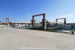
Ohara Port dock.24 views
|
|
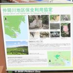
Tourist signs at Ohara Port.24 views
|
|
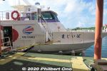
Anei Kanko high-speed boat named "Paijima" for 181 passengers. We rode this boat from Ohara, Iriomote back to Ishigaki Port. ぱいじま24 views
|
|

Kabira Bay beach.23 views
|
|
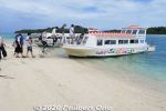
Boarding a glass bottom boat. Your feet don't get wet.23 views
|
|
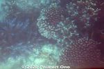
Glass bottom boat in Kabira Bay, Ishigaki.23 views
|
|
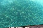
Glass bottom boat in Kabira Bay, Ishigaki.23 views
|
|
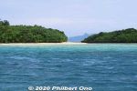
23 views
|
|
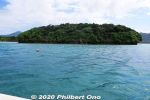
23 views
|
|
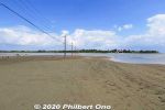
Yubu is a small, sandbar island near Mihara, Iriomote. They converted the island into a lush botanical garden. 23 views
|
|
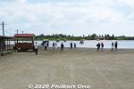
We ride these water buffalo carts to the island across shallow water. 23 views
|
|
|
|