
Soma (Jan. 2025 pop. 32,721, 2010 pop. 37,817) is a small city in northern Hama-dori 45 km away from the Daiichi nuclear power plant. It was less affected by the nuclear radiation and did not have evacuation orders.
However, it suffered catastrophic 3.11 tsunami damage in the coastal areas. The 3.11 earthquake measured M6- in Soma, and the tsunami was over 9 meters high, reaching as far as 4 km inland.
Giant tsunami waves swept away most all homes in Soma’s three coastal areas: Obama, Haragama, and Isobe (尾浜、原釜、磯部地区). Soma lost 458 lives from the 3.11 disaster.
Nearby highways were repaired in the years following and the new Soma City Hall was completed in October 2016.
Contents
- Soma City Memorial Hall
- Soma Great East Japan Disaster Memorial Monument
- Soma Futaba Fisheries Cooperative Association
- Hama-no-eki Matsukawa-ura market
- Oshu Coast, Soma
- Isobe district
- Soma Emergency Rations Storehouse
- Minami-Soma, Fukushima
- Soma Nomaoi samurai horse festival
- Meijokan exhibition hall
Soma City Memorial Hall
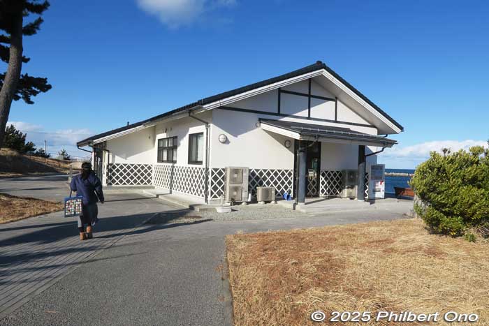
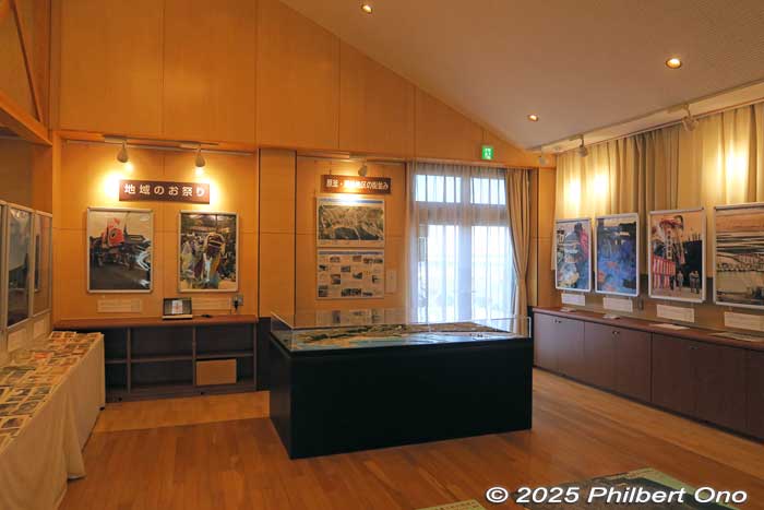
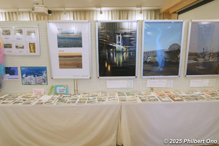
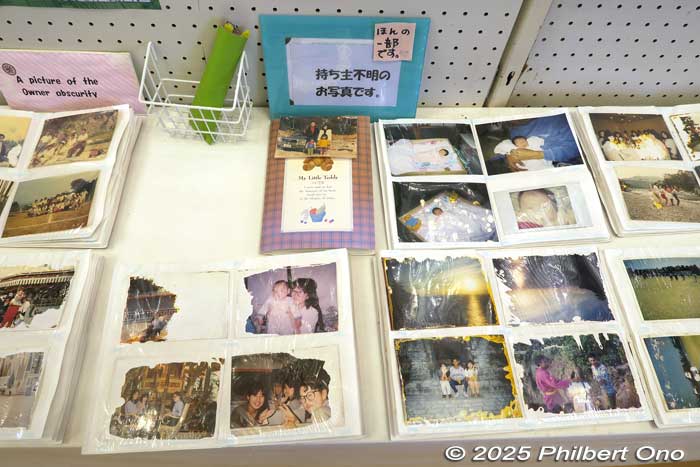
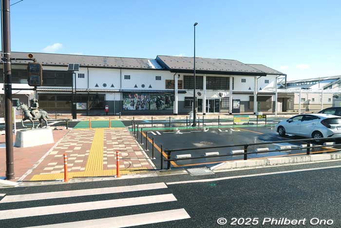
Soma City Memorial Hall (Soma-shi Densho Chinkon Ki’nenkan 相馬市 伝承鎮魂祈念館) is Soma’s 3.11 tsunami memorial museum on the Haragama waterfront. Opened on April 1, 2015, it exhibits photos and videos of the city’s coastal areas before and after the disaster so people and future generations can see what the city looked like.
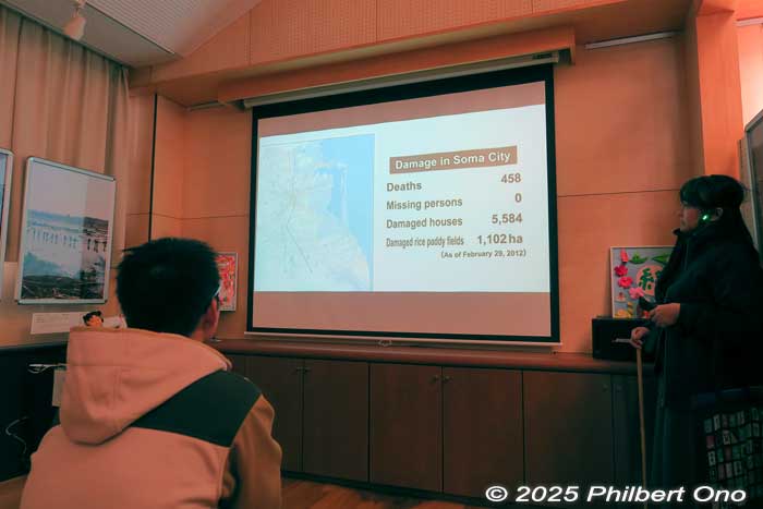
The video screening room shows pre-disaster videos of Soma and amateur footage of the tsunami devastating Soma’s coast. There’s also an English version of the video. The museum centers more on the tsunami than the nuclear disaster.
The memorial hall also has a memorial wall or non-religious altar with the names of Soma victims to provide solace to surviving family members. The museum is also for people to meet and comfort each other.
Soma City Memorial Hall also has local people (kataribe) giving 20-min. talks about their disaster experiences. They charge ¥3,000 per group for a talk.
Soma Tourist Association also offers disaster recovery tours (“Hope Tourism”) in Soma for groups of 10 to 30 people. The tour is two hours long and the guide fee is ¥5,000 per bus load. Discounts given if the tour group has a meal in Soma. You must provide your own English interpreter. Details in Japanese: https://soma-kanko.jp/event/sisatutour/
Soma City Memorial Hall (Soma-shi Densho Chinkon Ki’nenkan 相馬市 伝承鎮魂祈念館)
Hours: 9:00 am–5:00 pm, closed Dec. 29–Jan. 3
270 Otsu, Harakama, Soma, Fukushima Prefecture 福島県相馬市原釜字大津270
Phone: 0244-32-1366
Website: https://soma-kanko.jp/trip/tinkonkinenkan/
English: https://www.densho-road-fukushima.com/institution/requiem-prayer/
Location map: https://maps.app.goo.gl/wTq7HCPFY1VypiwL7
Getting there: JR Soma Station is the nearest train station. Take a bus to Haragama, then short walk.
Soma Great East Japan Disaster Memorial Monument
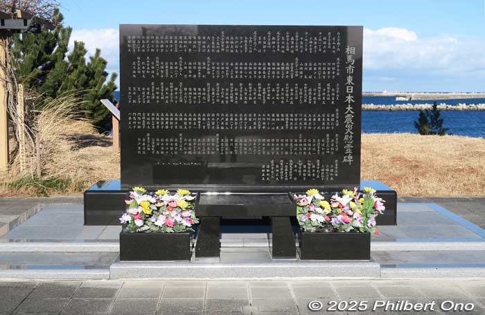
Next to Soma City Memorial Hall is Soma’s 3.11 memorial monument inscribed with the names of the city’s 458 victims. Nearby is a large pine tree that survived the tsunami. There’s also a wisteria trellis grown from a miraculous, blooming wisteria found nearby in May 2011. (相馬市東日本大震災慰霊碑)
Soma Futaba Fisheries Cooperative
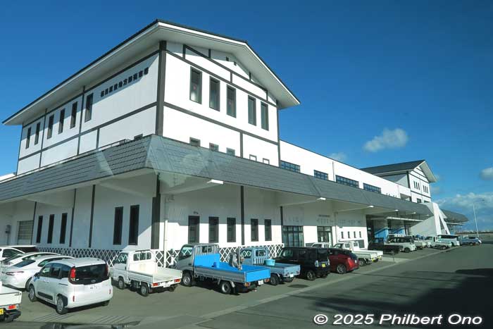
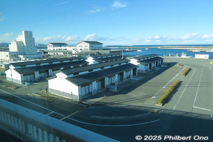
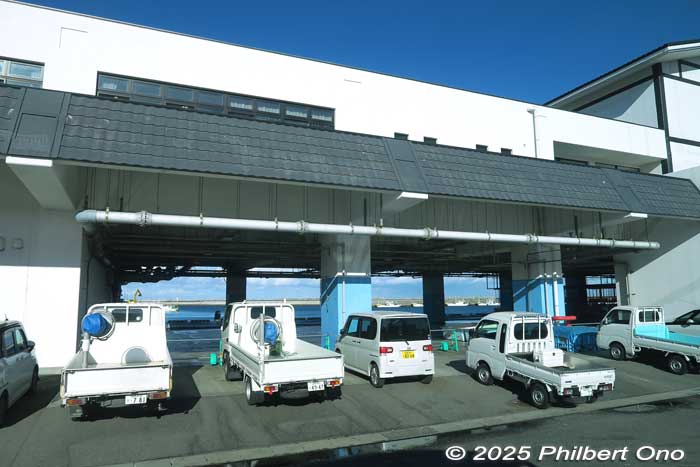
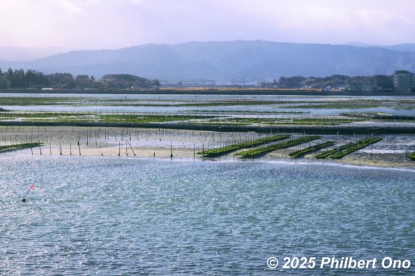
In Soma, Matsukawa-ura Fishing Port (松川浦漁港) had Japan’s highest number (30) of bottom-trawling fishing boats which brought in Japan’s largest catches of octopus, flounder, and Arctic surf clams. However, the port was totally decimated by the 3.11 tsunami.
In September 2016, the Soma Futaba Fisheries Cooperative Association’s rebuilt fish market and storehouse facilities opened. Facilities to filter seawater and supply fuel to boats were restored. By March 2017, Soma’s damaged wharfs (total length 2,660 m) were completely rebuilt.
Fishermen in Fukushima Prefecture had much difficulty not only in clearing and rebuilding their ports and neighborhoods, but also fending off fears of radiation in seafood and the negative stigma (風評被害) amplified by the mass media and people’s pessimistic imagination.
They had no choice but to abandon fishing until June 2012 when they started trial fishing activities for fish known to have low levels of radiation. After testing other types of fish found to have safe levels of radiation, Fukushima fishermen also started catching those fish on a trial basis until March 2021.
In 2022, Fukushima fishermen caught the most fish since the 3.11 disaster, but it was still only 20 percent of the pre-disaster volume. So from 2023, more fishing methods were employed to catch more fish. They included coastal fishing and offshore bottom trawling to try and increase the catch to 50 percent of pre-disaster levels.
To regain public and international confidence in Fukushima’s seafood, the fish were tested for radioactive substances and the results were reported online and in pamphlets in plain language in Japanese and English for consumers.
Many explanatory meetings were also held for consumers and seafood industry people. Tritium levels in seafood were also monitored even before 2022 when radioactive water from the Fukushima Daiichi Nuclear Power Plant was treated by the Advanced Liquid Processing System before being discharged into the Pacific Ocean.
Most of the tsunami debris obstructing fishing operations (including aquaculture for seaweed and oysters) in Tohoku were cleared by 2018. During 2017-2023, most all tsunami debris was cleaned up and all tsunami-affected fishing port facilities in Tohoku were completely rebuilt or restored.
However, the volume of fish catches along the Tohoku Pacific coast is still well below pre-disaster levels across the board as of 2023. For example, Fukushima Prefecture’s catch of Pacific saury is less than 10 percent of pre-disaster levels. There’s simply not as much fish stocks as before and there are fewer fishermen working.
After the 3.11 nuclear disaster, 55 countries and regions barred seafood imports from Japan. By 2015, radiation levels in Fukushima seafood returned to safe levels, making it safe for consumption.
As of January 2024, only seven countries (China, Russia, Hong Kong, South Korea, Taiwan, Macao, and French Polynesia) still banned seafood from all or part of Japan. Fukushima Prefecture and the Japanese government have worked hard to convince consumers in major Japanese cities that its seafood is safe and delicious.
Soma Futaba Fisheries Cooperative Association website: https://www.soso-gyokyo.jp/
Location map: https://maps.app.goo.gl/rprWGFc1ASgyTqEXA
Hama-no-eki Matsukawaura, Soma
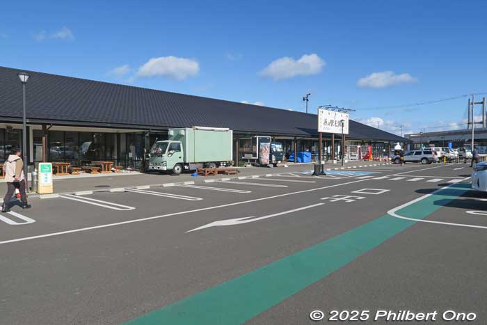
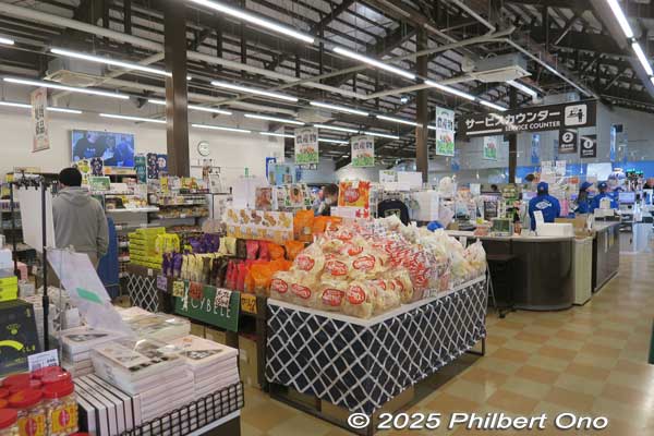
Hama-no-eki Matsukawaura port-side market (浜の駅 松川浦) opened on Oct. 25, 2020 as another symbol of recovery in Soma. It’s in the Haragama district (原釜地区) near Soma fishing port where the 3.11 tsunami decimated the area.
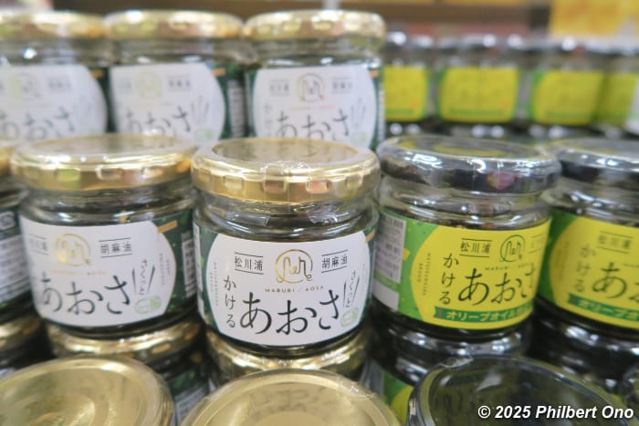
It’s like a roadside station selling local souvenirs, fresh local seafood, and farmer’s produce. The seafood is fresh from Soma’s fishing ports. The restaurant specializes in Soma’s seafood.
This market aims to dispel the negative stigma of Fukushima’s seafood (due to the nuclear disaster), promote local production for local consumption, attract both locals and tourists, revive the coastal area’s vitality, and to connect consumers with local food producers. It’s operated by a joint venture company managed by the city, local chamber of commerce, and local fish processing companies.
Hama-no-eki Matsukawaura (浜の駅 松川浦)
Hours: 9:00 am–6:00 pm, closed Jan. 1 and 2.
Address: Oikawa 196, Obama, Soma, Fukushima (福島県相馬市尾浜字追川196)
Phone (Japanese): 0240-23-7121
Location map: https://maps.app.goo.gl/vUpbHQANxeL3Q1Km6
Directions: 15 min. by taxi from JR Soma Station.
Website: https://hamanoeki.com/
Oshu Coast, Soma
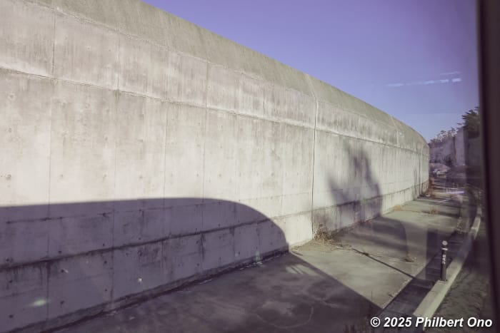
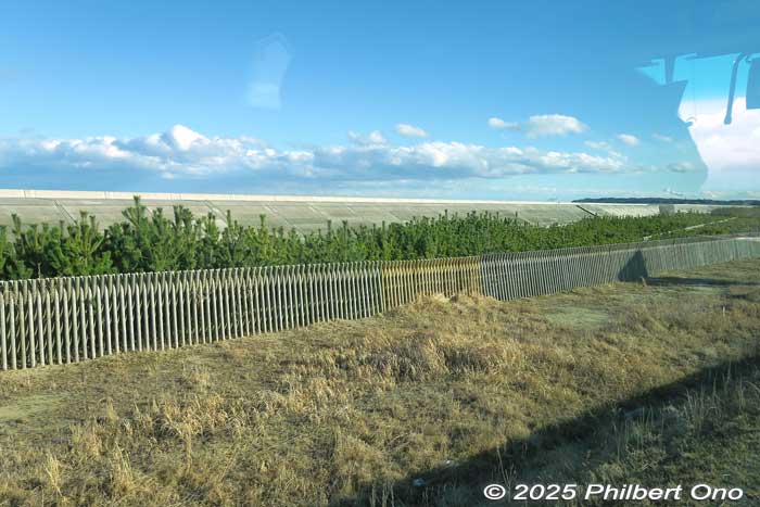
Along the Tohoku Region’s Pacific coast, they are building multiple lines of defense against large tsunami. For example near the fishing port in Soma, Fukushima, they built a Disaster Defense Green Belt Park with a gutter, backed by a high concrete wall, then a green belt of pine trees.
The park was built from 2012 to 2020 where the homes of local fishermen and residents once stood. The planted pine trees still need more years to grow larger. All this to mitigate major tsunami reaching inland.
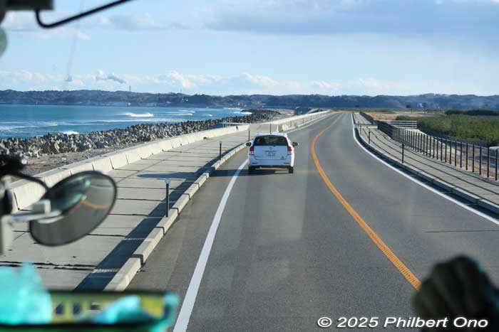
Soma’s Oshu Coast (大洲海岸) is one of Japan’s most scenic shorelines and the city’s major tourist attraction. It’s a long, sand bar beach on one side and Matsukawaura Lagoon (松川浦) on the other side. It’s the Oshu-Matsukawa Line coastal road 6 or 7 km long.
This road and coast was overrun and greatly damaged by the tsunami. The road was repaired and reopened on April 21, 2018 to revive the city’s tourism. Running parallel to the road are green pine trees planted to cushion any future tsunami waves.
However, a large earthquake on March 16, 2022 off the Fukushima coast damaged the road and embankment, forcing the entire 6 km road to be closed again for repairs. The road was reopened on Oct. 22, 2022. Young pine trees have also been planted to further restore this scenic coast.
Location map: https://maps.app.goo.gl/CtdpE3hxsQk642eU7
Isobe district, Soma
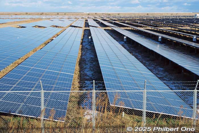
Soma’s Isobe district (磯部地区) near the ocean was decimated by the 3.11 tsunami and was once covered with debris. It’s now designated as a “disaster danger zone” (災害危険区域).
Land where it would be difficult to restart farming or residential housing has been turned into solar panel farms, so the space won’t go to waste. They are developing the area as a base for renewable energy.
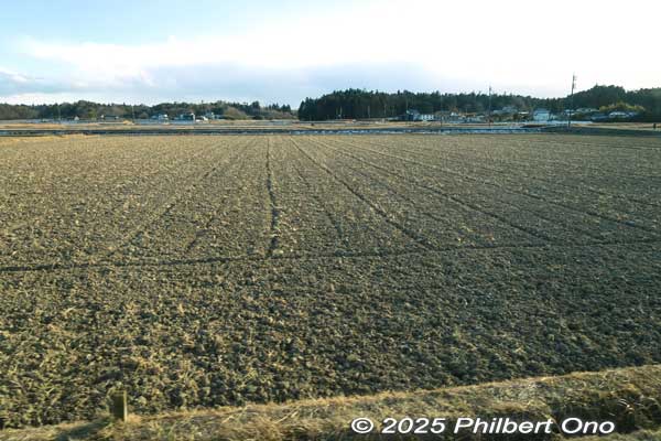
Further inland in Isobe district is farmland. The tsunami covered this area and it took about seven years to cleanup the debris (and some human bodies) and desalinate the soil by using freshwater to dilute the salt, then chemicals to further clean the soil. Hopefully, the soil is fertile enough for crops.
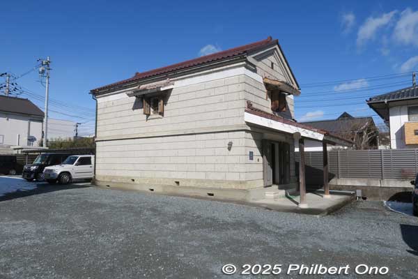
Soma Emergency Rations Storehouse (相馬市防災備蓄倉庫『相馬兵糧蔵』)
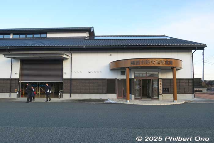
Soma Emergency Rations Storehouse (Soma Hyoro-gura 相馬市防災備蓄倉庫『相馬兵糧蔵』) was built in August 2013 to store food rations, water, blankets, and other essential provisions for all Soma residents in case of an emergency. There’s enough food and water to last several days.
The building is Japanese style with white plaster-like walls and cedar panels to make it look affable. The storehouse can be powered by its own power generators and solar panels.
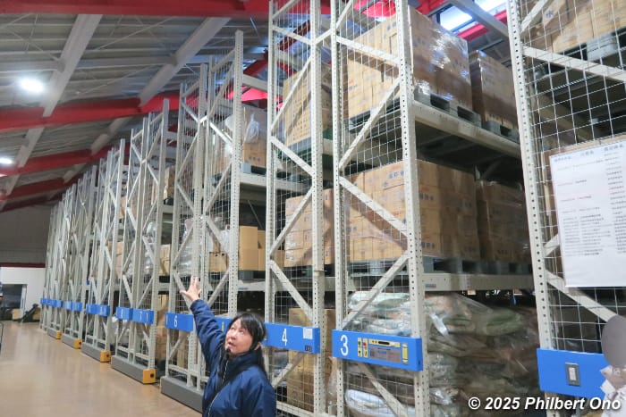
The storehouse has 512 pallets on movable racks, large refrigeration rooms to store perishables, and large cooking pots on wheels. There’s a forklift inside to transport the pallets. Most all city employees have a forklift driver’s license.
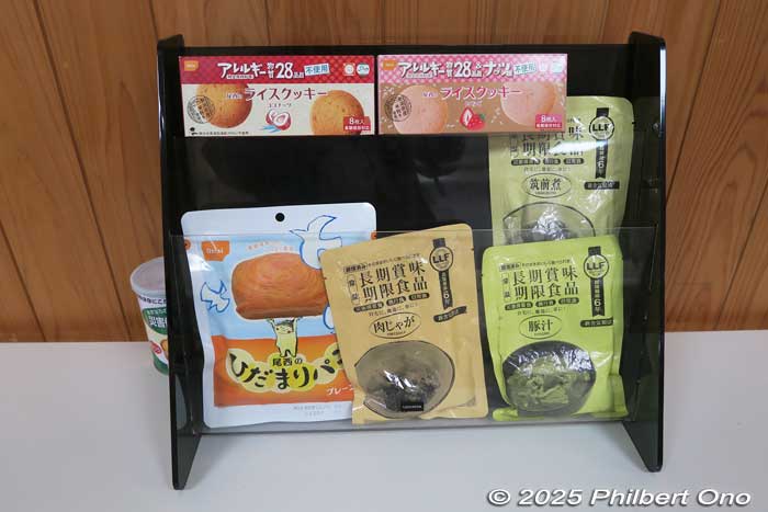
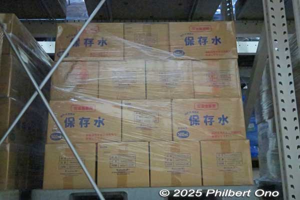
Left photo: Sample food rations kept in the storehouse. Right photo: Cases of water on a pallet.
The food and water are consumed before the expiration date by distributing it for free to residents at local events. The supply is then replaced.
Soma also has mutual emergency support agreements (相互応援協定) with many cities and regions in Japan to dispatch emergency provisions to them in case they have an emergency. They have already sent essential supplies to a number of cities in need in the past.
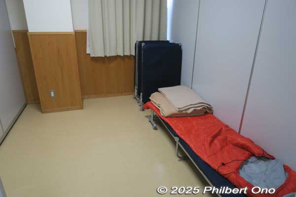
The storehouse also has a large conference room for 100 people and small partitioned rooms with cots to lodge 10 to 20 first responders from the fire department. The parking lot can also be used as a heliport to deliver emergency supplies.
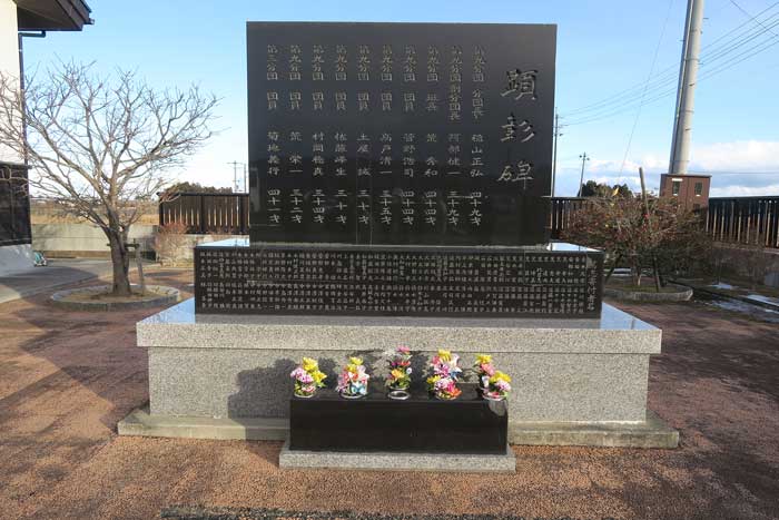
Next to the storehouse is this memorial monument for the ten dutiful firefighters who got caught in the tsunami while urging and guiding Soma residents to evacuate. Their portraits are also displayed in the storehouse. Sad because they were quite young.
Soma Emergency Rations Storehouse (not open to the public)
Address: Miyahigashi 25 Tsubota, Soma, Fukushima (相馬市中村字北町55-1)
Phone: 0244-37-2121
Location map: https://maps.app.goo.gl/SqbQJKYvSA235zSx5
*For guided tours of Soma’s disaster recovery sites, contact:
Soma Tourist Association (相馬市観光協会)
Email: kanko@bb.soma.or.jp
Phone: 0244-35-3300 (Hours: 8:15 am–5:15 pm)
*Guided tours require your own English interpreter.
https://soma-kanko.jp/event/sisatutour/
Map of 3.11 sites: https://www.google.com/maps/d/viewer?mid=1EnQYaLqLKzD_nMgPAun-db8YdUZBUQOe&hl=ja&usp=sharing
Minami-Soma, Fukushima
South of Soma is neighboring Minami-Soma city (Jan. 2025 pop. 55,448, 2010 pop. 70,878). Another small coastal city in northern Hama-dori suffering catastrophic damage on 3.11. The tsunami waves reached as far as 2.5 km inland along the city’s long, 20 km coast.
Minami-Soma was within the 20 km to 30 km radius from Daiichi and residents were ordered to evacuate. Residents beyond the 30 km radius were ordered to shelter in place. However, due to the evacuation order within the 30 km radius, food and supplies could not be brought into the city, forcing supermarkets, convenience stores, and gas stations to close. After about two weeks, residents sheltering in place began to run out of food, water, and gas.
This dire situation compelled the city’s mayor (Sakurai Katsunobu) to go on Youtube to broadcast an SOS message with English subtitles on March 26, 2011 to plead for help. He also complained about the lack of information from the Japanese government and plant operator TEPCO, making it hard for residents to decide whether to evacuate or not. This alarmed the world.
The press also couldn’t enter the city to report current conditions. Volunteers were asked to come at their own risk. Fortunately, radiation levels were relatively low at 25 km and further away from Daiichi.
By April 9, 2011, there were 403 confirmed dead, 1,071 missing, and 1,800 destroyed homes in Minami-Soma. In March 2015, the Mayor Sakurai Katsunobu pledged at the city assembly that Minami-Soma will end its reliance on nuclear power and instead rely completely on renewable power such as solar and wind by 2030.
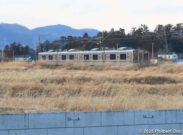
From July 12, 2016, evacuation orders were lifted for the main residential areas and train service on the JR Joban Line between JR Haranomachi Station and Odaka Station within the city was finally restored after five years of repairs. (Train service on the entire JR Joban Line was finally restored on March 14, 2020.)
Soma Nomaoi samurai horse festival
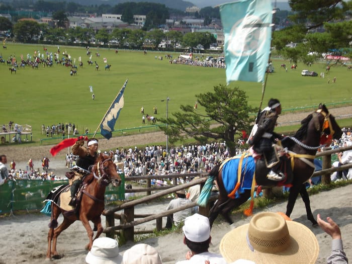
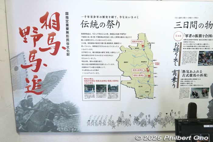
Minami-Soma is best known for the Soma Nomaoi samurai horse festival (相馬野馬追) held annually for three days on the last weekend (Sat., Sun., Mon.) in May. The festival originated over 1,000 years ago as a training exercise for samurai in present-day Nagareyama, Chiba Prefecture. When the local samurai lord (Taira no Masakado, ancestor of the local Soma samurai clan) moved to the Soma area 700 years ago in 1323, he brought the training exercise with him.
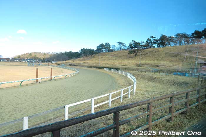
It’s now a religious ritual held by three Shinto shrines: Soma Nakamura Shrine in Soma and Soma Ota Shrine and Soma Odaka Shrine in Minami-Soma. The festival is a prayer for prosperity and peace. The main festival venue at Hibarigahara Field (雲雀ヶ原祭場地) is a horse racetrack and field in Minami-Soma and the festival’s original location (location map).
The first day is the festival eve when the warrior sendoff ceremony (Okuridashi) is held at the three shrines. At Hibarigahara Field, pre-event horse races (Yoinori Keiba) are held. The riders are in traditional costume.
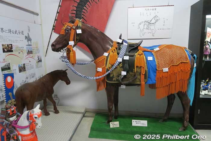
The second day is the main festival day with a gallant and colorful parade of 400 (!) mounted horses (Ogyoretsu) with riders in samurai armor representing descendants of local samurai families from different local regions. Portable shrines are also in the parade. They parade to Hibarigahara Field in the morning. From noon, horse races are held around the racetrack (Katchu Keiba) with the riders in samurai costume and holding clan banners. They also hold a contest to catch sacred banners drifting down from the sky after being shot into the air (Shinki Sodatsusen).
Soma Nomaoi spectator seating (reserved and non-reserved) is sold for this event from February 1 at 10:00 am at Minami-Soma City Hall, Ticket Pia (P code: 655-701), and convenience stores. More ticket info in Japanese here.
The third day is held at Odaka Shrine for an event called Nomakake or wild horse catching. This is the most traditional event harking back to the festival’s origins to train samurai. Indeed, “Nomai” literally means “wild horse chase.” A few unsaddled, wild horses gallop in a corral where five men in white try to catch a horse with their bare hands and strap on a bridle and present the horse to the gods.
Until 2023, it used to be held in July, but the summer heat proved to be debilitating for spectators. JR Haranomachi Station on the JR Joban Line is the closest train station where shuttle buses go to the main venue during the second day of the festival.
You’ll often see horse designs and statues in Minami-Soma and Soma, very proud of their samurai and equine heritage and history.
English: https://www.japan.travel/en/spot/1740/
Official site (in Japanese only): https://soma-nomaoi.com/
Meijokan, Minami-Soma
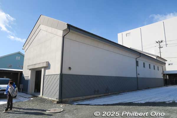
Meijokan (銘醸館) on Nomaoi-dori street (野馬追通り) in central Minami-Soma is a former sake brewery named “Matsumoto Meijo” (旧松本銘醸). It’s a complex of traditional storehouses (kura) dating back to three Japanese historical periods: Meiji, Taisho, and Showa spanning from 1878 to 1963. Now converted into rental exhibition and event spaces.
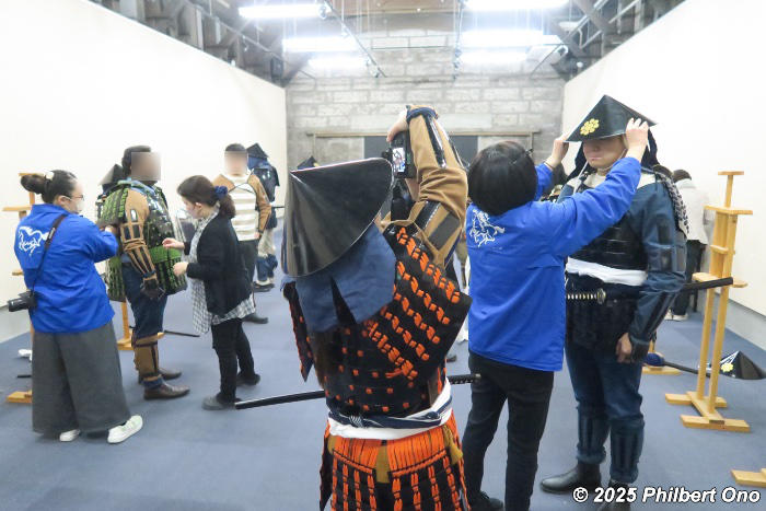
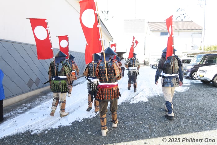
At Meijokan, you can also rent samurai armor for as cheap as ¥3,000. There are two types: Ashigaru foot solder samurai armor and Busho samurai commander armor which is more expensive.
We wore the foot soldier armor and walked to a nearby shrine for photos. It was unique because they also attached samurai banners to our armor. Our banners had a white sun on a red background. This was the symbol of the Udasato Clan (宇多郷族), one of the clans based north of Hibarigahara Field where the Nomaoi horse festival is held.
Rental hours: 10:00 am–3:00 pm, closed on last weekend in May and late Dec. 28–Jan. 4
Rental info (in Japanese only): https://minamisomakanko.org/%e7%94%b2%e5%86%91%e7%9d%80%e4%bb%98%e3%81%91%e4%bd%93%e9%a8%93/

Meijokan also has a small office and gift shop of the Minami-Soma Tourism Association (南相馬観光協会) in the Western-style building fronting the street. You can pick up local tourist information and souvenirs from the friendly and helpful staff.
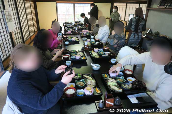
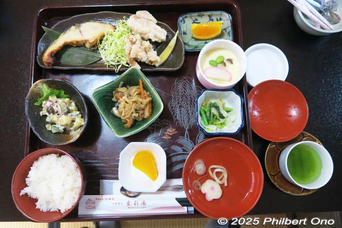
Meijokan also has a Japanese-style house built in 1919 as the residence of the Matsumoto family (松本家) who operated the sake brewery. It has been converted into an inexpensive Japanese restaurant named Shokusai-an (食彩庵) and rental meeting space with tatami mats.
The house has a nice courtyard with a Japanese garden. The Japanese restaurant sadly closed on March 22, 2025, but they hope to reopen under new management. Fortunately, we were able to have a delicious Japanese lunch there.
Meijokan (野馬追通り銘醸館)
Hours: 9:00 am–5:00 pm, closed Dec. 29–Jan. 3
Address: Motomachi 2-52, Haramachi-ku, Minamisoma, Fukushima (福島県南相馬市原町区本町2-52)
Phone: 0244-26-8040
JR Haranomachi Station is the closest station, 20-min. walk or short taxi ride.
Map location: https://maps.app.goo.gl/puy8rbBTsPkN3uik9
Website: https://meijokan.wixsite.com/website
Tourist info (in Japanese only): https://minamisomakanko.org/
Also see:
- Fukushima’s Road to Recovery
- Fukushima’s three regions
- March 11, 2011 triple disaster in Fukushima
- Fukushima Daiichi Nuclear Power Plant
- “Hope tourism” in Tohoku Region
- Soma, Fukushima after 3.11
- Soma City Memorial Hall
- Minami-Soma after 3.11