File:Regionkanto.jpg
Regionkanto.jpg (500 × 341 pixels, file size: 41 KB, MIME type: image/jpeg)
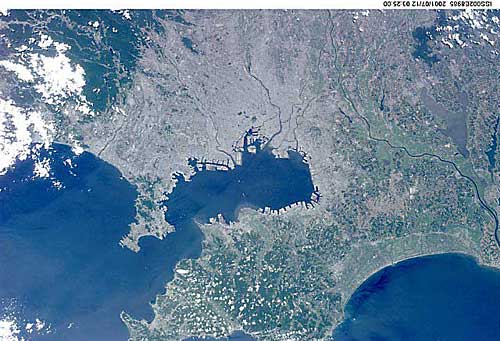
Satellite photo of the the central Kanto region of Japan. The entire Tokyo Bay can be seen. Chiba is on the big Boso Peninsula on the right, and the smaller one on the left is Miura Peninsula in Kanagawa Prefecture.
Public domain image courtesy of Earth Sciences and Image Analysis Laboratory, NASA Johnson Space Center. http://eol.jsc.nasa.gov
File history
Click on a date/time to view the file as it appeared at that time.
| Date/Time | Thumbnail | Dimensions | User | Comment | |
|---|---|---|---|---|---|
| current | 02:52, 23 February 2006 |  | 500 × 341 (41 KB) | Philbert (talk | contribs) | Satellite photo of the the central Kanto region of Japan. The entire Tokyo Bay can be seen. Chiba is on the big Boso Peninsula on the right, and the smaller one on the left is Miura Peninsula in Kanagawa Prefecture. Public domain image courtesy of Earth |
You cannot overwrite this file.
File usage
The following page uses this file:
