File:Mapshigakonan.png
No higher resolution available.
Mapshigakonan.png (356 × 500 pixels, file size: 26 KB, MIME type: image/png)
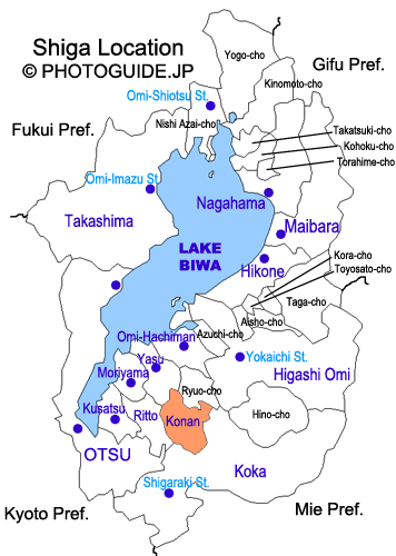
Map showing the location of Konan, Shiga Prefecture.
File history
Click on a date/time to view the file as it appeared at that time.
| Date/Time | Thumbnail | Dimensions | User | Comment | |
|---|---|---|---|---|---|
| current | 00:48, 1 February 2007 | | 356 × 500 (26 KB) | Philbert (talk | contribs) | Map showing the location of Konan, Shiga Prefecture. |
You cannot overwrite this file.
File usage
There are no pages that use this file.