 Image search results - "osu" Image search results - "osu" |
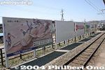
Billboard depicting Ki-otoshi (Log Drop) at Shimosuwa Station.
|
|
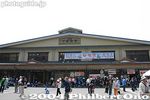
Shimosuwa Station on May 8, 2004. Here for the final three days of the Onbashira Matsuri's climax, the Satobiki when they haul the Onbashira logs to the Shimo-sha Shrines (Akimiya and Harumiya) and erect them.
|
|
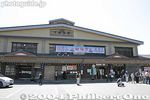
Shimosuwa Station 下諏訪駅
|
|

Onbashira monument in front of Shimosuwa Station. This Onbashira log was used in the opening ceremony of the Nagano Winter Olympics in 1998.
|
|
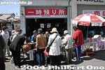
Store your luggage here. Not enough lockers at the train station so they provide this service. 400 yen/day.
|
|
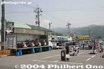
Entertainment stage in front of Shimosuwa Station.
|
|
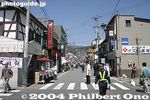
Go straight on this road in front of the station.
|
|
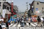
In front of Shimosuwa Station.
|
|
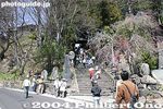
There are no buses nor taxis to where we want to go.
|
|
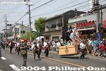
Parade of Nagamochi which are long chests. 長持
|
|
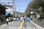
We had to walk it. This was April 10, 2004, one of the days for Shimo-sha Shrine's Yamadashi when they hauled the logs from the mountain forest.
|
|
|
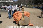
After walking for 30 min., we reached this place called Shimekake, a resting place for the logs which had been hauled from the mountains. This is Log No. 2 for Akinomiya Shrine. 注連掛
|
|
|
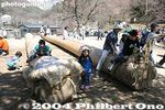
The logs will rest here for about a month until early May when they will be hauled to the shrines for the Satobiki erection.
|
|
|
Here is where anybody can get on the logs and play.
|
|
|
|
|

Water intake for Lake Biwa Canal No. 2. Near Mihogasaki in Otsu, and adjacent to the boat racing arena.
|
|
After the Shimekake, we walked further.
|
|
Crowded street
|
|

Entrance to Kiyosumi Teien Gardens. Admission 150 yen.
|
|
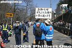
Until we were stopped here. Sign says that only people with tickets can proceed further. Yeah, we walked all this way only to be told we cannot go further. Our destination was the Ki-otoshi slope where the huge logs slide down for the Yamadashi.
|
|
|

This garden is very green. Even the pond is deep green. Kiyosumi Garden is classified as a "kaiyu-shiki teien" (回遊式庭園) or "circular-strolling Japanese garden." It's a common and classic Japanese garden design where you simply walk around the garden, usually around a central pond.
|
|

We had to wait until the Ki-otoshi at 1pm was over. That's the one we wanted to see. But the place was already too full.
|
|
|
|

Iwasaki Yataro, the founder of the Mitsubishi Zaibatsu, acquired the estate in 1878 and developed the garden with a pond and famous stones brought from all over Japan.
|
|

We had to wait until the 1pm Ki-otoshi log came out.
|
|
|

Many matsu pine trees and many stones.
|
|
|
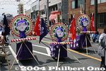
Nagamochi chest decorations
|
|

Stepping stones, called Isowatari, are another major feature of the garden.
|
|

Log No. 4 for Shimo-sha Shrine's Akinomiya Shrine which already went down the big slope for Ki-otoshi (Log Drop) comes out at 1:30 pm. 秋宮四之柱
|
|
|

Tamagawa Josui floodgate. Hamura is noted as the starting point of the Tamagawa Josui Aqueduct built by the Tamagawa farmer brothers in 1653 to supply water to the growing and thirsty city of Edo.
|
|

Stepping stones, called Isowatari. 磯渡り
|
|

Log No. 4 for Shimo-sha Shrine's Akinomiya Shrine. 秋宮四之柱
|
|
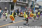
Umbrella dance
|
|

Isowatari. 磯渡り
|
|

Entry point of Tamagawa Josui Aqueduct straight ahead. This water has been diverted from the Tamagawa River (on the right).
|
|

So after this log came out, we were allowed to proceed to the giant slope.
|
|
|

Start of Tamagawa Josui Aqueduct. The Aqueduct was built in 1653, 50 years after Shogun Tokugawa Ieyasu moved to Edo. 玉川上水
|
|

Isowatari. 磯渡り
|
|

There it is, the slope.
|
|
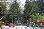
Shimo-sha Akimiya Shrine torii
|
|
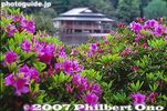
Azalea bushes and Ryotei teahouse
|
|

Tamagawa Josui Aqueduct entrance.
|
|

We weren't the only ones there.
|
|
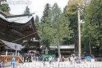
Shimo-sha Akimiya Shrine. That's a support pole for erecting the No. 1 Akimiya Onbashira log. 秋宮
|
|
|

Floodgate. The position and length is almost the same as the original one built in the 17th century. Only the materials have been replaced with concrete. Water from the Tamagawa River going to Tamagawa Josui canal/Aqueduct.
|
|
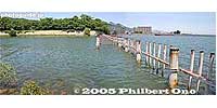
Water intake for Lake Biwa Canal No. 2. The Lake Biwa Canal (Biwako Sosui) supplies water from Lake Biwa in Otsu to Kyoto. After four years of monumental construction, the canal was completed in 1890.
|
|

The Ki-otoshi slope, and one of the icons of the festival. This is the larger slope for Ki-otoshi compared to the one for the Kami-sha Shrine in Chino. 木落とし坂
|
|
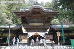
Shimo-sha Akimiya Shrine 秋宮 幣拝殿
|
|

Pine branches and azaleas
|
|

Tamagawa River is dammed here by Hamura Intake Weir. Some of the diverted water is released back into Tamagawa River on the right.
|
|

The Ki-otoshi slope up close. Very rough-looking. 木落とし坂
|
|

Hole for the No. 4 Akimiya Onbashira log
|
|

Red and white azaleas
|
|

Tamagawa River
|
|

People everywhere along the edge of the slope.
|
|

Small support poles.
|
|

Map of Tamagawa Josui Aqueduct
|
|

Ryotei teahouse 涼亭
|
|

The numerous people and trees made it impossible to see the slope itself.
|
|

Hole for the No. 2 Akimiya Onbashira log
|
|

Park adjacent to Tamagawa Josui Aqueduct
|
|

Huge and hungry carp
|
|

It was very steep and uncomfortable to sit on, so I decided to leave this place.
|
|

Hole for the No. 2 Akimiya Onbashira log
|
|

Statue of the Tamagawa brothers who were consigned to build the Tamagawa Josui Aqueduct.
|
|

In case you fall into the pond...
|
|
|

Hole for the No. 2 Akimiya Onbashira log
|
|

Statue of the Tamagawa brothers
|
|

Tamagawa Josui canal in Fussa
|
|

Taisho Memorial Hall
|
|

I was forced to join this crowd.
|
|
|

Materials and technique used for the Tamagawa Josui floodgate in the Edo Period.
|
|

Big flower
|
|

The crowd extended all the way to the rear. All to see the 3pm Ki-otoshi log drop.
|
|
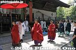
Shimo-sha Akimiya Shrine priests 秋宮
|
|

Tamagawa Josui Aqueduct required constant repair and maintenance during the Edo Period. It created new jobs for Hamura residents (mostly farmers).
|
|
|

This was my view of the slope.
|
|
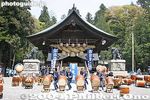
Taiko performance at Shimo-sha Akimiya Shrine's Kaguraden
|
|

Tamagawa Josui Aqueduct lined with cherry trees. I missed the full bloom period.
|
|

Bridge to a small island and gazebo
|
|

Thank goodness for telephoto lenses.
|
|

Shimenawa sacred rope on Kaguraden
|
|

Walking path parallel to Tamagawa Josui Aqueduct. These are all cherry trees.
|
|

Gazebo on one of the three islands in the pond. あずまや
|
|

Water intake for Lake Biwa Canal No. 2
|
|

We waited for the log scheduled to come down at 3 pm, but it was delayed by 2 hours...
|
|
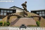
Onbashira Grand Park
|
|

Cherry trees
|
|
|

We sat there for hours.
|
|
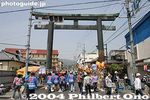
Harumiya torii 春宮大門
|
|

Tamagawa Josui Aqueduct
|
|
|

Finally, people pulling the log appeared.
|
|
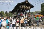
On the way to Harumiya Shrine, you see this bridge. It is a rest stop for the Akimiya Onbashira log procession. 下馬橋
|
|

Tamagawa Josui Aqueduct goes on for over 40 km to Yotsuya in Tokyo.
|
|

"Mt. Fuji" with azalea bushes blooming in early May.
|
|
|
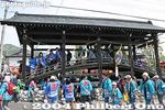
The bridge is normally closed to the public. In the old days, this bridge marked Harumiya Shrine's sacred area where even warlords had to get out of their palanquin or get off their horse out of respect before proceeding further. 下馬橋
|
|
|

The log pullers split into two.
|
|
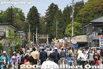
Harumiya Shrine ahead.
|
|
|
|
|

Harumiya Shrine torii 春宮
|
|
|

Then came the log, and a lotta dust which made it difficult to see what was going on.
|
|
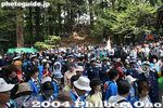
Harumiya has a little slope where the logs are slid down.
|
|

Tiny flowers
|
|

This was Log No. 1 for Shimo-sha's Harunomiya Shrine.
|
|

People everywhere.
|
|

Famous stone
|
|

But my camera captured the log going down, even though I could hardly see it. Onbashira Festival, Shimosuwa, Nagano. 木落とし坂 春宮一之柱
|
|

People along the small slope.
|
|
|
|

It was over after a few seconds. We walked for an hour from the train station and waited hours for just a few seconds of mostly dust.
|
|

This is May 9, 2004, the second day of Shimo-sha Shrine's Satobiki. Shimo-sha Shrine consists of two separate shrines called Akimiya and Harumiya.
|
|
|

Water intake for Lake Biwa Canal No. 2
|
|

Now we walked back together with hundreds of thousands of people...
|
|

Ropes to pull the Onbashira log from Harumiya Shrine.
|
|
|

The Ax Man. He cuts the rope which sets the log loose down the slope.
|
|
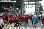
Log in Harumiya Shrine.
|
|

Bird
|
|

The log heading to the Shimekake resting place. If you don't like crowds, don't see this festival. Also see photos of Shimo-sha Satobiki.
|
|

Onbashira Log No. 1 already erected for Harumiya Shrine on May 8, 2004.
|
|

Stone buddha
|
|

Erecting Onbashira Log No. 4 for Harumiya Shrine on May 9, 2004. 春宮四之御柱
|
|

Playground
|
|
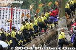
Erecting Onbashira Log No. 4 for Harumiya Shrine on May 9, 2004. Shimosuwa, Nagano. 春宮四之御柱
|
|

Iris garden
|
|
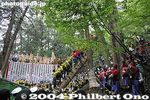
Everything is done with great fanfare, with these men riding on the log as it slowly rises by a system of cables and pulleys.
|
|

Basho Haiku Monument written with the famous haiku of the frog jumping into the pond. 芭蕉の句碑
|
|

"Yoisa! Yoisa!"
|
|

Ryotei teahouse 涼亭
|
|
|

Wisteria
|
|
|
|

Ryotei teahouse 涼亭
|
|
|
|

Entrance to Hiroshima-Nagasaki photo exhibition 広島・長崎原爆写真展の入口
|
|

When the log is erected, a banner is unrolled.
|
|

Kasa-tei 傘亭
|
|

The banner reads, "Thank you everyone for your cooperation."
|
|
|
|
|

Irises
|
|
|
|
|
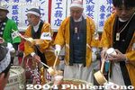
Sake is given for free.
|
|

Pine tree and Ryotei
|
|
|

Pine tree and Ryotei
|
|
|
|
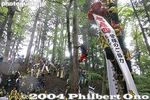
The men now descend from the log.
|
|

Stone pagoda on island named Matsushima
|
|
|

Stone lantern
|
|
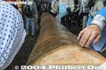
Onbashira Log No. 3 for Harumiya Shrine.
|
|
|
|
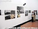
Hiroshima photos 広島原爆写真
|
|

The base of the Onbashira log is reinforced by these smaller logs.
|
|
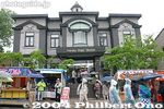
Music Box Museum
|
|

Parade
|
|

One Onbashira log at a rest stop.
|
|

Ropes at rest
|
|
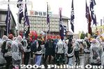
The logs are pulled by people from various districts or parishes in the Suwa region including Chino, Shimosuwa, Okaya, and Suwa.
|
|
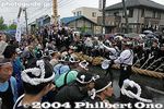
Another Onbashira log makes its way through.
|
|
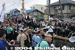
All the Onbashira logs are hauled manually by human hands from when it is cut in the mountain forest. No motor vehicles of any kind is used to haul the logs.
|
|
|
|

Hiroshima panorama photos by Shigeo HayashiThe exhibition room was divided in half by this panel. The right side was for Hiroshima, and the left side for Nagasaki.
|
|
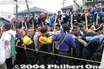
The log can move quite fast, even with all those people riding it.
|
|
|
|
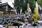
This looks like Log No. 2 for Akimiya Shrine.
|
|
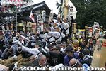
These people are from Suwa city.
|
|

Ax man
|
|
|

Log standing by in front of Akimiya Shrine.
|
|
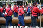
Onbashira-sai, Shimosuwa-machi, Nagano.
|
|

Log standing by in front of Akimiya Shrine.
|
|
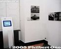
Video monitor showing Hiroshima
|
|
|
|

Parade continues even in the rain.
|
|
|
|
|
|
|
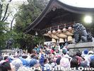
Now it's May 10, 2004, the last day of the Shimo-sha Satobiki. All four logs will erected at Akimiya Shrine on this day.
|
|

We waited in the rain for Onbashira Log No. 1 to be erected first at Akimiya Shrine at 10:00 am. However, we had to wait, standing up in the rain and in the crowd, for 2.5 hours before they finally started to raise the log.
|
|
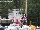
Finally, something to photograph.
|
|
|

Sadako and her origami cranesBased on a story of a girl named Sadako who was exposed to the atomic bomb in Hiroshima. She was told that if she folded 1,000 paper origami cranes, she would be granted a wish. But she died at age 12 even after folding over 1,000 paper cranes.
|
|
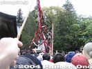
They threw out free streamers and I caught one. "Yoisa! Yoisa!"
|
|
|
|
|

They waved their pom-poms and cheered all the while.
|
|

Water intake for Lake Biwa Canal No. 2
|
|

Water intake for Lake Biwa Canal No. 2. The canal is covered. The water supply for Kyoto and Osaka.
|
|

Water intake for Lake Biwa Canal No. 2. This is the second, almost parallel canal constructed in 1912.
|
|

Water intake for Lake Biwa Canal No. 1
|
|

Water intake for Lake Biwa Canal No. 1 at Mihogasaki
|
|

Water intake for Lake Biwa Canal No. 1. Kyoto was thereby revitalized with electric power and a stable water supply. A second, almost parallel canal for drinking water was also constructed in 1912.
|
|
|
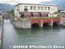
Lake Biwa Canal No. 1
|
|

Lake Biwa Canal No. 1
|
|

Lake Biwa Canal No. 1. The Lake Biwa Canal (Biwako Sosui) supplies water from Lake Biwa in Otsu to Kyoto. After four years of monumental construction, the canal was completed in 1890.
|
|
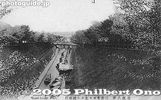
Lake Biwa Canal on vintage postcard. Notice the boats in the canal. Boat rides were initially offered.
|
|

Biwako Sosui. The city of Otsu is thinking about resurrecting a tourist boat service on this canal. MAP
|
|
|

The Biwako Sosui or Lake Biwa Canal in Otsu is also noted for cherry blossoms.
|
|
|
|
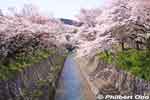
Lake Biwa Canal (Biwako Sosui) and cherry blossoms. This is one of two canals which supply water from Lake Biwa to Kyoto. National Historic Site
|
|

Lake Biwa Canal and cherry blossoms in full bloom. They also light up the trees at night from 6:30 pm-9:30 pm. Beautiful and serene.
|
|
|

Lake Biwa Canal and cherry blossoms.
|
|
|

Lake Biwa Canal and cherry blossoms above the tunnel entrance.
|
|

No. 1 Tunnel entrance. The first and longest tunnel under a mountain. The entrance is very artistic.
|
|
|
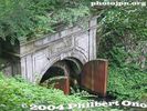
No. 1 Tunnel entrance.
|
|

Onbashira Festival. They included one woman.
|
|
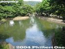
The canal in Kyoto near Yamashina.
|
|
|
|
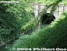
No. 1 Tunnel exit
|
|
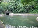
Yamashina
|
|
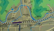
Yamashina map showing the exposed portion of the Lake Biwa Canal near JR Yamashina Station in Kyoto.
|
|

Yamashina
|
|

Lake Biwa Canal Museum in KyotoAt the end of the canal, there's this museum in Kyoto tracing the history of the canal.
|
|
|
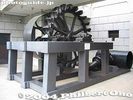
Pelton water wheel at Lake Biwa Canal MuseumUsed at the Keage Power Plant to generate electricity. The Keage Plant was Japan's first hydroelectric power plant.
|
|
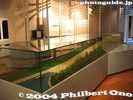
Lake Biwa Canal MuseumModel of Keage Incline.
|
|
| 792 files on 4 page(s) |
1 |
 |
|