 Image search results - "nishi" Image search results - "nishi" |

Belonging to the Shingon Sect's Buzan school, this is one of Tokyo's major temples. The real name is Sojiji (總持寺), but everyone calls it Nishi-Arai Daishi.The temple grounds feature many flowering trees and plants including an unusual species of cherry blossoms which bloom in winter. Daishi-mae Station. Much larger station than I expected. Probably for the New Year's crowds. 大師前駅
|
|

Daishi-mae Station 大師前駅. Nishi-Arai Daishi Temple was said have been founded by Priest Kobo Daishi in 826. One of the Kanto Region's Big Three Daishi Temples.
|
|

The main path to the temple is lined with the usual shops, but it is not aligned with the train station. The path from the train station takes a different route.
|
|

Main path to temple
|
|

Sanmon Gate, the main gate. 山門
|
|

Sanmon Gate
|
|

Food stalls lead you to the main worship hall.
|
|

Dai-Hondo Hall, Nishi-Arai Daishi, Tokyo 大本堂According to legend, when prayers were offered to save villagers from an epidemic, pure water gushed out of a hitherto dried-up well and got rid of the plague. Since the well was on the west side of the temple hall, this area came to be called "Nishi-Arai" (New Well in the West). The temple is famous for warding off fire and misfortune.
|
|

Incense burner
|
|

Lantern
|
|

Dai-Hondo Hall 大本堂
|
|

Altar inside Dai-Hondo Hall 大本堂
|
|

View from Dai-Hondo Hall
|
|

Winter-flowering cherry blossoms
|
|

Winter-flowering cherry blossoms and Dai-Hondo Hall
|
|
|

Winter-flowering cherry blossoms, Nishi-Arai Daishi, Tokyo 寒桜
|
|
|

Winter-flowering cherry blossoms 寒桜
|
|
|
|
|

Winter-flowering cherry blossoms 寒桜
|
|

Winter-flowering cherry blossoms 寒桜
|
|

Ume plum blossoms
|
|

Ume plum blossoms
|
|

Ume plum blossoms
|
|

White plum blossoms
|
|

White plum blossoms 白梅
|
|

White plum blossoms 白梅
|
|

White plum blossoms 白梅
|
|

Red plum blossoms
|
|

In spring, see 4,500 peony plants in 70 varieties bloom. Temple is nicknamed "Botan Daishi" (Peony Daishi).
|
|

Red plum blossoms
|
|

Red plum blossoms and pagoda
|
|

White plum blossoms
|
|
|

Pond behind the Dai-Hondo Hall
|
|

Waterfall
|
|

Koi
|
|

Benten-do 弁天堂
|
|

如意輪堂
|
|

如意輪堂
|
|

Side view of Dai-Hondo
|
|

Side view of Dai-Hondo
|
|

13-story pagoda 十三大塔
|
|

Chigo Daishi 稚児大師
|
|

Chigo Daishi 稚児大師
|
|

Three-story Treasure Pagoda 三重宝塔
|
|

水子地蔵
|
|

水子地蔵
|
|
|

Salt Jizo 塩地蔵
|
|

Salt Jizo 塩地蔵
|
|

Rokkaku-do 六角堂
|
|

水洗地蔵
|
|

Temple bell and pond
|
|

Koi
|
|

Koi. Seems like a sumi painter just painted on this fish.
|
|

A flea market is held monthly in the temple grounds.
|
|

光明殿
|
|

Hakkaku-do Hall 八角堂
|
|

Inside Hakkaku-do Hall. A glass door lets you see inside, but the door is locked. 八角堂
|
|

Maruko-bune Museum (Maruko-bune no Yakata). The maruko-bune was commonly used to transport cargo over the lake from the Hokuriku region to the Kyoto-Osaka region during the 17th and 18th c. MAPThe museum is a short bicycle ride from Nagahara Station (JR Kosei Line). 滋賀県西浅井町大浦582 丸子船の館
|
|

Maruko-bune wooden boat which was a common sight on Lake Biwa in the old days before trains came to fore. Near this area was a major maruko-bune port called Oura.
|
|

Maruko-bune, a traditional wooden boat mainly for shipping cargo across Lake Biwa in the old days. This used maruko-bune was donated by a local resident. 丸子船
|
|

Black copper plates decorate the bow (ダテカスガイ). This checkered pattern was unique to Lake Biwa boats. The wood seams are stuffed with conifer fiber (槙縄) to repel water.
|
|

Maruko-bune's trademark is this half-round cedar or cypress log on both sides. おも木
|
|

The bow's tip is studded.
|
|

Maruko-bune were a vital transportation link between northern Japan and Kyoto/Osaka. Goods coming and going via the Sea of Japan also went over the lake.
|
|

Rudder hangs down from a torii-like brace (かさ木), also used as a mast rest when the mast is laid down. Most of the wood is Japanese conifer (槇の木).
|
|
|

The sail is made of thick cotton material, replacing the old straw mat that didn't last long.
|
|
|
|

This maruko-bune is 17.2 meters long.
|
|

Top view of maruko-bune.
|
|

During the 17th and 18th-centuries, over 1,000 maruko-bune sailed on the lake. The busiest ports were Shiotsu in the north and Otsu. After railroads were built, maruko-bune dwindled. Today, there are no maruko-bune on Lake Biwa.
|
|

Maruko-bune transported rice, fish, kelp, and many other northern Japan goods bound for Kyoto/Osaka. From Kyoto, came cotton, confections, soy sauce, sake, kimono, textiles, tobacco, and more.
|
|

Maruko-bune exhibits.
|
|

Diorama of Oura Port. MAP
|
|
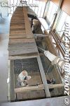
Top view with roof partially removed for viewing.
|
|

Maruko-bune crew.
|
|

Maruko-bune boat hands.
|
|
|
|

Adjacent museum called Oura Furusato Shiryokan. A museum of local artifacts and knicknacks.
|
|

Adjacent museum showing things from Oura.
|
|

Bicycling to Sugaura.
|
|

Sugaura is a small settlement in Nishi-Azai along the northern shore of Lake Biwa. It is a quiet and scenic area with a nice lakeshore road and trail almost to the tip of the peninsula. Akasaki Maruko-bune park赤崎丸子船
|
|
|
|

Some scenery from the road between Nagahara and Sugaura.
|
|

Sugaura is one of the best areas of northern Shiga and northern Lake Biwa. Quiet, clean, and scenic.
|
|
|
|
|
|
|

Large maruko-bune displayed outdoors, without a mast.
|
|

The wooden maruko-bune boat was a common sight on Lake Biwa before railroads were built. They were mainly used for shipping cargo between Kyoto and the northern region of Fukui, Kanazawa, etc.
|
|

Large wooden paddle of a maruko-bune boat. The boat also had a sail. The boat had a round log on both sides.
|
|
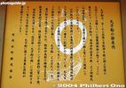
The big maruko-bune boat (17 meters long) was donated by a native of Nishi-Azai. It could hold 13 tons of cargo.
|
|

Lookout point, Chikubushima island in the distance
|
|
|
|
|
|

Chikubushima island in the distance
|
|
|
|
|
|
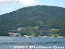
Sugaura as seen from Lake Biwa.
|
|
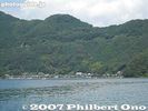
Sugaura as seen from Lake Biwa. The Oku Biwako Parkway Road can be seen going up the mountain.
|
|

The maruko-bune boat is a symbol of Nishi-Azai town which is now part of the city of Nagahama.
|
|

Going down to the lake shore of Sugaura.
|
|

Sugaura is a length-wise town hugging the shore of the lake.
|
|
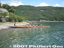
Imazu Junior High School rowers on the shore of Sugaura. They row across the lake between Imazu and Nagahama every summer.
|
|
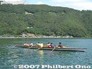
They row in a fixed-seat, wooden boat based on a traditional design circa 1917. Off Sugaura. Oku Biwako Parkway Road going up the mountain.
|
|

Entrance to Sugaura, a quaint lakeshore village on a peninsula. It is will be designated as an Important Cultural Landscape. A pleasant trail goes along the lakeshore trail.
|
|

Thatched-roof gate, called Shisokumon 四足門, on the west end used to monitor outsiders entering the village. Another one is at the east end. MAP
|
|

Suga Shrine, dedicated to Sugaura's patron god. The shrine also has a connection with Emperor Junnin (733-765). 淳仁天皇. 須賀神社須賀神社
|
|

Way to Suga Shrine. Emperor Junnin supposedly once lived in this area in secret.
|
|

Suga Shrine
|
|
|

Sugaura Local History Museum 菅浦郷土史料館. Contains historical documents related to the town. But it was closed when I went.
|
|
|

Thatched-roof gate, called Shisokumon 四足門, on the east end used to monitor outsiders entering the village.
|
|

Beyond the east end of Sugaura (beyond the east thatched-roof gate) is a scenic walking trail along the peninsula's shore.After you pass through the town, there is a hiking/bicycle trail along the peninsula.
|
|

Swimming area
|
|

Trail goes further.
|
|

Trail going up the mountain.
|
|

Scenic point at end of trail
|
|
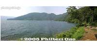
Panorama at end of trail
|
|
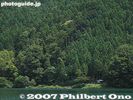
Scenic point at end of trail. Notice the hut.
|
|

One entrance to Oku Biwako Parkway is at Sugaura. It's not a toll road. The most trying part of bicycling around Lake Biwa. MAP
|
|

But the views can be marvelous. There is an alternate and less strenuous bicycling route behind the mountains, but there's no scenery like this.
|
|

Looking at Sugaura in Nishi-Azai.
|
|
|

View from Oku Biwako Parkway
|
|
|

At the top of the Oku Biwako Parkway road is a lookout point.
|
|

There's a large parking lot at the top.
|
|

A few pretty good views from the top.
|
|
|
|
|

View from Oku Biwako Parkway
|
|
|

Hydrangeas
|
|
|
|
|
|
|
|
|

Omi-Shiotsu Station platform JR近江塩津駅
|
|

Omi-Shiotsu Station and old trains
|
|
|

Nishi Azai-cho Town Hall
|
|

Nishi Azai-cho Town Hall in winter
|
|
|
|

Nagahara Station
|
|

Nagahara Station in winter
|
|

Tunnels
|
|
|
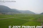
Nishi-Azai scenery from the train toward Nagahara Station.
|
|
|
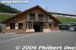
Nagahara Station on the JR Kosei Line.
|
|

Nagahara Station on the JR Kosei Line. A nice, loghouse station building. JR湖西線、永原駅
|
|

Nagahara Station in the distance.
|
|
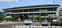
Nagahama City Hall, Nishi-Azai Branch. An incredibly large and beautiful town hall for a small town (Later merged with Nagahama.)
|
|
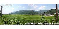
Near Nagahara Station
|
|
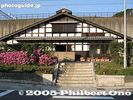
Omi-Shiotsu Station JR近江塩津駅
|
|
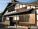
Omi-Shiotsu Station
|
|
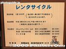
Bicycle rental sign. Most stations along Lake Biwa offer bicycles for rental.
|
|

Tickets please
|
|
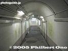
Omi-Shiotsu Station corridor to the tracks upstairs.
|
|
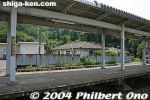
Omi-Shiotsu Station platform.
|
|
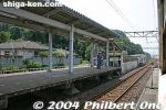
Omi-Shiotsu Station platform.
|
|

Omi-Shiotsu Station with an old 111-series JR train.
|
|

Old Hokuriku Line train
|
|

The Nishiyama Crater Trail (Nishiyama Kako Sansakuro) is accessible by car or bus from Toyako Onsen Spa or Toya Station. Get off at the Nishiyama Kako Kitaguchi which is in front of this former fire dept. station. 旧西胆振消防組合本部
|
|

The fire dept. building was damaged by the eruption, so it is no longer used by the fire dept. However, you can enter it and see some display panels.
|
|

Inside former fire station.
|
|

Next to the former fire station is this small pond, called Nishiyama Kako-numa, created by the eruption and blocking the road. 西山火口沼(西新山沼)
|
|

Road blocked by the pond. The Nishiyama Craters are part of Mt. Usu. They are on the west side of Usuzan and were formed by the March 2000 eruption.
|
|

The former fire station in the distance. The building still looks quite new.
|
|

The north entrance to the Nishiyama Crater Trail (Nishiyama Kako Sansakuro Kitaguchi). Open from April 20 to Nov. 10 during 7 am - 6 pm. Free admission, but donations accepted.
|
|

The trail starts with a bumpy asphalt road.
|
|

The wrecked road.
|
|

The walking trail becomes a nice wooden boardwalk on rough terrain.
|
|

Nishino Water Tunnel is near Lake Biwa at the foot of the Yamamoto-yama mountains. There are three tunnels. The original one was built in 1845 by a local priest to alleviate frequent flooding. 西野水道 MAP
|
|

Apparently there weren't any cars on the road when this happened since everyone had been evacuated before the eruption occurred.
|
|

Near the tunnel entrance is a rest house where you can borrow rubber boots and flash lights for free.
|
|

Flowers from the asphalt cracks.
|
|

Near the tunnel entrance is the Nishino Horinuki Park with various monuments. 西野ほりぬき公園
|
|

The trail continues to more dramatic landscapes.
|
|

Statue and monument at Nishino Water Tunnel entrance.
|
|

Sign explaining the deformed road.
|
|

Tunnel monument and song monument.
|
|

Broken telephone pole.
|
|

The monument shows tunnel laborers.
|
|

No. 1 Nishiyama Crater Lookout deck for the most conspicuous crater, still emitting steam.
|
|

Monument for a song about the tunnel digging, titled "Nishino Suido Uta."
|
|

No. 1 Nishiyama Crater Lookout deck
|
|

Lyrics to the song, "Nishino Suido Uta." 西野水道歌
|
|

One of the largest and most active Nishiyama crater. There are about 30 craters in the area, and this one emits the most steam.
|
|

This is the original Nishino Water Tunnel built in 1845. Engineered by a Buddhist priest named Esho and with the help of fellow villagers, it took 6 years to dig through the mountain for about 220 meters. The tunnel drained excess water to Lake Biwa.
|
|

An adjacent crater contains water and emits some steam.
|
|

You can enter and go through the Nishino Water Tunnel. Water does not flow through anymore, but it's still quite muddy and wet.
|
|

Nishiyama Crater Trail
|
|

The problem is, it's pitch black on the inside, and the tunnel size is quite small and craggy. Hard hats required. Not recommended, especially if you are taller than a 10-year-old.
|
|

It takes about 40 min. to walk the crater trail one way. So allow at least 90 min. for a round-trip.
|
|

This is the other end of the original tunnel. The air was cold on this end.
|
|

View of the No. 2 Nishiyama Crater Lookout deck
|
|

This is the second water tunnel, next to the original tunnel and running parallel.
|
|
|

Entrance to the second water tunnel. This is much larger, large enough for a car to pass through. No longer used as a water drainage tunnel. We could easily walk through this tunnel.
|
|

View from the No. 2 Nishiyama Crater Lookout deck
|
|

Floor of second water tunnel. Some water still flows through. Boots recommended.
|
|

View from the No. 2 Nishiyama Crater Lookout deck
|
|

Other end of the second tunnel. This tunnel is no longer used for Yogo River. It is now mainly used by people wanting to go fishing.
|
|

View from the No. 2 Nishiyama Crater Lookout deck
|
|

This is the third water tunnel and currently in use. The Yogo River flows out of it to Lake Biwa. Built in 1980. Also a local fishing spot.
|
|

View from the No. 2 Nishiyama Crater Lookout deck. On the right is the crater of the initial eruption occurring in March 2000.
|
|

Close-up of Nishiyama's first crater formed during the March 2000 eruption.
|
|

Yogo River mouth outside the Nishino water tunnel. Lake Biwa ahead.
|
|

Another crater which is dry.
|
|

Original Nishino Water Tunnel facing Lake Biwa.
|
|
|
|

Crater bottom.
|
|

The trail passes by a wrecked confection factory.
|
|

The trail goes to the Minami-guchi (South entrance) of the crater trail.
|
|

Wrecked confection factory. A dramatic reminder of what volcanoes can do.
|
|

Going further along the crater trail.
|
|

Another wrecked house.
|
|
|

Wrecked car
|
|

More dramatic terrain. There's no threat of further eruptions in this area, so don't worry about getting caught in a shower of hot lava and volcanic ash while walking around here.
|
|

Heading back. Remember that the trail is not open during the winter months. For more info call 0142-75-4400.
|
|

Approaching Nishi Hongwanji, the headquarters temple of the Jodo Shinshu Sect (Hongwanji school) in Kyoto. A short walk from Kyoto Station. This is New Year's Day, Jan 1, 2010.
|
|

Goeido-mon Gate is one of the main gates to enter Nishi Hongwanji. The temple gates are open from 5:30 am to 5:30 pm (or till 6 pm in summer).
|
|

Goeido-mon Gate leads to the Goeido Founder's Hall. 御影堂門
|
|

Another main gate is this Amidado-mon Gate which leads to Amida-do Hall. 阿弥陀堂門
|
|
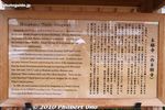
About Nishi Hongwanji in English.
|
|

Large flags outside the temple gates.
|
|

New Year observance schedule.
|
|
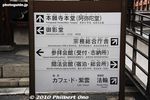
Directional sign
|
|

Goeido Founder's Hall. For several years, the Nishi Hongwanji buildings were hidden by construction scaffolding as they underwent major renovations. Finally, we get to see all the buildings unobstructed. 御影堂
|
|

Goeido Founder's Hall at Nishi Hongwanji, Kyoto. The building is an Important Cultural Property. 御影堂
|
|

Goeido Founder's Hall
|
|

Roof of Goeido Founder's Hall
|
|

Side of Goeido Founder's Hall.
|
|

Panoramic view of Nishi Hongwanji temple, Kyoto. The layout of the buildings is almost the same as Higashi Hongwanji.
|
|

Next to the Goeido Founder's Hall is this modern Ryukoden Hall which is like a reception counter for worshippers. 龍虎殿
|
|

Hiunkaku Pavilion is a National Treasure. Unfortunately, it is not open for public viewing. One of Kyoto's Three Best Pavilions along with Kinkakuji and Ginkakuji Pavilions. 飛雲閣
|
|

Bell tower at Nishi Hongwanji
|
|
|
|