 Image search results - "hike" Image search results - "hike" |

Mt. Mitake is one of Tokyo's easily accessible peaks via cable car. But it still requires a good deal of climbing up slopes and steps. You can also hike to adjacent Mt. Hinode-yama. Great daytrip getaway from Tokyo's concrete jungle.Getting off the train at Mitake Station on the JR Ome Line. I wasn't the only one who decided it was a good day to hike up Mitake. 御岳駅
|
|

Mitake Station on the JR Ome Line. 御岳駅
|
|

Mitake Station on the JR Ome Line. 御岳駅
|
|

Bus stop for cable car station.
|
|

Bus for cable car station.
|
|

Cable car station.
|
|

Welcome to Mt. Mitake
|
|

Cable car for Mt. Mitake.
|
|

570 yen one way. There's also a lift for an extra 100 yen. No one rides the lift.
|
|

Cable car to Mt. Mitake
|
|

Mitake-san Station for cable car
|
|

Lookout deck near cable car station
|
|

View from lookout deck on Mt. Mitake, Tokyo
|
|
|

Mt. Hinode-yama which is next to Mt. Mitake.
|
|

Lift station in middle (very short distance) which no one rides.
|
|

Welcome Gate. Everyone goes through here instead and walk toward the top.
|
|

Back of welcome gate.
|
|

Torii ahead. Mt. Mitake is topped with a Shinto shrine.
|
|

Torii
|
|

Back of torii
|
|
|

Hailstones in Feb.
|
|

Hinode-yama, my target after Mt. Mitake.
|
|

Bird house
|
|
|

Mt. Mitake Visitors Center where you can get maps and hiking advice.
|
|

Inside Visitors Center
|
|

Old minka house on Mt. Mitake, Tokyo
|
|

Mitake-san Youth Hostel. The mountain has many lodges and inns.
|
|

Slope up
|
|

Thatched roof
|
|

Mt. Mitake, Tokyo
|
|

Veranda
|
|

Tree designated as a Natural Monument. Almost dead in Feb. though.
|
|

Souvenir shops and restaurants
|
|

Steps toward Musashi-Mitake Shrine
|
|

More steps
|
|

Lots of stone monuments (not gravestones)
|
|

More monuments
|
|

More steps (rest time)
|
|

More steps...
|
|

Oh my God, more steps...
|
|

Musashi-Mitake Shrine
|
|

Musashi-Mitake Shrine, Tokyo 武蔵御嶽神社
|
|

Musashi-Mitake Jinja 武蔵御嶽神社
|
|

The shrine buildings at rear.
|
|

View from the shrine, not much.
|
|

But there was one clear pocket of scenery.
|
|
|

Omikuji
|
|

Omikuji
|
|

Treasure House 宝物殿
|
|

Musashi-Mitake Shrine, Tokyo
|
|

Going down
|
|

Turn left for Mt. Hinode-yama
|
|

Cable car station peak.
|
|

The torii which we passed through.
|
|

Wooden cart wheels are a common sight.
|
|

Trail to Mt. Hinode-yama. Takes about 40 min. from Mt. Mitake.
|
|
|
|

Deep forest
|
|
|

Roots
|
|

Torii
|
|
|

Take a left here.
|
|

Hiking guide
|
|

Roots in stone
|
|
|

Steps
|
|
|
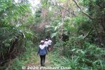
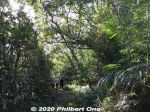
Iriomote has many hiking trails through the tropical forest or jungle. The popular trails usually lead to a waterfall, but we went on a short nature trail in Otomi that didn't lead to anything. 大富林道大正池
|
|
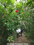
Iriomote's forests are a mishmash of all kinds of flora growing wild everywhere in all directions. It's not like the neat, orderly forests of trees on mainland Japan. 大富林道大正池
|
|
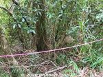
Beehive roped off. (Do not disturb.)
|
|
|
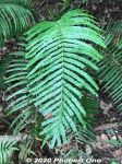
Ferns
|
|
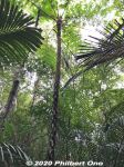
Tree fern, common in Okinawa. The fronds break off. 木生シダ
|
|
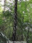
The trunk of a tree fern shows the remains of branches that broke off. 木生シダ
|
|
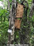
Bird feeder for research purposes.
|
|
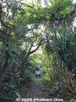
When going on hikes, best to wear long sleeves and long pants so the tree branches, leaves, etc., don't scratch you. Also protection from bugs.
|
|
Guided tours are recommended. Local guides know the flora and fauna and the difficult or slightly hazardous sections of hiking trails. Local tour guide: https://www.motti-iriomotejima.com/
|
|
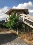
Otomi Lookout Deck 大富展望台
|
|
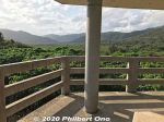
Otomi Lookout Deck 大富展望台
|
|
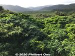
Great views of the greenery from the Otomi Lookout Deck.
|
|
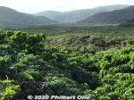
Nakama River is beyond this area.
|
|
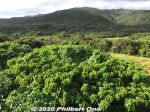
Great views of the greenery from the Otomi Lookout Deck.
|
|
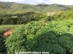
Great views of the greenery from the Otomi Lookout Deck.
|
|

At Gunkan-iwa dock, there's a hiking trail called Urauchigawa Shizen Kenkyu-ro. A nature trail that goes to two waterfalls.Note that cell phones won't work on the hiking trail. 浦内川自然研究路
|
|

Urauchi River hiking trail to waterfalls. It can be quite muddy.
|
|

Sometimes there are views from the hiking trail.
|
|

Lush forest, but rocky and muddy trail. Hiking shoes or sneakers are good. Sometimes a tree or branch has fallen over the trail. Need to go over/under it.
|
|

Ferns and a nameless mini waterfall.
|
|

After hiking about 30 min., a scenic point gives a view of Mariyudu Falls. Series of three waterfalls. It empties into a round stream pool. "Mariyudu" means stream pool. マリゥドゥの滝
|
|

Mariyudu Falls on Urauchi River. About 20 meters wide and 16-meter drop in total. One of Japan's 100 Famous Waterfalls. マリゥドゥの滝*People can no longer come this close to the falls. There were people who slipped and fell in, so the closeup path is blocked.
|
|

Behind Mariyudu Falls looking from upstream.
|
|

Mariyudu Falls. From here, the hiking trail continues to another waterfall, Kanbire (Kanpire) Falls about 250 meters away.
|
|

Kanbire (Kanpire) Falls on Urauchi River, near the center of Iriomote. This is about 2 km from the Gunkan-iwa boat dock. Or 30-40-min. hike. You can get quite close to the falls. カンビレーの滝Instead of having one big drop, Kanbire Falls flow down on a series of steps on the river for about 200 meters. The riverside also has small potholes. Kanbire (Kanpire) means "where gods sit." This spot was considered to be a sacred site where the gods gathered.
|
|

Hiking back. The lady in front of me was wearing rubber slippers on this muddy trail. She kept slipping and almost falling. Her dainty feet got all muddy.
|
|

River cruise back to the dock.
|
|

Urauchi River boat dock as seen from Urauchi Bridge near the mouth of the river.
|
|
|

Mangroves near the mouth of Urauchi River, seen from Urauchi Bridge.
|
|

Bus stop (Urauchihashi) for the Urauchi River boat dock. In the background is our tour bus.
|
|
|
|