 Last additions - CHIBA 千葉県 Last additions - CHIBA 千葉県 |
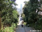
Going down the steps from Guhoji Temple. In the distance, The Towers West skyscraper is visible. The road ahead goes all the way to JR Ichikawa Station.Apr 08, 2022
|
|
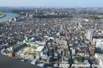
View from The Towers West lookout deck on the 45th floor. The patch of green is the hill where Guhoji is located.Apr 08, 2022
|
|
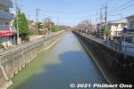
Mama River empties into Edogawa River. We later walked along Edogawa River toward Konodai Station on the Keisei Line.Apr 07, 2022
|
|
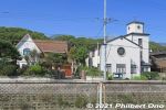
Western-style buildings along Mama River. The Christian church on the right is the Japan Evangelical Lutheran Church in Ichikawa and a National Tangible Cultural Property. 日本福音ルーテル市川教会【国登録有形文化財】Apr 07, 2022
|
|
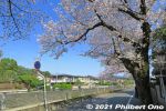
Mama River cherry blossoms in Ichikawa, Chiba.Apr 07, 2022
|
|
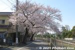
After Guhoji Temple, we walked back to Edogawa River along Mama River which had a few cherry blossoms.Apr 07, 2022
|
|
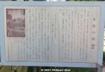
About Mama no Tsughihashi Bridge. 真間の継橋Apr 07, 2022
|
|
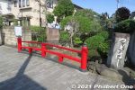
Mama no Tsughihashi Bridge near the steps going up to Guhoji Temple. The bridge is mentioned in some poems in the Man'yoshu. 真間の継橋Apr 07, 2022
|
|
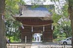
Niomon Gate rear view as you exit.Apr 07, 2022
|
|
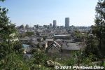
View of Ichikawa Station area from Guhoji. The two skyscrapers are The Towers East on the left and The Towers West on the right. The higher Towers West building has a lookout deck on the 45th floor.Apr 07, 2022
|
|
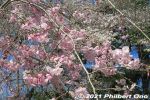
Apr 07, 2022
|
|
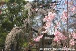
Apr 07, 2022
|
|

Apr 07, 2022
|
|
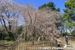
Another weeping cherry tree next to Fushihime Sakura.Apr 07, 2022
|
|
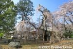
Apr 07, 2022
|
|
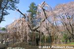
Apr 07, 2022
|
|
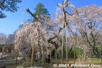
We can see that a few branches had been cut, which means the tree was larger.Apr 07, 2022
|
|
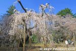
In Ichikawa, Chiba, Guhoji's 400-year-old weeping cherry blossom tree is named "Fushihime Sakura." 伏姫桜Apr 07, 2022
|
|
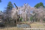
Guhoji's 400-year-old weeping cherry blossom tree is named "Fushihime Sakura." 伏姫桜Apr 07, 2022
|
|
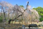
The weeping cherry tree looks different from different angles.Apr 07, 2022
|
|
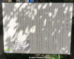
Guhoji is a Nichiren Buddhist temple founded by Priest Gyoki in 737. It's on a small hill noted for cherry blossoms and autumn foliage.Priest Kobo Daishi (Kukai) later reconstructed and expanded the temple in 822. Tokugawa Ieyasu, before he became shogun, granted the temple ownership of its temple grounds in 1591. In 1695, Mito Komon named the temple's tea ceremony room "Henrantei" (遍覧亭). In 1888, the entire temple was destroyed by fire. The present structures were reconstructed in 1890.Apr 07, 2022
|
|
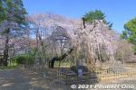
In spring, Guhoji's 400-year-old weeping cherry blossom tree is famous. 伏姫桜Apr 07, 2022
|
|
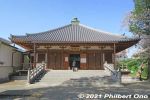
After Niomon Gate, this is the first building you see, Soshido Hall dedicated to Nichiren, founder of the Nichiren Buddhist sect. Reconstructed in 2010 on the 700th anniversary of Nichiren's death. 祖師堂 There are other temple buildings spread out on the hill.Apr 07, 2022
|
|
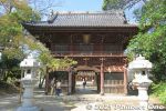
Niomon Gate at the top of the steps, Guhoji's front gate. The two columns house a pair of Nio kings considered to be the protectors of the temple. 仁王門Apr 07, 2022
|
|
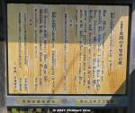
Poem about Tekona.Apr 07, 2022
|
|
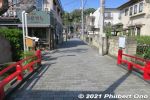
"Mamasan" is the temple's mountain name. Not the same as a mama-san operating a Japanese bar. Photo shows Mama no Tsughihashi Bridge leading to the steps going up to Guhoji Temple on a wooded hill. 真間の継橋Apr 07, 2022
|
|
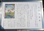
In 1501, Tekona's spirit told a priest to build a grave for her. This evolved into this temple where women pray for maternal happiness including safe childbirth and child rearing. 手児奈霊神堂Apr 07, 2022
|
|
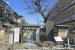
Near Guhoji is Tekona Reijindo, another temple. We didn't go to see this temple though. (Too tired walking.) Tekona Reijindo is dedicated to a local girl named Tekona who lived 2,000 years ago. 手児奈霊神堂Her job was to fetch water from a well. She was such a beautiful girl that every man who saw her fell in love with her and wanted to marry her. They even fought over her. Even the moon fell in love with her. She got so distraught by all the attention and fighting that she drowned herself in the well. Poor girl, she was loved to death.Apr 07, 2022
|
|
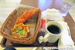
My coffee and pastries at Yamazaki Plaza Ichikawa in the city where Yamazaki-pan was founded. This capped my good day and hike in Ichikawa.Apr 07, 2022
|
|
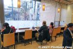
Good number of seats inside Yamazaki Plaza Ichikawa, the coffee shop and bakery operated by Yamazaki Baking.Apr 07, 2022
|
|
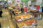
Yamazaki Plaza Ichikawa, a bakery operated by Yamazaki Baking in front of Ichikawa Station. Freshly baked in their own hometown, looks yummy.Apr 07, 2022
|
|
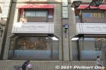
Yamazaki Plaza Ichikawa, a coffee shop and bakery operated by Yamazaki Baking in front of Ichikawa Station. This was a good place for refreshments before heading home.Apr 07, 2022
|
|
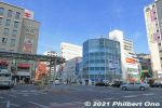
In front of Ichikawa Station, the building (Sun Plaza 55) on the left has a coffee shop and bakery operated by Yamazaki Baking.Apr 07, 2022
|
|
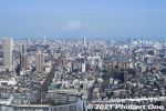
Looking east toward Chiba. The JR Sobu Line tracks can be seen on the left going to Moto-Yawata Station.Apr 07, 2022
|
|

Looking east toward Chiba. The tall building in the foreground is The Towers East. The JR Sobu Line tracks can be seen on the left.Apr 07, 2022
|
|
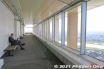
Another side of the lookout deck.Apr 07, 2022
|
|
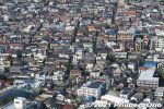
High-density housing.Apr 07, 2022
|
|
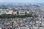
"Temple" marks the location of Guhoji Temple, famous for a 400-year-old weeping cherry blossom tree. See this album.Apr 07, 2022
|
|

Looking north.Apr 07, 2022
|
|
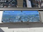
Guide to visible landmarks.Apr 07, 2022
|
|

Looking further upstream on Edogawa River. Left of the river is Edogawa (Koiwa) and Katsushika (Shibamata) Wards.Apr 07, 2022
|
|

Looking west toward Edogawa River. The JR Sobu Line (left) and Keisei Line (extreme right) over Edogawa River can be seen. The bridge in the middle is Route 14.Apr 07, 2022
|
|
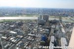
Looking west toward Edogawa River. The JR Sobu Line can be seen.Apr 07, 2022
|
|
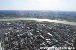
Looking west toward Edogawa River. On clear days, Mt. Fuji can also be seen.Apr 07, 2022
|
|
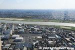
View from I-Link Town Observatory, looking west toward Edogawa River. This deck is open 9 am to 10 pm. Closed on the first Monday of the month and during Dec. 29 to Jan. 3.Apr 07, 2022
|
|
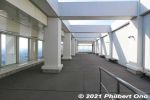
The 45th floor of The Towers West building is named "I-Link Town Observatory." It's a panoramic lookout deck on all four sides of the building. Free admission. This is open-air. If it's raining, there's also an indoor lookout deckApr 07, 2022
|
|
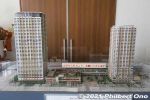
Scale model of the skyscraper buildings next to JR Ichikawa Station. On the left is The Towers West building and on the right is The Towers East. The West building has a nice lookout deck on the 45th floor.Apr 07, 2022
|
|
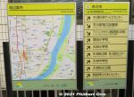
Directions at Ichikawa Station.Apr 07, 2022
|
|
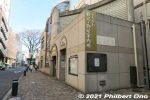
Ichikawa Tourist Information office next to Ichikawa Station. It was closed.Apr 07, 2022
|
|
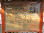
Map in front of JR Ichikawa Station showing another hiking route.Apr 07, 2022
|
|
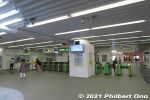
Turnstiles at JR Ichikawa Station.Apr 07, 2022
|
|
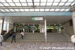
JR Ichikawa Station is the first station in Chiba on the JR Sobu Line.Apr 07, 2022
|
|
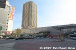
JR Ichikawa Station on the JR Sobu Line. The skyscraper is The Towers East.Apr 07, 2022
|
|
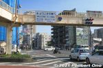
From the Edogawa riverside, we turned left on Route 14 and walked to Ichikawa Station. Welcome to Chiba! Ichikawa is one of Chiba Prefecture's cities adjacent to Tokyo. Apr 07, 2022
|
|

Police motor scooter.Apr 07, 2022
|
|
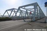
Route 14 bridge over Edogawa River. Bridges were not built over Edogawa River until after the Edo Period ended. Until then, shuttle boats were used to shuttle travelers across the river.Apr 07, 2022
|
|
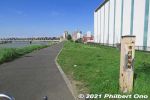
Ichikawa Sekisho marker near Yamazaki Baking.Apr 07, 2022
|
|
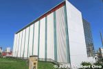
Near the Ichikawa Sekisho Checkpoint is a Yamazaki Baking (山崎製パン) research and training facility ("Creation Center"). Yamazaki is the world's second largest bread-baking company. Founded in Ichikawa, Chiba in 1948.Apr 07, 2022
|
|

Old drawing of Ichikawa Sekisho. It was operated in together with staff on the opposite side (Koiwa) of the river until it was abolished in 1869. The opposite side of the river (Koiwa) also has a signboard marking the sekisho location. 市川関所跡Apr 07, 2022
|
|
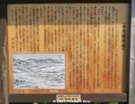
LIke other sekisho checkpoints in Edo during the Edo Period, the Ichikawa Sekisho checked for any weapons on travelers entering Edo and any women trying to escape Edo without permission. 市川関所跡To pass through a sekisho, travelers were required to have a travel permit (like a passport) issued by their local government official.Apr 07, 2022
|
|
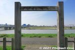
This was where people crossed the river by boat and it was a busy/important artery. The Ichikawa Sekisho Checkpoint was at the border between Shimosa (Chiba) and Musashino (Tokyo) Provinces. So the Sekisho was the border control. 市川関所跡Apr 07, 2022
|
|
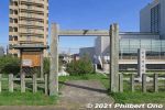
Slightly south of Keisei Line's Konodai Station next to Edogawa River is the Ichikawa Sekisho Checkpoint site. This is only a marker monument (no original structures). 市川関所跡Apr 07, 2022
|
|
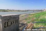
Instead of going to Konodai Station on the Keisei Line, we walked further south along the Edogawa River. Keisei Line's bridge can be seen behind us.Apr 07, 2022
|
|
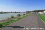
Edogawa River has a nice walking/cycling path.Apr 07, 2022
|
|
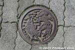
Manhole cover in Ichikawa, Chiba. Pine tree and river fish.Apr 07, 2022
|
|
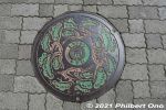
Manhole cover in Ichikawa, Chiba. Pine trees.Apr 07, 2022
|
|
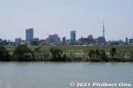
Edogawa RiverApr 07, 2022
|
|
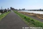
Straight ahead is the bridge for the Keisei Line. 江戸川沿いApr 07, 2022
|
|
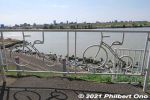
Bicycle art on Edogawa River.Apr 07, 2022
|
|
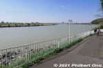
Edogawa RiverApr 07, 2022
|
|
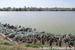
Edogawa RiverApr 07, 2022
|
|
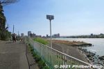
江戸川沿いApr 07, 2022
|
|
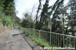
This is part of the riverside walking path. On the left is a forest on a hill. The forest is also being protected.Apr 07, 2022
|
|
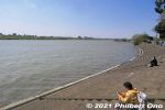
Edogawa River has a nice riverside walking/cycling path on both sides of the river.Apr 07, 2022
|
|
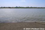
From Satomi Park, the remaining walk went along Edogawa River to the train station. Apr 07, 2022
|
|
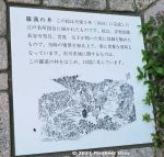
The Rakan-no-I well was actually depicted in this 1834 illustration, part of Illustrations of Edo's Noted Sights. 羅漢の井Apr 07, 2022
|
|
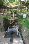
Old well on the fringe of Satomi Park named "Rakan-no-I". 羅漢の井Apr 07, 2022
|
|
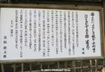
Apr 07, 2022
|
|
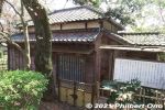
Shien-soja (紫烟草舎).Apr 07, 2022
|
|

About Shien-soja. It was originally located in Koiwa (Edogawa Ward, Tokyo) and moved here. (紫烟草舎).Apr 07, 2022
|
|
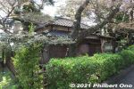
Satomi Park also has Shien-soja (紫烟草舎), the former home of famous tanka poet named Kitahara Hakushū (1885–1942) (北原白秋). He lived in this house for only a year in 1916. Apr 07, 2022
|
|
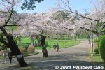
Apr 07, 2022
|
|
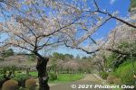
Nice cherry blossoms at Satomi Park, Ichikawa.Apr 07, 2022
|
|
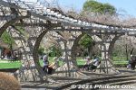
Apr 07, 2022
|
|
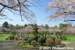
Flowery site of Konodai Castle in Ichikawa, Chiba. No castle buildings. 国府台城跡Apr 07, 2022
|
|
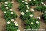
Apr 07, 2022
|
|
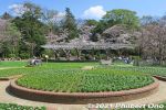
Satomi Park is also noted for roses in early summer and fall. The rose is Ichikawa's official flower. Apr 07, 2022
|
|

During World War II, Satomi Park was an Imperial Army base camp. It finally became a public park in 1959. Flower beds now cover the site of Konodai Castle.Apr 07, 2022
|
|
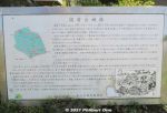
Being the site of Konodai Castle, Satomi Park was also the site of the Battles of Konodai fought twice between the local Satomi Clan (ruler of Awa Province in present-day Chiba) and the invading Hojo Clan (from Odawara) in the 16th century. The Hojo won the final battle and thereby took control of present-day Chiba. The Hojo is said to have expanded and reinforced Konodai Castle.
However, when Tokugawa Ieyasu took control of Japan, he had Konodai Castle dismantled because it had a intimidating view of his own Edo Castle.Apr 07, 2022
|
|
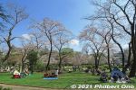
This is where most people enjoyed Satomi Park, under the cherry blossoms.Apr 07, 2022
|
|
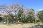
Satomi Park playground.Apr 07, 2022
|
|
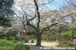
Apr 07, 2022
|
|
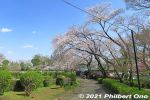
Satomi Park cherry blossoms.Apr 07, 2022
|
|
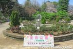
Satomi Park visit date.Apr 07, 2022
|
|
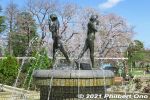
Satomi Park water fountain. Apr 07, 2022
|
|
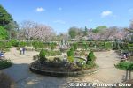
Satomi Park water fountain. This is another area of the park. Totally different landscape. This was the main site of Konodai Castle. 国府台城Apr 07, 2022
|
|
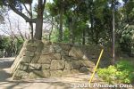
Apr 07, 2022
|
|
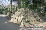
Castle-like stone foundation. Satomi Park is the site of Konodai Castle. However, this stone foundation is not original.Apr 07, 2022
|
|
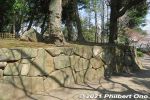
Castle-like stone foundation.Apr 07, 2022
|
|
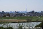
Edogawa River and Tokyo Skytree as seen from Satomi Park.Apr 07, 2022
|
|
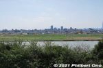
Edogawa River.Apr 07, 2022
|
|

Poetry Monument for So Sakon's Ichikawa poem. He was a longtime resident and honorary citizen of Ichikawa . 宗 左近Apr 07, 2022
|
|
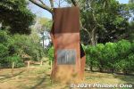
Poetry Monument for So Sakon's poem. 宗 左近Apr 07, 2022
|
|

Sign on a cherry tree saying that no hanami flower-viewing picnics are not allowed here due to Covid-19.Apr 07, 2022
|
|
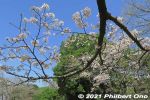
Apr 07, 2022
|
|
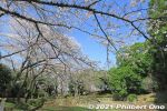
Cherry blossoms in Satomi Park. Apr 07, 2022
|
|
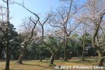
Cherry blossoms in Satomi Park. Apr 07, 2022
|
|
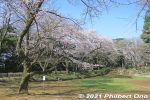
Cherry blossoms in Satomi Park. Apr 07, 2022
|
|
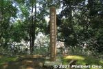
Marker indicating Ichikawa city's highest point (elevation). A whopping 30.1 meters above sea level.Apr 07, 2022
|
|
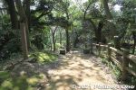
At the top of this small hill is Ichikawa city's highest point (elevation).Apr 07, 2022
|
|
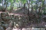
Apr 07, 2022
|
|
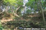
Konodai Castle remains in Satomi Park. Embankments and rocks. 国府台城Apr 07, 2022
|
|
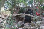
Satomi ParkApr 07, 2022
|
|
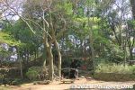
Satomi Park, near the burial mound.Apr 07, 2022
|
|
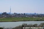
View of Edogawa River from Satomi Park. Across the river is Koiwa and Shibamata. Tokyo Skytree can also be seen. 江戸川Apr 07, 2022
|
|
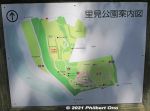
Map of Satomi Park. The burial mound is on the upper part next to the red, dotted oval on the map. The park is next to Edogawa River.Apr 07, 2022
|
|
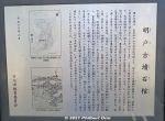
About the Akedo Kofun burial mound. The diagram shows a keyhole-shaped burial mound. The stone coffins are on the top of the round hill. This burial mound has been a noted site since the Edo Period. 明戸古墳石棺Apr 07, 2022
|
|
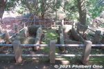
The Akedo Kofun burial mound stone coffins date from the 6th century. They were discovered in 1479. The dirt mound over the coffins fell away to expose the coffins which contained samurai armor, swords, etc. 明戸古墳石棺Apr 07, 2022
|
|
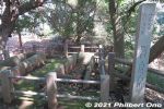
Two stone coffins on Akedo Kofun burial mound. Experts believe that they contained the remains of local nobility who ruled this area in the 6th to 7th century. Chiba Prefecture has many of these stone coffins. 明戸古墳石棺Apr 07, 2022
|
|
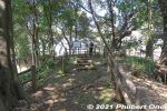
Satomi Park also has the Akedo Kofun burial mound complete with two stone coffins exposed on the mound. 明戸古墳石棺Apr 07, 2022
|
|
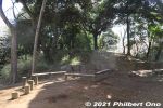
Places to sit in the park.Apr 07, 2022
|
|
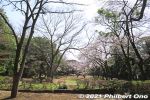
Satomi Park is the site of Konodai Castle occupied by the Satomi Clan who ruled the Boso domain in present-day Chiba during the 16th century. Almost nothing remains though. 国府台城Apr 07, 2022
|
|
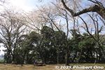
Next is Satomi Park, another large park with different areas. This part is undeveloped and quiet. 里見公園Apr 07, 2022
|
|
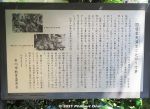
About Konodai Tenmangu Shrine and an event called Tsujikiri.Apr 07, 2022
|
|
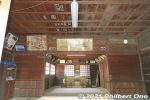
Inside Konodai Tenmangu Shrine. 国府台天満宮Apr 07, 2022
|
|
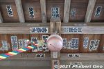
Ceiling and bell.Apr 07, 2022
|
|
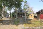
Konodai Tenmangu Shrine dedicated to Michizane, scholar deity. Stone lanterns behind the torii date from 1863. 国府台天満宮Apr 07, 2022
|
|
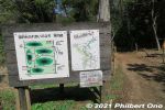
We came out of this trail which goes through into a small forest of different species of trees.Apr 07, 2022
|
|
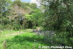
Lush trees and shrubs in Konodai Ryokuchi Park. 国府台緑地Apr 07, 2022
|
|
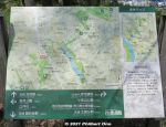
Apr 07, 2022
|
|
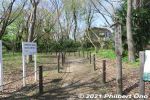
Follow the trail to Satomi Park next.Apr 07, 2022
|
|
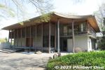
Ekoin Betsuin Temple's main hall rebuilt in 2009. There's actually a cafe (Cafe Terrace Ekoin) on the 2nd floor. It belongs to the Jodo-shu Buddhist sect and is a branch of Ekoin Temple in Ryogoku, Tokyo. 回向院市川別院源光寺Apr 07, 2022
|
|
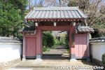
The trail passes by a few temples like Ekoin Betsuin Temple. This is the temple gate. 回向別院Apr 07, 2022
|
|
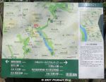
Map and where we are now.Apr 07, 2022
|
|
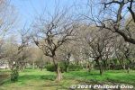
Plum blossom trees near Junsai-ike Pond. Apr 07, 2022
|
|
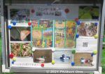
Photos of the park's flora and fauna by a local environmental group.Apr 07, 2022
|
|
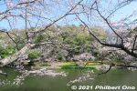
Cherry blossoms along Junsai-ike Pond. じゅん菜池Apr 07, 2022
|
|
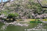
Cherry blossoms along Junsai-ike Pond. じゅん菜池Apr 07, 2022
|
|
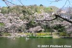
Cherry blossoms along Junsai-ike Pond. じゅん菜池Apr 07, 2022
|
|

Cherry blossoms along Junsai-ike Pond in late March. じゅん菜池Apr 07, 2022
|
|
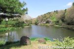
Some cherry blossoms along Junsai-ike Pond. じゅん菜池Apr 07, 2022
|
|
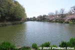
Junsai-ike Pond. No swan boats or rowboats. Only ducks. じゅん菜池Apr 07, 2022
|
|
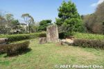
Small island in the middle of the pond.Apr 07, 2022
|
|

Small bridge in the middle of Junsai-ike Pond.Apr 07, 2022
|
|

Some cherry blossoms along Junsai-ike Pond. じゅん菜池Apr 07, 2022
|
|
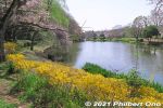
In autumn, Junsai-ike Pond is also noted for fall leaves.Apr 07, 2022
|
|
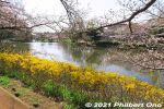
Cherry blossoms along Junsai-ike Pond.Apr 07, 2022
|
|
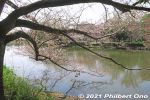
じゅん菜池Apr 07, 2022
|
|
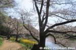
Some cherry blossoms along Junsai-ike Pond in late March. じゅん菜池Apr 07, 2022
|
|
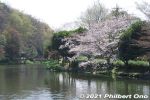
Junsai-ike Pond じゅん菜池Apr 07, 2022
|
|
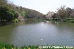
Junsai-ike Pond じゅん菜池Apr 07, 2022
|
|

If you started the hike at Kita-Kokubun Station, Junsai-ike Pond Ryokuchi green belt park is the first substantial park where you can rest or have lunch. Large pond and cherry blossoms. じゅん菜池緑地Apr 07, 2022
|
|

Junsai-ike Ryokuchi Park is a nature area where the flora and fauna are not to be disturbed. じゅん菜池緑地Apr 07, 2022
|
|
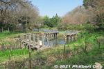
Junsai-ike Ryokuchi green belt park じゅん菜池緑地Apr 07, 2022
|
|
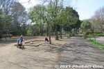
Junsai-ike Ryokuchi green belt park. じゅん菜池緑地Apr 07, 2022
|
|

Rules for using Junsai-ike Ryokuchi Park. No bicycle riding, dogs must be leashed, etc.Apr 07, 2022
|
|

Water hose manhole for firemen.Apr 07, 2022
|
|
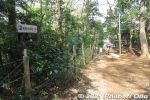
Follow the sign.Apr 07, 2022
|
|
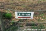
Signage for the hiking trail.Apr 07, 2022
|
|
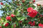
Apr 07, 2022
|
|
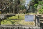
Sawara Park, we walked through here.Apr 07, 2022
|
|
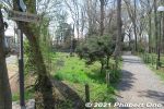
Follow the sign to Konodai Ryokuchi green belt.Apr 07, 2022
|
|
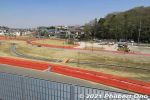
Kozuka-yama Park was still under construction. 小塚山公園Apr 07, 2022
|
|
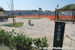
Next was Kozuka-yama Park. There are restrooms. 小塚山公園Apr 07, 2022
|
|
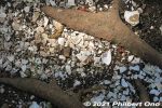
While walking through Horinouchi Kaizuka Shell Mound, many pieces of shell or pottery on the ground. Still here, after thousands of years!Read more about this shell mound here: https://ichikawashi.jp/horinouchi/index_en.htmlApr 07, 2022
|
|

While walking through Horinouchi Kaizuka Shell Mound, we indeed saw many pieces of shell or pottery on the ground.Apr 07, 2022
|
|
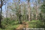
Walking through Horinouchi Kaizuka Shell Mound, larger than what meets the eye. The shell mound's immediate area was the ocean shallows where it was easy to harvest shellfish.Apr 07, 2022
|
|
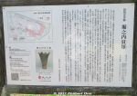
It's hard to discern, but Horinouchi Kaizuka Shell Mound is as long as 225 meters and 100 meters wide. Pink portion in the diagram on the upper left shows where the shells, animal bones (mostly boar and deer) and other food waste were tossed on the hillsides during 4,000 to 2,500 years ago (Jomon Period). They form a horseshoe shape on the hill.
The mound was a central feature of the Jomon Period cluster of homes in this area. Since the late 19th century (Meiji Period), many digs and research on this shell mound have been conducted by archaeologists. However, there are still unknown things about mound.Apr 07, 2022
|
|
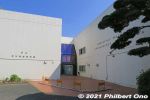
The other museum in the park is the Ichikawa Archaeology Museum displaying shell mound remains as old as 3,000 years (Jomon Period). Pottery & human remains found here are also exhibited. Good to have this museum next to the shell mound. 市川考古�Apr 07, 2022
|
|
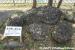
Hardened shell rocks from the ocean 150,000 years ago displayed in Horinouchi Kaizuka Park. These are not shells discarded by humans. 堀之内貝塚公園Apr 07, 2022
|
|
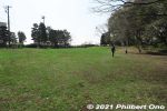
Horinouchi Kaizuka Park is a flat hill where shells, animal bones, and other food waste were discarded by Jomon people 4,000 years ago. "Kaizuka" means "shell mound." 堀之内貝塚公園This hill was also the site of a Jomon Period human settlement 2,500 to 4,000 years ago. A number of excavations were made since 1904 and ancient human remains, pottery, etc., have been found. National Historic Site.Apr 07, 2022
|
|
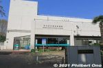
You will pass by the Ichikawa Municipal Museum of History. Free admission, but it was closed when we were there. Horinouchi Kaizuka Shell Mound Park has two museums. 市川歴史博物館Apr 07, 2022
|
|
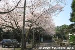
After the small green belt, walk on the street to the Shell Mound. Apr 07, 2022
|
|
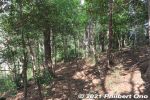
Horinouchi Ryokuchi green belt. 堀之内緑地Apr 07, 2022
|
|
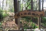
Horinouchi Ryokuchi green belt. 堀之内緑地Apr 07, 2022
|
|
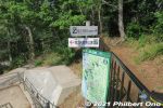
For the most part, the trail has signage in both Japanese and English. We soon got to some greenery called Horinouchi Ryokuchi green belt. There's this fork in the trail. Go left to see the shell mound in Horinouchi Kaizuka Park.Apr 07, 2022
|
|
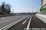
From Kita-Kokubun Station, we walked about 600 meters along this highway until we reached the first green belt.Local environmental groups have been active in trying to preserve and protect the city's nature, but it's an uphill struggle with the encroaching urban development, especially when the Hokuso train line was built through Ichikawa in 1979.Apr 07, 2022
|
|
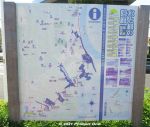
Water & Greenery Corridor (Mizu-to-Midori-no-Kairo) is a semi-urban, hiking trail in the northwestern part of Ichikawa fronting the border with Tokyo along Edogawa River.This part of Ichikawa is dotted with patches, hills, and slithers of small forests, parks, and ponds. This "Corridor" links all this greenery and bodies of water to help protect and preserve the flora and fauna in a coordinated effort by local environmental groups.
This is a map of the trail. Download the official map here: https://www.city.ichikawa.lg.jp/gre01/1111000022.htmlApr 07, 2022
|
|
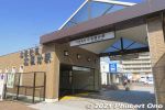
The corridor is 6 km and takes a few hours to walk it between Kita-Kokubun Station (photo) and Konodai Station both in Ichikawa.There are also side treks to other nearby sights. Enjoyable especially when the cherry blossoms are in bloom or during the autumn foliage.Apr 07, 2022
|
|

Tokyo Bay Aqua Line heading to Kisarazu over the ocean. After 2 hours on Umihotaru, took the bus to Kisarazu. Great place to visit.Jan 04, 2017
|
|

Jan 04, 2017
|
|

Bus for Kisarazu.Jan 04, 2017
|
|

Bus schedule at Umihotaru.Jan 04, 2017
|
|

Umihotaru bus stop.Jan 04, 2017
|
|

Chiba skyline is mostly industrial.Jan 04, 2017
|
|

Umihotaru showing its age with rust here and there.Jan 04, 2017
|
|

Jan 04, 2017
|
|

Jan 04, 2017
|
|

Tokyo Bay Aqua Line above the ocean toward Kisarazu, Chiba.Jan 04, 2017
|
|

Jan 04, 2017
|
|

I went on a Sunday so it was packed with cars. Jan 04, 2017
|
|

Jan 04, 2017
|
|

Jan 04, 2017
|
|

Jan 04, 2017
|
|

Jan 04, 2017
|
|

HelipadJan 04, 2017
|
|

One shop even had Hawaiian goods.Jan 04, 2017
|
|

Gift shops inside.Jan 04, 2017
|
|

Jan 04, 2017
|
|

Gift shops inside.Jan 04, 2017
|
|

Food court with ocean views.Jan 04, 2017
|
|

Umihotaru has escalators in the middle going up 5 floors.Jan 04, 2017
|
|

Umihotaru is basically a parking structure with three levels of parking topped with two levels of shops and restaurants. Top floor.Jan 04, 2017
|
|

Wave breakersJan 04, 2017
|
|

Passengers flying to or from Haneda Airport can usually see Umihotaru from the plane.Jan 04, 2017
|
|

About the tunnel boring machine.Jan 04, 2017
|
|

Tunnel boring machine cutaway illustration.Jan 04, 2017
|
|

Closeup of drill bits on the cutting shield.Jan 04, 2017
|
|

One corner on the lower deck had this impressive display of a cutting shield of a tunnel boring machine used to dig the undersea tunnel.Jan 04, 2017
|
|

Jan 04, 2017
|
|

Jan 04, 2017
|
|

Looking toward Kawasaki. In the center is Kaze no To (風の塔, "Tower of Wind") which supplies air into the tunnel.Jan 04, 2017
|
|

Godzilla footprint is huge.Jan 04, 2017
|
|

On the lower deck, Godzilla footprints. Great idea. Pointing toward Kawasaki. Umihotaru has appeared in a Godzilla movie.Jan 04, 2017
|
|

Jan 04, 2017
|
|

Tokyo skyline. On really clear days, Mt. Fuji is visible.Jan 04, 2017
|
|

Jan 04, 2017
|
|

Jan 04, 2017
|
|

Jan 04, 2017
|
|

Top deck facing south.Jan 04, 2017
|
|

As long as they don't do this on real turtles. Must be the Urashima Taro influence.Jan 04, 2017
|
|

Top deck facing Kawasaki. Dress warmly if you visit in the colder months because it's quite windy.Jan 04, 2017
|
|

The ocean is right there.Jan 04, 2017
|
|

Umihotaru has escalators in the middle going up 5 floors.Jan 04, 2017
|
|

Umihotaru floor plan. It has 5 floors. The 4th and 5th floors are the main floors.Jan 04, 2017
|
|

Entrance to Umihotaru.Jan 04, 2017
|
|

Bus schedule on Umihotaru. You can either go back to Kawasaki or go on to Kisarazu in Chiba.Jan 04, 2017
|
|

Get off at the Umihotaru bus stop.Jan 04, 2017
|
|

Off-ramp to Umihotaru.Jan 04, 2017
|
|

It's the fourth longest undersea tunnel in the world.Jan 04, 2017
|
|

Entrance to the undersea tunnel of Tokyo Bay Aqua Line in Kawasaki.Jan 04, 2017
|
|

It took 9 years to build Tokyo Bay Aqua Line which opened in 1997. It's 14 km long, with 9.6 km undersea.Jan 04, 2017
|
|

Umihotaru is an artificial island serving as a highway rest area and tourist attraction in the middle of Tokyo Bay.It's part of the Tokyo Bay Aqua Line highway traversing Tokyo Bay above and below the ocean to connect Kawasaki, Kanagawa Prefecture and Kisarazu, Chiba Prefecture. Umihotaru is built atop the entrance/exit of the undersea tunnel going to Kawasaki.Jan 04, 2017
|
|

From Tokyo, taking the bus at JR Kawasaki Station is most convenient. Buses for Umihotaru leave once an hour. It takes about 45 min to get to Umihotaru. Bus fare is cheap.Jan 04, 2017
|
|

Jan 04, 2017
|
|

Rocket near the ferris wheel.Jan 04, 2017
|
|

Jan 04, 2017
|
|

DucksJan 04, 2017
|
|

Jan 04, 2017
|
|

Magic mushrooms.Jan 04, 2017
|
|

Jan 04, 2017
|
|

Jan 04, 2017
|
|

I'm inclined to believe their claim to have the biggest Christmas light decorations in the Tokyo area.Jan 04, 2017
|
|

Very impressive, it was worth the trouble to get here by bus.Jan 04, 2017
|
|

They also had a hilltop lookout point (seen here in the distance) to get a bird's eye view, but I didn't go up there.
Jan 04, 2017
|
|

Besides the Village, they light up a large swath of the surrounding rolling hills. They have a few footpaths to walk through the lights on the ground.Jan 04, 2017
|
|

Tunnel to the rolling, illuminated hills.Jan 04, 2017
|
|

Jan 04, 2017
|
|

Jan 04, 2017
|
|

Jan 04, 2017
|
|

Jan 04, 2017
|
|

Picture-taking serviceJan 04, 2017
|
|
| 1947 files on 8 page(s) |
2 |  |
 |
 |
 |
|