 Last additions - Mt. Mikami & Omi-Fuji Karyoku Koen Park 三上山(近江富士)・近江富士花緑公園 Last additions - Mt. Mikami & Omi-Fuji Karyoku Koen Park 三上山(近江富士)・近江富士花緑公園 |

Apr 07, 2008
|
|

Apr 07, 2008
|
|

Apr 07, 2008
|
|

Sato no Ie thatched-roof house now a display space. 里の家Apr 07, 2008
|
|

Inside Sato no IeApr 07, 2008
|
|

Apr 07, 2008
|
|

Grassy lawnApr 07, 2008
|
|

Apr 07, 2008
|
|

This park and surrounding area has a number of different things to see and do. Walk further more and you will reach Kibogaoka Park.Apr 07, 2008
|
|

Mt. Mikami and slideApr 07, 2008
|
|

Furusato Yakata for nature workshopsApr 07, 2008
|
|

Bridge over the highwayApr 07, 2008
|
|

Camping lodgeApr 07, 2008
|
|

BBQApr 07, 2008
|
|

Mt. MikamiApr 07, 2008
|
|

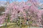
Weeping cherry tree in Omi-Fuji Karyoku Koen Park (also called Omi-Fuji Green Acres) in Yasu.Apr 07, 2008
|
|

Apr 07, 2008
|
|

Weeping cherry treeApr 07, 2008
|
|

Apr 07, 2008
|
|

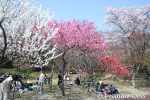
Garden of various cherry trees.Apr 07, 2008
|
|

I visited this park after coming down from Mt. Mikami which was full of green and brown. So seeing bright colors in this park was a great sight.Apr 07, 2008
|
|

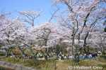
Cherry blossomsApr 07, 2008
|
|

Cherry trees bloom in early April in Omi-Fuji Karyoku Koen Park (also called Omi-Fuji Green Acres), Yasu. MAPApr 07, 2008
|
|

Sandwiched between the foot of Mt. Mikami and Kibogaoka Bunka Park, Omi-Fuji Karyoku Koen Park (also called Omi-Fuji Green Acres) is about flowers and greenery, including cherry blossoms. 植物園Apr 07, 2008
|
|

In spring, the cherries bloom in the botanical gardens. Lodging facilities, walking trails, playgrounds, and workshops are also provided. Water fountain. 近江富士花緑公園Apr 07, 2008
|
|

Water fountainApr 07, 2008
|
|

View of Mt. Mikami from Omi-Fuji Karyoku Koen Park in spring.Apr 07, 2008
|
|

Prevent forest fires.Apr 07, 2008
|
|

Apr 07, 2008
|
|

Getting close to civilization.Apr 07, 2008
|
|

Camping lodge in Karyoku Koen Park. There are more trails within the park and other sights like cherry blossoms. To get back to Yasu Station, walk to Kibogaoka Bunka Koen Park and the bus stop is at the Kibogaoka Nishi Gate next to the parking lot.Apr 07, 2008
|
|

850 meters to Karyoku Koen flower park.Apr 07, 2008
|
|

Tree trunkApr 07, 2008
|
|

Beware of snakes (mamushi). Never saw any. Never saw any monkeys either.Apr 07, 2008
|
|

1.4 km to Karyoku Koen ParkApr 07, 2008
|
|

Apr 07, 2008
|
|

Apr 07, 2008
|
|

Large stone wallsApr 07, 2008
|
|

Apr 07, 2008
|
|

Going down from the summit.Apr 07, 2008
|
|

Lots of ferns.Apr 07, 2008
|
|

Chain railing really helps.Apr 07, 2008
|
|

Entrance/Exit to Karyoku Koen-gawa TozandoApr 07, 2008
|
|

Just beyond the tree is the peak.Apr 07, 2008
|
|

Log stepsApr 07, 2008
|
|

Apr 07, 2008
|
|

Downward slope and trail. This trail is called the Karyoku Koen-gawa Tozando which starts from the Karyoku Koen flower park. 花緑公園側登山道Apr 07, 2008
|
|

Chain railingApr 07, 2008
|
|

"Take home your trash"Apr 07, 2008
|
|

Sign at the summit.Apr 07, 2008
|
|

Route 8 crossing Yasu RiverApr 07, 2008
|
|

Apr 07, 2008
|
|

Summit of Mt. Mikami. Only a small clearing with a bench. It was a great day for hiking. It is quite a popular mountain for climbers. Even for families with little kids. Didn't see any monkeys. No bears.Apr 07, 2008
|
|

To the peak.Apr 07, 2008
|
|

Apr 07, 2008
|
|

Apr 07, 2008
|
|

The path on the left leads to the mountain's peak.Apr 07, 2008
|
|

On the right, Route 8 can be seen crossing Yasu River.Apr 07, 2008
|
|

View from Mt. Mikami, Yasu.Apr 07, 2008
|
|

Sign pointing to a lookout point, slightly below the shrine.Apr 07, 2008
|
|

Looking toward RittoApr 07, 2008
|
|

View from Mt. Mikami, Yasu. Ishibe is toward the left.Apr 07, 2008
|
|

Lookout point on Mt. Mikami in Yasu.Apr 07, 2008
|
|

Gods here must be happy to see such grand views.Apr 07, 2008
|
|

Going down to the lookout point.Apr 07, 2008
|
|

Great view, but hazy when I was there. Ishibe is toward the left, and the shinkansen tracks toward the right.Apr 07, 2008
|
|

Sacred rock where the god lives.Apr 07, 2008
|
|

Summit in sight.Apr 07, 2008
|
|

This is almost near the mountain's peak.Apr 07, 2008
|
|

A shrine with a view.Apr 07, 2008
|
|

Shrine and torii at the summit.Apr 07, 2008
|
|

KokegataniApr 07, 2008
|
|

Shrine and torii at the summit.Apr 07, 2008
|
|

Yuba-no-FutokoroApr 07, 2008
|
|

The sign is almost totally unreadable.Apr 07, 2008
|
|

Steel railing to grab.Apr 07, 2008
|
|

View from the dip. There should be a better view on the other side too, but too many trees block the view.Apr 07, 2008
|
|

No sign for this little shrine.Apr 07, 2008
|
|

Kokegatani Valley. There's a small dip in the trail, going down and up again. This is a small valley near the peak. Visible as a small notch next to the peak. 苔が谷Apr 07, 2008
|
|

Small torii and shrine.Apr 07, 2008
|
|

RootsApr 07, 2008
|
|

Chain railing is helpful.Apr 07, 2008
|
|

500 meters until the peak.Apr 07, 2008
|
|

Trail to summit.Apr 07, 2008
|
|

RootsApr 07, 2008
|
|

Halfway point called Uchikoshi 打越. It's a small clearing and crossroads for multiple trails. Also a good place to harvest matsutake mushrooms during the fall (Sept. 23-Nov. 3).Apr 07, 2008
|
|

This trail goes around the side of the mountain. Not recommended.Apr 07, 2008
|
|

SignApr 07, 2008
|
|

Sometimes log steps are provided.Apr 07, 2008
|
|

Sacred tree. The bark from this tree is used for the roofing of the shrine. Do not scratch or damage it.Apr 07, 2008
|
|

The trail is rocky and rooty, with lots of tree roots.Apr 07, 2008
|
|

StepsApr 07, 2008
|
|

Two wooden signs pointed in opposite directions both say "To Mt. Mikami summit." Go right to continue on the easier Back Mountain Path. Or go left to get on the steeper Front Mountain Path. The large white sign says "Take home your trash.&qApr 07, 2008
|
|

Hiking up the Back Mountain Path. The trail actually goes mainly toward the side of the mountain rather than the back. The back of the mountain has a trail going down toward Kibogaoka Bunka Koen Park.Apr 07, 2008
|
|

Gate to the Back Mountain Path. Be sure to close the gate after entering. I don't know how it would prevent monkeys from climbing over the low gate. Between Sept. 23 and Nov. 3 during mushroom season, 500 yen admission is charged for the Front/Back paApr 07, 2008
|
|

Map of Mt. Mikami. It says the trail is 1.3 km long, taking 40 min. For normal people, allow 80 min. to reach the peak. I took about 90 min. to reach the top, while taking time to take pictures.Apr 07, 2008
|
|

Hiking Rules: No smoking. Do not make fire. Don't break tree branches or damage any trees. Don't take home any rocks, wood, etc. Take home your own trash.Apr 07, 2008
|
|

Time capsule to be opened in 2042.Apr 07, 2008
|
|

At the foot of Mt. Mikami is Tempo Gimin Monument dedicated to the farmers who were tortured to death after the 1842 Tempo Ikki (天保一揆) uprising against the government's unfair land taxation surveys..Apr 07, 2008
|
|

After passing through a bamboo grove, there is a clearing with the Tempo Gimin Monument.Apr 07, 2008
|
|

Sign shows the way to the "Back Mountain Path" (Ura Tozando). This is the less steep trail to the summit. Notice the peak on the left. I went on this trail. 裏登山道 MAPApr 07, 2008
|
|

The "Front Mountain Path" has a gate to prevent monkeys from escaping to the residential area. Be sure to close the gate after entering.Apr 07, 2008
|
|

Sign shows the way to the "Front Mountain Path" (Omote Tozando). I recommend taking a bottle or two of drinks. There's a vending machine near the bus stop. If you miss the bus from Yasu Station, it's a 40 min. walk. Taxis available. 表�Apr 07, 2008
|
|

From Yasu Station, it's a short bus ride to the foot of Mt. Mikami (get off at Yamade-mae 山出前). Then backtrack along the road to see two hiking paths. There are two trails, the Front (Omote, seen on the left)) and Back (Ura, seen on the right).Apr 07, 2008
|
|

Mt. Mikami as seen from JR Yasu Station train platform. The south exit of Yasu Station has a tourist info office where you can get maps and directions to the bus stop.Apr 07, 2008
|
|

View of Mt. Mikami from Karasaki, across Lake Biwa.Apr 07, 2008
|
|
|

View of Mt. Mikami-yama amid rice paddies in Yasu. Elevation 432 meters.Apr 07, 2008
|
|
|
|