|
|

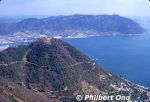
Mt. Fudekage is 313 meters high and part of the Seto Inland Sea National Park. Great views of Seto Inland Sea and Shikoku from Mihara, Hiroshima.
|
|

From JR Mihara Station, there's a local bus that goes up to Mt. Fudekage taking 7 min. Otherwise, it's a 50-min. hike from JR Sunami Station (JR Kure Line).
|
|
|

Looking east.
|
|

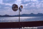
View of Seto Inland Sea from Mt. Fudekage in Mihara, Hiroshima.
|
|

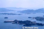
View of Seto Inland Sea from Mt. Fudekage in Mihara, Hiroshima. you can see Kosagi in the foreground, Sagi, and Hoso islands. In the distance on the right is Innoshima and part of the Shimanami Kaido bridge connecting Shikoku (Imabari) and Hiroshima.
|
|

Mt. Fudekage has a lookout deck for great views.
|
|

View of Seto Inland Sea from Mt. Fudekage in Mihara, Hiroshima.
|
|
|
|
|

View of Seto Inland Sea from Mt. Fudekage in Mihara, Hiroshima.
|
|
|

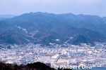
View of central Mihara (area around Mihara Station) from Mt. Fudekage in Mihara, Hiroshima.
|
|

View of central Mihara (area around Mihara Station) from Mt. Fudekage in Mihara, Hiroshima.
|
|

JR Sunami Station (JR Kure Line) is the closest to Mt. Fudekage. Then it's a 50-min. hike up. 須波駅
|
|
|
|
|