 Image search results - "hiking" Image search results - "hiking" |

Mt. Mitake is one of Tokyo's easily accessible peaks via cable car. But it still requires a good deal of climbing up slopes and steps. You can also hike to adjacent Mt. Hinode-yama. Great daytrip getaway from Tokyo's concrete jungle.Getting off the train at Mitake Station on the JR Ome Line. I wasn't the only one who decided it was a good day to hike up Mitake. 御岳駅
|
|

Boundary between Ome city and Hinode-machi town. I was hiking from Mt. Mitake in neighboring Ome.
|
|

Mitake Station on the JR Ome Line. 御岳駅
|
|
|

Very close to the summit of Hinode-yama. Only one lodge is here.
|
|

Mitake Station on the JR Ome Line. 御岳駅
|
|

Last flight of steps to the summit.
|
|

Bus stop for cable car station.
|
|
|
|

Bus for cable car station.
|
|

Top of Mt. Hinode-yama
|
|

Cable car station.
|
|

Top of Mt. Hinode-yama
|
|

Welcome to Mt. Mitake
|
|

Benches all over for us to gaze at the panorama.
|
|

Hiking trail on Mt. Yukinoyama.
|
|

Cable car for Mt. Mitake.
|
|

Alpine map pointing the way to various areas
|
|

570 yen one way. There's also a lift for an extra 100 yen. No one rides the lift.
|
|
|

Cable car to Mt. Mitake
|
|

Mt. Hinode-yama summit has a little picnic pavilion
|
|

Mitake-san Station for cable car
|
|

Benches for hikers who had lunch.
|
|

Lookout deck near cable car station
|
|

Spectacular views from the top of Mt. Hinode-yama, Tokyo. But I couldn't recognize any landmarks.
|
|

View from lookout deck on Mt. Mitake, Tokyo
|
|

Views from the top of Mt. Hinode-yama, Tokyo
|
|
|
|

Views from the top of Mt. Hinode-yama, Tokyo
|
|

Mt. Hinode-yama which is next to Mt. Mitake.
|
|

Views from the top of Mt. Hinode-yama. The large white building is the Seibu baseball dome in Tokorozawa.
|
|

2nd lookout point 第二展望台
|
|

Lift station in middle (very short distance) which no one rides.
|
|

Surrounding mountains in pastel colors
|
|

Welcome Gate. Everyone goes through here instead and walk toward the top.
|
|
|
|

Back of welcome gate.
|
|

Trail to go down
|
|

Torii ahead. Mt. Mitake is topped with a Shinto shrine.
|
|

Going down
|
|

Torii
|
|
|

Back of torii
|
|
|
|
|
|

Hailstones in Feb.
|
|
|
|

Hinode-yama, my target after Mt. Mitake.
|
|
|

Bird house
|
|

Lots of steps, glad I was going down instead of up.
|
|
|
|

Mt. Mitake Visitors Center where you can get maps and hiking advice.
|
|

Lots of trees.
|
|

Inside Visitors Center
|
|

Fork in the road. Turned left for the waterfall trail.
|
|

Old minka house on Mt. Mitake, Tokyo
|
|

Log bridge
|
|

Mitake-san Youth Hostel. The mountain has many lodges and inns.
|
|
|

Slope up
|
|

Pine cone
|
|

Thatched roof
|
|

Okuno village was here.
|
|

Mt. Mitake, Tokyo
|
|

Beware of bears...
|
|

Veranda
|
|

Looking up a slope...
|
|

Tree designated as a Natural Monument. Almost dead in Feb. though.
|
|
|
|

Souvenir shops and restaurants
|
|

Finally a waterfall
|
|

Steps toward Musashi-Mitake Shrine
|
|

More waterfalls...
|
|

More steps
|
|

And more...
|
|

Lots of stone monuments (not gravestones)
|
|
|
|

More monuments
|
|

This is the famous Shiraiwa Waterfall. 白岩の滝
|
|

More steps (rest time)
|
|

Shiraiwa Waterfall. 白岩の滝
|
|

More steps...
|
|
|

Oh my God, more steps...
|
|

It's actually a series of small waterfalls. Mt. Hinodeyama, Tokyo.
|
|

Musashi-Mitake Shrine
|
|
|

Nature trail
|
|

Musashi-Mitake Shrine, Tokyo 武蔵御嶽神社
|
|

Trail to Shiraiwa Waterfalls
|
|

Nature trail
|
|

Musashi-Mitake Jinja 武蔵御嶽神社
|
|

Trail to Shiraiwa Waterfalls
|
|

Nature trail into bamboo forest.
|
|

The shrine buildings at rear.
|
|

Entrance to trail to Shiraiwa Waterfalls and Mt. Hinode-yama
|
|

View of Ritto from Mt. Anyoji. Marvelous view if it weren't for the trees...
|
|

View from the shrine, not much.
|
|

View of Ritto from Mt. Anyoji.
|
|

But there was one clear pocket of scenery.
|
|

View Hira mountains from Mt. Anyoji.
|
|
|
|

Omikuji
|
|

View from Mt. Anyoji in Ritto.
|
|

Omikuji
|
|

View from Mt. Anyoji.
|
|

Treasure House 宝物殿
|
|

Mt. Anyoji trail sign totally illegible. No map on the mountain to tell you where ypu are either.
|
|

Musashi-Mitake Shrine, Tokyo
|
|

Small shrine
|
|

Going down
|
|

Another broken sign.
|
|

Turn left for Mt. Hinode-yama
|
|

View from Mt. Anyoji 安養寺山
|
|

Cable car station peak.
|
|

Power line tower on Mt. Anyoji
|
|

The torii which we passed through.
|
|

Mt. Anyoji from afar looks like a tumulus.
|
|

Wooden cart wheels are a common sight.
|
|

Trail to Mt. Hinode-yama. Takes about 40 min. from Mt. Mitake.
|
|
|

Deep forest
|
|
|

Roots
|
|

Torii
|
|
|

Take a left here.
|
|

Hiking guide
|
|

Roots in stone
|
|
|

Steps
|
|
|
|

View of Mt. Mikami from Omi-Fuji Karyoku Koen Park in spring.
|
|

View of Mt. Mikami-yama amid rice paddies in Yasu. Elevation 432 meters.
|
|

View of Mt. Mikami from Karasaki, across Lake Biwa.
|
|
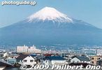
Mt. Fuji as seen from the shinkansen bullet train.
|
|
|
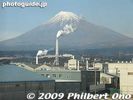
Smokestacks mar the view of Fuji.
|
|
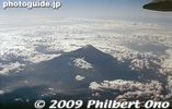
Mt. Fuji from the air.
|
|

Yoshida-guchi trail entrance sign.
|
|
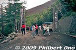
Yoshida-guchi trail entrance, we started from the 5th station.
|
|
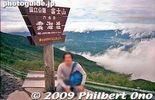
After climbing for about 40 min., we reached the 6th station here. We're already above the clouds.
|
|

Bags of drink cans.
|
|
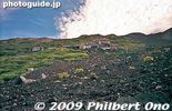
Rocky trail looking up on Mt. Fuji.
|
|
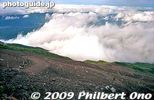
Looking down at the trail.
|
|

Hut roofs are weighed down with rocks so it doesn't blow away with the wind.
|
|
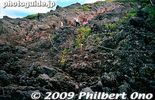
Rock and more rock on Mt. Fuji.
|
|

A good part of the trail had us going on all fours.
|
|
|

Mt. Fuji torii
|
|
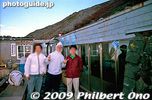
Our mountain hut on the 8th station, called Toyokan. 東洋館
|
|
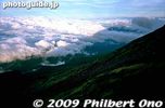
Shadow of Mt. Fuji
|
|
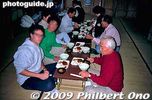
We spent the night in the mountain hut with a small dinner.
|
|

Branding my walking stick.
|
|
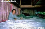
Our bunk bed.
|
|

Watching the sunrise from outside our hut.
|
|

Reaching the summit.
|
|

At the summit of Mt. Fuji. It was so windy and rainy that we couldn't walk around the rim. Could hardly see anything.
|
|
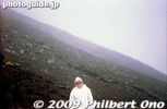
Going down was tiring too. But better than going up.
|
|

From Yasu Station, it's a short bus ride to the foot of Mt. Mikami (get off at Yamade-mae 山出前). Then backtrack along the road to see two hiking paths. There are two trails, the Front (Omote, seen on the left)) and Back (Ura, seen on the right).
|
|

Sign shows the way to the "Front Mountain Path" (Omote Tozando). I recommend taking a bottle or two of drinks. There's a vending machine near the bus stop. If you miss the bus from Yasu Station, it's a 40 min. walk. Taxis available. 表�
|
|

Way to the "Front Mountain Path" (Omote Tozando). Be aware that this is the steep trail, going almost straight up the mountain. You will be going on all fours much of the way. Gloves recommended. 表登山道
|
|

The "Front Mountain Path" has a gate to prevent monkeys from escaping to the residential area. Be sure to close the gate after entering.
|
|

Sign shows the way to the "Back Mountain Path" (Ura Tozando). This is the less steep trail to the summit. Notice the peak on the left. I went on this trail. 裏登山道 MAP
|
|

After passing through a bamboo grove, there is a clearing with the Tempo Gimin Monument.
|
|

At the foot of Mt. Mikami is Tempo Gimin Monument dedicated to the farmers who were tortured to death after the 1842 Tempo Ikki (天保一揆) uprising against the government's unfair land taxation surveys..
|
|

Time capsule to be opened in 2042.
|
|

Map of Mt. Mikami. It says the trail is 1.3 km long, taking 40 min. For normal people, allow 80 min. to reach the peak. I took about 90 min. to reach the top, while taking time to take pictures.
|
|

Hiking Rules: No smoking. Do not make fire. Don't break tree branches or damage any trees. Don't take home any rocks, wood, etc. Take home your own trash.
|
|

Gate to the Back Mountain Path. Be sure to close the gate after entering. I don't know how it would prevent monkeys from climbing over the low gate. Between Sept. 23 and Nov. 3 during mushroom season, 500 yen admission is charged for the Front/Back pa
|
|

Hiking up the Back Mountain Path. The trail actually goes mainly toward the side of the mountain rather than the back. The back of the mountain has a trail going down toward Kibogaoka Bunka Koen Park.
|
|

Two wooden signs pointed in opposite directions both say "To Mt. Mikami summit." Go right to continue on the easier Back Mountain Path. Or go left to get on the steeper Front Mountain Path. The large white sign says "Take home your trash.&q
|
|

Sacred tree. The bark from this tree is used for the roofing of the shrine. Do not scratch or damage it.
|
|

Steps
|
|

The trail is rocky and rooty, with lots of tree roots.
|
|

Sometimes log steps are provided.
|
|

Halfway point called Uchikoshi 打越. It's a small clearing and crossroads for multiple trails. Also a good place to harvest matsutake mushrooms during the fall (Sept. 23-Nov. 3).
|
|

Sign
|
|

This trail goes around the side of the mountain. Not recommended.
|
|

Trail to summit.
|
|

500 meters until the peak.
|
|

Roots
|
|

Chain railing is helpful.
|
|

Roots
|
|

Steel railing to grab.
|
|

Small torii and shrine.
|
|

No sign for this little shrine.
|
|

Kokegatani Valley. There's a small dip in the trail, going down and up again. This is a small valley near the peak. Visible as a small notch next to the peak. 苔が谷
|
|

Kokegatani
|
|

View from the dip. There should be a better view on the other side too, but too many trees block the view.
|
|

Yuba-no-Futokoro
|
|

The sign is almost totally unreadable.
|
|

Summit in sight.
|
|

Shrine and torii at the summit.
|
|

Shrine and torii at the summit.
|
|

A shrine with a view.
|
|

Gods here must be happy to see such grand views.
|
|

This is almost near the mountain's peak.
|
|

Sacred rock where the god lives.
|
|

Great view, but hazy when I was there. Ishibe is toward the left, and the shinkansen tracks toward the right.
|
|

Sign pointing to a lookout point, slightly below the shrine.
|
|

Going down to the lookout point.
|
|

Lookout point on Mt. Mikami in Yasu.
|
|

View from Mt. Mikami, Yasu. Ishibe is toward the left.
|
|
|

Looking toward Ritto
|
|

View from Mt. Mikami, Yasu.
|
|

On the right, Route 8 can be seen crossing Yasu River.
|
|

Route 8 crossing Yasu River
|
|

The path on the left leads to the mountain's peak.
|
|
|

To the peak.
|
|

Just beyond the tree is the peak.
|
|

Summit of Mt. Mikami. Only a small clearing with a bench. It was a great day for hiking. It is quite a popular mountain for climbers. Even for families with little kids. Didn't see any monkeys. No bears.
|
|

Sign at the summit.
|
|

"Take home your trash"
|
|

Going down from the summit.
|
|
|
|

Log steps
|
|

Large stone walls
|
|

Chain railing
|
|

Chain railing really helps.
|
|

Lots of ferns.
|
|

1.4 km to Karyoku Koen Park
|
|
|

Downward slope and trail. This trail is called the Karyoku Koen-gawa Tozando which starts from the Karyoku Koen flower park. 花緑公園側登山道
|
|

Tree trunk
|
|
|

850 meters to Karyoku Koen flower park.
|
|

Entrance/Exit to Karyoku Koen-gawa Tozando
|
|

Getting close to civilization.
|
|

Beware of snakes (mamushi). Never saw any. Never saw any monkeys either.
|
|
|
|

Prevent forest fires.
|
|

Camping lodge in Karyoku Koen Park. There are more trails within the park and other sights like cherry blossoms. To get back to Yasu Station, walk to Kibogaoka Bunka Koen Park and the bus stop is at the Kibogaoka Nishi Gate next to the parking lot.
|
|
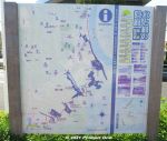
Water & Greenery Corridor (Mizu-to-Midori-no-Kairo) is a semi-urban, hiking trail in the northwestern part of Ichikawa fronting the border with Tokyo along Edogawa River.This part of Ichikawa is dotted with patches, hills, and slithers of small forests, parks, and ponds. This "Corridor" links all this greenery and bodies of water to help protect and preserve the flora and fauna in a coordinated effort by local environmental groups.
This is a map of the trail. Download the official map here: https://www.city.ichikawa.lg.jp/gre01/1111000022.html
|
|
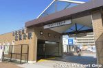
The corridor is 6 km and takes a few hours to walk it between Kita-Kokubun Station (photo) and Konodai Station both in Ichikawa.There are also side treks to other nearby sights. Enjoyable especially when the cherry blossoms are in bloom or during the autumn foliage.
|
|
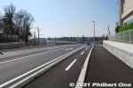
From Kita-Kokubun Station, we walked about 600 meters along this highway until we reached the first green belt.Local environmental groups have been active in trying to preserve and protect the city's nature, but it's an uphill struggle with the encroaching urban development, especially when the Hokuso train line was built through Ichikawa in 1979.
|
|
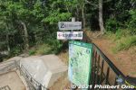
For the most part, the trail has signage in both Japanese and English. We soon got to some greenery called Horinouchi Ryokuchi green belt. There's this fork in the trail. Go left to see the shell mound in Horinouchi Kaizuka Park.
|
|
Horinouchi Ryokuchi green belt. 堀之内緑地
|
|
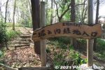
Horinouchi Ryokuchi green belt. 堀之内緑地
|
|
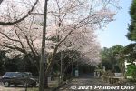
After the small green belt, walk on the street to the Shell Mound.
|
|
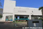
You will pass by the Ichikawa Municipal Museum of History. Free admission, but it was closed when we were there. Horinouchi Kaizuka Shell Mound Park has two museums. 市川歴史博物館
|
|
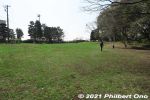
Horinouchi Kaizuka Park is a flat hill where shells, animal bones, and other food waste were discarded by Jomon people 4,000 years ago. "Kaizuka" means "shell mound." 堀之内貝塚公園This hill was also the site of a Jomon Period human settlement 2,500 to 4,000 years ago. A number of excavations were made since 1904 and ancient human remains, pottery, etc., have been found. National Historic Site.
|
|
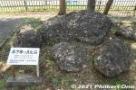
Hardened shell rocks from the ocean 150,000 years ago displayed in Horinouchi Kaizuka Park. These are not shells discarded by humans. 堀之内貝塚公園
|
|
|
|